skip to main |
skip to sidebar
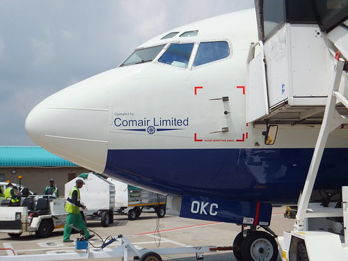 Comair 737 ZS-OKC on the ground at O. R. Tambo International Airport.
On my Safari Trip in February 2012 (described here, Boeing 737 ZS-OKC operated by Comair took me from O. R. Tambo to Livingstone. Whilst waiting to board, I noticed, marked in red on the side of the fuselage, the 'RVSM Sensitive Area'. I didn't know what 'RVSM' meant but it was not until I returned to the U.K. that I had an opportunity to research its significance (and it was almost another seven years before I wrote about it).
Although more modern techniques now exist, the basic method for determining an aircraft's altitude is by measuring barometric pressure with a 'pressure altimeter'. Increasing air traffic led to the introduction of a world-wide system of 'airways' with flying altitudes assigned to each aircraft to ensure safe vertical separation. Errors in measurement on the aircraft obviously potentially erode this separation. Continued growth in air traffic has led to improvements in pressure altimeters justifying an initial vertical separation of 2,000 feet between aircraft flying above Flight Level 290 ('Two,Nine,Zero') being reduced to 1,000 feet (as was already applied up to Flight Level 290). Of course, this requires suitably-tested equipment and the 'RVSM Sensitive Area' is kept pristine so that the air pressure sensed by the 'Pitot Tubes' feeding the pressure altimeter is not affected by turbulence.
Wikipedia has an article about this at Reduced vertical separation minima
.
The diagram below illustrating Non-RVSM and RVSM Flight Levels is from CSSI Inc:-
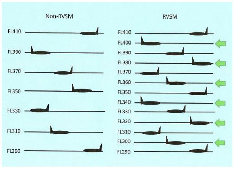
Non-RVSM and RVSM Flight Levels between FL290 and FL410.
CSSI Inc. also produced this sketch illustrating the effect of different errors on the altitude indicated to the pilot:-

Difference between Assigned and Actual Altitude.
There's more about altimeter setting on the excellent 'Skybrary' site here.
Of course, RVSM is just one feature of the amazing and complex Air Traffic Control system that world trade is dependent on.
Back in 2008, the post Work in progress stated my ambition regarding the backlog of draft blog posts to "Get 'em published, ready or not". How well did that work out? To my amazement, I have made 1,406 published posts at present, varying in length from the short to the quite long ("too long" do I hear you say?). But there are also 173 draft posts 'in the works', incomplete or awaiting further research.
The fact that I'm still working limits time available to write for the blog. I confess to still being a railway enthusiast (I think I prefer that term to 'railwayac' which I believe was used some time ago but unfortunately rhymes with 'maniac'). So that pastime consumes more of my available time (and is responsible for around half of the published posts). Finally, although my mobility is deteriorating with increasing age, my interest in travel is undiminished and any journey (even a modest one using the dreadful British railway system) supplies sufficient material for more unfinished posts.
The earlier 'Work in progress' post asked for the reader's indulgence regarding typographical and grammatical errors. Has that situation improved? Probably not. The editing software in 'Blogger' (which I still use) helpfully flags up spelling errors with a wiggly red underlining but, since it doesn't understand 'formatting directives', the editing screen is usually covered with highlighted formatting text, tending to hide the real errors. The other problem is that, just because a word is spelled correctly, it doesn't mean that's the word you intended. So, I will plod on, as best I can.
In the post An Apology, which appeared in 2009, I wrote about the perils of spelling place names, before digressing about L.M.S. signal box nameboards. For balance, below is a picture of a Great Western signal box nameboard. As I commented in the post here:-
The Great Western liked to dignify their signal boxes with a single, cast-iron name plate showing the name in full so I noticed the imposing length of the sign mounted on side facing the tracks reading 'SUTTON BRIDGE JUNCTION SIGNAL BOX'.
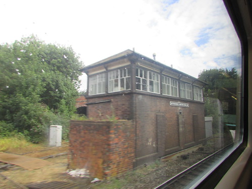
Shrewsbury area rail: Sutton Bridge Junction signal box, 28th July 2018.
Jan 'Blogging', 27th January 2019.
During the first of two visits I made to to Myanmar in 2017, on Sunday 7th May 2017, I travelled by train from Kalaw to Shwe Nyaung, as briefly described in the post here. More technical comments are in this present post.
The published timings of the train were:-
13:30 depart Kalaw
15:40 depart Heho
17:00 arrive Shwenyaung
This is train 141 booked to leave Thazi at 7.00 a.m. (Which I'd caught in 2016 when travelling from Thazi to Kalay as described in posts Thazi-Kalaw and Thazi - Kalaw (part 2)).
There was a particular reason I'd chosen to to now make the journey beyond Kalaw to Shwe Nyaung - I'd found out there was a circular loop or spiral, descending in our direction of travel between Heho and Shwe Nyaung. I might have been tempted to catch an ascending train, when the loco would be working hard but travelling on a descending train fitted in better with my overall programme and certainly emphasised the importance of brakes!
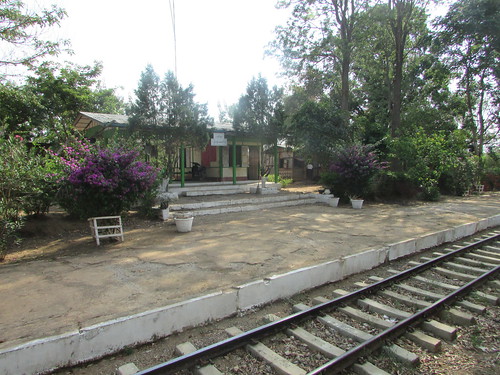
Kalaw Station (mileage: 369)
Division 4 of Myanma Railways
Kalaw is the headquarters of Division 4 of Myanma Railways and the Divisional offices face the station across the tracks.
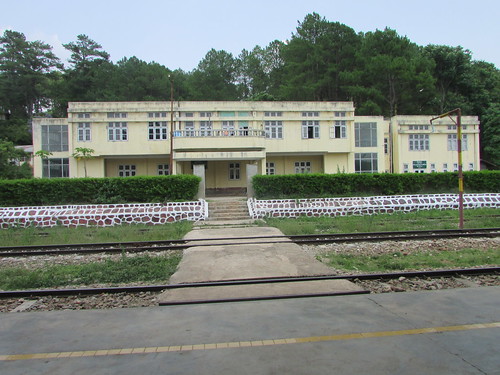 Kalaw Division Railway Offices stand opposite Kalaw Station.
Map showing extent of Division 4
Click on map for larger view
Layout of Station
I'd first visited Kalaw Station (elevation 4297 feet) in 2016 when I'd arrived at Kalaw by train but I'd also studied the station the following day when travelling around Kalaw by road. In 2017, I first visited the station by road on our arrival on Saturday because my guide, Thandar Oo, wanted to confirm the train timings. So my pictures in the album Kalaw Station consolidates the pictures taken on these various visits. On the Sunday of our train journey to Shwe Nyaung, we arrived at the station nice and early so that I could take more pictures which form the start of the album Kalaw - Shwe Naung by train.
The station is provided with one broad platform situated on the left looking towards Shwe Naung.
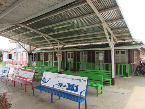
Kalaw Station showing the covered waiting area on the broad platform.
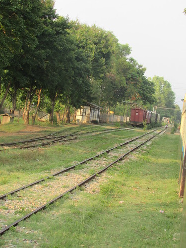
There is a main line, passing loop, goods loop and three sidings with stop blocks. Points are controlled from single lever point frames with Trapped Key Interlocking arrangements supervised by the Station Master. Points are equipped with the usual semi-derelict point indicators.
General view of Kalaw Station looking towards Thazi.
An Outer Home signal approaching the station is provided in each direction and both are controlled from a Signal Capstan on the station platform. I'd previously seen these Signal Capstans (which I sometimes called 'windlasses') on the line to Maymyo.
Outer Home Signal Capstan at Kalaw (Up/Down)
The Outer Home signals are preceded by fixed Distant signals. There is a level crossing with manual gates on the Thazi side of the station. Movements over the level crossing and through points are authorised by a green hand signal from the pointsman/crossing keeper.
The usual diagram in the Station Master's office makes the arrangements clearer:-
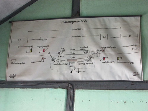
Track diagram in Station Master's office at Kalaw. Shwe Naung is to the left, Thazi to the right.
Click here for larger view
Kalaw: Arrival and Departure of my train
A member of the station staff (whom I'll call the 'pointsman') was despatched to to the Signal Capstan to make sure that the Outer Home was 'clear' for the approaching train, then he carried on to the loop points to check that they were correctly set and 'clipped' (secured with a point clip, similar to a 'G'-clamp, and padlocked), ready to give a 'green' handsignal to the approaching train to authorise the train's entry to the platform. Since there's also a level crossing next to the points, a Crossing Keeper also appeared to push the two hand operated gates across the road after which he also displayed a 'green' handsignal. The 2,000 horse power diesel-electric locomotive and its train slowly bounced over the pointwork and crawled into the platform.
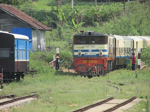
Kalaw - Shwe Naung by train: DF.2010 arriving from Thazi. Pointsman on left, Crossing Keeper on right, both displaying green flags.
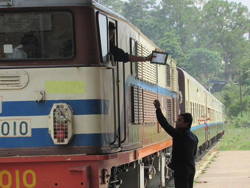
Another member of station staff stood ready on the platform to collect a document pouch offered by the Second Man on the locomotive. I assume the pouch surrendered the 'Line Clear' form which had authorised departure from the previous Block Station.
Kalaw - Shwe Naung by train: My train arriving at Kalaw late at 14:57.
I'd not seen a document pouch in use previously. A cane 'hoop' is more common, as shown below.
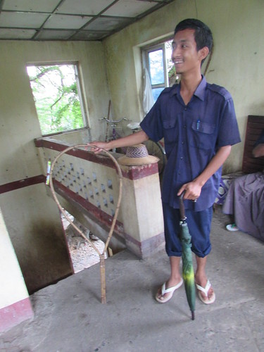
Myo Haung Signal Cabin, Mandalay: A railwayman displays the cane hoop with the vital Paper Line Clear Form attached. This form is issued by the Controller and, when received by the driver, authorises the train movement.
The train comprised four bogie coaches and two bogie goods vans, one with 'duckets' (a part-glazed lookout used by the guard). There was the usual flurry of activity as passengers boarded and alighted and freight was loaded and unloaded. After a plaintive sounding of the locomotive air horn, we quietly departed.
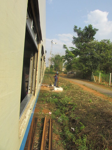
Track maintenance gang
Not long after leaving Kalaw, we slowed right down passing a Permanent Way gang, apparently carrying out spot replacement of rotten wooden sleepers with reinforced concrete ones.
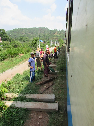
Track Repairs.
The line to Aung Ban
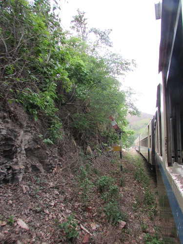
The line twisted and turned over the undulating route across the mountains meaning that our locomotive was working quite hard at times.
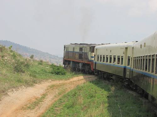
Kalaw - Shwe Naung by train.
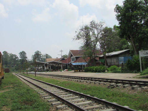
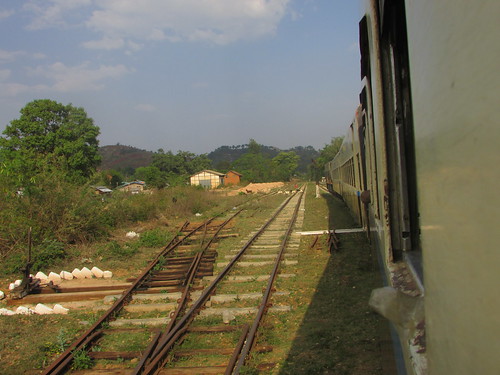
Aung Ban Station (mileage: 376)
Our first stop was at Aung Ban (elevation 4219 feet, just 78 feet lower than Kalaw Station). As at Kalaw, approaching the station in each direction there is a fixed Distant signal. The design of these varies quite a bit from site to site.
Kalaw - Shwe Naung by train: Aung Ban semaphore fixed distant.
The distant is followed by an Outer Home signal the design of which can vary. Both upper-quadrant and lower quadrant arrangements are in use.
Kalaw - Shwe Naung by train: Aung Ban upper-quadrant semaphore stop signal.
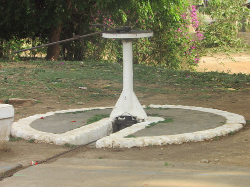
I'd visited Aung Ban by road four days previously, on my way from Heho Airport to Loikaw. In addition to the main line and passing loop, there are four siding loops, plus the diverging branch line to Loikaw. At the Kalaw end of the station, there's a large water tank on a steel truss support to feed a derelict water column, with a swan-neck cast delivery pipe.
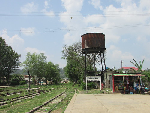
Aung Ban Station: Derelict water column and steel water tower.
Track 4 stabled a coach and an old bogie goods van probably used by railway workers as they were next to Railway Gang Car ED/RGC113 used for track maintenance.
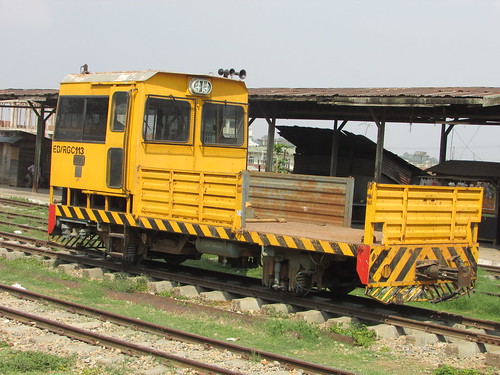
Kalaw - Shwe Naung by train: Railway Gang Car ED/RGC113 at Aung Ban.
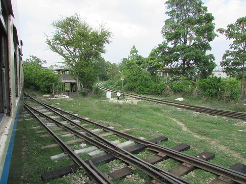
After a brief stop, we set off again.
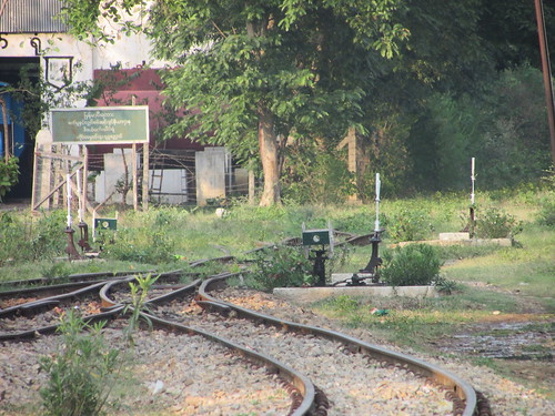
Kalaw - Shwe Naung by train: Leaving Aung Ban, showing sidings on the left and single platform on the right. Note the single lever point frame.
Kalaw - Shwe Naung by train: Leaving Aung Ban, showing branch to Loikaw diverging, two single lever point frames and a point indicator. Note raised hut.
Once again, we were in countryside, sometimes twisting and turning around hills, sometimes overlooking grazing herds and, at least once, passing over a watercourse on a steel girder bridge set on tall stone piers before reaching Kan Na.
Kan Na Station (mileage: 384.75)
We stopped briefly at the rural station of Kan Na. I was surprised to see a lower-quadrant semaphore 'stop' signal beyond the platform, obstinately at 'danger', even as we drew up to the signal. Presently, a pointsman cleared the signal (arm pointing downwards, as you'd expect a lower quadrant to do) and we departed. The signal was protecting a facing point leading to a short siding with a stop block, so I concluded at the time that we were about to descend a reasonably severe gradient but, lacking a gradient diagram, I can't be certain..

Kalaw - Shwe Naung by train: Passing Kan Na semaphore fixed distant.
Kalaw - Shwe Naung by train: Kan Na station.
Kalaw - Shwe Naung by train: Kan Na station showing semaphore stop signal with Trapped Key locking box, point indicator, hand point lever and separate warning sign.
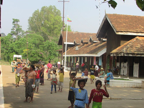
As we continued towards Heho, the scenery was initially quite rugged but then turned into a high plain, with extensive vegetable-growing and villagers tending the crop.
Heho Station (mileage: 404)
We passed Heho Airport on our left and then the fixed semaphore distant for Heho. The Outer Home signal was 'off' and I managed a reasonable picture. A square concrete foundation has two short steel projections to which the signal post is bolted. The post is formed of two parallel channel-sections of different lengths held parallel by bolting-through nicely-cast spacer blocks. Near the base of the signal, a large pulley wheel diverts the signal operating wire vertically up the post. Near the top of the shorter channel section, a lever is pivoted so that the pull of the signal wire on one end of the lever is converted into a push on the solid rod which extends upwards to operate the signal arm. I was amused to note that three weights had been wired to the end of the lever to ensure that the signal arm returns to danger when the signal wire slackens. The arm itself is pivoted near the top of the longer channel-section which is terminated in a neat, cast finial. On this particular example, the signal arm appeared quite elderly - corrugated steel bolted to a cast spectacle and apparently of the pattern used by The Railway Signal Co, where an arm that looks as if designed to be lower-quadrant is arranged as upper-quadrant. The back-blinder was in the correct position (had the signal been illuminated) and spectacle glasses were still intact (both 'clear' but I couldn't determine whether glass, plastic or metal gauze). Variations of this pattern are found all over Myanmar and, as here, they often lack an access ladder. At Heho, this signal is controlled from a signal capstan on the station platform.
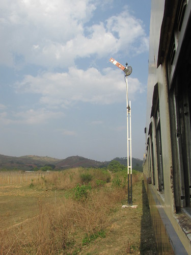
Kalaw - Shwe Naung by train: Semaphore stop signal, Heho.
And so we arrived at Heho where I took plenty of pictures whilst the various vendors plied their wares. Two days later, I made a second visit by road, met the station master and took more pictures (in the album Heho Station). Heho has the main line, passing loop, and one siding loops with moveable scotches (a second siding loop has been abandoned). Points, equipped with point indicators, are controlled from single lever point frames with Trapped Key Interlocking arrangements supervised by the Station Master.
Kalaw - Shwe Naung by train: Entering Heho, showing single lever point frame and abandoned water column.
Kalaw - Shwe Naung by train: Heho.
Kalaw - Shwe Naung by train: Heho Station. Signal Capstan for Up Outer Signal.
During my second visit to Heho station, I was able to photograph the track diagram in the Station Master's Office.
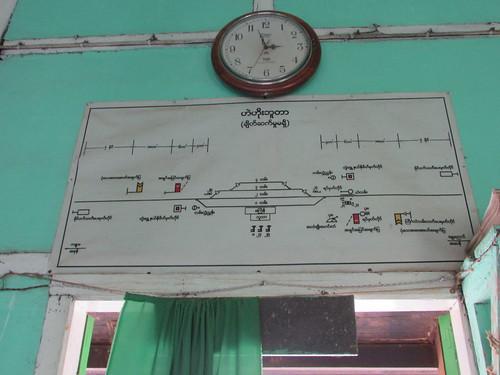
Track diagram in Station Master's Office, Heho. Kalaw is to the left, Shwe Naung to the right.
Click here for larger version.
Unlike, for instance, Kalaw the signal capstan on the platform at Heho only operates the Outer Home Signal for trains heading towards Shwe Nyaung because the Outer Signal heading towards Kalay protects a set of 'trap' points. So, in this case, the signal is operated using a nearby single lever signal frame with Trapped Key locking box shown in the picture below. Again, I assume that this is because the gradient is falling towards Heho but I haven't confirmed this. This signal is similar in design to the other Heho Outer signal illustrated above but, in this case, the 'modern' signal arm has no spectacle, is arranged as an upper-quadrant and is provided with a signal ladder.
Kalaw - Shwe Naung by train: Leaving Heho, showing semaphore stop signal, single lever signal frame with Trapped Key locking box and Hand point lever for 'trap' points. Note the bullock cart on the roadway.
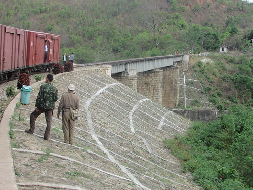
The Spiral at Ba Wa Sam Sa Ra Bridge
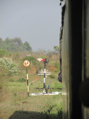
After a lot more twisting and turning to pick our way through the contours of this mountainous area, we came to the Spiral. To lose height rapidly, the railway takes a descending single spiral and crosses under the high level line at the Ba Wa Sam Sa Ra Bridge. After passing a fixed distant, I was not surprised that we came to a 'stop' signal at danger with another fixed distant mounted under the 'stop' arm. This was the last chance for the driver to satisfy himself that the train brakes were operating correctly. Then the signal came 'off' and we gingerly moved forwards.
This was a most curious signal with a short post of channel section painted alternately black and white, rather than white (not that unusual) but with three short lengths of 'rebar' welded to the post, one above the other, to form a ladder. The stop signal arm was corrugated steel, probably old and attached to a spectacle which, from its proportions, was also old. Like the two signals I'd spotted at Kan Na, it was built to be lower-quadrant but, when the handsignalman had 'cleared' the signal, the arm was 'up', not 'down'. As we passed the signal, I looked in vain for any operating mechanism and reluctantly decided the handsignalman had climbed up the 'rebar' to somehow alter the signal aspect. Incidentally, the painted 'vee' on the front of the distant signal arm mounted on the same post was white, not black as usually found in Myanmar although the 'vee' on the rear of the arm was the expected black.
Kalaw - Shwe Naung by train: Semaphore stop signal and fixed distant signal, Ba Wa Sam Sa Ra Bridge.
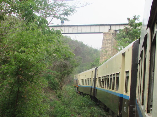
Kalaw - Shwe Naung by train: View looking back, immediately after passing over the Ba Wa Sam Sa Ra Bridge at high level.
With plenty of braking to control our speed, the train then descended the spiral and passed under the bridge we'd crossed over around three minutes earlier.
Kalaw - Shwe Naung by train: View looking ahead, immediately before passing under the Ba Wa Sam Sa Ra Bridge at low level.
I was quite impressed by our descent of the spiral.
Shwe Nyaung Station (mileage: 369)
It took us around half an hour to travel from the Spiral to Shwe Nyaung station but, by that time, I was getting fairly tired and didn't pay too much attention, I'm afraid.
Shwer Nyaung has the main line, passing loop, and a couple of siding loops. Points, some equipped with point indicators, are controlled from single lever point frames with Trapped Key Interlocking arrangements supervised by the Station Master.
Kalaw - Shwe Naung by train: Arriving at Shwe Naung, with two Single lever point frames, one with point indicator.
Kalaw - Shwe Naung by train: Arriving at Shwe Naung: L-R: Siding, siding, loop, platform line.
Shwe Naung Station:
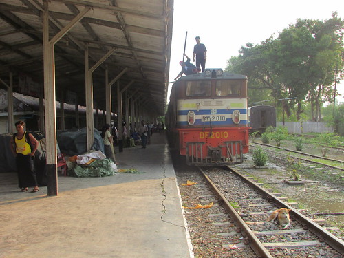
Shwe Naung Station: DF.2010 on arrival. Second man and mechanic on loco roof performing checks (fuel?). Note dog between the rails.
History
History of rail transport in Myanmar (Wikipedia).
Related posts in my blog
On to Inle Lake.
All my Myanma Railways posts.
My Pictures
Pictures in this article can be viewed uncropped by clicking on the image. To view in other resolutions or download, select from the albums below:-
Kalaw - Shwe Naung by train.
Kalaw Station (2016, 2017).
Aung Ban Station.
Heho Station.
All my Myanma Railways Pictures.
Events of Sunday Afternoon, 30th September 2018
On Sunday morning, I'd made brief visits to Hagia Sophia, Topkapi Palace and the Museum of Archaeology (described here). After a simple lunch at my hotel, I took a 20-minute ferry trip to Kadikoy, on the Asian side (described here).
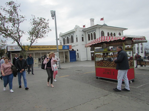
I arrived at Kadikoy by public ferry and spent a little time exploring the waterfront. It was quite mild, with a pale sun and lots of people seemed to be enjoying their Sunday afternoon in a relaxed manner. To the south of the pier where I'd arrived was the Princes' Islands Pier. I'd watched the ferry 'M/S ŞEHİT MUSTAFA AYDOĞDU'(brief information here) leaving the berth . The pier appeared to serve two destinations - Adalar on the Princes' Islands and Besiktas (near the First Bosphorus Bridge on the European side).
Around Istanbul: Princes' Islands Pier, Kadikoy.
A small crowd was watching some sort of presentation publicising (I think) culture, entertainment and activities but I haven't worked it out, I'm afraid. The presentation was being made from a plinth mounting an elaborate statue commemorating the reform of the Turkish language. I assume this statue refers to the changes in alphabet introduced in 1928 and the creation of the Turkish Language Association in 1932 but, again, I'm not sure. Wikipedia has an article on the Turkish language here.
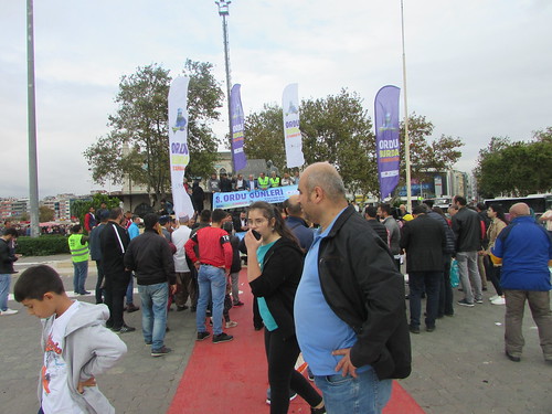
Around Istanbul: A publicity presentation drew a small crowd at Kadikoy. A figure forming part of the language commemorative statue is just visible behind the speakers in yellow jackets.
I sat watching the people coming and going for a while. A middle-aged Turkish woman joined me and opened a chocolate biscuit snack, immediately sharing it with me in a charming gesture. We sat companionably in silence for a few minutes, then I thanked her, said 'goodbye' and made my way towards the town. I had intended to explore the town a little but when I saw how crowded the streets were I decided, instead, to head for the Kadikoy Metro.
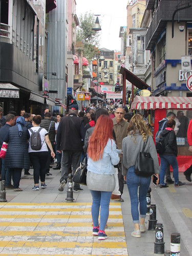
Around Istanbul: Kadikoy
On my way to the Metro station, I crossed the single, 1000mm-gauge line of the Moda Tram (Line T3) which forms a short, circular route advertised as a 'nostalgic tram'. It didn't appear to be operating on Sunday. There's a useful Wikipedia article here.
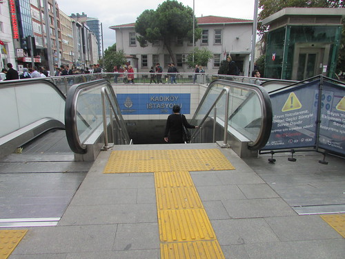
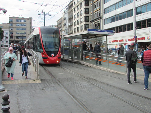
Istanbul's Metro: Entering Kadikoy Station, Kadikoy Line Metro (oh dear, the down escalator's not working).
Istanbul's M4 Metro line ('Kadikoy Metro') extends for 26.5 km and opened in 2012, using rolling stock from the Spanish company CAF. It's Standard Gauge to 'Light Rail' standards, powered from a 1,500 volt d.c. overhead conductor. There's a Wikipedia article here and an article on all Istanbul's Metro lines here.
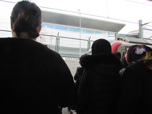
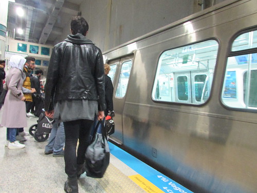
I only travelled one stop on the Kadikoy Metro, to Ayrilik Cesmesi, so that I could transfer to the present Asian terminus of the Marmaray Line, one stop from Uskudar. The Marmaray platforms at Ayrilik Cesmesi are on the surface and there was quite a crowd waiting as the next train pulled in from the turnback sidings.
Marmaray Line surface-platform at Ayrilik Cesmesi, with train arriving.
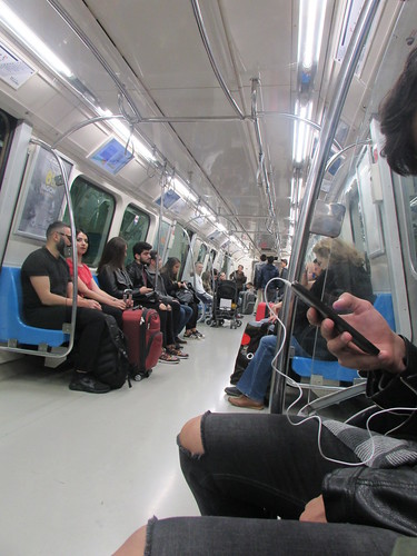
Phase 1 of the Marmaray project, from Ayrilik Cesmesi (Asian side) to Kazlicesme (European side) opened in 2013. The line is Standard Gauge to 'Heavy Rail' standards, powered from a 25 kV a.c. overhead conductor. I'd already traversed the Marmaray Tunnel twice the previous day, travelling between Sirkeci and Uskudar and back again (described briefly in the post here). The engineering achievement of crossing the Sea of Marmara with an immersed-tube tunnel construction (I believe the deepest in the world) in an earthquake zone continued to impress me.
I had to stand during the speedy journey back to the European side. Some people got off at Sirkeci but the train remained quite full as we continued to Yenikapi, one stop beyond Sirkeci. There was a mass exodus at Yenikapi, as I anticipated, since Yenikapi is an interchange station with two Metro Lines - M1 ('Ataturk Airport Metro') and M2 ('Taksim Metro').
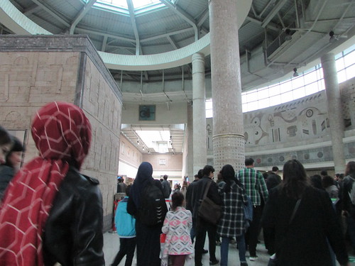
Istanbul's Metro: The Mezzanine Concourse at Yenikapi Station (interchange station serving Taksim Metro, Ataturk Airport Metro, Marmaray Line).
The Ataturk Airport Metro Line not only serves the airport but the coach station at Otogar and a branch to Kirazli which connects with the Basaksehir Metro. There was no time to sample these routes, instead, I'd decided to take the Taksim Metro Line as far as Taksim. It would also have been interesting to explore beyond Taksim, as there is yet another Metro Line (the Etiler Metro) and a branch serving a funicular at Havaray which runs on a concrete viaduct but, with limited time at my disposal, Taksim was to be my destination.
Istanbul's Metro: Boarding the Taksim Metro at Yenikapi
Istanbul's M2 Metro line ('Taksim Metro') extends for 23.5 km and opened in 2000, using rolling stock from Alstom. Standard Gauge to 'Light Rail' standards, it is powered from a 750 volt d.c. third rail. There's more information on Wikipedia here.
Istanbul's Metro: Yenikapi - Taksim
The journey to Taksim was swift and uneventful, stopping at Vezneciler, Halic and Sishane and I was glad that the long escalator to return me to the surface was working.
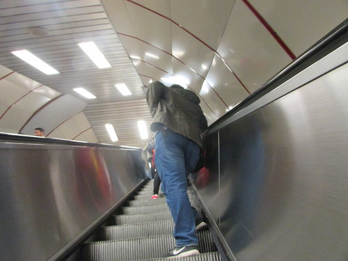 Istanbul's Metro: Returning to the surface at Taksim.
There's a Wikipedia article with more details of Taksim Metro Station here. A short walk from the metro station, I came to Gezi Park, very peaceful on that Sunday afternoon. But, in 2013, it had been the trigger for a series of wide-ranging, violent protests in Turkey. There's a detailed analysis of the escalation of what was initially a demonstration against an urban development plan into a major uprising against the state in the Wikipedia article here.
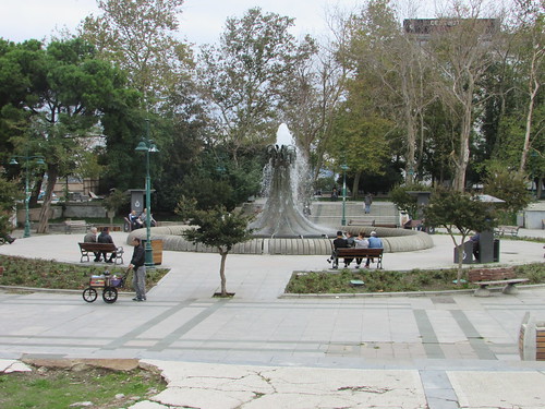
Around Istanbul: Fountain in Gezi Park, Taksim.
I walked towards Taksim Square, passing through the temporary market for 'Beoglu Antiquarian Book Fair'. I found Istanbul's other tram line, called simply 'Nostalgic Tram' (line T2) but, like the 'Moda' tram, not running on Sunday. This line is described in the Wikipedia article here. The local bird population seemed well aware that the trams weren't operating, as large numbers were perching on the tramway's overhead conductors and guy wires.
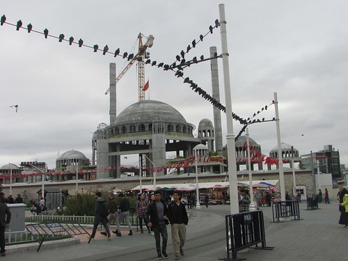
Around Istanbul: Taksim Square.
The centrepiece of Taksim Square is the Republic Monument, by the Italian sculptor Pietro Canonica, which was completed 1928. Wikipedia has additional information here.
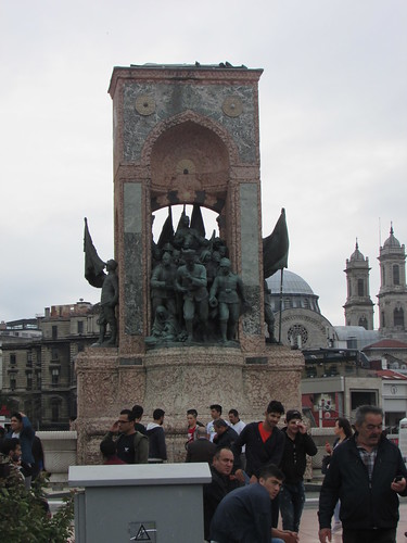
The Republic Monument, Taksim Square, Istanbul, by Pietro Canonica, completed 1928.
Determined to travel on at least one of Istanbul's funiculars, I walked back to Taksim Metro Station and through the long pedestrian tunnels leading to the Kabatas Funicular. This is a modern, underground system with two cable-hauled counter-balanced trains operating on a single line with a passing loop. Because of the gradient the doors, stepped floors and seats in each coach are set at an angle to the rails. There's a Wikipedia article here and a video (by MBC) here.
I emerged from the underground funicular a few yards from Kabatas Terminus on the T1 (Sultanahmet) tram line as it was getting dusk. The modern tram station is on a double-track line which runs on the central margin of a busy dual-carriageway road. An empty tram arrived and I took my seat. Before the tram left, quite a few more passengers had boarded and, after three intermediate stops had picked up more passengers, it was standing room only. We crossed the Galata Bridge and, after some difficulty, I left the crowded tram at Eminonu where it was already dark.
The waterfront was just yards away so I crossed to the nearest ferry waiting room which was crowded with people waiting for the next service to Uskudar. This route seems to be operated by modern,'double-ended' ferries with passenger ramps each end and accommodation for 500 passengers inside plus a further 200 outside. The Yalova Yard in Turkey built four of this design in 2015 named ŞH-KÜÇÜKSU, ŞH-GÖKSU, ŞH-GÜMÜŞSU and ŞH-DURUSU, each powered by two Scania DI13 070M diesel engines (engine data here). Earlier in the day, I'd photographed ŞH-DURUSU operating the route.
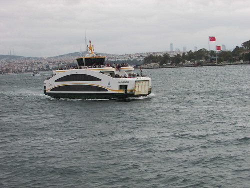
Istanbul's Ferries: 'SH-DURASU', arriving at Eminonu earlier in the day.
I took a seat in the noisy waiting room and, after a few minutes, the large ferry docked and, having passed through the automatic ticket barrier with my 'Istanbulkart', I was swept up the broad loading ramp with the boarding crowds. I assume the ferry was ŞH-DURUSU but, in the dark and the crush of people, I didn't confirm that. It was a little chilly on the water and rather damp so, for once, I was content to take a seat in the lower passenger saloon and watch through the misted window as we made our ten-minute crossing to Uskudar. I disembarked and was once again swept along as we passed through the broad exit gate into the street. As I was now noticeably tiring, I turned left, re-entered the terminal building and passed through the ticket barrier in time to rejoin the ferry I'd just left. Although still busy, the return crossing was not as crowded as the outward journey.
Safely back at Eminonu, I decided to head towards my hotel using the Sultanahmet tram which uses the 'Citadis 304', a 3-section, fourth-generation version of the successful Alstom 'Citadis' range. There's a Wikipedia article here. I was too tired and it was too dark for pictures but I'd photographed one of the Alstom 'Citadis' trams (at Sirkeci) the previous day.
Istanbul, Turkey: Sirkeci Tram Stop with a Sultanahmet line Alstom 'Citadis 304' tram heading for Kabatas.
I stayed on the tram to the Grand Bazaar tram stop but found the area quiet and uninviting so decided to cut short any further exploring and slowly make my way (largely downhill, thankfully) back to my hotel, amazed at how much I'd seen since my arrival the previous day.
The next morning, I finished my packing and said 'good-bye' to the hotel staff. My booked car arrived on time and took me back to Ataturk Airport for my final flight back to Birmingham and home after an extremely stimulating and instructive trip which, together with my Caspian Odyssey tour, had embraced four countries.
Related posts on other websites
The Marmaray Tunnel and railways
Marmaray Railway Engineering Project.
Haydarpaşa railway station (Wikipedia).
TCDD Taşımacılık (Wikipedia).
TCDD (Wikipedia).
Marmaray (Wikipedia).
Marmaray Tunnel (Wikipedia).
Istanbul Ferries
Ferries in Istanbul (Wikipedia).
IDO fleet list.
Sehir Hatlari History.
Sehir Hatlari typical modern ferry.
Light Rail and Trams
Istanbul Metro (Wikipedia).
M1 (Istanbul Metro) (Wikipedia).
M2 (Istanbul Metro) (Wikipedia).
M4 (Istanbul Metro) (Wikipedia).
Kabatas Funicular (Wikipedia).
Taksim (Istanbul Metro) (Wikipedia).
Istanbul Tram (Wikipedia).
Istanbul nostalgic tramways (Wikipedia).
Related posts on this website
This is one of a number of posts describing my weekend in Istanbul, starting with Arriving in Istanbul.
Alternately, clicking on the 'All my Istanbul reports' link displays all the posts on this weekend in reverse date-of-posting order.
All my Istanbul reports.
My pictures
Istanbul, Turkey.
Istanbul's Ferries: Eminonu - Kadikoy.
Istanbul's Metro.
Istanbul's Railways.
All my pictures in Turkey.
 Comair 737 ZS-OKC on the ground at O. R. Tambo International Airport.

