Events of Friday 2nd May 2014
I had a simple breakfast served in my room on Friday morning. I then thought I’d spend some time writing up the previous few days activities for the Blog.
I’m afraid it takes some time to write even a “quick’n’dirty” account. It may read like a “stream of consciousness” but, believe me, if it were, it would put James Joyce to shame. Once again, I apologise for typographical errors. I actually proof-read the stuff before sending it but I’m invariably appalled to subsequently discover how many errors remain. I know people who tour with a notebook at the ready but I’m afraid I’m not one of them. I rely on taking more-than-enough pictures, which the camera conveniently stores in chronological order. Displaying the pictures one at a time gives me a clue as to what happened next and seeing the image often evokes a memory of what I thought at the time.
But I still think it’s desirable to write it up as soon after the event as possible.
Since leaving the Aye Yar Resort, I’d been unable to contact the internet directly from my Notebook so the procedure had been:-
Write the text using ‘Word’ on my Notebook, including the ‘html’ formatting tags I normally use.If that sounds complicated, it sometimes is, especially if I’m tired and the hotel computer keyboard has re-arranged keys or non-standard labelling. You can e-mail a post to Blogger if all else fails.
Transfer the ‘Word’ file to a memory stick.
Go to the Hotel’s computer and try to open ‘Blogger’ for a new post.
Plug my memory stick into the Hotel’s computer and open my ‘Word’ file.
Copy the text to the Clipboard then copy it into the empty ‘Blogger’ new post.
Check the text in the new post is as required then publish.
By the time I’d published one post, I thought it was time I went out into the City. I’d never walked east along Strand Road, towards the Botataung Pagoda so that was my chosen direction, with the docks on my right between Strand Road and the river.
In the lobby of the Strand Hotel, there’s a framed copy of the ‘Rangoon Guide Map of 1930’. This map, at a scale of 3 inches to a mile, was published under the direction of Brigadier R. H. Thomas, D.S.O., Surveyor General of India. The way in which the series of jetties and quays had developed along the north bank of the river was very clear. Near Pazundaung, east of Yangon Central Railway station, a single line branch line still diverges to the docks. This line ran along the south side of Strand Road, throwing off numerous spurs to the various transit sheds and jetties. Eventually, this dock line originally re-joined the main railway west of Yangon Central. As far as I knew, the western and of the dock lines had been abandoned, but I didn’t know what remained in the direction of Botataung.
The development of the docks in Yangon were reminiscent of the history of both Liverpool and Birkenhead Docks and there are parallels in recent history, too.
The key was ‘Containerisation’ which transformed international shipping. The need for manual labour was dramatically reduced and theft of cargo, whilst not eliminated, became a much more sophisticated crime. Railways lost their advantage in carrying loads to and from the port as road lorries could transport containers directly to or from the consignee or to a shipping agent who could ‘stuff’ or ‘unstuff’ part container loads.
So, in Yangon docks as elsewhere, huge areas were concreted over to provide access to container lorries, storage for the lorries and storage for the huge numbers of shipping containers coming and going.
As I started to walk alongside the docks, I found that the original single line dock branch had been retained. In fact, it had been re-laid and ‘inset’ into the concrete to allow lorries to cross easily. I was briefly quite excited when I realised this relaid track was dual gauge providing not only Burma’s metre gauge but also ‘standard gauge’. I knew that some of the new lines being built in Burma were adopting ‘standard gauge’ (for instance, the one which will go into China). There was no sign that the standard gauge track had ever been used and I decided it probably resulted from a bit of ‘over-specifying’ in the contract for modifying the port approaches for container lorries.
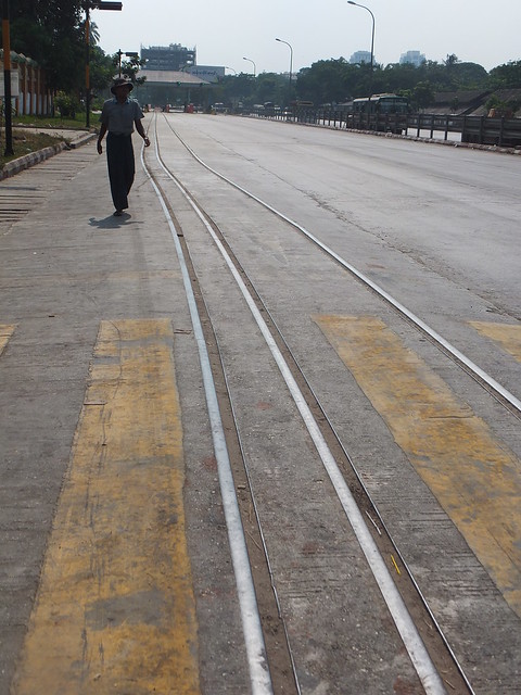 Modern dual-gauge track on the dock approach road.
As I passed the container handling area, I could see a couple of ‘straddle cranes’ and one large container crane at the quayside, with a large jib which can be lowered for loading and unloading. I think I saw at least one mobile crane with a container handling adapter but the docks are ‘enclosed’ behind substantial walls so it was hard to be sure.
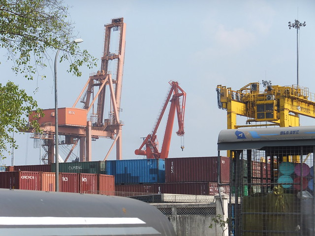 View of part of the Container Terminal from Strand Road.
I knew from the 1930 map that there used to be a general railway goods depot on the north side of Strand Road, but I assumed it was long gone. However, there it was, apparently in use and proudly labelled ‘BOTATAUNG GOODS SHED’ in English.
I passed the Botataung Pagoda but, instead of the isolated cone-shaped pagoda I’d expected from old photographs, it’s spawned a whole town of modern Buddhist-related buildings. I decided I’d give exploring a miss, this time.
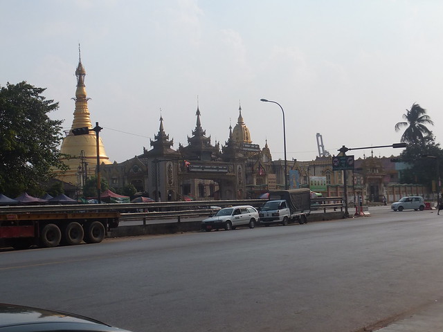 Botataung Pagoda viewed from Strand Road.
Fairly obviously, with large numbers of container lorries coming and going, there is need for tyre specialists and motor mechanics. But I found no garage premises – with the pragmatism often shown by the Burmese vehicles are simply parked at the kerb whilst receiving attention. I passed a number of large lorries and buses, some with a missing wheel, and gangs of mechanics carrying out quite major work (including welding) with the minimum of equipment.
At the east end of Botataung Goods shed, I found a siding which emerged, crossed the broad Strand Road and joined the single dock line on the south side of Strand Road. Like many railway lines in Burma, the poor condition of the permanent way would encourage you to think the connection was long-abandoned but the rail burns suggested that a diesel shunter probably still struggles this way on a regular basis.
Beyond the enclosed docks, a large, sandy area had been levelled and seemed to be in use as a lorry park. The sandy area extended to the river and a number of ships passed as I watched.
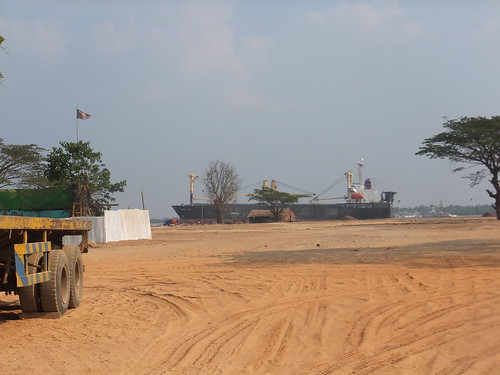 A cargo vessel on the Yangon River slips downstream.
I followed the dock branch until it turned inland and I was satisfied it would lead to the junction with the main line west of Pazundaung.
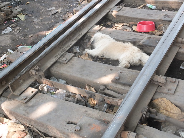 Dock Branch Sleepers (a) Wooden (b) Canine.
I was fairly exhausted by this time so I crossed to the north side of Strand Road and slowly headed west back to my hotel, past the Myanmar Red Cross Society premises and the British Embassy Chancery.
I spent the evening relaxing at the Strand. The following day, I was to fly to Rakhine State – an area I’ve not previously visited.
My Pictures
Strand Hotel, Yangon.
Rangoon Map (1930).
Around Yangon, 2014.
Yangon's Railways.
More
Next Post describing this trip.
[Revised 28-May-2014]
