skip to main |
skip to sidebar
Sandakan, Sabah, Malaysia: Tuesday, 10th February 2015
Early on Tuesday morning, we had our first sightings of our destination - Sandakan. This was originally part of British North Borneo which is now called Sabah and is part of Malaysia. We passed the massive bulk of Pulau Berhala on our starboard side and entered the large natural harbour which allowed Sandakan to develop as an important port.
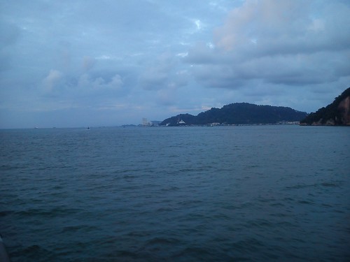 Approaching Sandakan, with a large mosque and beyond the multi-storey bulk of the 'Four Points by Sheraton' visible. Notice the number of ships dotted around the natural harbour.
For the last time on this trip, I watched a Pilot climb aboard to assist the Captain in the final approach to our quay.

The Sandakan Pilot climbs aboard.
At about 7.00 a.m. Tuesday, we berthed alongside the quay, facing a rather bleak-looking transit shed. It appeared that our quay was more used to handling freight rather than people. A number of large, bulk material conveyor units stood ready for use at one end of the quay and a massive mobile harbour crane with a rubber-tyred chassis and outriggers stood at the other end of the quay. The crane was labelled 'Gottwald' but these cranes now seem to be marketed as Terex Gottwald Port Solutions. An adjacent quay appeared to deal with smaller passenger ferries which I think go to the Phillipines.
 'Caledonian Sky' gently approaches the quay at Sandakan.
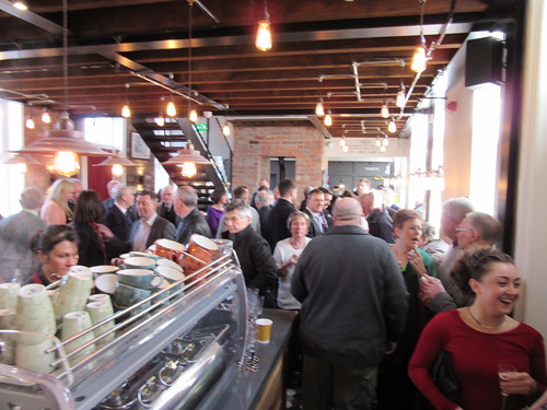
An open lorry drew up next to the ship and the crew started to take our luggage ashore, setting it out next to the lorry. A group of musicians appeared and set up outside the transit shed, playing for seven dancers in traditional costume, watched by the passengers from various decks on the ship. A group of dock employees appeared and enjoyed the free entertainment.
 Traditional dancers welcome the ship.
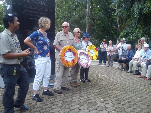
Saying our 'goodbyes' to the crew (many of whom were being relieved at Sandakan by fresh crew), the passengers disembarked for the last time, identified their luggage which was then loaded onto the lorry and boarded the three coaches which had appeared. We were to spend the day around Sandakan, before being reunited with our luggage (hopefully) at the 'Four Points by Sheraton' hotel. The coaches moved off through the dock area to join the main road to Sandakan town, about five miles away. The contrast with some of the rural places we'd visited was very striking. Everything is modern - the Japanese occupation during World War II and the subsequent Allied bombing reduced the town to rubble. Now, there are dual carriageways and frequent housing developments up to four stories tall. We didn't initially drive into the town centre but turned inland, eventually arriving at what was clearly a fairly 'upmarket' area of apartments with some detached houses. The coaches parked at the side of the road and we disembarked to enter the Sandakan Memorial Park. A dignified sign explained:-
"The Government of the State of Sabah has set aside this site as a memorial to those prisoners of war who suffered and died here, on the Death Marches and at Ranau. The memorial also commemorates the suffering and sacrifice of the local people."
The wooded gardens were in immaculate condition and radiated a great sense of peace, in jarring contrast with how the area would have been during the Japanese occupation during World War II.
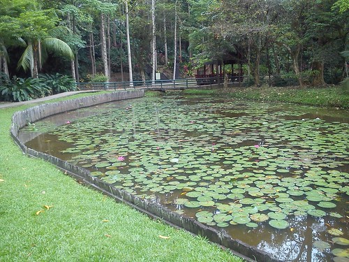 The immaculate gardens at Sandakan Memorial Park.
In 1942, 1500 Australian Prisoners of War were brought here to construct a military airfield for the Japanese. The following year, around 700 British and a further 500 Australian Prisoners of War arrived. Late in 1943, the prisoners were force-marched 260 km to Ranau in three 'Death Marches'. The only recorded survivors of these marches were six escapees. A Wikipedia article on this tragic era is here.
In the Sandakan Memorial Park, a wooden Commemorative Pavilion houses information displays and photographs. Nearby, there are a few reminders of the wartime camp - concrete water tanks, the remains of an ancient vertical boiler, an electric generator and a British 'Ruston Bucyrus' excavator. The excavator was commandeered by the Japanese but later sabotaged by an Australian prisoner. There is an engraved black marble monolith as the focus of the memorial park, and we were invited by our guide to observe a one minute silence here before three of the group placed wreathes.
 The Memorial Monolith.
After this thought-provoking interlude, we returned to our coaches and continued our tour of modern Sandakan. Building is still proceeding - Sandakan is the second largest town in Sabah with a population of around 400,000. Only Kota Kinabulu (formerly called Jesselton) is larger. There are still fairly basic wooden houses on stilts but there is a policy to remove these, transferring the occupants to modern (if rather barrack-like) apartments.
 Modern apartments in Sandakan.
As we neared the centre of the town, we turned up into the hills overlooking the sea. Here we visited St. Michael's and All Angels Church, a granite building dating from the early twentieth century, next to the large St. Michael's school.
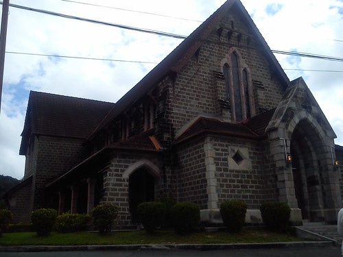 St. Michael's and All Angels Church.
We re-joined our coaches for a short ride to the English Tea House and Restaurant which has the proper appearance of a colonial bungalow, with its own croquet lawn. Its hilltop location offers wonderful views of the natural harbour of Sandakan.
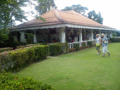 The English Tea House and Restaurant, Sandakan.
However, before we enjoyed luncheon at the English Tea House, we visited 'The Agnes Keith House' just next door. I'm afraid I'd not heard of Agnes Keith, but I was charmed by her house. Before World War II, she lived at the house with her husband who was Conservator of Forests and Director of Agriculture for the government of North Borneo. She wrote a book of her experiences called 'Land Below the Wind' which was prize-winning and has become a classic. During the War, the family were interned by the Japanese and that grim time is recounted in her book 'Three Came Home'. Upon release at the end of the War, they found that the house had been destroyed, but they rebuilt it on the same site and spent about five more years there, giving rise to another book 'White Man Returns', before moving first to the Phillipines and then Libya. The house in Sandakan became derelict before being restored by Sabah Museum and becoming an important visitor attraction.
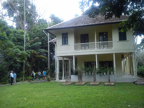 The restored Agnes Keith House.
We then returned to the English Tea House for a very enjoyable buffet lunch. I was then drawn back to the Agnes Keith House for a final walk around the well-kept garden before boarding our waiting buses. Our next journey took us inland. After some of our recent visits to rather smaller communities, I was still having trouble getting used to the scale of developments around Sandakan - such as the aptly-named 'Giant' Hypermarket, part of the Malaysian 'Giant' chain.
 The 'Giant' Hypermarket, Sandakan.
We were heading broadly west on Malaysia Federal Route 22. Around 14 miles from Sandakan, we left the main road to reach Sepilok, where we were to visit the Bornean Sun Bear Conservation Centre and Sepilok Orang Utan Rehabilitation Centre. I'll describe these visits in Part 22.
You can find all the posts on this trip here.
My pictures
Arriving at Sandakan, Sabah, Malaysia.
Sandakan, Sabah, Malaysia.
Sandakan Memorial Park, Sabah.
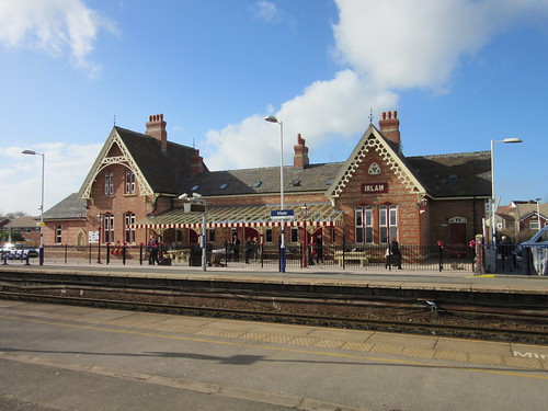 The restored building viewed from the Down platform.
The refurbished station house at Irlam was officially opened on Thursday, 26th March 2015, exactly 122 years after the station first opened to passengers.
The long-term project to bring the derelict building back into use was masterminded by the Hamilton Davies Trust, a registered charity founded in 2004 by Neil McArthur MBE who is the Chairman of the Trustees (see Our Story).
Hamilton Davies Trust brought together a number of partners: Salford City Council, NC Developments, Transport for Greater Manchester, Network Rail, Northern Rail, Irlam and Cadishead History Society and the Friends of Irlam Station in order to bring about the successful completion of this ambitious scheme. The work has been carried out to a high standard, with careful attention to detail, resulting in a facility which is now a major asset to the local community.
Around 200 invited guests attended the event, many making use of the new car park, but some including the writer travelled by train (Northern Rail had kindly provided complimentary tickets from either Manchester or Liverpool).
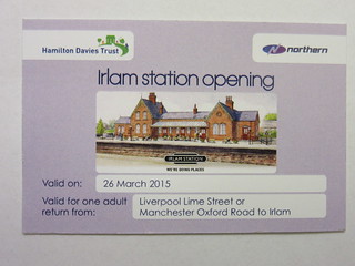
Special ticket issued by Northern Rail.
There was a very friendly, party spirit as guests arrived. Wine, hot and cold drinks and light refreshments were provided.
 The main area viewed from near the refreshment counter. Note the stairs to the upper floor.
At around two thirty, as many people as possible crowded into the main area for a series of introductory speeches, including addresses by Councillor Christine Hudson, Ceremonial Mayor of Salford and Ian Stewart, City Mayor of Salford. After the speeches, the guests were entertained by Cadishead Public Band (who are sponsored by Hamilton Davies Trust).
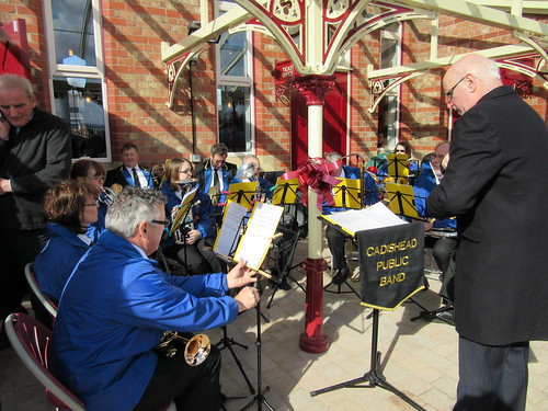 Cadishead Public Band prepares to entertain the visitors.
The ribbon-cutting ceremony then took place outside on the terrace.
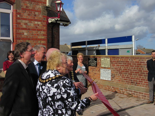 The ribbon-cutting moment arrives.
Irlam Station now has a comfortable waiting room, complete with a cafe/bistro, toilet facilities, free Wi-Fi and facilities for meetings. The new car park accommodates 60 vehicles with motorcycle bays, a 'Cycle Hub', dedicated pedestrian walking routes, better lighting and closed-circuit television for improved security. Future developments include the provision of step-free access to the Liverpool-bound platform and landscaping.
The people I spoke to judged the project a triumph and I endorse that view. Hamilton Davies Trust and all their partners are to be congratulated on their hard work and determination in making this project happen.
On the Hamilton Davies website, there's a report An Historic Day for Irlam Station!. The Salford Online Local Community Website has a report here. Manchester Evening News has an on-line article here.
My pictures
Irlam Station Launch.
My first two driving turns in January 2015 were cancelled. I was supposed to be on the '38' at Shackerstone on Sunday, 4th January but the locomotive broke another spring the previous day and was unavailable for service on the Sunday. Then, I was supposed to be at Peak Rail on Sunday 18th January but 'Lord Phil' suffered injector problems the previous day and, again, my turn was cancelled. So the first turn I had was 'Lord Phil' at Peak Rail on Sunday, 22nd February with Dave Rimmer (Fireman) and Jacob Short (Cleaner).
Peak Rail, Sunday, 22nd February 2015
 'Lord Phil' being prepared for duty on the outside pit at Rowsley.
The Peak Rail Winter Timetable features four round trips from Rowsley to Matlock Riverside (our original Matlock terminus before the extension to Matlock Town was opened). Matlock Riverside is provided with run-round facilities so, rather than top-and-tail as we currently operate when working to Matlock Town, one steam locomotive runs the service, running round at each end. This keeps the engine crew busy but I prefer this arrangement as more faithful to traditional steam railway working.
Originally, the points at Matlock Riverside were operated by the train crew but, since Matlock Riverside Signal Box was built, a signalman is required to operate the points at each end of the station. However, the Signal Box has not been formally commissioned yet so the signals are not in use. This means that movements are authorised by a Yellow Flag displayed from the signal box. I've previously talked about these arrangements firstly in the post Winter Timetable at Peak Rail and later in the post Peak Rail in early 2014.
The plan for Sunday, 22nd January had called for a Driving Experience Course on the line between Rowsley and Church Lane prior to the first passenger train at 11:15 a.m. but, unfortunately, the lady who had booked the Course had broken her wrist (cycling in Cambodia), necessitating that her course be deferred until a later date. However, as a 'consolation prize', it had been arranged that she would turn up and have a trip on the footplate as an observer on the first passenger train of the day.
The weather forecast for the day had not been very encouraging but when I arrived on site it had been cold but dry. Since steam locomotives at Peak Rail are prepared in the open, it's always better if you can carry out oiling and examination in dry weather: you can quickly get quite wet (and miserable) when the weather doesn't co-operate.
Our lady driving candidate arrived with Peak Rail Fireman Mike Shelton as we were completing preparation. Once I'd obtained the Train Staff, now an Electric Token, for the Rowsley - Church Lane single line (which we needed to operate the crossover at the south end of Rowsley Station), we made our way across to our five-coach train waiting in the platform. Under the watchful eye of Ken, the Guard, the Trainee Guard called us on to the stock and we 'tied-on'. There was time for a welcome bacon bap and cup of tea before departure.
The day proceeded as scheduled (and as described in the reports linked above). We had rather mixed but tolerable weather so by the time we'd returned to shed and disposed of 'Lord Phil' Dave, Jacob and I were tired but in good spirits
Peak Rail, Sunday, 1st March 2015
Just 7 days later, I was back at Peak Rail for the first day of the 'Main Season' timetable so there were changes - five round trips during the day running to Matlock Town (not Matlock Riverside) and top-and-tailing with 'Penyghent' on the north end. This time, Phil Mason was the Fireman and Jacob was, once again, our Cleaner.
Before the passenger service commenced, we'd a two hour Driving Experience Course but under new arrangements introduced this year. I've described the typical format of Driving Experience Courses at Peak Rail in a post here. Since writing that post, there have been a number of changes but picking up the trainee at Darley Dale and operating on the single line from Darley Dale to Matlock Riverside have remained the same. But under the new arrangements, the trainee is picked up at the platform at Rowsley and the single line from Rowsley to Church Lane is used for operations. In addition, the Trainee can now pick up a Brake Van and carry out limited shunting movements around Rowsley. A Plough Brake Van (used by Engineers to spread ballast) had been left on the Loading Dock for us. When the plough at either end of the vehicle has been raised, the Plough Brake can be used like any other sort of goods brake van. A Plough Brake is often referred to as a 'SHARK', because that was a common telegraph code for the vehicle.
 The vehicle in the foreground is a Plough Brake.
Once we'd joined up with our driving trainee, I explained the driving controls and, light engine, he took us to Church Lane and back a couple of times, displaying good judgement. We then spent some time with the Plough Brake, using all three ground frames at Rowsley (South End, North End, Traps at north end of Loop), giving our trainee experience of operating ground frames as well. He also did some firing with Phil explaining the principles of Boiler Management on a steam locomotive. All too soon, we had to move across to our train and, once called on by the guard, couple up and start carriage warming. We had to replenish our saddle tank with water from the 'brown tank wagon'.
 The 'brown tank wagon' used as a water tank at the south end of Rowsley station.
Up until then, the weather had been cold but dry. As soon as we got the "Right Away" from the Guard, it started to rain fairly hard. Although the front of the cab has two 'spectacles' - hinged, glazed windows - for forward visibility, with rain driving against them, they rapidly become useless. Windscreen wipers, of course, are not provided. You can rotate the window and wipe the outside clear but with heavy rain, they become obscured again in seconds. You can partially open the window and try to keep a lookout through the opening but the effect is often to channel wind and rain straight into the driver's face. So I normally end up leaning out of the side of the cab in any case, as I tend to do in good weather, getting a good soaking in the process.
Some steam locomotives had a narrow, hinged brass frame carrying a toughened glass 'sidescreen' on each side of the cab which could be hinged outwards to deflect the worst of the weather when required (and hinged flat in places of limited clearance. I remember many years ago reading a Local Instruction about retracting sidescreens in Berkswell Tunnel).
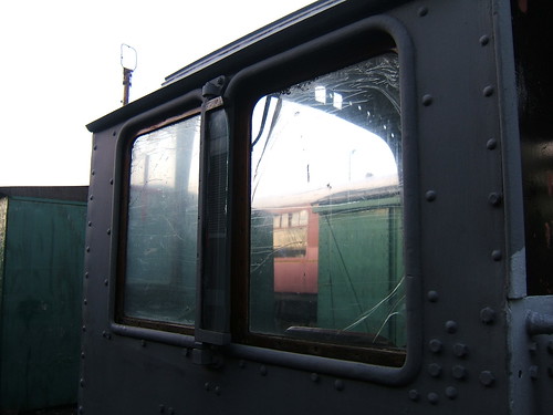 The Stanier cab from 48624 during restoration. In between the two side windows (front fixed window on the left, sliding rear window on the right) the vertical sidescreen is folded flat against the cab side.
I was reminded of a similar trip in poor weather at the Battlefield Line in 2014 (described in the post Another Busy Week) and one of my sayings: "Anyone can work on the footplate in good weather. It takes an engineman to do it in bad weather."
But the rain didn't continue - before long, it had changed to sleet which seemed even more chilling. However, once we arrived at Matlock Town, we would be dragged back to Rowsley by 'Penyghent' so it was possible to 'thaw out' by the boiler backhead for a while. However, the driver is not relieved from checking signals and keeping a lookout. Once arrived at Rowsley, we deemed it prudent to take water. Particularly when steam heating is being provided for the train, water (and, of course, coal) consumption is increased. It's desirable to not run the locomotive water tank too low, as this tends to encourage drawing debris from the tank into the injector, where even small pieces of foreign matter can cause problems, as briefly described in the post The Clack Valve.
For variety, the sleet then turned to snow which didn't seem much of an improvement. At track level, the snow wasn't 'sticking' but the surrounding hills were slowly turning white. We carried on plodding between Rowsley and Matlock Town as called for by the timetable, taking water as required at Rowsley. The snow turned back to penetrating rain but by the time we returned to Rowsley on our last round trip, the rain had more-or-less stopped. It was still cold, so I was glad of my heavy woollen overcoat.
We took the locomotive across to the outside pit and carried out disposal. With three of us to share the work, it didn't take us too long to clear the firegrate, rake out the ashpan, empty the smokebox, wash off the dust, return the tools to the store, fill the boiler, stable the locomotive on Number 2 Road (next to 'Penyghent'), shut down the various footplate fittings, isolate the gauge frames and complete the required report sheet.
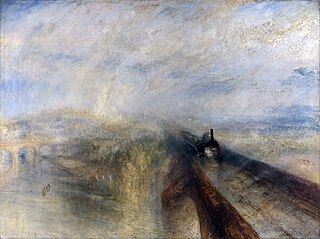
Rain, Steam and Speed
The title of this report was inspired by the famous painting 'Rain, Steam and Speed' by J.M.W. Turner (currently achieving renewed celebrity because of a recent film Mr. Turner). Locomotives of that period, like 'Lion' and 'Planet', lacked cabs or, at most, simply had a vertical spectacle plate at the front of the footplate. Oddly enough, when rather rudimentary cabs were introduced, many drivers objected to the change!

'Rain, Steam and Speed – The Great Western Railway' painted by J.M.W. Turner in 1844.
The cutting between Liverpool Lime Street and Edge Hill became known to many railway enthusiasts through the work of the remarkable clergyman and photographer Eric Treacy MBE (1907-1978). From 1932 to 1936 he was a Church of England Deacon at Liverpool, then 1936-1940 Vicar of Edge Hill. In that time, he produced some iconic shots around Merseyside, such as the one below, from the book 'Great Railway Photographs by Eric Treacy' [reference 1]
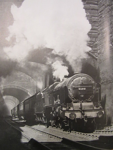
'Royal Scot' class 6130 'The West Yorkshire Regiment' leaving Liverpool Lime Street through Edge Hill Cutting (Photo: Eric Treacy).
The aerial view from 1938 below shows the city end of Edge Hill Cutting. The size reproduced below is licensed for non-commercial use but larger versions may be purchased from the website shown at the bottom of the picture.
 Liverpool, 1938: St. Georges' Hall is near the centre of the picture, with the curving trainsheds of Lime Street Station upper right leading to Edge Hill cutting top right.
According to a Liverpool Museums publication, the geology of Merseyside is largely dominated by sandstones and mudstones of the Triassic age, with the sandstones forming the higher ground at the northern end of the Wirral and Liverpool.
In the post Edge Hill, Liverpool I described the coming of the railway to Liverpool in 1830 with the passenger terminus at Crown Street and Wapping Tunnel cut through sandstone to Park Lane Depot near the docks. Because of the success of the railway, by 1837 a new passenger terminus had been constructed at Lime Street, connected by a double-track, cable-worked tunnel to Edge Hill. The original Crown Street site was retained as a goods depot. Increased demand at the Port of Liverpool led to the building of new docks further north (downstream) and the Waterloo double-track tunnel from Edge Hill to serve them. In 1879, locomotive working replaced the cable-haulage through the Lime Street Tunnel. By 1881, the Lime Street Tunnel was being opened-out into a deep rock cutting providing four running lines. The complex web of streets above the Lime Street tunnel required the construction of numerous bridges to carry the various streets over the new cutting.
The following photographs from around 1881 are from the Crewe Works photographic department collection and give an amazing insight into the work involved in creating the 4-track deep rock cutting. The size reproduced below is licensed for non-commercial use (copyright National Railway Museum and SSPL) but larger versions may be purchased from the website here.

Plate 1: The bowler-hatted gentlemen (one apparently with a furled umbrella) are remarkable, as is the worker about to cross a narrow plank. Notice the excellent workmanship on the stone facings to the bridge: the arch itself is made from multiple rows of bricks. The single track on the left is presumably temporary - the original double track tunnel is still buried under the rock on the right. Note the manually-operated Scotch Derrick crane.

Plate 2: The original double-track tunnel is presumably below the temporary sidings on the left. Notice the lean-to buildings, with chimneys, far left. An overhead travelling crane bridging the cutting is visible in the background.

Plate 3: Probably the same location as the previous picture, but looking in the opposite direction. A six-coupled goods locomotive stands on a train of spoil wagons. There appears to be a rail-mounted steam crane in the background. The overhead travelling crane is clearer in this picture. It is steam powered and mounted on a composite beam - wooden with an iron truss for stiffness. In the foreground are a couple of rectangular skips, wooden but iron bound, presumably used by the travelling crane.

Plate 4: Here, a temporary track has been laid in a narrow cutting excavated to the final level. The original double track tunnel will be in the rock on the right. A wooden chute is visible, leading from street level above the tunnel, presumably for loading spoil into railway wagons.

Plate 5: This is almost the same location as the last picture, but apparently on a later date. Some of the rock entombing the original double-track tunnel has been removed and temporary wooden bracing has been fitted. There are spoil wagons in the tunnel in the background and a crane is visible top right.

Plate 6: This might be the location in Plate 5 from the opposite direction, but probably on an earlier date. There's a good view of a rail-mounted steam crane at street level on the right.

Plate 7: An interesting picture, but puzzling.

Plate 8: Workmen proudly posing for the photographer.

Plate 9: This shows a network of temporary sidings. Note the excellent quality of the stepped retaining wall on the right.

Plate 10: A relatively early stage of the excavations, just about level with the base of the arches of the new bridges. The deep cutting on the right is presumably to facilitate carrying out the spoil. Visible through the bridge arches is probably a crane.

Plate 11: This may be the same location as Plates 4 and 5 but an earlier stage. In addition to the chute from street level, there's a diagonal chute from the area where rock is being removed. In the background on the right, there's evidence of partial building demolition. We may surmise that the railway have bought sufficient land for the width of cutting and demolished the part of the terrace in that area, leaving the remaining houses standing.

Plate 12: Excavations have now revealed the brick lining of the original 2-track tunnel.

Plate 13: Workmen, operating in groups, have started to demolish the brick lining of the original tunnel.

Plate 14: The tunnel lining has been collapsed.

Plate 15: Another section of the original tunnel exposed.

Plate 16: Most of the rock has been removed. The arrangement of tunnels (1-2-1) may identify the location as immediately west of Tunnel Road, Edge Hill.

Plate 17: This picture clearly shows the exposed original double-track tunnel lining (supported by curved timbers) and the remaining rock the right, with the 4-track retaining walls and bridges complete.

Plate 18: A similar view to Plate 17.

Plate 19: Another location with most of the rock removed. This view now stands comparison with the Eric Treacy photograph at the head of this article.

Plate 20: This is probably the same location as Plate 19, but the work is now almost complete.
There are other rocks cuttings around Merseyside, such as:-
Olive Mount Cutting was constructed in 1830 to accommodate two tracks but was later expanded for four tracks.
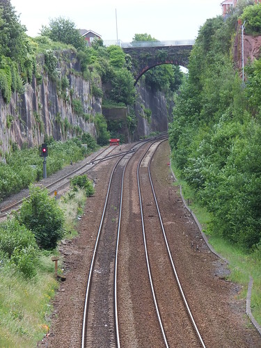
Olive Mount Cutting in 2013, viewed from Rathbone Road.
The line between Runcorn and Halton Junction is partly in a rock cutting.
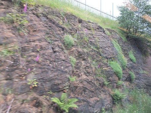 The rock cutting between Runcorn and Halton Junction (Up side).
I've also spotted rock outcrops on the line from Hooton to Ellesmere Port.
In addition to the railway tunnels around Edge Hill, there is a curious set of tunnels called the Williamson Tunnels, constructed by the eccentric philanthropist Joseph Williamson (1769-1840). For details of public access to these tunnels, see the Williamson Tunnels Heritage Centre site.
Book references
[reference 1] 'Great Railway Photographs by Eric Treacy' compiled G. Freeman Allen, editor P. B. Whitehouse, introduction Dr. J. A. Coiley, edition published 1997 by Chancellor Press (ISBN: 978-0-753708-72-9).
Related posts in this blog
Edge Hill, Liverpool.
Railways around Edge Hill in 2013.
Liverpool Lime Street Station.
'Black 5' to Birmingham.
My pictures
Liverpool area rail.
Leaving Toli Toli, Sulawesi: Sunday, 8th February 2015
At around 6.00 p.m. we left Toli Toli for Sandakan, a distance of 366 nautical miles. By the time I'd enjoyed the usual excellent dinner, I was ready to retire to my cabin.
Cruising to Sandakan, Sabah: Monday, 9th February 2015
We were at sea for the whole of Monday, with various talks and diversions laid on. On a cruise like this one, periods of frenetic activity when ashore are interspersed with periods of relative inactivity as the ship moves to the next port of call. The ship had a well-equipped gymnasium but I didn't find the need to trouble those facilities. However, I remained in a fairly constant state of movement around the ship and between the various decks. Throughout the cruise, I refrained from using the lift. The restaurants on Deck 2 (inside) and Deck 5 (outside) provided breakfast, lunch and dinner. Afternoon tea was provided each day in the Lounge on Deck 3. Throughout the day, passengers could make beverages in both the Lounge on Deck 3 or the Panorama Lounge on Deck 6 and Bars in the two lounges were either staffed or operated on an Honesty Basis (where you completed a 'chit' for drinks). The Panorama Lounge had a fairly well-equipped library and two PC computers connected to the ship's satellite internet (although apparently at a low priority which caused most users some frustration). The open deck area forward of the Panorama Lounge had various cane chairs and loungers for taking the sun.
Review of the trip (so far)
A day at sea gives an excellent opportunity to review the areas you've passed through:-
We'd started our adventures on the 'Caledonian Sky' in Port Moresby, Papua New Guinea (see Part 7). The island of New Guinea is divided between the independent state of Papua New Guinea and Indonesia. Taking the two areas together, the island of New Guinea is reckoned the second largest island in the world. We then crossed the Torres Strait to visit Australia's tiny Thursday Island (see Part 8). On leaving Thursday Island, we crossed the Arafura Sea and travelled west to meet the Asmat people who live around Syuru on the south coast of West New Guinea, now part of Indonesia (see Part 9 and Part 10). We anchored overnight off Syuru, allowing us a Zodiac cruise of the mangrove forests before 'Caledonian Sky' continued west, arriving at Triton Bay, still on the south coast of West New Guinea, the following day. We enjoyed a Zodiac cruise around the limestone islands and, in the afternoon, a Zodiac landing on a beach offering the possibility of snorkelling, swimming and walking. Then, we set off west again, cruising overnight (see Part 11). The next day, we arrived in the vicinity of Kokas. We viewed the cliff paintings of Andamatta by Zodiac, then the 'Caledonian Sky' was moved closer to Kokas whilst we had lunch, after which Zodiacs took us ashore for a programme with the friendly residents (see Part 13). Another overnight cruise took us to the Boo Peninsula. Anchored of Torobi Island, we had the option of snorkelling from a Zodiac platform or a Zodiac Nature Cruise. Whilst we had lunch, the 'Caledonian Sky' repositioned to the small island of Pulau Boo, where we all landed by Zodiac. Sea conditions meant that the activities ashore were curtailed and the ship was under way again by 4.00 p.m. (see Part 14). We had finally reached our last destination on the western extremity of West New Guinea and our overnight voyage would take us across the Ceram Sea to 'the Spice Islands' which the English often call the Moluccas but are now better known as the Maluku Islands. These islands are now part of Indonesia. Around noon, we arrived at the port of Ternate and spent a fascinating afternoon ashore (see Part 15). Overnight, we sailed west again, crossing the Molucca Sea to the oddly-shaped island now called Sulawesi and also part of Indonesia. Sulawesi is reckoned the 11th largest island in the world. We docked at Bitung and enjoyed a city tour and village visit in the morning then, fortified by lunch on the ship, visited the Tangkoko Nature Reserve where we saw the rare Spectral Tarsier (see Part 16). After a leisurely overnight cruise, we'd moved to the important Bunaken Marine Reserve. The morning was occupied by Zodiac Nature Cruises or snorkelling for the enthusiasts (see Part 17) and then we set off on the long cruise to our final port on Sulawesi at Toli Toli. Around noon the next day, we berthed at Toli Toli and spent the next few hours enjoying a very special shore visit (see Part 18 and Part 19). We left Toli Toli in Sulawesi heading towards to the next land mass to the west of Sulawesi - Borneo. Borneo is the third largest island in the world (Australia doesn't rate a place in the 'largest islands table' because it's a Continent). The political division of Borneo is rather complex. The southern (larger) section is part of Indonesia. The northern section is part of Malaysia but divided into two states, Sarawak to the west and Sabah to the east. There's also a small enclave in the north coast of Burneo forming the independent state of Brunei. To reach our destination, Sandakan in Sabah from Toli Toli, we were cruising a little west of due north.
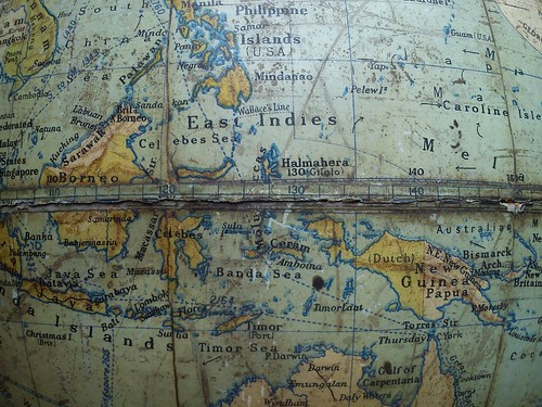
The Map View
Rather than show the usual Mercator Projection map of the area we were cruising, the picture below shows part of a (rather battered) family globe from the 1930s. We'd started at Port Moresby (around 9 degrees south of the equator and 147 degrees east of Greenwich). On the globe, this area is coloured 'British pink' although Australia had administered the territory from 1905. West Guinea is shown on the globe as Dutch - it was annexed by Indonesia as recently as 1975. As we continued west, we crossed into the northern hemisphere before arriving at Ternate in the Moluccas (just 47 minutes north of the equator). The British, the Dutch and other countries had interests in the Spice Islands over the years but it was the Dutch who finally allowed the area to become part of Indonesia as 'Maluku'. Westward again to Sulawesi, shown on the globe by its Portuguese name of 'Celebes'. Once again, after a chequered history it was the Dutch who passed the territory to Indonesia. Finally, we were travelling west to Borneo. On the globe, the northern part is coloured 'British pink' and what is now called 'Sabah' carries its earlier name 'British North Borneo'. These pink areas are now part of Malaysia. The larger, southern part of Borneo is another Dutch possession transferred to Indonesia. We would finally leave the ship at Sandakan (around 5 degrees north of the equator and 118 degrees east of Greenwich).
 Click for larger version.
From the Coral Sea to the South China Sea as it appears on a 1930s globe.
When I look at maps of the world, I'm always reminded of the early explorers who set off in tiny sailing ships with little in the way of charts and only very basic tools for navigation who opened up our world to global trade (despite some major misapprehensions about what was there).
On the Bridge
During daylight and when the ship was not "manoeuvring in confined waters" there was an Open Bridge Policy, so I made fairly frequent visits. We were crossing the Celebes Sea; further north lay the Philippines and, beyond, Hong Kong. Further south, the sea between Borneo and Sulawesi is called the Makassar Strait and provides a route to the important Indonesian island of Java and beyond so, for once, were seeing other ships.
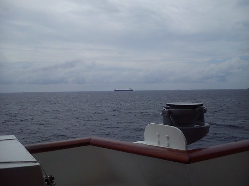 Passing a southbound oil tanker.
When I was on the Bridge on Monday afternoon, the ECDIS (Electronic Chart Display and Information System) showed our heading was 342 degrees and, west of our track, details of four other ships (obtained from a system called AIS which supplements radar and the need to keep a good lookout).
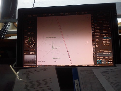 ECDIS (Electronic Chart Display and Information System) showing our track and other ships in range.
In the Engine Control Room
Health and Safety considerations determined that Engine Room visits were not possible but, with a few other passengers, I made a visit to the cramped Engine Control Room (E.C.R.) to find out more about the ship's systems. There's a album of pictures taken in the E.C.R. here and a post about the ship and its systems here.

The Engine Control Room on 'Caledonian Sky'.
I'll describe our arrival at Sandakan in a later post. You can find all the posts on this trip here.
My pictures
Sailing to Sandakan on 'Caledonian Sky'.
Engine Control Room, 'Caledonian Sky'.
Toli Toli, Sulawesi, Indonesia: Sunday, 8th February 2015 (continued)
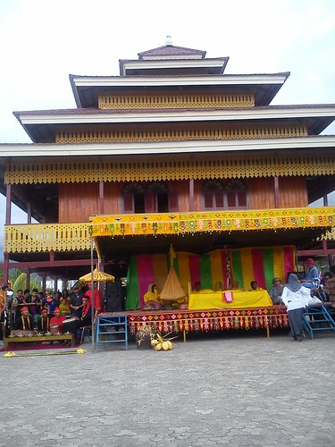
Our rather surprising journey by Police Convoy delivered us to the site for the promised traditional cultural performance. The location had been described as a 'traditional house' but appeared to be the former palace of a local sultan, now preserved as a museum. Once again, we were mobbed by smiling local people, anxious to shake our hands, have their picture taken or take our picture.
 A warm welcome in Toli Toli.
We slowly made our way through the crush to a courtyard at the rear of the building. A large modern tent, lavishly decorated, had been erected at one side of the courtyard and this was already occupied by what were clearly local dignitaries. The Mayor, the Chief of Police and the Head of the Prison Service were certainly there.
 The V.I.P. Tent.
a row of similar tents, with rows of chairs, had been erected on the second side of the courtyard and this, with a smaller tent along the third side of the courtyard accommodated the passengers from 'Caledonian Sky'.
 One of the tents for 'Caledonian Sky' passengers.
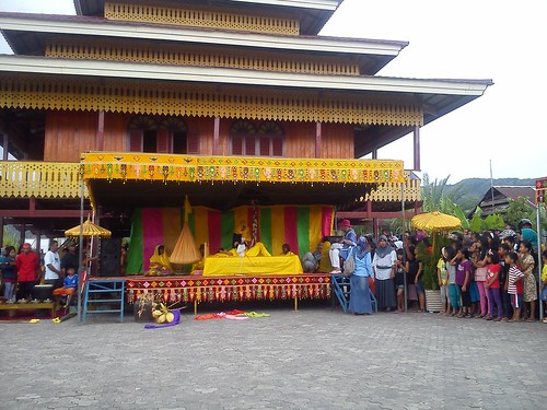
The fourth side of the courtyard was formed by the rear wall of the museum building. A low stage had been built and a number of local ladies were seated here. Two ladies from the ship were invited to join the local ladies on stage. The band from the passenger terminal at the jetty had set up next to the stage, re-inforced by an additional drummer.
The stage, with the band on the left and the museum building in the background.
A group of dancers (three boys and three girls in another traditional dress featuring black shorts for the boys and red 'pantaloons' for the girls) performed a dance for us.
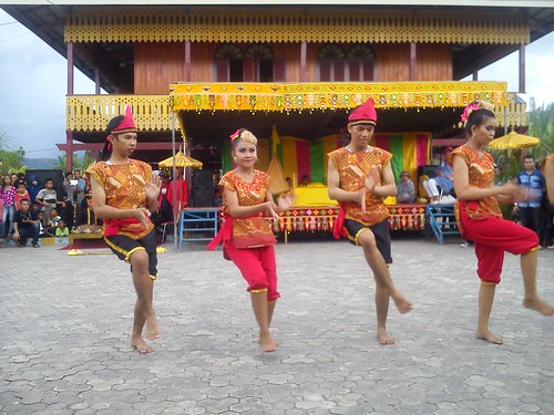 Part of the dance troupe.
For the next dance, four of the dancers carried wooden poles. After a variation of 'ring-a-ring-of-roses', the poles were used for a variation of the pole dance we'd seen at Kokas (described here. At Kokas, only two parallel poles were used first separated then ‘clacked’ together. At Toli Toli, two more poles at right angles to the first two were deployed, making it harder for the two remaining dancers to dance without getting trapped. Afterwards, our good-natured Expedition Leader, Jane, agreed to attempt the dance, with predictable results.
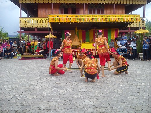 The Toli Toli Four Pole Dance.
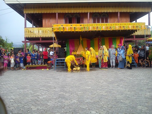
Attention now turned to the stage, where a 'Seven Months Pregnant' ceremony took place. Most of the passengers (including me) were rather unfamilar with this ritual, at least in the form we saw at Toli Toli. The Indian parentree site says "Most cultures the world over, have ceremonies/celebrations before a baby is born. Mostly, all over the world these are celebrated in the 7th month of pregnancy (Usually the odd numbered months – 7th or 9th for good luck - but the 9th month might be too late)." In Java, the mitoni ritual is practised. In Toli Toli, a bed covered with a yellow sheet had a number of coloured scarves placed across before a young pregnant woman in yellow 'pyjamas' lay on the bed. One of the local ladies on stage then declaimed the ritual, culminating in the removal of the uppermost of the scarves which was tossed into the courtyard in a theatrical manner. In turn, the other local ladies on stage each removed a scarf, followed by the two ladies selected from the ship. Finally, another local lady, presumably the oldest or most senior, removed the seventh scarf which was white.
 Removal of the seventh (white) scarf.
The young pregnant woman left the stage and stood in the courtyard, where she was joined by her husband, also in yellow pyjamas. I'm afraid they both looked rather miserable. I don't think I'd have enjoyed being the focus of such a public ceremony and, apart from all the photographs being taken by the ship's passengers and the various local people, there was a group of local men with high-specification cameras prowling the courtyard in a good imitation of paparazzi. As far as I could see, the husband was then required to chop the top off a coconut with a vicious-looking machete and present it to his wife. I suppose the final part of the ritual was predictable - the couple were liberally doused with water (giving a literal meaning to "baby shower").
 The bedraggled couple after the ceremony.
It was only afterwards I was told that the orange sheet arranged as a sling which had been suspended from the roof of the stage throughout the ceremony was a crib and had contained a four-week old baby, presumably to symbolise a happy delivery for the expectant mother. The Expedition Guide gave various presents to the young couple who perhaps then looked a little less glum. A few of the passengers were then selected to be honoured by Toli Toli - they were each presented with a decorated scarf and hat.
With the formal business completed, we were invited to look around the 'Museum'. At ground level, there were just timbers supporting the accommodation on what the English call the 'First' floor (but which Americans and much of the world call the 'Second' floor). A long flight of wooden steps lead up to the accommodation where the lighting was a bit difficult for photography but I've included a picture of a rather nice bed.
 The Bed in the Museum.
An open walkway ran around the outside of the accommodation and the local children were having great fun scooting around this whilst the opportunity presented.
 "... the local children were having great fun scooting around ...".
"The Mayor has invited you to visit his Premises" we were told, so we said goodbye to all our new friends and piled back onto the buses.
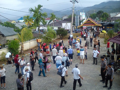 The 'Caledonian Sky' passengers making their way back to the buses.
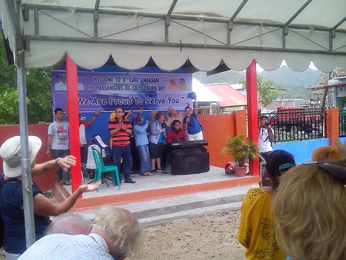
Once again, we travelled in convoy with the police pick-up truck leading the way. We made our way across town whilst it rained quite heavily. By the time we arrived, the rain had virtually stopped. The 'premises' appeared to be a large cafe with a roofed but open-sided area, plus a number of modern plastic tents to accommodate the 'overspill'. Once again, lots of local people were curious to watch the event. There was a permanent open-air stage with microphones, large loudspeakers and a 'Yamaha' keyboard. The back wall of the stage sported a computer-printed banner reading:-
WELCOME TO D' CAFE UMBASAN
THE PASSANGERS OF CALEDONIAN SKY
"We Are Proud To Serve You"
Soft drinks and beer were served together with a liberal supply of a sort of pancake, with chocolate sauce. The vocalist regaled us with various 'Western' standards and, before long, passengers from the ship were joining in enthusiastically. Once again, it did seem a little surreal.
 Sing-a-long, Toli Toli style.
But the best bit, for me, was the 'Bamboo Band'. This was like a Brass Band, but with the instruments made out of bamboo. Unbelievable! The melody was carried by bamboo 'piccolos', held transversely and played by using fingers to 'stop' holes, rather than keys. There were bamboo trumpets but without valves. I think there were 'stop' holes to allow some range. The other instruments seemed to be in the style of a marching band, with forward-facing bells similar to the mellophone and the sousaphone. Again, there were no valves and I'm not sure which instruments had 'stop' holes to give some variation but the combined effect provided a splendid 'oom-pah' sound, even if a mite limited musically.
 The 'Bamboo Band' - 'trumpets' in the first row, 'piccolos' in the second, 'sousaphones' behind.

The 'Bamboo Band' - variations on the 'sousaphone'.
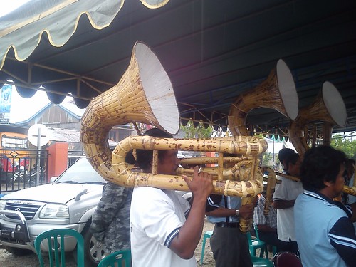 The 'Bamboo Band' - I've dubbed this splendid variation the 'toli-toli-phone'.
With this entertainment over, it was back onto the buses to be returned to our ship after a memorable afternoon in Toli-Toli. It was drizzling slightly as we made our way through the passenger terminal and across the jetty to the gangway of our waiting ship. I noticed a yellow road tanker parked near the stern of the ship, apparently having replenished our Fresh Water Tanks.
 Returning to our ship at Toli Toli.
At around 6.00 p.m., we left Toli Toli for Sandakan, a distance of 366 nautical miles.
You can find all the posts on this trip here.
My pictures
Sailing to Toli Toli, Sulawesi.
Toli Toli, Sulawesi.


