skip to main |
skip to sidebar
Following a meeting in London on 27th January 2017, I stayed with my friend Rita in Croydon. On Saturday, 28th January 2017, we decided to visit 'The View From The Shard'.
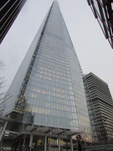
The Shard.
The Shard, situated in the London Bridge area of London is the tallest building in the United Kingdom at 1,016 feet. It was designed by Italian architect Renzo Piano and opened in 2012. The building has its own website at The Shard.
There's a Wikipedia article on the building here. I discovered that there's another version of Wikipedia called The Simple English Wikipedia with versions of the main articles better suited to students or people coming to grips with the complexities of the English Language. The Simple English article on The Shard is here. I found both versions very informative.
'The View From the Shard' is a tourist attraction offering "London's highest viewing platform". This attraction has its own official website here.
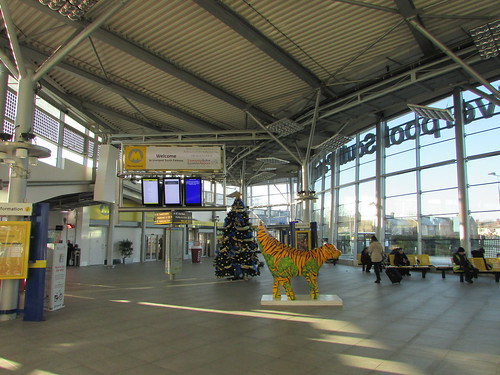
The Southern railway franchise was running a reasonable service from Croydon to London Bridge that day and a few minutes walk took Rita and I to 'The View From The Shard' and the ticket counter. There were plenty of visitors around but we only had a few minutes wait before we passed through the airport-style security installation and joined a short queue for the first of two lifts.

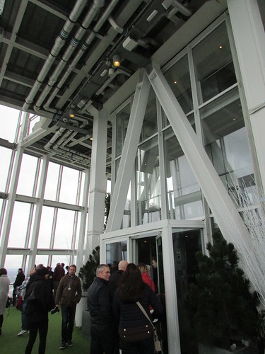
About to enter the first lift. The wall graphic shows how two lifts (elevators) are used to take visitors to the main viewing gallery.
A high-speed lift takes visitors to level 33, then a second lift ascends to level 68 where stairs lead to the main viewing gallery on level 69 (a lift is available when required).
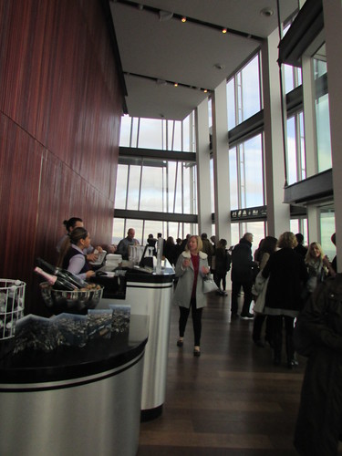
The View From The Shard: Main Viewing Deck.
Further stairs lead to the Open-Air Deck, level 72. Like the main viewing gallery, the area is surrounded by fully-glazed walls but it was distinctly cooler so I presume the tall space rising to the top of the building was vented to the outside.
The View From The Shard: Open-Air Viewing Deck.
Both viewing levels had simple refreshment facilities and there was a souvenir shop before descending to the entrance where there's another, larger shop. We were able to stay aloft as long as we wished and all the staff were unfailingly courteous. Visitors were free to take their own photographs but photographic souvenirs could also be purchased. The attraction certainly offered a unique view of London.
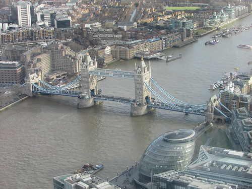
Tower Bridge.
It was only after my visit I remembered my visit to the Skybridge on floor 41 of the Petronas Twin Towers in Kuala Lumpur back in 2010. There's a very brief description here with links to my photograph albums. Both visits were very enjoyable.
Videos by Pink Banana Studios.
The Shard Occupier Film - 2016 (building tenants describe their experiences).
Renzo Piano explains the concept.
My pictures
Where necessary, clicking on an image above will display an 'uncropped' view or, alternately, my pictures may be selected, viewed or downloaded, in various sizes, from the album listed:-
London: The View From The Shard.
Croydon Airport finally closed in 1959 but, through the efforts of Croydon Airport Society, memories of this significant location in the development of aviation are kept alive. The Main Terminal Building survives as Airport House, now converted into a number of offices for small businesses and the Croydon Airport Visitor Centre.
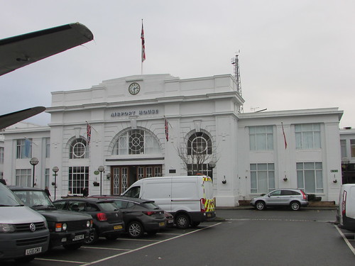
Airport House, Croydon.
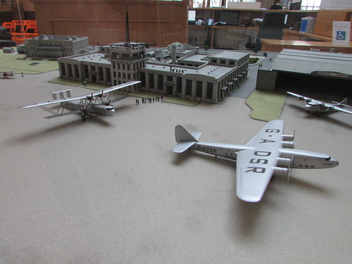
A 1:200 scale model of Croydon Airport in its heyday is displayed in Airport House Reception.
The iconic 'big biplane', the Handley Page H.P.42, handled most international flights in and out of Croydon, until replaced by more modern monoplanes like the Armstrong Whitworth 'Ensign'. In the picture above, an H.P.42 is on the left with an 'Ensign' G-ADSR on the right.
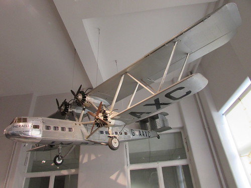
An imposing flying model of H.P.42 'Heracles' (G-AAXC) is displayed in the stairwell of Airport House.
History
The Croydon Airport Society website has a concise, but thorough, history here. Croydon Airport Society have also been involved in the creation of detailed published histories (see Related Books, below).
In 1916, the site was used by the fledgling Royal Flying Corps (later the Royal Air Force) as an aerodrome engaged in the defence of London against German airship attacks. The aerodrome replaced Hounslow Heath in 1920 as London's civilian airport and international passenger services were established. The original facilities were rather primitive so an Act of 1925 authorised the building of a new airport with hard-standing near the terminal although the actual runways remained grass.
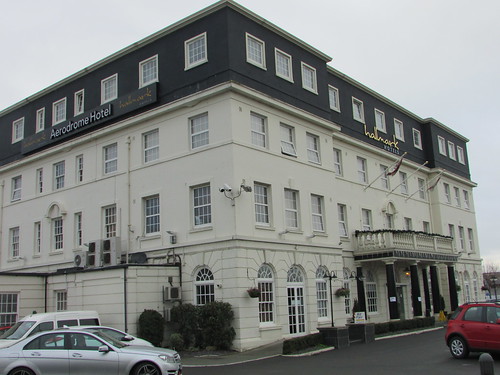
The new Administration Building, opened 1928, was built by Wilson Lovatt & Son. This construction firm (based in Wolverhampton, where I grew up) was founded in 1914 and survives, although under threat of 'striking off' by the Companies Registrar. A hotel, the 'Aerodrome Hotel', was built adjacent to the Administration building for the convenience of air travellers.

Croydon Airport: Administration Building Ground Floor Plan
(from the Official Guide, 1928).
Click here for a larger view
On the outbreak of World War II in 1939, the airport reverted to military use. In 1946, the airport was restored to commercial use but Heathrow was designated as London's main airport so Croydon's importance diminished although international services and general aviation flying continued until closure in 1959.
Croydon Airport Visitor Centre
Croydon Airport Society was founded in 1978 and in 2000 opened an award-winning volunteer-led micro museum designed by Haley Sharpe Design (whose head office is in Leicester). The first open day in 2017 was Sunday, 8th January 2017 and my friend Rita (who is a member of the Society) and I decided to visit. Adjacent to Airport House the 'Aerodrome Hotel', now operated by Hallmark, survives and retains its original name (but has acquired an additional storey). The Hotel was hosting a one-day sale of aviation memorabilia, including models, books and photographs, which Rita and I checked out. This is an annual event in January, coinciding with the first Open Day of the year by the Croydon Airport Society.
Aerodrome Hotel, Croydon.
Related books
[1] ‘The First Croydon Airport 1915-1928’ (Croydon Airport Society 2001 edition) ISBN 0-9541370-0-0.
[2] ‘Croydon Airport 1928-1939’ by Douglas Cluett, Joanna Nash, Bob Learmonth (London Borough of Sutton Libraries & Arts Services 1980 edition) ISBN 0-9503224-8-2.
[3] ‘Croydon Airport – The Peaceful Years’ by Mike Hooks(2006 reprint) ISBN 0 7524 2758 X (Photographic collection with detailed annotations).
My Pictures
Where necessary, clicking on an image above will display an 'uncropped' view or, alternately, my pictures may be selected, viewed or downloaded, in various sizes, from the album Airport House, Croydon.
A year older but, I suspect, no wiser, with a generous collection of new memories and a clear understanding of how fortunate I've been.
OVERSEAS TRAVEL
I fitted in three overseas trips in 2016, outlined below. For lists of most previous travels see:-
Jan Ford's Travels (2001 onwards).
Jan Ford's Travels - The early trips (before 2001).
Jan Ford's Travels: Around the World in pictures (alphabetic list with links to pictures).
South Atlantic Voyage
This was an Expedition Cruise on the ship 'Silversea Explorer' which Silversea call 'Cape to Cape' (Cape Horn to Cape of Good Hope). I embarked in Ushuaia, sailed to the Falkland Islands, then South Georgia, then the isolated islands of Tristan da Cunhaa before finishing our crossing of the Atlantic at Cape Town.
 I was pleased to visit remote Tristan da Cunha, even when it rained (Photo: Laurent Derame).
You can find all the posts here or go to the first post in the series here and follow links to subsequent posts on the trip.
Trip to Burma
My visits to Myanmar, as Burma is now named, have become an annual affair. This years visit was especially varied including getting wet at the annual water festival, witnessing the new year at the amazing Shwedagon temple, visiting Drop In Centres in Mon State, observing the work of the Bagan Medical Clinic, visiting schools around Bagan, travelling by train up the 'Zig-Zag' line to Kalaw (where I visited various temples and attempted but failed to milk a cow at my hotel, Kalaw Hill Lodge), tried out the 'new' electric tram line in Yangon, travelled on the railway around Yangon with a visit to a railway signal box and spent six days on a yacht cruising in the Mergui Archipelago.
Yacht 'Meta IV' at anchor at Ba Wel.
All the posts on the trip in 2016 are here or go to the first post in the series here and follow links to subsequent posts on the trip.
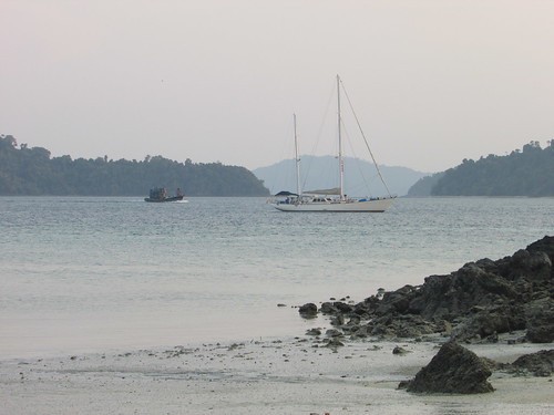
Chilean Fjords and Antarctic Peninsula
November saw me starting another trip on 'Silver Explorer', this time seeing the Chilean Fjords and making my second trip to the Antarctic Peninsula. I flew to Santiago via Paris and, after one night in Santiago, travelled to the improbable, facinating city of Valpasraiso where I boarded the ship. Unusually, before we finally left Chile, we were able to make a landing at Cape Horn.
Cape Horn: The Albatross Memorial to drowned sailors.
After visiting the Antarctic Peninsula, the cruise finished at Ushuaia, Argentina, from where I flew to the capital, Buenos Aires (finding time to ride around on their metro system called 'Subte') before flying to Iguassu Falls (which straddles the border between Argentina and Brazil) and spending two nights at the luxurious Hotel das Cataratas on the Brazilan side. I had time for a comprehensive tour of the falls from both the Brazilian and Argentinian side, together with a visit to the most productive hydro-electric station in the world, Itapu, before returning home.
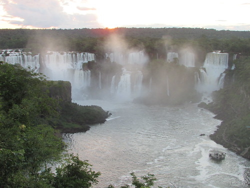
Part of Iguassu Falls - viewed from Brazilian side.
You can find all the posts here or go to the first post in the series here and follow links to subsequent posts on the trip.
TRAVEL IN THE UK
During the year I made a few trips (mainly by rail) to various destinations, some of which have blog posts.
By Train to Surrey
Grand Central and Birmingham New Street Station
Return to Llandudno
Return to Blackpool and Fleetwood (part 1)
By Rail to Nottingham
Return to Manchester
Return to Merseyside (Part 1)
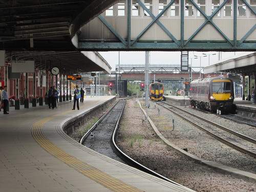
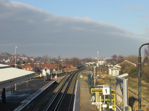
Nottingham station: View from platform 3.
RAILWAYS AND PRESERVATION
During 2015, I continued to support the Old Locomotive Committee and remained an active volunteer at The Battlefield Line and Peak Rail.
The Old Locomotive Committee
On Saturday, 7th May 2016 the 31st Annual General Meeting of the Old Locomotive Committee was held in the Old Pilotage Building adjacent to the Museum of Liverpool. Although I remain secretary, I wasn't able to attend in 2016 because of a conflict with my trip to Burma (see above). However, I did attend the 'Lionsmeet' event on Saturday, 27th August 2016 which was hosted by Nottingham Society of Model and Experimental Engineers Limited at Ruddington, near Nottingham. My report is here.
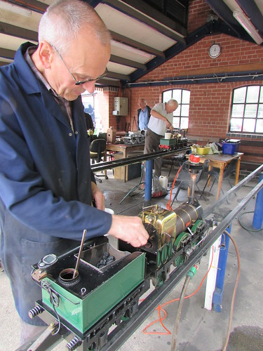
Lionsmeet 2016, Nottingham: Jon Swindlehurst prepares his 'Lion' with another 'Lion' being steamed in the background.
You can find all my posts about OLCO here and there's more information on the Old Locomotive Committee's website (and becoming a member) here.
The Battlefield Line
I had a number of driving turns during the year, some of which are described in blog posts:-
Sunday at Shackerstone
Teddy Bears' Picnic
'Operation: Market Bosworth' - The Battlefield Line 1940s Weekend 2016
'Operation: Market Bosworth' - On the Footplate
Shackerstone Santa Specials
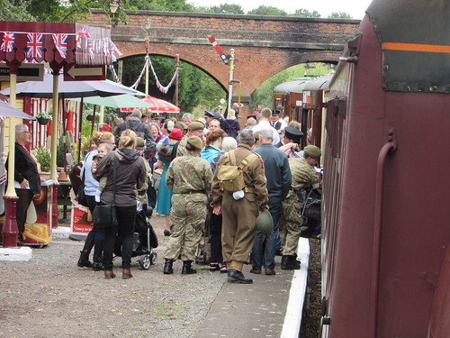
Battlefield Line 1940s Weekend 2016: Passengers at Market Bosworth.
You can find all my posts about the Battlefield Line here.
Peak Rail
I regularly drove steam during the year and there are some blog posts:-
Peak Rail Winter Season
'Peak Forester', 2016
Peak Rail 1940s Weekend, 2016
Peak Rail Santa Specials
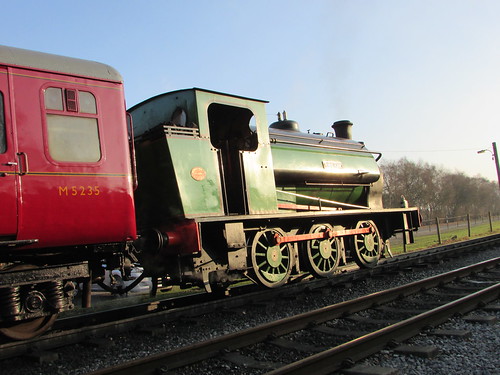
Visiting locomotive 'Ring Haw' at Peak Rail.
You can find all my posts about Peak Rail here.
Myanma Railways
During my 'Trip to Burma' (see above) I again spent some time studying the railway system, resulting in a number of blog posts:-
Trams Return to Rangoon
Thazi Railway Station and Diesel Locomotive Depot
Kyee Myin Daing Railway Station
Around the Circle Line in 2016
Thazi-Kalaw
Thazi - Kalaw (part 2)
Insein Railway Station
Around the Circle Line in 2016.
You can find all my posts about Myanma Railways here.
BREWOOD HALL
The Brewood Garden Party was held at Brewood Hall for the fourth time on Saturday, 16th July 2016. Once again, we were lucky with the weather. There's a report here.
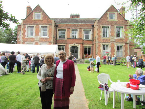
Brewood Garden Party 2016.
You can find all my posts about Brewood Hall here.
'ROAD TO MANDALAY' SOCIAL CONTRIBUTION
For a number of years, I've supported the charitable initiatives operated under the above name in Burma. When I visit Burma, I try to see as much as possible of the work in hand. The charity provides Educational Support to a range of schools and orphanages (including the Orphans & Vulnerable Children Project in Mon State) and Medical Treatment to all ages (centred on the wonderful Bagan Medical Clinic).

Hlaing D.I.C. in Mawlamyine.
You can find my posts on Educational Support here and those on Medical Support here.
OTHER BLOG POSTS IN THE YEAR
This review covers trips and events during the year but doesn't include other types of post including:-
technical or historical articles, mainly about railways
recollections of past events
PREVIOUS ANNUAL REVIEWS
2015
2014
2013
2012
2011
2010
2009
2008
2007
2006
This report is based on information from Doctor Hla Tun, who also supplied the photographs. The delay in posting this report is, I'm afraid, down to me.
My previous report showed monthly statistics up to the end of October 2015, when the total number of treatments since the Clinic opened on August 6, 2011 was 159,680.
Treatment Summary
The table below summarises the number of treatments per month from November 2015 to March 2016 and the total number of treatments.
| Month |
Treatments in month |
Total treatments |
| November 2015 |
1,470 |
161,150 |
| December 2015 |
1,590 |
162,740 |
| January 2016 |
2,691 |
165,431 |
| February 2016 |
2,170 |
167,601 |
| March 2016 |
1,610 |
169,211 |
General Notes
Need for translators
Some patients travel long distances from the Delta, Rakhine State and Chin State to the Clinic. Translators are required for some of these ethnic groups because of the local dialects they use rather than standard Myanmar language.
Free Lunches
Lunch is served to patients and their companions on the clinic days (Friday, Saturday, Sunday).
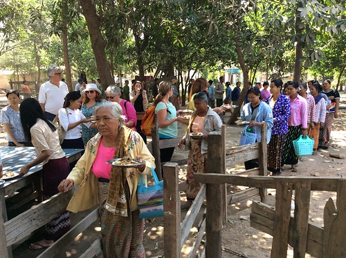
Free Lunch being served to waiting patients by guests from 'Road to Mandalay' ship.
Anti-snake Venom
The Bagan Medical Clinic has made a number of donations of Anti-snake Venom to local hospitals. In July 2015, during flooding which increased the risk of snake bites, donations were made in Magway, Nyaung Oo and to local health staff. Originally, the products were imported from India or Thailand. However, locally-made products (extracted from horse serum after being injected with venom from indigenous vipers and cobras) prove more potent. The donations are particularly important because almost all snake-bite victims are farmers or daily-waged who are often unable to afford the more potent but more expensive local product. Provided the victim is admitted to hospital promptly, the treatment saves lives. The picture below shows the Assistant Surgeon at Myin Mu hospital receiving anti-snake venom from Dr. Hla Tun.
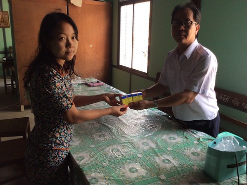
Donation of anti-snake venom to Myin Mu Hospital.
Other reports on medical support in Myanmar
There are a number of posts in this Blog describing medical support in Myanmar provided by the RTM Social Contribution with help from donors around the world. You can find them all here.
Photographs
There's a collection of pictures showing the Bagan Clinic from its inception here.
Doctor Hla Tun's photographs showing the work of the Bagan Clinic can be accessed by the following links:-
2014
2015
2016
On Saturday, 7th January 2017 my friend Rita and I decided to make a day trip from Croydon to Brighton.
I've complained before that our railway system has developed the habit of withdrawing services to allow engineering works to take place at what long-suffering passengers consider to be inappropriate times. The weekend we travelled, early in the New Year, less than half the usual trains were running between London and Brighton and these were terminating at Three Bridges with the journey being completed by Rail Replacement Buses. In the spirit of adventure, we endured these arrangements and enjoyed our time in Brighton.
We arrived at East Croydon station with only a short wait before the service as far as Three Bridges. The station was busy and there seemed to be a fair amount of confusion amongst passengers regarding the temporary arrangements which harrassed staff were attempting to address, not helped by a lack of signage or co-ordinated visual and audible announcements on the various 'Passenger Information Systems'. The train was well-loaded but proceeded reasonably enough to Three Bridges, with a stop at Gatwick Airport.
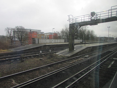
Arriving at Three Bridges.
A busy 12-coach train discharging all its passengers at Three Bridges rather challenged the station facilities. I saw little in the way of signage and station announcements were inaudible but we had little alternative to being swept along in the crowd, down the long subway ramp and out through a side entrance on the Up side, where I saw one small printed sign with an arrow saying 'Buses'. We had to climb steps, cross a busy car park access road and enter a large, featureless car park. I saw a few people in high visibility jackets, who appeared to be hired-in security. They were studiously avoiding the crowd surging past in favour of the attractions of the screens of their various mobile phones. We followed the crowd towards the back of the car park where coaches and buses from a number of firms were parked, with a variety of stickers in the front windows, just a number, 'Rail Replacement' or the slightly more helpful 'Brighton'. I'd managed to work out that there were two types of bus to Brighton, direct and calling at all intermediate stations but none of the signs gave that information. I asked a young marshal which was the 'Direct Brighton' coach and he was very definite in identifying the correct coach. So my friend and I clambered up the steps to the high-level floor of the long-distance coach and found seats. After a short wait, another marshal appeared and announced that we were, in fact, on the 'All Stations' coach and directed us to another coach some distance away, apologising briefly for his colleague's error. With a groan, about a dozen misdirected travellers got off and we all made our way to the other bus, with a similar set of steps to be negotiated.
Finally, the coach set off but took around 45 minutes to complete the journey to Brighton, taking some time to thread its way through the heavy traffic past Preston Park and into the centre of Brighton, where narrow streets led us to the station's pick-up and drop-off area, some distance from the front entrance of the station. Relieved at actually being in Brighton, we set off on the walk towards the station buildings, on which I was happy to distract myself studying the Train Shed, a magnificent Victorian structure with two main arches and a smaller one on the Down side which we passed under to reach the concourse. There was a limited service of trains being run on the other lines radiating from Brighton, but the majority of travellers seemed to be trooping to and from the temporary bus terminal we'd just arrived at.
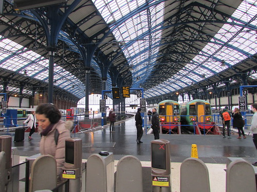
Brighton station, viewed from the Gate Line.
In the civilised way that used to be commonplace at major railway stations, having passed through the entrance of the main station building we came to a covered taxi rank with a number of waiting vehicles and were soon on our way to the Grand Hotel through a Brighton crowded with Saturday shoppers. The hotel currently rather lacks its external grandeur having started, in October 2016, a major project to restore the facade but the top-hatted doorman was welcoming enough. The reception area was exceptionally busy, dealing with enrolment for the BRIGHTON AREA INTERGROUP – 14TH AA WEEKEND CONVENTION. As a result, both the dining room and the terrace overlooking the sea were unavailable. We did take a simple lunch in the bar/coffee shop area of the ground floor but there were signs of the pressure the staff were under.

Brighton: Grand Hotel, looking towards entrance.
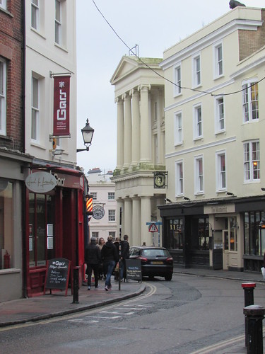
Having obtained a street map, we decided to walk to an area of the old town called 'The Lanes' - a network of narrow passages and small shops that, when I was younger, were the haunt of a myriad antique shops. But, to my disappointment, the area appears to have been largely modernised and is mainly multiple eating opportunities and clothing stores, lacking the character I remember but still very successful in attracting visitors.
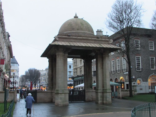
Brighton: Town Hall.
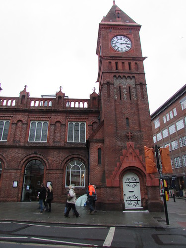
After some time exploring the interesting alleyways, we walked along North Street and admired the Chapel Royal. This dates from 1793 when the foundation stone was laid by the Prince Regent. The present rather odd architectural style with brick, flint and terracotta results from repairs and alterations by Arthur Blomfield towards the end of the 19th century when the clock tower was added. There's a Wikipedia article here.
Brighton: Chapel Royal.
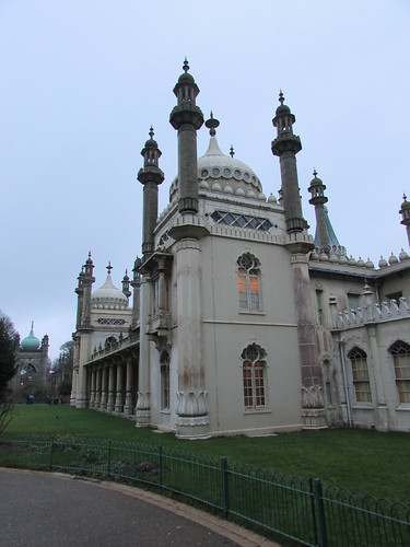
Next, we studied the outside of the Royal Pavilion, an exotic pleasure palace developed for the future King George IV from a more modest building by John Nash, starting in 1815. In 1851, the Royal Pavilion was opened as a public attraction, having been purchased by Brighton from Queen Victoria the previous year. There's more about the Royal Pavilion on Wikipedia here and an excellent full-colour Souvenir Guide & Catalogue (see 'Related books' below).
Brighton: Royal Pavilion.
Just outside the Royal Pavilion is the India Gate, whose interesting history I'd forgotten. The Indian Memorial Gate was a gift from India following World War I, given in thanks for the the care given to around 12,000 wounded Indian soldiers in Brighton at hospitals set up in the Royal Pavilion and other locations. There's a detailed report on the opening ceremony in 1921 here and an interesting article on the 'Sikh Museum' site here.
The Indian Memorial Gate, outside the Royal Pavilion.
In 1841, a railway had been opened from London to Brighton by the London and Brighton Railway but earnings were initially disappointing. In 1846, disgruntled shareholders forced amalgamations to form the London, Brighton and South Coast Railway (LBSCR) and the railway made serious attempts to encourage 'trippers'. With attractions like the Royal Pavilion, the rail traffic grew. You can read more about the origins of the railway in the post Origins of the Southern Railway: Part 2: L.B.S.C.R..
We made our way to the promenade just by the concrete and stone groyne bearing the public artwork Afloat. This represents our planet transformed into a 'Donut' (technically, a torus). An interesting idea, but not for me, I'm afraid. To the east, lights were appearing along the length of the Palace Pier.
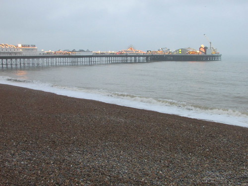
Brighton: The Palace Pier.
To the west stood the dark, sad skeleton of the West Pier, opened in 1866, closed in 1975 and seriously damaged by collapse and fire since 2002. The pier structure still stands (in rebuke?) near the not-universally-welcomed 'i360', sorry, the British Airways i360, opened in 2016. This is "the world's slenderest tall tower", 531 feet tall and lifting up to 200 people at a time to a height of 435 feet. There's a Wikipedia article here. I'll reserve judgment until I've tried it.
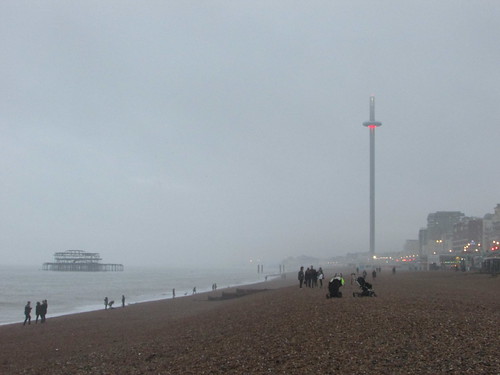
Brighton: The remains of the West pier and the i360 observation tower.
We'd had a recommendation to try the Mock Turtle Tea Room - a traditional tea shop hidden in a side street near East Street which revived us with tea and teacakes. The 'Mock Turtle' is, of course, a fictional character in Lewis Carroll's book 'Alice's Adventures in Wonderland' but I didn't realise, until I consulted the Wikipedia article here, that Mock Turtle Soup was a popular dish in Victorian times providing a cheap substitute for Green Turtle Soup. We walked to the nearest taxi rank and took a taxi back to the front of Brighton Station.
There were plenty of passengers about, but staff seemed to be confined to security staff mournfully watching the passing crowds. The normal electronic Passenger Information Displays situated near the ticket barriers on the concourse had been updated to give a slight hint as to the use of buses, showing buses as if they were trains, without a platform number but with a scrolling note at the bottom of the screen reading 'Bus leaves from car park ...' but with no guidance I could spot as to how you reached the car park. Of course, we knew the rather improbable pedestrian route we had to take from our arrival earlier in the day but I sympathised with the uncertainty some travellers displayed. Once we emerged from the train shed into the darkened bus pick-up area, we could see large crowds and some buses. I asked an apparent member of staff where the direct Three Bridges bus loaded. She expertly duped me by pointing to the swirling crowd and claiming "the man with a clipboard over there has details of the buses". Of course, there was no 'man with a clipboard' just rather gladiatorial jousting as people clambered on buses. We abandoned the nearest bus as both not indicating its route and also being unlikely to have free seats by the time we succeeded in boarding. At a somewhat calmer area around a similarly anonymous bus, the driver was getting off and confirmed he was going to Three Bridges without intermediate stops so we gratefully boarded. I was quite surprised when we moved off promptly and made fairly good time to Three Bridges.
To my relief, on arrival at the station, the bus stopped at the ramped entrance to the main station building, so we had only a short walk to the ticket barriers, which we bypassed because a wide access gate had been opened. I spotted an employee in the darkness by the Gate Line Control panel. He seemed quite startled when asked what platform we would require but his answer proved correct. We went up the long ramp to the platform he'd suggested and, within a few minutes, a train arrived which conveyed us back to East Croydon without further excitement. We had a good day but very little credit goes to the Government, the Infrastructure Operator (the dreadful Network Rail) and the Train Operating Company (the reviled Southern) for allowing our national railway system to descend to such a poor level of service. The Southern franchise has been in dispute with its staff for over nine months over the extension of Driver Only Operation (DOO) and two days later, Southern drivers started a further series of strikes which paralysed the system. Separate strikes by London Underground staff heightened the misery for commuters.
Related books
[1] ‘The Royal Pavilion Brighton:Souvenir Guide & Catalogue’ edited by David Beevers (Brighton & Hove City Council) ISBN 0-948-72321-1.
My Pictures
Where necessary, clicking on an image above will display an 'uncropped' view or, alternately, my pictures from this (and earlier) trips may be selected, viewed or downloaded, in various sizes, from the albums listed:-
East Croydon Area Rail.
Brighton area rail.
Brighton.
['Souvenier Guide' reference added: 23-Jan-2017]
On 29th December 2016, I made a trip to Liverpool by train. The journey there, visiting the Museum of Liverpool and crossing the river on the Mersey Ferry is described here. After the ferry my exploration by rail as far as Liverpool Central is described here. Now read on ...
At Liverpool Central, I'd decided to take a Northern Line train to Liverpool South Parkway and pick up my Wolverhampton-bound service there, giving me enough time to have a brief look (a very brief look) at what remained of the docks 'upstream' from Pierhead. Whilst there are quite a few posts in this blog about Liverpool, including explorations around the dockland downstream (north) of Pierhead and in Birkenhead, the dockland upstream (south) of Pierhead has received scant coverage. That's partly because I decided that upstream, the changes had been more massive, leaving less of historical interest to find. The original extent of the upstream docks is shown below. For a high-resolution version of this image, go to Liverpool Overhead Railway Map & Guide.
The original extent of Liverpool Docks 'upstream' from Pierhead, with the Liverpool Overhead Railway shown in red (from the Liverpool Overhead Railway Map and Guide).
In the post More Merseyrail, I described a trip on 4th October 2014 which included a journey from Hunts Cross to Sandhills where I commented:-
"The area around the modern Brunswick station appeared to be a retail park - I'll have to go back to see if any parts of the early railway infrastructure remain".
So, I decided to try to 'whet my appetite' by a very brief visit around Brunswick Business Park and caught the next service from Liverpool Central towards Hunts Cross. We left Liverpool Central and entered a bewildering series of tunnels, a mixture of ancient and modern, at some point joining the Cheshire Lines Committee extension from Brunswick which opened in 1874. At one point, there was a series of 'DO NOT ALIGHT HERE' signs on the tunnel walls which I assumed was the location of St. James' station, closed in 1917. The 'Disused Stations' site has a detailed report on St. James' here. Emerging from the series of tunnels, my train curved left under the Caryl Street skew bridge and immediately halted at the present Brunswick station.
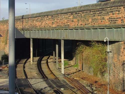
Caryl Street skew bridge at north end of Brunswick station.
The original Brunswick passenger station opened in 1864 but was closed when Liverpool Central opened in 1874. However, the important goods facilities with connections to the dock system continued in use until the 1970s. Once again, there's a 'Disused Stations' detailed report here.
The present Brunswick station dates from 1998 (there's a Wikipedia article here). A few people alighted with me and I followed them to the particularly utilitarian and ugly footbridge which led us over the tracks to the river side but I noticed there's a further exit at high level into Caryl Street and the housing on the landward side. The station has a (free) car park and is flanked by a small bus station.
I crossed the busy main road (Sefton Street) and looked back, to see a magnificent stone facade - the restored remains of the approach to what was once Horsfall Street Bridge over the railway. The bridge itself is long gone but the approach, with twin stone steps and vehicle ramps looks suitably grand.
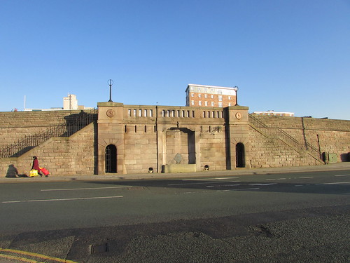
Restored approach to former Horsfall Street Bridge.
The two round plaques (featuring the Liver Bird) read "ERECTED BY THE HEALTH COMMITTEE 1866".
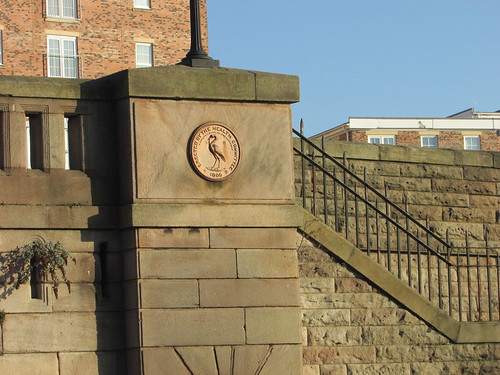
Commemorative plaque on former Horsfall Street Bridge, Brunswick.
Further explanation was afforded by the decorative plaque which read:-
THIS RAMP WAS ERECTED BY THE LIVERPOOL HEALTH COMMITTEE IN 1866 TO PROVIDE ACCESS TO A BRIDGE SPANNING THE FORMER CHESHIRE LINES RAILWAY LINKING HORSFALL STREET WITH THE DOCKS
THE RAMP WAS RESTORED BY MERSEYSIDE DEVELOPMENT CORPORATION IN MAY 1984 AS PART OF THE REGENERATION OF LIVERPOOL SOUTH DOCKS
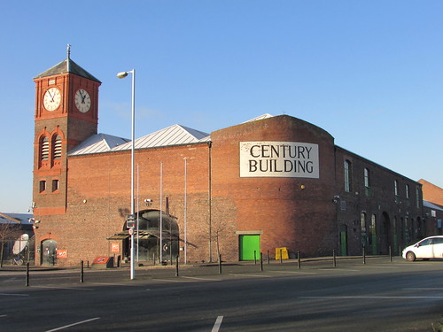
I entered the fenced Brunswick Business Park and walked down Harrison Way towards the river. On my right lay a huge brick-built warehouse building, marked 'Century Building', complete with a clock tower marked '1887' (and a working clock) - clearly an original dock building restored, modernised and now forming part of the Brunswick Business Park.
'Century Building', Brunswick Business Park.
I passed a broad car park and came to another huge, brick warehouse on my right, similarly modernised, just before reaching the river bank. This building carried a dual datestone 1887/1987 and was occupied by King and Fowler Limited.
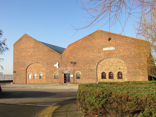
Modernised warehouse building, Brunswick Business Park.
Looking further right and to my left, I could see more large, modernised buildings forming lines with the two buildings near me: one row near Sefton Street, the second row near the river. When I returned home, I was able to confirm my suspicions that the rows of buildings to my right were the original transit sheds and warehouses of Toxteth Dock, those to my left had served Harrington Dock. The 'broad car park' on my right was the filled-in Toxteth Dock, that to my left the filled-in Harrington Dock.
The picture below, from the Liverpool Daily Post shows the area in September 1957 during the demolition of the Liverpool Overhead Railway. The warehouse with the clock tower is visible in the background.
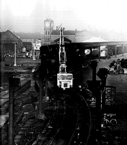
1957 view at Harrington Dock, looking north, as the Liverpool Overhead Railway is demolished (Photo: Liverpool Daily Post).
Continuing my walk, I passed the Business Park service road called Atlantic Way and the business park fence, where a pedestrian gate lead me to a promenade overlooking the river. A number of cyclists were using this promenade. Indeed, I could have hired a bicycle right there as Liverpool has a Citybike Cycle Hire Scheme with an unmanned hire station on the promenade at Brunswick Business Park. There's more information on the scheme here.
Across the river, I could see the tanker I'd spotted from Rock Ferry earlier in the day. I took a picture and identified the vessel as 'MR LEO'. I was sure the 'MR' didn't mean 'Mister', despite the fact I thought that would be quite an amusing name, but I had to look-up the the fact that 'MR' is used to denote 'medium range oil tankers between 30,000 and 50,000 Dead Weight Tons'. I also discovered that 'MR LEO' is 175 metres long with a 32 metre beam (width) and a gross tonnage of 30,345. By the time I looked the vessel up, it had already left the Mersey and had arrived in Antwerp.
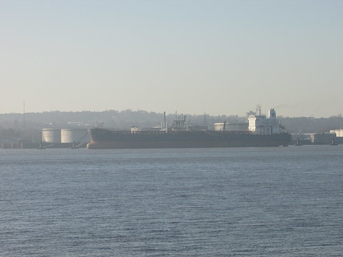
Tanker 'MR LEO' moored at Tranmere, Birkenhead.
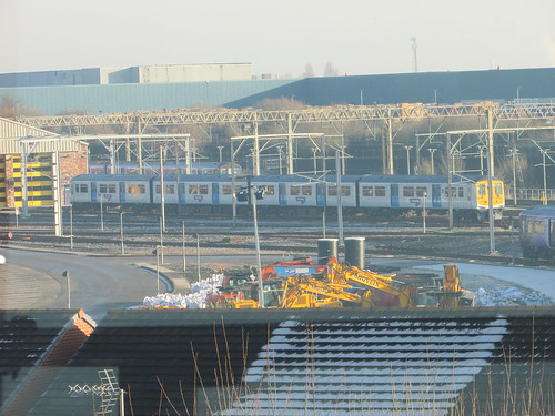
My vantage point also allowed me to take more pictures of the Cammell-Laird Shipyard on the Birkenhead shore. Anxious to stick to my timetable, I then hurried back to Brunswick station, in time to catch an electric train as far as Liverpool South Parkway.
Once upon a time, the station was simply 'Allerton' (the surviving British Rail standard pattern signalbox is still called, simply, 'Allerton Junction') but has been transformed into a modern 'transport interchange' with extensive car parking, bus station, shuttle bus to the nearby airport (now 'John Lennon Airport'). The third-rail electrified Northern Line of Merseyrail and the 25 kV a.c. overhead electrified Crewe-Liverpool Lime Street line serve the new station, together with certain 'City Line' and long-distance services which use the main line between Liverpool Lime Street and Liverpool South Parkway but are then routed via the non-electrified former 'CLC' line.
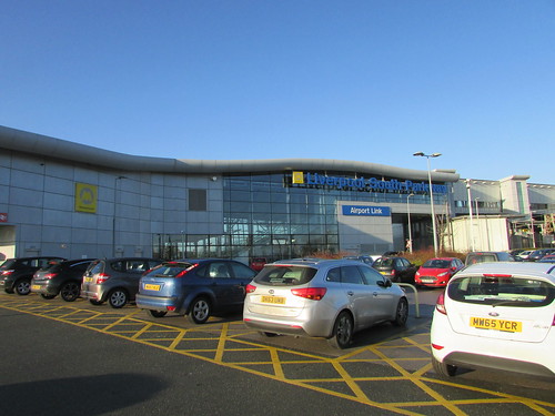
Liverpool South Parkway from the car park.
Readers will be aware that I'm not a great fan of modern architecture but the new station is light and airy so I found its modernity acceptable. The Ticket Office was operated by Merseyrail and looked more like a small supermarket. There were newspapers and magazines, food, drink, confectionery and a hot drinks machine (but they sell tickets, too). I rather approve of Merseyrail's approach, particularly since purchases are made at an open counter rather than via a toughened glass screen with communication using an often-inaudible intercom system, as is the case at many large stations.
Liverpool South Parkway from inside.
Northern Rail have a Traction Maintenance Depot at Allerton and from the bridge linking to the main line platforms I could see a Class 319 there, still in Thameslink livery. When the Liverpool and Manchester line was electrified in 2015, the first of 20 sets of the 25-year old Class 319 were cascaded from the London area following 'overhaul'. I wrote about this in the post By Train to Irlam (but a couple of the external links I quote there no longer work, sorry).
Class 319 outside Allerton TMD, still in Thameslink Livery.
I had a few minutes to wait before my train arrived, watching various trains arrive and depart under the control of Allerton Junction Signal Box. British Railways ran out of money during the original electrification of the Euston to Liverpool line so, whilst the London end of the route was favoured with a series of 1960s-era Power Signal Boxes, the northern end retained many of the mechanical signal boxes with colour light signals and, in some cases, power operation of points. In the years since, these signal boxes have been subject to various incremental attempts at modernisation. Allerton Junction is one of these survivors. Although all the running signals are colour light, I spotted a few ground disc shunting signals still mechanically operated by wire.
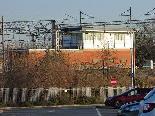
Allerton Junction Signal Box.
My train arrived just a minute late and the waiting passengers joined an already-busy train. We made the usual stops with people leaving and joining so we remained pretty full for the whole journey back to Wolverhampton. As usual, I found the trip very enjoyable but tiring.
Related posts on other sites
Merseyrail - A Brief History (Merseytravel).
Northern line (Merseyrail) (Wikipedia).
Liverpool’s citybike cycle hire scheme.
Related posts on this site
Return to Merseyside (Part 1).
Return to Merseyside (Part 2).
More Merseyrail.
Railways around Birkenhead.
I've written about Liverpool a number of times. Most are referenced in the post Liverpool (again).
My Pictures
Where necessary, clicking on an image above will display an 'uncropped' view or, alternately, all the pictures from this and earlier trips may be selected, viewed or downloaded, in various sizes, from the albums listed:-
Return to Merseyside (This trip).
Merseyrail (Earlier trips).
Liverpool Overhead Railway Map & Guide.
On 29th December 2016, I made a trip to Liverpool by train. The journey there, visiting the Museum of Liverpool and crossing the river on the Mersey Ferry is described here. Now read on ...
Hamilton Square
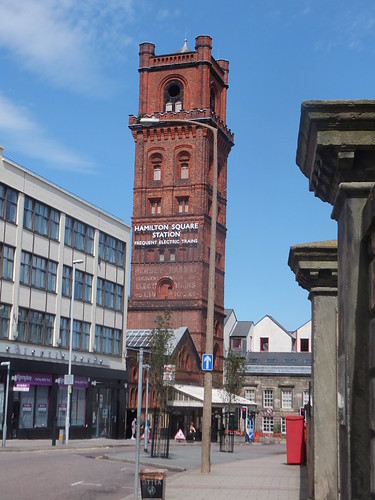
Birkenhead Hamilton Square station building looking towards the river.
Having made the almost-obligatory journey on the Mersey Ferry, I walked to Birkenhead Hamilton Square station, where my 'Saveaway' ticket admitted me past the automatic barriers and a rapid lift took me down to the underground concourse level where steps lead down to each of the three platforms (1: to Liverpool, 2: to Chester/Ellesmere Port, 3: to West Kirby/New Brighton). I'd decided to make a brief visit to Rock Ferry, so I took the steps to platform 2 and, within seconds, a 3-coach Chester train arrived. After stops at Birkenhead Central and Green Lane, I alighted at Rock Ferry.
Rock Ferry
Rock Ferry is an interesting location which has seen many changes over the years. The Chester & Birkenhead Railway passing through Rock Ferry was originally a single line railway. It opened in 1840 to a terminus in Grange Lane, Birkenhead. The line was then extended via a single-line tunnel to a cramped site at Monks Ferry, from where ferries provided a connection to Liverpool. There's more information about Monks Ferry on the excellent Disused Stations site here. Following a merger in 1859, the line became part of the Birkenhead Railway, which was acquired jointly by the London & North Western and Great Western railways in 1860. In 1878, a new terminus was provided at Birkenhead Woodside. This important route eventually became 4-track for much of the route (Down Slow/Up Slow to the west, Down Fast/Up Fast to the east). In 1891 Rock Ferry also became the southern terminus of the Mersey Railway when the line extended south from the original terminus at Green Lane. The Mersey Railway was operated by steam haulage until electrification in 1903.
Even as recently as 1961, Birkenhead Woodside retained quite a healthy service, as shown in the post Services to Birkenhead Woodside in Steam Days. But, by 1967 the passenger service from Chester to Birkenhead had been reduced to a few Diesel Multiple Units. Terminating these trains at Rock Ferry and forcing passengers to change to the electric trains on the former Mersey Railway to reach Birkenhead (and Liverpool) allowed Birkenhead Woodside station to be closed. For more information about Birkenhead Woodside, see the Disused Stations site here. Rock Ferry then became two terminal stations, side-by-side, pointing in opposite directions and I remember during this period once making the journey from Liverpool to Chester with a change from EMU to DMU at Rock Ferry.
In 1985, Rock Ferry became a through station once again when Merseyrail electrified the line from Rock Ferry to Hooton. Subsequently, this electrification has been extended to Chester and Ellesmere Port.
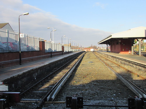
Rock Ferry station, looking north. (L-R) Platform roads 4, 3, 2, 1, Goods Line.
In the view above, platform roads 4 and 3 are the terminal platforms originally provided by the Mersey Railway (now used for stabling stock and occasional passenger services). Platform roads 2 and 1 are the through platforms serving trains between Liverpool and Chester/Ellesmere Port (formerly the Down Slow and Up Slow). The Goods Line (behind the fence) is what remains of the former Down Fast and Up Fast lines. The Goods Line still connects to what's left of the Dock Lines but appears to be out of use. However, signal ML730 is still lit. It is a single-aspect colour light, permanently red. Movements towards the uncontrolled dock lines are authorised by the 'cats eyes' subsidiary signal of two white lights diagonally.
Rock Ferry station - terminal platforms 4 and 3, looking north. There was originally a 'middle siding'.
Most of the station facilities are modern. There's an earlier brick and stone kiosk on platform 2 boarded-up and labelled "WARNING ASBESTOS IS PRESENT WITHIN THIS ROOM. NO ACCESS TO ANY INDIVIDUAL TILL FURTHER NOTICE. THANKS, LORNE STEWART". The canopy on platform 2/3 and associated brick and stone building are of a similar age to the kiosk. I left the station briefly and contemplated walking along Bedford Road towards the river where I could see a tanker moored adjacent to the Tranmere oil storage tanks but I decided that this would probably be unproductive so returned to platform 2 and caught a Liverpool-bound train.
Rock Ferry station looking south, showing Bedford Road overbridge, Goods Line converging from left and Liverpool-bound EMU approaching.
Hamilton Square (again)
At Hamilton Square, I'd hoped to take a New Brighton train but I approached the platform just in time to see a New Brighton train disappear. With 15 minutes to wait for the next service, I reviewed whether my schedule really allowed time for a visit to the seaside and decided, instead, to return to Liverpool. After a short wait, a crowded train arrived.

Birkenhead Hamilton Square - Train for Liverpool Central approaching platform 1.
My train passed under the River Mersey, paused at James Street station, then traversed the single-line Liverpool Loop opened by British Rail in 1977, stopping at Moorfields and Lime Street before I left the train at Liverpool Central.
The original Liverpool Central
Liverpool Central has a complex history. The Cheshire Lines Committee or 'CLC' (there's a brief history here) built a line from Manchester to Liverpool to siphon off traffic being carried by the London & North Western Railway and the Lancashire & Yorkshire Railway. The Liverpool terminus was originally at Brunswick but, when the complex task of driving a series of tunnels into the city was complete, a new 'CLC' terminus, called Liverpool Central, was opened in 1874.
A little to the north, Liverpool Exchange had become the Lancashire and Yorkshire terminus in Liverpool, dealing not only with longer-distance steam-hauled trains but also with an intensive commuter service from Southport which had been electrified in 1904. There's a little about the line from Southport in the post Day Trip to Southport and Liverpool (Part 2).
The original Liverpool Central (Low Level)
The Liverpool terminus of the Mersey Railway was initially at James Street but, to provide a more central station, a double track tunnel was driven from James Street to a sub-surface station provided with a single island platform located underneath the platforms of the 'CLC' Liverpool Central station. This extension opened in 1892.
The new Liverpool Central (Low Level)
In the 1960s, the reports prepared by Dr. Richard Beeching resulted in the loss of many services and routes: both Liverpool Central and Liverpool Exchange closed. The 'Disused Stations' site has an article on Liverpool Central (CLC) here, on Liverpool Central (Low Level) here and on Liverpool Exchange here.
Although both terminal stations closed, an ingenious scheme by British Railways developed the electric services. Firstly, the terminus at Liverpool Central (Low Level) was replaced by a new tunnel, the Liverpool Loop, so that trains from Hamilton Square approaching James Street diverged to the left, using a new platform at James Street station, traversed a single-line serving new underground stations at Moorfields (near the now-closed Liverpool Exchange), Liverpool Lime Street and Liverpool Central before returning to James Street, now heading out of the city.
The original Liverpool Central (Low Level) sub-surface station was not abandoned but incorporated into a new line - the Northern Line. At the north end of the sub-surface station, part of the 1892 tunnel from James Street was re-used and this, together with a new tunnel serving two platforms at Moorfields followed by an incline linked-up with the existing electrified lines to Southport. At the south end of the sub-surface station, a new tunnel and incline was provided to link-up with the existing but closed 'CLC' line to Manchester and the former 'CLC' route was electrified as far as Hunts Cross.
Part of the 1892 tunnel from James Street to the sub-surface platforms at Liverpool Central (now part of the Northern Line) was re-connected as a single-line Stock Transfer Siding, providing a link between the former Mersey Railway, now marketed as the Wirral Line, and the newly-created line from Southport to Hunts Cross, the Northern Line.
The Northern Line
On my arrival at Liverpool Central on the 'deep tube' Liverpool Loop, I took the long escalator up to booking hall level by which time I'd decided that, rather than look at shops, I would take a better look at the Northern Line platforms at Liverpool Central so I then took the short escalator down to the sub-surface island platform now serving the Northern Line. It's a fairly cramped site and I noticed that, each time a crowded 3-coach train arrived, it took some time for the escalator and stairs to clear the platform.
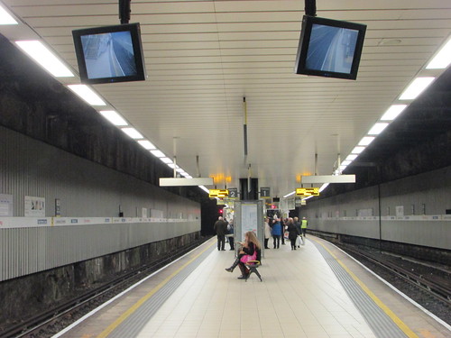
Liverpool Central Northern Line platforms looking north.
The station is rather featureless: I found it disorientating trying to remember which end was which. At the extreme south end of the platforms there's an enclosed metal staircase marked 'EXIT', presumably intended for emergencies. The access doors were prominently labelled 'HUNTS CROSS', I suppose for the benefit of train crews similarly disorientated. I did rather worry that the labelling might induce passengers to conclude either that they had already arrived at Hunts Cross or that, through some space-warp, the metal stairs might transport them to Hunts Cross.

Liverpool Central Northern Line platforms looking south.
Liverpool Central is a through station for trains from Southport to Hunts Cross but terminates trains from Ormskirk and Kirkby which reverse at Liverpool Central. I watched as a heavily-loaded 3-car train arrived from Ormskirk in platform 1, discharged all its passengers, loaded waiting passengers and the Driver and Guard changed ends, ready to return to Ormskirk. Looking north from platform 1, I could see colour light signal ML29 suspended from the roof on the left near the tunnel portal. There was a duplicate signal on a tubular post on the right, identified as signal ML29CA where the 'CA' indicated a 'Co-Acting' signal. I was intrigued by the illuminated 'TT' displayed in the tunnel. This may refer to 'Tunnel Telephone' but Merseyrail normally use the acronym 'T.E.C.' (Traction Emergency Communication, I think).
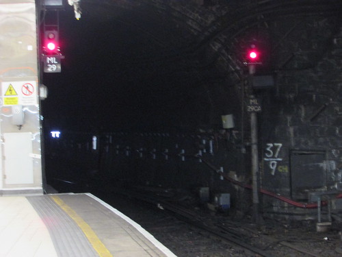
Liverpool Central Northern Line platform 1 looking north with signals ML29 and ML29CA. applying to reversing trains. Note the white illuminated 'TT' displayed in the tunnel.
Another fully-loaded train arrived in platform 2, bound for Southport. After the Southport had departed, I heard the loud 'clunk' as the crossover in the tunnel at the north end reversed. The route indicator on signal ML29 (suspended from the roof on the left near the tunnel portal) lit, showing 'D' for Down Line and finally, when the route indicator had been 'proved' as lit, the 2-aspect colour light changed from 'red' to 'yellow'. The same indication was given by a duplicate signal on a tubular post on the right, identified as signal ML29CA where the 'CA' indicated a 'Co-Acting' signal. There's presumably another route possible, for movements onto the Stock Transfer Sidinig.
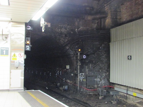
Liverpool Central Northern Line platforms looking north with signal ML29 (and ML29CA) cleared for a train which reversed in platform 1.
Whilst this was going on, I'd made another changed of plan. I'd decided that, rather than travel home from Liverpool Lime Street, I'd take a Northern Line train to Liverpool South Parkway and pick up my Wolverhampton-bound service there, giving me enough time to have a brief look (a very brief look) at what remained of the docks 'upstream' from Pierhead.
Go to Part 3 ...
Related posts on other sites
Rock Ferry railway station (Wikipedia).
Merseyrail - A Brief History (Merseytravel).
Northern line (Merseyrail) (Wikipedia).
Related posts on this site
Return to Merseyside (Part 1).
More Merseyrail.
Railways around Birkenhead.
I've written about Liverpool a number of times. Most are referenced in the post Liverpool (again).
My Pictures
Where necessary, clicking on an image above will display an 'uncropped' view or, alternately, all the pictures from this and earlier trips may be selected, viewed or downloaded, in various sizes, from the albums listed:-
Return to Merseyside (This trip).
Merseyrail (Earlier trips).
