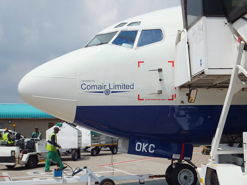
 Comair 737 ZS-OKC on the ground at O. R. Tambo International Airport.
On my Safari Trip in February 2012 (described here, Boeing 737 ZS-OKC operated by Comair took me from O. R. Tambo to Livingstone. Whilst waiting to board, I noticed, marked in red on the side of the fuselage, the 'RVSM Sensitive Area'. I didn't know what 'RVSM' meant but it was not until I returned to the U.K. that I had an opportunity to research its significance (and it was almost another seven years before I wrote about it).
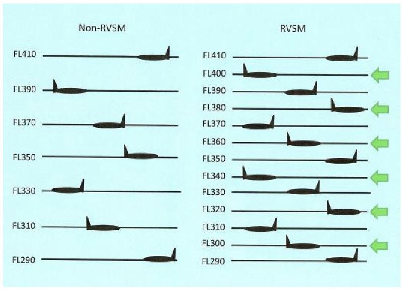
Although more modern techniques now exist, the basic method for determining an aircraft's altitude is by measuring barometric pressure with a 'pressure altimeter'. Increasing air traffic led to the introduction of a world-wide system of 'airways' with flying altitudes assigned to each aircraft to ensure safe vertical separation. Errors in measurement on the aircraft obviously potentially erode this separation. Continued growth in air traffic has led to improvements in pressure altimeters justifying an initial vertical separation of 2,000 feet between aircraft flying above Flight Level 290 ('Two,Nine,Zero') being reduced to 1,000 feet (as was already applied up to Flight Level 290). Of course, this requires suitably-tested equipment and the 'RVSM Sensitive Area' is kept pristine so that the air pressure sensed by the 'Pitot Tubes' feeding the pressure altimeter is not affected by turbulence.
Wikipedia has an article about this at Reduced vertical separation minima
. The diagram below illustrating Non-RVSM and RVSM Flight Levels is from CSSI Inc:-

Non-RVSM and RVSM Flight Levels between FL290 and FL410.
CSSI Inc. also produced this sketch illustrating the effect of different errors on the altitude indicated to the pilot:-

Difference between Assigned and Actual Altitude.
There's more about altimeter setting on the excellent 'Skybrary' site here.
Of course, RVSM is just one feature of the amazing and complex Air Traffic Control system that world trade is dependent on.
