Events of Saturday, 16th April 2016
The Doctor invited me to join him and his wife on an early morning constitutional. We left, by car, just before 6.00 a.m. and drove to a nearby lake where we found lots of people, many middle-aged couples, walking or otherwise exercising along the path bordering the water. After an out-and-back walk of about 30 minutes, we drove to the market. This was not fully open but the stalls that were trading seemed to be doing excellent business. At one stall, in the short time it took for the Doctor to complete his purchase, two assistants clashed three times trying to simultaneously use the single, rather battered scales to check the weight! I did notice that the scales used proper cast weights presumably in the traditional Burmese units of ‘Vliss’, rather than (as I have seen in many places) dry batteries.
After breakfast at the Doctor’s home, the Doctor drove to his wife to Yangon International Airport, where they have a shop. The development of the airport terminal since my first visit in 2008 is remarkable. New Domestic and International Terminals are currently under construction.
The traffic was very heavy and the lines of pick-up trucks trying to get to the major Water Stations seemed completely jammed so the Doctor returned via a different route, stopping for dairy products at the ‘Milk Bar’ we’d visited the year before (described in the post Yangon (Part 4)).
The Doctor had decided to show me one final, very special and popular Water Station. The road in front of City Hall had been blocked by an elaborate stage comprising the usual row of hose-wielding water-throwers set below a large performance area flanked by two large colour screens. There was room for a single line of vehicles to pass in front of the hoses with crowds of onlookers opposite forming an audience for the performers. Two ‘Sky’ Electronic News Gathering vehicles with satellite dishes were nearby, suggesting that at least part of the event was being broadcast. Certainly, the two large screens were showing a ‘mixed’ output from a number of cameras.
To ensure that the onlookers entered into the spirit of the festivity, a series of hoses on tall posts were watering the crowds. In addition, two manually-operated high-capacity ‘monitors’ set on either side of the crowd were continuously ‘raking’ the onlookers with water. A number of onlookers had taken the precaution of equipping themselves with umbrellas but I’m not sure that this was terribly effective. Certainly, I became quite wet.
We returned to the Doctor’s home along part of Strand Road, where I had my first sight of the modern overhead catenary installed for the recently-introduced trams. I didn’t see a tram, though.
Related posts
Next post on this trip.
All my posts on this trip can be found here.
My pictures
Burma-2016.
More pictures will be posted as soon as possible.
Saturday, 16 April 2016
Visiting Pagodas
Events of Friday, 15th April 2016
The Doctor said that we would visit a pagoda on an island to the south of Yangon. The Doctor, his wife and I set off by car about 7.15 a.m. It took us around an hour to reach Kyauktan, a small town bordering a fast-flowing, muddy river. The small island we could see was completely occupied by the Kyaik Hmaw Won Yele Pagoda and a fleet of gaily-painted elegant wooden ferries was transferring pilgrims from the mainland to the Pagoda.
We discovered that, as a Foreigner, I was only allowed to travel on one of the ‘big boats’, so we had to wait a few minutes for one of these to become available. It featured a roof, plastic moulded seats to sit on and even lifejackets (but lacked the aesthetic appeal of the smaller ferries). It’s often the case in Burma that Foreigners have to pay a premium. Knowing how poor many Burmese are, it’s a cost I don’t resent (and they did provide a lifejacket!).
I’m not a Buddhist, but the devotions of Burmese Buddhists never fail to impress me. We walked around the various temples and I noted the inscribed stone with the Exhortation Verses:-
Near the water’s edge, a vendor was selling fish food balls to throw to the fish – carp, I imagine, from the violent thrashing of the water but the water was too muddy to see the fish clearly.
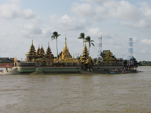 Kyaik Hmaw Won Yele Pagoda.
We returned to the mainland using the same ‘big boat’ which took us to the island and explored the open market, where the Doctor and his wife made a few purchases. Then it was back to the car and we retraced our outwards route from Yangon. On the outward journey, the roads had been much quieter and the Water Stations had not been throwing water – I gathered that 9.00 a.m. was the usual starting time. But I’d been amused that, even as early as 8.00 a.m., most of the sound systems had already ‘turned it up to 11’ (a reference to ‘This is Spinal Tap’ for the cogniscenti). On the way back, there was heavy traffic principally heading towards Kyauktan with lots of pick-up trucks loaded with happy (and already wet) revellers.
Out in the country, we made a brief stop where the Doctor spoke to a friend who has a business selling bamboo. The versatility of bamboo as a building material is perhaps not fully appreciated in countries which do not produce ‘construction grade’ bamboo. Certainly, all the buildings where we stopped were bamboo-built.
Our next stop was at the Kyaik Khauk Pagoda, Thanlyin where the main pagoda is on a hilltop location, surrounded by extensive monastic buildings. The hilltop was reached by a number of sets of covered steps, in the traditional arrangement I’d seen in many places. Although I made the ascent, I’m slower than I used to be (on my recent trip to Cape Point in Cape Town my right knee suddenly started to aggravate me).
Because of the holiday period, the pagoda was packed, with many groups dressed in the white top and plain brown longyi of the pilgrim. They were likely to spend the whole day at the pagoda and, since a pilgrim’s lunch is traditionally taken before noon, there was a lot of eating going on.
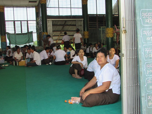 Pilgrims taking lunch in one of the Prayer Halls.
Over the loudspeaker system, a monk with a particularly mellifluous voice was intoning sacred texts.
The elevated position of the pagoda gave wonderful views in all directions. The skyline of Yangon city is changing as numerous tall buildings, at one time prohibited, are erected.
The new port of Thilawe, with a couple of large cargo ships, was visible. Burma has now taken its place on the cruise liner itinerary, with the ships docking at Thilawe and passengers being bussed into Yangon for a ‘whistle-stop’ tour.
I’d already noticed a separate lift giving access to the hilltop. This was also a feature I’d seen at other important sites (like the Shwedagon and Mandalay Hill) and the Doctor and his wife, concerned for my well-being, suggested we used the lift to descend. However, previous experience meant that I was unsurprised that the lift did not appear to be in general use. I’d spotted the rolled-up red carpet waiting for important visitors and the ‘VIP Lounge’ near the lift, but where’s the Merit in that? I was quite happy to descend (albeit slowly) using the covered steps.
We carried on back to Yangon. The area around the National Stadium in Yangon was very busy and the sound of modern dance music was overpowering. I wondered what event was in progress and the Doctor offered to show me. Apparently, the New Year practices in Rakhine State vary from those generally observed and so, I suspect to raise the profile of the Rakhine people, a water-throwing event had been organised on part of the National Stadium site. It was noisy, it was wet and everybody seemed to be having a great time. There were lines of water-throwing stations and a covered walkway to facilitate seeing it all. However, the roof of the covered walkway had been connected to the water supply and a series of rotating nozzles, like upside-down lawn sprinklers, generously sprayed the pedestrians beneath. There was a wide range of cafes and food stalls and a remarkable number of traders selling all sorts of goods.
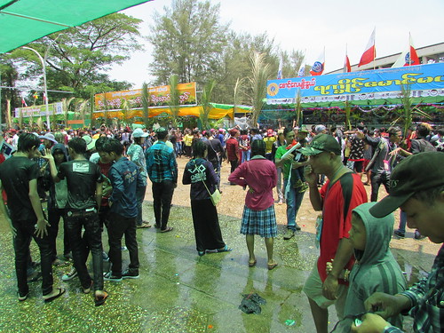 Thingyan - Rakhine Style.
The remainder of our trip back to the Doctor’s home was, of course, punctuated by the car being liberally sprayed with water at the Water Stations we passed but, with the car windows closed, we completed our journey without further soaking.
Related posts
Next post on this trip.
All my posts on this trip can be found here.
My pictures
Kyaik Hmaw Won Yele Pagoda.
Kyaik Khauk Pagoda.
Thingyan - Rakhine Style.
All my pictures on this trip are in the collection Burma, 2016.
[Links to pictures added 7-May-2016]
The Doctor said that we would visit a pagoda on an island to the south of Yangon. The Doctor, his wife and I set off by car about 7.15 a.m. It took us around an hour to reach Kyauktan, a small town bordering a fast-flowing, muddy river. The small island we could see was completely occupied by the Kyaik Hmaw Won Yele Pagoda and a fleet of gaily-painted elegant wooden ferries was transferring pilgrims from the mainland to the Pagoda.
We discovered that, as a Foreigner, I was only allowed to travel on one of the ‘big boats’, so we had to wait a few minutes for one of these to become available. It featured a roof, plastic moulded seats to sit on and even lifejackets (but lacked the aesthetic appeal of the smaller ferries). It’s often the case in Burma that Foreigners have to pay a premium. Knowing how poor many Burmese are, it’s a cost I don’t resent (and they did provide a lifejacket!).
I’m not a Buddhist, but the devotions of Burmese Buddhists never fail to impress me. We walked around the various temples and I noted the inscribed stone with the Exhortation Verses:-
VERSE 1There was a third rule inscribed but the text was obscured by a display of flowers.
Forbearing patience is the highest moral practice.
“Nibbana is supreme” say the Buddhas.
A bhikkhu does not harm others.
One who harms others is not a bhikkhu.
VERSE 2
Not to do evil
To cultivate merit
To purify one’s mind
This is the teaching of the Buddhas.
Near the water’s edge, a vendor was selling fish food balls to throw to the fish – carp, I imagine, from the violent thrashing of the water but the water was too muddy to see the fish clearly.
Kyaik Hmaw Won Yele Pagoda.
We returned to the mainland using the same ‘big boat’ which took us to the island and explored the open market, where the Doctor and his wife made a few purchases. Then it was back to the car and we retraced our outwards route from Yangon. On the outward journey, the roads had been much quieter and the Water Stations had not been throwing water – I gathered that 9.00 a.m. was the usual starting time. But I’d been amused that, even as early as 8.00 a.m., most of the sound systems had already ‘turned it up to 11’ (a reference to ‘This is Spinal Tap’ for the cogniscenti). On the way back, there was heavy traffic principally heading towards Kyauktan with lots of pick-up trucks loaded with happy (and already wet) revellers.
Out in the country, we made a brief stop where the Doctor spoke to a friend who has a business selling bamboo. The versatility of bamboo as a building material is perhaps not fully appreciated in countries which do not produce ‘construction grade’ bamboo. Certainly, all the buildings where we stopped were bamboo-built.
Our next stop was at the Kyaik Khauk Pagoda, Thanlyin where the main pagoda is on a hilltop location, surrounded by extensive monastic buildings. The hilltop was reached by a number of sets of covered steps, in the traditional arrangement I’d seen in many places. Although I made the ascent, I’m slower than I used to be (on my recent trip to Cape Point in Cape Town my right knee suddenly started to aggravate me).
Because of the holiday period, the pagoda was packed, with many groups dressed in the white top and plain brown longyi of the pilgrim. They were likely to spend the whole day at the pagoda and, since a pilgrim’s lunch is traditionally taken before noon, there was a lot of eating going on.
Pilgrims taking lunch in one of the Prayer Halls.
Over the loudspeaker system, a monk with a particularly mellifluous voice was intoning sacred texts.
The elevated position of the pagoda gave wonderful views in all directions. The skyline of Yangon city is changing as numerous tall buildings, at one time prohibited, are erected.
The new port of Thilawe, with a couple of large cargo ships, was visible. Burma has now taken its place on the cruise liner itinerary, with the ships docking at Thilawe and passengers being bussed into Yangon for a ‘whistle-stop’ tour.
I’d already noticed a separate lift giving access to the hilltop. This was also a feature I’d seen at other important sites (like the Shwedagon and Mandalay Hill) and the Doctor and his wife, concerned for my well-being, suggested we used the lift to descend. However, previous experience meant that I was unsurprised that the lift did not appear to be in general use. I’d spotted the rolled-up red carpet waiting for important visitors and the ‘VIP Lounge’ near the lift, but where’s the Merit in that? I was quite happy to descend (albeit slowly) using the covered steps.
We carried on back to Yangon. The area around the National Stadium in Yangon was very busy and the sound of modern dance music was overpowering. I wondered what event was in progress and the Doctor offered to show me. Apparently, the New Year practices in Rakhine State vary from those generally observed and so, I suspect to raise the profile of the Rakhine people, a water-throwing event had been organised on part of the National Stadium site. It was noisy, it was wet and everybody seemed to be having a great time. There were lines of water-throwing stations and a covered walkway to facilitate seeing it all. However, the roof of the covered walkway had been connected to the water supply and a series of rotating nozzles, like upside-down lawn sprinklers, generously sprayed the pedestrians beneath. There was a wide range of cafes and food stalls and a remarkable number of traders selling all sorts of goods.
Thingyan - Rakhine Style.
The remainder of our trip back to the Doctor’s home was, of course, punctuated by the car being liberally sprayed with water at the Water Stations we passed but, with the car windows closed, we completed our journey without further soaking.
Related posts
Next post on this trip.
All my posts on this trip can be found here.
My pictures
Kyaik Hmaw Won Yele Pagoda.
Kyaik Khauk Pagoda.
Thingyan - Rakhine Style.
All my pictures on this trip are in the collection Burma, 2016.
[Links to pictures added 7-May-2016]

Friday, 15 April 2016
Thingyan
Introduction
A number of Asian countries celebrate the New Year with Water Festivals, where the throwing of water symbolises the washing-away of past sins. In Thailand and Laos, the festival is called 'Songkran' but in Myanmar it's 'Thingyan', described on Wikipedia here.
Getting wet on 14th April 2016
As described in the first post in this series Return to Rangoon, I arrived in Yangon early morning on the 1th April and my host, the Doctor, took me to see the temporary 'water throwing stations' erected in connection with the New Year -Thingyan. These exist in a wide variety of forms.
Within Yangon area, the simplest comprise one or more plastic waters barrels or, alternately, oil drums with the end cut off filled with water. The ‘water throwers’ are each equipped with a plastic bucket, a plastic bowl or a (usually battered) aluminium bowl. As the target, pedestrian or vehicle, approaches the bowl is ‘charged’ with water from the barrel allowing the target to be ‘baptised’ with water. There seemed to be an infinite variety of techniques, from the genteel splashing only a few drops of water to more aggressive but still good-natured producing a good soaking. I was reminded of the difference between the symbolic baptism of much of the Christian church and the total immersion practised by Baptists. Even the water barrel was not essential. In a few places I saw a rectangular frame made out of lengths of substantial bamboo lashed together with plastic rope and lined with heavy-duty polythene sheet to form a reservoir.
I quickly realised, as we drove across the city, that this type of ‘water throwing station’ could be made mobile, by loading it in the back of a standard pick-up truck, accompanied by an improbable number of water-throwers. To slightly lessen the chances of water-throwers falling off the crowded vehicle, most trucks had been fitted temporarily with a simple frame of four lengths of thick bamboo lashed together and wedged into the load space to raise the height of the sides. In fact, as we slowly negotiated the crowded streets it sometimes seemed as if every other vehicle was a ‘water throwing station’.
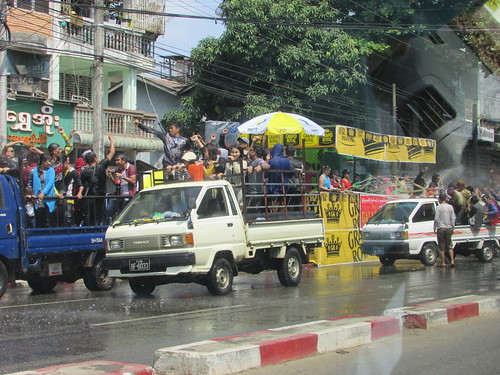 Thingyan (Yangon, 2016).
Although the water-throwers varied – some trucks had a mix of age and gender - most were male teenagers in a ‘uniform’ of dark clothing, usually with a black baseball cap worn backwards and testing the truck suspension to destruction by dancing to some form of ‘ghetto blaster’.
Although the roadside ‘water throwing stations’ were sometimes silent, when sound systems were fitted they could be less inhibited than on vehicles and many locations featured a wall of loudspeakers producing an exceptionally loud modern dance beat.
Even simple roadside water throwing stations were often provided with shelters – the inevitable bamboo lashed together with a plastic roof tied-on. These constructions were often embellished with palm fronds. Increasing sophistication appeared to be linked to commercial sponsorship –larger stores had their own water throwing stations, sometimes with uniformed staff. A ready supply of mains water encouraged the use of hoses, rather than water bowls. Temporary plastic plumbing at the side of the road produced a ‘fire-main’ to which perhaps ten or twenty lengths of garden hose could be attached, each manned by a separate water-thrower.
The pick-up trucks appeared to queue-up at roadside water-throwing stations for their turn to ‘duel’ the fixed water throwers.
The Doctor parked a few hundred yards from the main water-throwing stations in Pyay Road and we joined the throng of pedestrians. We had to ‘run the gauntlet’ of a number of smaller water-throwing stations to reach the main road so, needless to say, I ended up wringing wet from head to foot (I saw very few Europeans so I imagine an elderly white woman presented an irresistible target). My conclusion is that a well-aimed bucket of water is a match for a number of poorly-directed hoses. The temperature was 42 or 43 degrees Celsius so I expected to start drying out but when we eventually arrived back at the Doctor’s house I was still encased in a mass of sodden clothing.
The main road represented a further escalation in scale as the closely-packed water-throwing stations were sponsored by some of the major companies in Myanmar and it appeared that no expense had been spared. Each station was built in the manner of a ’stage’ at an outdoor music festival, constructed from standard scaffolding providing multiple levels and topped with a proscenium arch equipped with modern computer-controlled lighting. The lower level invariably featured a battery of perhaps 50 hoses, manned by enthusiastic water-throwers who, I was informed, had paid 125 American dollars for a 5-day ticket. A few of the hoses had extra capacity and were more like fire hoses. Of course, all the water discharged had to find its way into the street drains, leaving the road awash to a depth of a few inches.
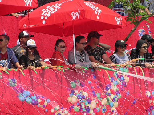 One of the major commercially-sponsored water-throwing stations in Yangon.
Each stage had its own live performers, blasting away at a high decibel level, apparently oblivious to the adjacent stages, delighting the mainly young (and wet) crowd dancing in the street. This was not a side of Burma I had seen before! There were plenty of police in attendance but they seemed to be keeping a watching brief. The opposite side of the road was lined with food and sales stalls (sales of waterproof pouches for a mobile phone to hang round the neck seemed particularly strong). Beyond the vendors, an embankment rose up to Inya Lake, finally revealing where all this water was coming from. I spotted a whole series of high capacity plastic pipes snaking down the embankment from the lake and disappearing under the road which presumably provided the source of the water-driven mayhem.
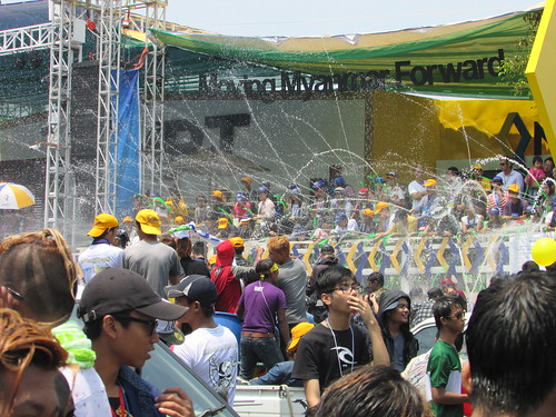 The MPT-sponsored water-throwing station.
I barely noticed the additional dousing as we walked back to the car. Back at the Doctor’s home, I had a shower, changed and was happy to comply with Doctor’s recommendation that I relax (or at least limit myself to computer work) for the rest of the day.
Related posts
Next post on this trip.
All my posts on this trip can be found here.
My pictures
There's an album of pictures showing Thingyan in Yangon here.
All my pictures on this trip are in the collection Burma, 2016.
[Picture references amended 10-May-2016, 26-May-2016]
A number of Asian countries celebrate the New Year with Water Festivals, where the throwing of water symbolises the washing-away of past sins. In Thailand and Laos, the festival is called 'Songkran' but in Myanmar it's 'Thingyan', described on Wikipedia here.
Getting wet on 14th April 2016
As described in the first post in this series Return to Rangoon, I arrived in Yangon early morning on the 1th April and my host, the Doctor, took me to see the temporary 'water throwing stations' erected in connection with the New Year -Thingyan. These exist in a wide variety of forms.
Within Yangon area, the simplest comprise one or more plastic waters barrels or, alternately, oil drums with the end cut off filled with water. The ‘water throwers’ are each equipped with a plastic bucket, a plastic bowl or a (usually battered) aluminium bowl. As the target, pedestrian or vehicle, approaches the bowl is ‘charged’ with water from the barrel allowing the target to be ‘baptised’ with water. There seemed to be an infinite variety of techniques, from the genteel splashing only a few drops of water to more aggressive but still good-natured producing a good soaking. I was reminded of the difference between the symbolic baptism of much of the Christian church and the total immersion practised by Baptists. Even the water barrel was not essential. In a few places I saw a rectangular frame made out of lengths of substantial bamboo lashed together with plastic rope and lined with heavy-duty polythene sheet to form a reservoir.
I quickly realised, as we drove across the city, that this type of ‘water throwing station’ could be made mobile, by loading it in the back of a standard pick-up truck, accompanied by an improbable number of water-throwers. To slightly lessen the chances of water-throwers falling off the crowded vehicle, most trucks had been fitted temporarily with a simple frame of four lengths of thick bamboo lashed together and wedged into the load space to raise the height of the sides. In fact, as we slowly negotiated the crowded streets it sometimes seemed as if every other vehicle was a ‘water throwing station’.
Thingyan (Yangon, 2016).
Although the water-throwers varied – some trucks had a mix of age and gender - most were male teenagers in a ‘uniform’ of dark clothing, usually with a black baseball cap worn backwards and testing the truck suspension to destruction by dancing to some form of ‘ghetto blaster’.
Although the roadside ‘water throwing stations’ were sometimes silent, when sound systems were fitted they could be less inhibited than on vehicles and many locations featured a wall of loudspeakers producing an exceptionally loud modern dance beat.
Even simple roadside water throwing stations were often provided with shelters – the inevitable bamboo lashed together with a plastic roof tied-on. These constructions were often embellished with palm fronds. Increasing sophistication appeared to be linked to commercial sponsorship –larger stores had their own water throwing stations, sometimes with uniformed staff. A ready supply of mains water encouraged the use of hoses, rather than water bowls. Temporary plastic plumbing at the side of the road produced a ‘fire-main’ to which perhaps ten or twenty lengths of garden hose could be attached, each manned by a separate water-thrower.
The pick-up trucks appeared to queue-up at roadside water-throwing stations for their turn to ‘duel’ the fixed water throwers.
The Doctor parked a few hundred yards from the main water-throwing stations in Pyay Road and we joined the throng of pedestrians. We had to ‘run the gauntlet’ of a number of smaller water-throwing stations to reach the main road so, needless to say, I ended up wringing wet from head to foot (I saw very few Europeans so I imagine an elderly white woman presented an irresistible target). My conclusion is that a well-aimed bucket of water is a match for a number of poorly-directed hoses. The temperature was 42 or 43 degrees Celsius so I expected to start drying out but when we eventually arrived back at the Doctor’s house I was still encased in a mass of sodden clothing.
The main road represented a further escalation in scale as the closely-packed water-throwing stations were sponsored by some of the major companies in Myanmar and it appeared that no expense had been spared. Each station was built in the manner of a ’stage’ at an outdoor music festival, constructed from standard scaffolding providing multiple levels and topped with a proscenium arch equipped with modern computer-controlled lighting. The lower level invariably featured a battery of perhaps 50 hoses, manned by enthusiastic water-throwers who, I was informed, had paid 125 American dollars for a 5-day ticket. A few of the hoses had extra capacity and were more like fire hoses. Of course, all the water discharged had to find its way into the street drains, leaving the road awash to a depth of a few inches.
One of the major commercially-sponsored water-throwing stations in Yangon.
Each stage had its own live performers, blasting away at a high decibel level, apparently oblivious to the adjacent stages, delighting the mainly young (and wet) crowd dancing in the street. This was not a side of Burma I had seen before! There were plenty of police in attendance but they seemed to be keeping a watching brief. The opposite side of the road was lined with food and sales stalls (sales of waterproof pouches for a mobile phone to hang round the neck seemed particularly strong). Beyond the vendors, an embankment rose up to Inya Lake, finally revealing where all this water was coming from. I spotted a whole series of high capacity plastic pipes snaking down the embankment from the lake and disappearing under the road which presumably provided the source of the water-driven mayhem.
The MPT-sponsored water-throwing station.
I barely noticed the additional dousing as we walked back to the car. Back at the Doctor’s home, I had a shower, changed and was happy to comply with Doctor’s recommendation that I relax (or at least limit myself to computer work) for the rest of the day.
Related posts
Next post on this trip.
All my posts on this trip can be found here.
My pictures
There's an album of pictures showing Thingyan in Yangon here.
All my pictures on this trip are in the collection Burma, 2016.
[Picture references amended 10-May-2016, 26-May-2016]
Thursday, 14 April 2016
Return to Rangoon
Introduction
Little did I realise, on my first visit to Burma in 2008 described in a few posts forming part of my record of the trip Round the World 5 that the country and its wonderful people would steal my heart. My trip in 2016 which I start to describe here is my tenth trip to this exotic and remarkable land.
For many people, the attraction of the country is still best encapsulated in the gnomic phrase written by Rudyard Kipling, which he attributes to Rangoon’s revered Golden Temple, the Shwedagon – "This is Burma and it will be quite unlike any land you know about". In Kipling’s day, Burma was part of British India and, whilst Kipling reported extensively on the British military actions in Burma during his employment by a newspaper in India, he only spent three days in Burma, as he travelled back to England to pursue his writing career. So my own time ‘in territory’ far exceeds Kipling’s but I bow to Kipling’s ability to capture the essence of the place. There's a short description of Kipling's Burma here.
A later British writer, George Orwell, served in Burma and his experiences are incorporated in his writing. Although he captures the snobbery and class divisions of the British abroad, I’m not alone in thinking it’s not equal to his more famous political works. I've visited the house in Katha which was formerly home to George Orwell twice - described here and here.
Leaving England
On my trip to Burma in 2015 I'd enjoyed my flights with Qatar Airways and used them again in 2016. This time, I left from Birmingham Airport on Wednesday, 13th April 2016 aboard flight QR36 to Doha. This was operated by a Boeing B787-8 'Dreamliner' which provided a very comfortable flight.
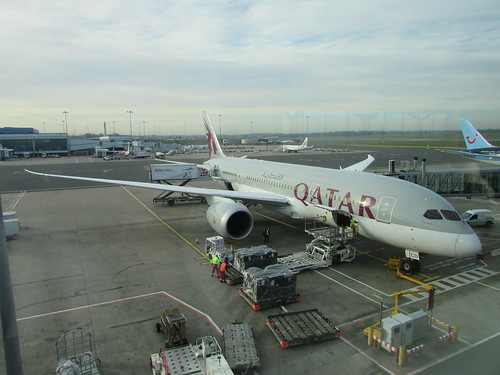 Boeing B787-8 at Birmingham Airport.
Transit in Doha
Hamad International Airport in Doha has a huge, well-appointed business lounge so the wait for my onwards flight QR918 to Yangon (formerly Rangoon) passed pleasantly enough, although I was very tired. An A320 Airbus worked this flight: everything worked and the cabin crew were excellent.
Arriving in Yangon
We made a 'right time' arrival at Yangon on Thursday, 14th April 2016, immigration was fast and my checked bag appeared promptly, so I was through customs and being met by my host, Doctor Hla Tun and his charming wife, at 06:25 a.m.
On the way to the Doctor's home, we went to a street market for fresh produce and sat at a 'kerbside diner' for delicious rice pancakes cooked as we watched. At the Doctor's home, I had a shower, a couple of hours rest and then changed ready for our morning visit to the Water Festival activities.
Related posts
Next post on this trip.
All my posts on this trip can be found here.
My pictures
There's an album of pictures of Birmingham Airport, including my departure on 13-Apr-2016, here.
All my pictures on this trip are in the collection Burma, 2016.
[Picture references amended 10-May-2016]
Little did I realise, on my first visit to Burma in 2008 described in a few posts forming part of my record of the trip Round the World 5 that the country and its wonderful people would steal my heart. My trip in 2016 which I start to describe here is my tenth trip to this exotic and remarkable land.
For many people, the attraction of the country is still best encapsulated in the gnomic phrase written by Rudyard Kipling, which he attributes to Rangoon’s revered Golden Temple, the Shwedagon – "This is Burma and it will be quite unlike any land you know about". In Kipling’s day, Burma was part of British India and, whilst Kipling reported extensively on the British military actions in Burma during his employment by a newspaper in India, he only spent three days in Burma, as he travelled back to England to pursue his writing career. So my own time ‘in territory’ far exceeds Kipling’s but I bow to Kipling’s ability to capture the essence of the place. There's a short description of Kipling's Burma here.
A later British writer, George Orwell, served in Burma and his experiences are incorporated in his writing. Although he captures the snobbery and class divisions of the British abroad, I’m not alone in thinking it’s not equal to his more famous political works. I've visited the house in Katha which was formerly home to George Orwell twice - described here and here.
Leaving England
On my trip to Burma in 2015 I'd enjoyed my flights with Qatar Airways and used them again in 2016. This time, I left from Birmingham Airport on Wednesday, 13th April 2016 aboard flight QR36 to Doha. This was operated by a Boeing B787-8 'Dreamliner' which provided a very comfortable flight.
Boeing B787-8 at Birmingham Airport.
Transit in Doha
Hamad International Airport in Doha has a huge, well-appointed business lounge so the wait for my onwards flight QR918 to Yangon (formerly Rangoon) passed pleasantly enough, although I was very tired. An A320 Airbus worked this flight: everything worked and the cabin crew were excellent.
Arriving in Yangon
We made a 'right time' arrival at Yangon on Thursday, 14th April 2016, immigration was fast and my checked bag appeared promptly, so I was through customs and being met by my host, Doctor Hla Tun and his charming wife, at 06:25 a.m.
On the way to the Doctor's home, we went to a street market for fresh produce and sat at a 'kerbside diner' for delicious rice pancakes cooked as we watched. At the Doctor's home, I had a shower, a couple of hours rest and then changed ready for our morning visit to the Water Festival activities.
Related posts
Next post on this trip.
All my posts on this trip can be found here.
My pictures
There's an album of pictures of Birmingham Airport, including my departure on 13-Apr-2016, here.
All my pictures on this trip are in the collection Burma, 2016.
[Picture references amended 10-May-2016]
Monday, 4 April 2016
Sunday at Shackerstone
My first driving turn at the Battlefield Line in 2016 was on Sunday, 3rd April when Dave H. and I ran five service trains to Shenton with 'Cumbria'.
'Cumbria' is a six-coupled 'Austerity' saddle tank locomotive (Hunslet 3794/1953) owned by the Furness Railway Trust. There's a short history of the locomotive here and my article The 'Austerity' 0-6-0ST locomotive has more background on this locomotive class.
I first drove this engine during the Steam Gala in 2015 (described here) and I had another turn during the 'Santa Specials' (described here). But running a full 'Green Timetable' service is considerably more demanding and, at the end of traffic whilst Dave and I agreed we'd had a good day, we were also pretty exhausted.
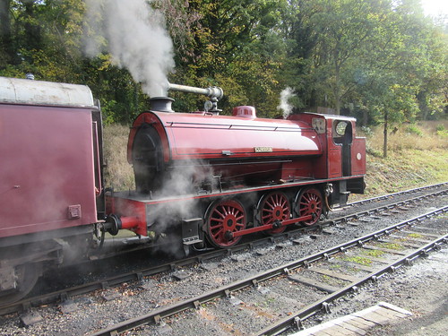 Battlefield Line Steam Gala, October 2015: 3794 'Cumbria', in its handsome lined-out 'Furness Indian Red' livery.
I signed on at seven o'clock (first departure was scheduled for 11:15) and was relieved to find 'Cumbria' already lit-up by Adrian L. I discovered that Dave H. was 'marked' as fireman but that he'd arranged a later start with Adrian agreeing to provide 'cover' until he arrived. Adrian and I spent a companiable couple of hours preparing the locomotive until Dave arrived.
We were using 'Welsh' coal which is, once again, available. The fearsome reputation of the Great Western Railway locomotives designed by Churchward was originally ascribed to the excellent steam-raising properties of the 'Welsh' coal normally used by that railway. But the locomotive exchanges of 1925 between the LNER and the GWR (touched on in my article 'Flying Scotsman') confirmed that the performance had more to do with sensible design proportions in boilers and cylinders, the use of 'long-lap, long travel' valves and good training of locomen, for the Great Western locomotives proved superior even when using the 'Yorkshire Hard' coal favoured by the L.N.E.R. But I was soon reminded of the one drawback of 'Welsh' - it's a rather soft coal prone to produce a lot of dust, suggesting the need for liberal use of the Coal Watering Pipe (an additional connection to the fireman's side injector with a cock allowing a jet of hot water to be directed around the footplate and bunker as required via a wire-reinforced flexible hose terminated in a nozzle, variously called, in different parts of the country, 'Pep Pipe', 'Slacking Pipe' or 'Degger'). Sadly, 'Cumbria' is not provided with a coal watering pipe so we were in for a dusty shift. Incidentally, whilst the LMS, LNER and SR installed automated coaling plants at their major depots, the GWR retained manual coaling using large rail-mounted 'tubs' to the end - supposedly because of the friability of 'Welsh' coal, rather than parsimony.
'Welsh' coal requires a modified firing technique. It takes a fair while to 'get going' but will then continue to give out high heat long after other coals have turned to ash. The new supply of 'Welsh' was smaller than the lumps I remember from over twenty years ago when I regularly fired 'Clun Castle' and 'Defiant' at Birmingham Railway Museum on driving experience courses and, as each lump absorbed heat from the firebed, it would swell and open resembling a glowing cauliflower head, creating steam for a long time. We didn't get this effect with the smaller lumps supplied on 'Cumbria' but the fuel did take its time and require plenty of air to produce steam (then it didn't want to stop!). The engine had been lit up in the shed so, as soon a we had about 20 p.s.i. of boiler pressure, I gingerly moved the locomotive outside the shed, in the hope of improving the drafting.
By 10:45, we had sufficient boiler pressure to ensure an effective steam brake, allowing us to move onto our 4-coach train waiting in platform 2, pausing on the way to fill the saddle tank at the water crane. This was a fairly time-consuming operation, since the pivoted arm of the crane carried a flexible plastic hose (this would have originally been riveted leather and always called 'the bag' by railwaymen) long enough to accommodate differing locomotive fillers, leaving it rather too long for the saddle tank of 'Cumbria'. Care was needed to dispose of the extra length of hose inside the saddle tank so that it didn't 'double up' when the water supply was turned on, impeding water flow.
Unfortunately we had to take water each time we ran round our train at Shackerstone during the day, ensuring that there was no time for a 'breather' throughout the shift. I didn't manage any photography, either.
The 'Green Timetable' is as below:-
As is often the case, even the first departure of the day was late, waiting for passengers. Thereafter, it was a struggle to keep to time because of the various speed restrictions on the line. Despite smart running round our train at each end of the line, the time required to take water meant that we lost further time, ending up at the end of the day around 20 minutes "down".
Notes on driving 'Cumbria'
When starting, any locomotive should be worked, at least briefly, in full gear, to maximise starting torque and start away smoothly. 'Full gear' can mean anything from 60-odd per cent cut-off to 80-odd per cent cut-off, depending upon the design. Once moving, I tend to 'link-up' (cutting off steam earlier in the piston's travel) quite quickly - with our four-coach train, 'Cumbria' was moving less than 200 tons total, yet the original design specified the ability to start 1,100 tons on the level, so an extended period of full gear was hardly warranted. Full-gear operation seeks to get lots of steam into the cylinders to generate power but, at the end of the piston stroke, that same steam has to be exhausted through the blast pipe and chimney and this can have the effect of 'choking' the locomotive, limiting acceleration.
But, of course, it's not that simple. The driver must consider various details of the design of the locomotive:-

Typical lever reverser on an 'Austerity' tank.
There's a bit about regulators in the posts Locomotive Regulators and The Best Laid Schemes ....
'Cumbria' was in need of some care and attention, which added to our difficulties. All the controls were rather stiff - water cocks took some strength to set correctly, lever reverser catch handle was stiff, even the valve spindle on the vacuum brake application valve needed some manual assistance. The fireman's side injector was temperamental to set, causing additional use of the (fairly reliable) driver's side injector. After shutting off steam, prior to a speed restriction or station stop, this often meant the additional task of 'setting' the driver's side water cock for the fireman at the same time as judging the vacuum brake application.
Like many industrial locomotives later fitted with an ejector to allow the operation of vacuum-braked passenger trains, the steam supply cock to the ejector required 'tuning' to obtain 'best vacuum'. This often means 'throttling-back' the steam since excessive steam supply can produce turbulence in the body of the ejector, impairing the desirable 'laminar fluid flow' and reducing the vacuum created. Depending upon the installation details, other events (such as operation of the safety valves or putting on a ejector or even adjusting the blower) can alter the level of vacuum created. In the case of 'Cumbria', it was desirable to pay close attention to the vacuum gauge as she would occasionally suddenly lose a few inches of vacuum, creating a partial brake application, for no discernable reason, resulting in furious 'twiddling' of the steam supply, to try to regain the "sweet spot".
I think all enginemen like the challenge of a slightly recalcitrant locomotive - but not too much of a challenge.
'Cumbria' is a six-coupled 'Austerity' saddle tank locomotive (Hunslet 3794/1953) owned by the Furness Railway Trust. There's a short history of the locomotive here and my article The 'Austerity' 0-6-0ST locomotive has more background on this locomotive class.
I first drove this engine during the Steam Gala in 2015 (described here) and I had another turn during the 'Santa Specials' (described here). But running a full 'Green Timetable' service is considerably more demanding and, at the end of traffic whilst Dave and I agreed we'd had a good day, we were also pretty exhausted.
Battlefield Line Steam Gala, October 2015: 3794 'Cumbria', in its handsome lined-out 'Furness Indian Red' livery.
I signed on at seven o'clock (first departure was scheduled for 11:15) and was relieved to find 'Cumbria' already lit-up by Adrian L. I discovered that Dave H. was 'marked' as fireman but that he'd arranged a later start with Adrian agreeing to provide 'cover' until he arrived. Adrian and I spent a companiable couple of hours preparing the locomotive until Dave arrived.
We were using 'Welsh' coal which is, once again, available. The fearsome reputation of the Great Western Railway locomotives designed by Churchward was originally ascribed to the excellent steam-raising properties of the 'Welsh' coal normally used by that railway. But the locomotive exchanges of 1925 between the LNER and the GWR (touched on in my article 'Flying Scotsman') confirmed that the performance had more to do with sensible design proportions in boilers and cylinders, the use of 'long-lap, long travel' valves and good training of locomen, for the Great Western locomotives proved superior even when using the 'Yorkshire Hard' coal favoured by the L.N.E.R. But I was soon reminded of the one drawback of 'Welsh' - it's a rather soft coal prone to produce a lot of dust, suggesting the need for liberal use of the Coal Watering Pipe (an additional connection to the fireman's side injector with a cock allowing a jet of hot water to be directed around the footplate and bunker as required via a wire-reinforced flexible hose terminated in a nozzle, variously called, in different parts of the country, 'Pep Pipe', 'Slacking Pipe' or 'Degger'). Sadly, 'Cumbria' is not provided with a coal watering pipe so we were in for a dusty shift. Incidentally, whilst the LMS, LNER and SR installed automated coaling plants at their major depots, the GWR retained manual coaling using large rail-mounted 'tubs' to the end - supposedly because of the friability of 'Welsh' coal, rather than parsimony.
'Welsh' coal requires a modified firing technique. It takes a fair while to 'get going' but will then continue to give out high heat long after other coals have turned to ash. The new supply of 'Welsh' was smaller than the lumps I remember from over twenty years ago when I regularly fired 'Clun Castle' and 'Defiant' at Birmingham Railway Museum on driving experience courses and, as each lump absorbed heat from the firebed, it would swell and open resembling a glowing cauliflower head, creating steam for a long time. We didn't get this effect with the smaller lumps supplied on 'Cumbria' but the fuel did take its time and require plenty of air to produce steam (then it didn't want to stop!). The engine had been lit up in the shed so, as soon a we had about 20 p.s.i. of boiler pressure, I gingerly moved the locomotive outside the shed, in the hope of improving the drafting.
By 10:45, we had sufficient boiler pressure to ensure an effective steam brake, allowing us to move onto our 4-coach train waiting in platform 2, pausing on the way to fill the saddle tank at the water crane. This was a fairly time-consuming operation, since the pivoted arm of the crane carried a flexible plastic hose (this would have originally been riveted leather and always called 'the bag' by railwaymen) long enough to accommodate differing locomotive fillers, leaving it rather too long for the saddle tank of 'Cumbria'. Care was needed to dispose of the extra length of hose inside the saddle tank so that it didn't 'double up' when the water supply was turned on, impeding water flow.
Unfortunately we had to take water each time we ran round our train at Shackerstone during the day, ensuring that there was no time for a 'breather' throughout the shift. I didn't manage any photography, either.
The 'Green Timetable' is as below:-
| Shackerstone Dep | 11.15 | 12.30 | 13.45 | 15.00 | 16.15 |
| Market Bosworth Dep | 11.27 | 12.42 | 13.57 | 15.12 | 16.27 |
| Shenton Arr | 11.35 | 12.50 | 14.05 | 15.20 | 16.35 |
| Shenton Dep | 11.50 | 13.05 | 14.20 | 15.35 | 16.50 |
| Market Bosworth Dep | 12.00 | 13.15 | 14.30 | 15.45 | 17.00 |
| Shackerstone Arr | 12.10 | 13.25 | 14.40 | 15.55 | 17.10 |
As is often the case, even the first departure of the day was late, waiting for passengers. Thereafter, it was a struggle to keep to time because of the various speed restrictions on the line. Despite smart running round our train at each end of the line, the time required to take water meant that we lost further time, ending up at the end of the day around 20 minutes "down".
Notes on driving 'Cumbria'
When starting, any locomotive should be worked, at least briefly, in full gear, to maximise starting torque and start away smoothly. 'Full gear' can mean anything from 60-odd per cent cut-off to 80-odd per cent cut-off, depending upon the design. Once moving, I tend to 'link-up' (cutting off steam earlier in the piston's travel) quite quickly - with our four-coach train, 'Cumbria' was moving less than 200 tons total, yet the original design specified the ability to start 1,100 tons on the level, so an extended period of full gear was hardly warranted. Full-gear operation seeks to get lots of steam into the cylinders to generate power but, at the end of the piston stroke, that same steam has to be exhausted through the blast pipe and chimney and this can have the effect of 'choking' the locomotive, limiting acceleration.
But, of course, it's not that simple. The driver must consider various details of the design of the locomotive:-
First consideration, the Steam Valve: Originally, all locomotives used ordinary slide valves where the steam valve is held tightly against the port face by the pressure of steam in the valve chest. As locomotives became more powerful, valves became larger and, because the steam valves were 'unbalanced', significant power was absorbed in simply dragging the valve up and down across the port face and it became harder for the driver to adjust the cut-off when under steam.Following a little experimentation, I decided that, after a few 'chuffs' in full gear, I would select 'Linked-Up a Bit More' and then let 'Cumbria' get on with it, progressively increasing the regulator opening to 'Full First Valve' if I wanted more speed.
Some of the 'Pannier' class locomotives of the Great Western railway were notorious for difficulties in adjusting cut-off, unless the regulator was first closed, the cut-off altered and then steam was re-applied. There was a possible disadvantage with this technique in that, with the regulator closed, any unburnt particles emerging from the smoke tubes could fall into the blast pipe so, rather than close the regulator I tend to partially close the regulator, adjust the cut-off and then re-open the regulator to the original setting.
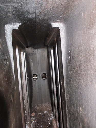
View inside the Valve Chest of an 'Austerity' under restoration showing (left and right) the rectangular steam and exhaust ports. Two (unbalanced) slide valves will be fitted back-to-back, each operated by a valve rod passing through the glands in the background.
'Balanced' slide valves sought to reduce these problems by reducing the area of the back of the valve exposed to live steam, reducing reducing the unbalance. The period of popularity of this type of valve was brought to a close by the development of successful 'Piston' valves, which are inherently 'balanced'.
View of valve chest of piston-valved locomotive under restoration in Insein Works, Burma.
Second consideration, the type of valve gear fitted to operate the steam valve: Although many, many designs of valve gear were produced, in the United Kingdom the two main contenders became the Link Motion (often called Stephenson Link Motion, developed by two employees of Robert Stephenson and Company, Williams and Howe) and Walschaert's Valve Gear (independently developed by the Belgian Egide Walschaerts and the German Von Heusinger).
Stephenson's Link Motion, as fitted to the six-coupled 'Austerities', can be designed to give pretty efficient steam distribution in both directions, although it's better suited to inside-cylinder locomotives. Don Ashton has produced an authoritative review of Stephenson Link Motion here. The picture below shows "Sapper's" driving axle and eccentrics which, like 'Cumbria', uses Link Motion.
"Sapper's" driving axle and eccentrics viewed from below. L-R: RH axlebox and underhung laminated spring, RH crank driven by (red) connecting rod, RH fore eccentric and rod, RH back eccentric and rod, LH back eccentric and rod, LH fore eccentric and rod, LH crank driven by (red) connecting rod, LH axlebox and underhung laminated spring.
Click here for a larger view
There's a little more on the locomotive 'Sapper' here.
Walschaert's gear, with separate lap-and-lead motion can be helpful for fast passenger designs but it is also ideal for outside-cylinder designs, keeping all the motion which needs examination and oiling readily accessible. Whilst I'm a great fan of Churchward's designs, I've always been puzzled that, when he did use Walschaert's gear on his 4-cylinder locomotives, he hid it between the frames where it was difficult to get at. Stanier, when he became Chief Mechanical Engineer at Derby, made sure his larger 2-cylinder designs, like the '8F' 8624 (shown below with a strange 'paint job'), used Walschaert's motion on the outside.
The public inauguration of the restored 8624 at Peak Rail on 23rd May 2009.
There's a little more about Stanier's '8F' design here.
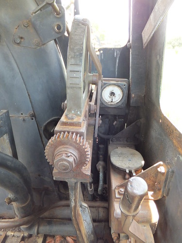
Third consideration, the type of reverser used to adjust the valve gear: In express locomotives, reversers were often screw-operated, permitting precise adjustment of cut-off to suit extended periods of fast running.
Stanier Screw Reverser on 8624.
But freight locomotives, like the six-coupled 'Austerity' often had a 'lever' or 'pole' reverser - convenient when frequently changing direction during shunting although not really suitable for delicate changes of cut-off when running in one direction.
Of course, some locomotives had a 'power' reverser (usually steam-operated in this country) so that the driver only adjusted a small 'pilot' lever to control the actual reversing mechanism. Bullied 'Pacifics', as built, had 'power' reversers, which I've seen described as "the biggest liar on the footplate"! In a Beyer-Garratt locomotive, there are often four sets of motion to adjust on two different engine units, so power reversers were common on these designs.
Hadfield Reverser on 20th class No. 708, built Beyer Peacock on display in Livingstone Railway Museum, showing control for steam reverser and cut-off indicator.
Some locomotives with a conventional 'lever' reverser had lots of slots implying the possibility of fine adjustment of cut-off. But I never met a driver who cared much what cut-off he operated at - he would just set the driving controls so that the engine 'felt right'. The reversing quadrant on 'Cumbria' subscribed to this common-sense approach to setting cut-off - in addition to the 'Mid Gear' notch, it had (in each direction) notches for 'Full Gear', 'Linked-Up a Bit' and 'Linked-Up a Bit More'.
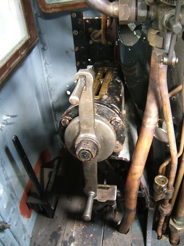

Typical lever reverser on an 'Austerity' tank.
There's a bit about regulators in the posts Locomotive Regulators and The Best Laid Schemes ....
'Cumbria' was in need of some care and attention, which added to our difficulties. All the controls were rather stiff - water cocks took some strength to set correctly, lever reverser catch handle was stiff, even the valve spindle on the vacuum brake application valve needed some manual assistance. The fireman's side injector was temperamental to set, causing additional use of the (fairly reliable) driver's side injector. After shutting off steam, prior to a speed restriction or station stop, this often meant the additional task of 'setting' the driver's side water cock for the fireman at the same time as judging the vacuum brake application.
Like many industrial locomotives later fitted with an ejector to allow the operation of vacuum-braked passenger trains, the steam supply cock to the ejector required 'tuning' to obtain 'best vacuum'. This often means 'throttling-back' the steam since excessive steam supply can produce turbulence in the body of the ejector, impairing the desirable 'laminar fluid flow' and reducing the vacuum created. Depending upon the installation details, other events (such as operation of the safety valves or putting on a ejector or even adjusting the blower) can alter the level of vacuum created. In the case of 'Cumbria', it was desirable to pay close attention to the vacuum gauge as she would occasionally suddenly lose a few inches of vacuum, creating a partial brake application, for no discernable reason, resulting in furious 'twiddling' of the steam supply, to try to regain the "sweet spot".
I think all enginemen like the challenge of a slightly recalcitrant locomotive - but not too much of a challenge.
Thursday, 24 March 2016
Stop Press
In the previous post in this series Gough Island, I described our Zodiac cruise off Gough Island. We then had a voyage of around 1,500 miles across the South Atlantic to Cape Town, a journey which would took four days.
...
I'm at Dubai International Airport, it's 05:15 local time and in a couple of hours I should be boarding the EK039 to Birmingham on my marathon journey to Argentina, the Falklands, South Georgia, Tristan da Cunha and Cape Town.
Here's a quick update on the last two days.
Tuesday, 22nd March 2016: Around Cape Point and Cape Town
Because the weather was kind on the voyage from Tristan da Cunha to Cape Town, we were off Cape Town harbour, waiting for the pilot to board, at 07:15, rather than the scheduled afternoon arrival. The expedition n team had arranged an additional trip and offered one of three alternatives:
Back on the bus, we continued south through spectacular scenery to the Cape of Good Hope where we made a brief photographic stop (along with lots of people enjoying a public holiday) before continuing to Cape Point, again with lots of people. There was a funicular railway to near the top of the point which we took, leaving a series of steps climbing further to the viewpoint at the old lighthouse on the summit. Although we had return tickets for the funicular, most of us chose to walk all the way down to our transport. On the way back to the ship, we stopped to observe a group of Benobo monkeys. Troops of these monkeys have become a menace, stealing food and breaking into cars or houses in search of food. We'd compressed what's usually a full day tour into half a day so, not surprisingly, it was after 4.00 p.m. when we arrived back at the ship. The restaurant on the ship had kindly stayed open for lunch, with a somewhat restricted menu.
The ship had also arranged a small shuttle bus to run between the ship and the V&A Complex. This is the old part of the docks reborn as a modern shopping mall and a magnet for tourists. I took a trip on the shuttle bus to wander around the 'V&A' but, as expected, found little to detain me so I carried on walking back to Cape Town Cruise Ship Terminal, in the newer docks, where our ship was berthed.
The day finished with a convivial dinner on board where we said our 'goodbyes' to fellow passengers before we went our separate ways early the next morning.
Wednesday, 23nd March 2016: Robben Island and Cape Town
Just before 8.00 a.m., I left the ship, picked up my luggage, and was met by the friendly proprietor of a tour company with a people carrier. A trip to Robben Island, notorious for the imprisonment of Nelson Mandela and other political prisoners in addition to serving as a criminal prison. The island lay 11 km offshore, making escape virtually impossible. A fleet of ferries shuttle tourists to the island for a bus tour outlining the history of the island and a conducted tour of part of the former prison. I was on the catamaran 'Jester' in both directions.
Back at the V&A, we walked through the shopping centre to the vehicle and my new fried readily agreed to provide some opportunities to view the complex of railway lines leading from Cape Town railway station. Before taking me to the airport for my flight to Dubai, he did say it was the most unusual City Tour he'd been asked to provide!
All my posts on this trip can be found here.
My pictures
There's currently a reasonable collection of pictures illustrating this trip at South Atlantic Voyage, but the rest of my pictures will not be uploaded until I return to the U.K.
I'm at Dubai International Airport, it's 05:15 local time and in a couple of hours I should be boarding the EK039 to Birmingham on my marathon journey to Argentina, the Falklands, South Georgia, Tristan da Cunha and Cape Town.
Here's a quick update on the last two days.
Tuesday, 22nd March 2016: Around Cape Point and Cape Town
Because the weather was kind on the voyage from Tristan da Cunha to Cape Town, we were off Cape Town harbour, waiting for the pilot to board, at 07:15, rather than the scheduled afternoon arrival. The expedition n team had arranged an additional trip and offered one of three alternatives:
Visit to the wine making areasI chose the last alternative, as did most of my fellow passengers, so we set off in two modern coaches, crossing the peninsula to Simonstown on the east coast. I'd visited Simonstown in 2011 (as described here) but the weather then was wet and cold so I didn't get beyond the town itself. The second time, we had splendid weather and stopped just beyond the town at Boulder, where South African penguins were dotted around the beach. After a while, we moved on to the formal nature reserve, crowded with people, where we could observe more penguins and birdlife from a boardwalk.
Visit to the Botanic Gardens
Trip to see South African penguins and the Cape of Good Hope.
Back on the bus, we continued south through spectacular scenery to the Cape of Good Hope where we made a brief photographic stop (along with lots of people enjoying a public holiday) before continuing to Cape Point, again with lots of people. There was a funicular railway to near the top of the point which we took, leaving a series of steps climbing further to the viewpoint at the old lighthouse on the summit. Although we had return tickets for the funicular, most of us chose to walk all the way down to our transport. On the way back to the ship, we stopped to observe a group of Benobo monkeys. Troops of these monkeys have become a menace, stealing food and breaking into cars or houses in search of food. We'd compressed what's usually a full day tour into half a day so, not surprisingly, it was after 4.00 p.m. when we arrived back at the ship. The restaurant on the ship had kindly stayed open for lunch, with a somewhat restricted menu.
The ship had also arranged a small shuttle bus to run between the ship and the V&A Complex. This is the old part of the docks reborn as a modern shopping mall and a magnet for tourists. I took a trip on the shuttle bus to wander around the 'V&A' but, as expected, found little to detain me so I carried on walking back to Cape Town Cruise Ship Terminal, in the newer docks, where our ship was berthed.
The day finished with a convivial dinner on board where we said our 'goodbyes' to fellow passengers before we went our separate ways early the next morning.
Wednesday, 23nd March 2016: Robben Island and Cape Town
Just before 8.00 a.m., I left the ship, picked up my luggage, and was met by the friendly proprietor of a tour company with a people carrier. A trip to Robben Island, notorious for the imprisonment of Nelson Mandela and other political prisoners in addition to serving as a criminal prison. The island lay 11 km offshore, making escape virtually impossible. A fleet of ferries shuttle tourists to the island for a bus tour outlining the history of the island and a conducted tour of part of the former prison. I was on the catamaran 'Jester' in both directions.
Back at the V&A, we walked through the shopping centre to the vehicle and my new fried readily agreed to provide some opportunities to view the complex of railway lines leading from Cape Town railway station. Before taking me to the airport for my flight to Dubai, he did say it was the most unusual City Tour he'd been asked to provide!
All my posts on this trip can be found here.
My pictures
There's currently a reasonable collection of pictures illustrating this trip at South Atlantic Voyage, but the rest of my pictures will not be uploaded until I return to the U.K.
Monday, 21 March 2016
Gough Island
In the previous post in this series Nightingale and Inaccessible Islands, I described our visit to the two islands close to Tristan da Cunha. Gough Island is also part of the Tristan da Cunha group but, some 160 miles away from the main island, we had to sail through the night to reach this World Heritage Site ...
Thursday, 17th March 2016: Gough Island
The Island, also of volcanic origin, is surrounded by tall cliffs rising straight out of the sea has been described as the “Seabird Citadel of the South Atlantic” with twenty two species of seabirds breeding there. Landing is not allowed, although South Africa maintains a manned meteorological station. Mice introduced accidentally to the island had become a serious threat to seabird chicks and, at the time of my visit, the Royal Society for the Protection of Birds was launching a campaign to eradicate the mice.
In sunny weather with calm seas, ‘Silver Explorer’ anchored off Gough Island around 2.00 p.m, near a small rocky island hosting a penguin colony and lots of birds. We were offered a Zodiac cruise lasting about 90 minutes to take a closer look along the shore.
In such benign conditions, the Zodiac cruise, the last on the trip, was a real joy. The map clarifies our location. The ship was moored neat the small island marked ‘PENGUIN’. Our Zodiac driver, Tim, headed across Milford Bay, giving us good views of the rugged grandeur of the location. He nosed into ‘ARCHWAY ROCK’ until we could see two small, man-made caves.
Further along the narrow boulder-strewn shore, we passed the site of one waterfall which appeared dry then a second with a little water flowing. Each gust of wind turned the water to a fine mist so little of the water actually fell to the rocks below.
There was an abundance of various types of kelp which lazily oscillated with the movement of the sea. This seemed to encourage the numerous fur seals to frolic, diving, or just sliding, from the rocks into the kelp and then climbing back onto the rocks before repeating the performance.
Next we came to a large arch in the rock leading to a water-filled cave. The roof of this cave had collapsed, allowing us to look up to the sky from within the cave.
Finally, we approached a colony of Rockhopper penguins, distributed across the face of the tall cliff. Beyond the penguins, we could see the tall radio mast of the South African Meteorological Observatory but not the buildings themselves.
It was time to return to our ship, so Tim turned his baseball cap back-to-front and ‘gunned’ the Zdiac’s engine. The sea remained flat calm and the sky was dusted with clouds bringing our trip to a perfect conclusion.
Once everyone was back on the ship, the Captain moved parallel to the shore until we were abeam the Weather Station. He then turned the ship to face the shore and sounded two long blasts on the siren in salute. A man from the weather station was spotted next to the crane used to lift their supplies up the cliff each year. His waving was enthusiastically returned by all the passengers on the foredeck. We afterwards learned that, in a radiotelephone conversation with the weather station, the occupants revealed that they had not even seen a ship for a number of months!
All that now remained was to sail some 1,500 miles across the South Atlantic to Cape Town, a journey which would take at least four days. All my posts on this trip can be found here.
My pictures
Since internet service resumed on the ship, I’ve added a few more pictures each day to the album South Atlantic Voyage, but most of them will not be uploaded until I return to the U.K.
Thursday, 17th March 2016: Gough Island
The Island, also of volcanic origin, is surrounded by tall cliffs rising straight out of the sea has been described as the “Seabird Citadel of the South Atlantic” with twenty two species of seabirds breeding there. Landing is not allowed, although South Africa maintains a manned meteorological station. Mice introduced accidentally to the island had become a serious threat to seabird chicks and, at the time of my visit, the Royal Society for the Protection of Birds was launching a campaign to eradicate the mice.
In sunny weather with calm seas, ‘Silver Explorer’ anchored off Gough Island around 2.00 p.m, near a small rocky island hosting a penguin colony and lots of birds. We were offered a Zodiac cruise lasting about 90 minutes to take a closer look along the shore.
In such benign conditions, the Zodiac cruise, the last on the trip, was a real joy. The map clarifies our location. The ship was moored neat the small island marked ‘PENGUIN’. Our Zodiac driver, Tim, headed across Milford Bay, giving us good views of the rugged grandeur of the location. He nosed into ‘ARCHWAY ROCK’ until we could see two small, man-made caves.
Further along the narrow boulder-strewn shore, we passed the site of one waterfall which appeared dry then a second with a little water flowing. Each gust of wind turned the water to a fine mist so little of the water actually fell to the rocks below.
There was an abundance of various types of kelp which lazily oscillated with the movement of the sea. This seemed to encourage the numerous fur seals to frolic, diving, or just sliding, from the rocks into the kelp and then climbing back onto the rocks before repeating the performance.
Next we came to a large arch in the rock leading to a water-filled cave. The roof of this cave had collapsed, allowing us to look up to the sky from within the cave.
Finally, we approached a colony of Rockhopper penguins, distributed across the face of the tall cliff. Beyond the penguins, we could see the tall radio mast of the South African Meteorological Observatory but not the buildings themselves.
It was time to return to our ship, so Tim turned his baseball cap back-to-front and ‘gunned’ the Zdiac’s engine. The sea remained flat calm and the sky was dusted with clouds bringing our trip to a perfect conclusion.
Once everyone was back on the ship, the Captain moved parallel to the shore until we were abeam the Weather Station. He then turned the ship to face the shore and sounded two long blasts on the siren in salute. A man from the weather station was spotted next to the crane used to lift their supplies up the cliff each year. His waving was enthusiastically returned by all the passengers on the foredeck. We afterwards learned that, in a radiotelephone conversation with the weather station, the occupants revealed that they had not even seen a ship for a number of months!
All that now remained was to sail some 1,500 miles across the South Atlantic to Cape Town, a journey which would take at least four days. All my posts on this trip can be found here.
My pictures
Since internet service resumed on the ship, I’ve added a few more pictures each day to the album South Atlantic Voyage, but most of them will not be uploaded until I return to the U.K.
Sunday, 20 March 2016
Nightingale and Inaccessible Islands
In the previous post in this series Tristan da Cunha (part 2), I described my afternoon exploring the Settlement, which left me quite tired. The next day was to prove no easier ...
Before we sailed away from Tristan da Cunha on Tuesday, about six of the Island men came aboard to act as guides the following day. Exhausted from my exertions on the Island, I took a quiet dinner in my cabin (which Silversea call a ‘suite’, to remind everybody how upmarket they are). The ship sailed for around a hour and a half to a sheltered anchorage off Nightingale Island where we spent the night.
Wednesday, 16th March 2016: Nightingale Island
The Island is the remnant of a volcanic cone, now only 36 Hectares in area. The name has no connection with birds but was so named in 1760 after Captain Gamaliel Nightingale. The people of Tristan de Cunha have traditionally visited Nightingale Island and the Tristanian guides were to provide advice to the expedition team on places where Zodiacs might land.
It was decided that the landing place with easy walking to the Rockhopper penguin rookery was unsuitable because of the sea conditions but that an alternative “back door” landing place was feasible. Unfortunately, this landing involved climbing over slippery rocks followed by a stiff climb assisted by ropes to use as a ‘handrail’. At the end of the climb, a trek through tussock grass would lead down, on the other side of the island to the penguin colony itself. Because of this increased difficulty, the expedition leader offered three options – land and definitely reach the penguins, land and at least attempt to reach the penguins or take a Zodiac ride, viewing the colony from the sea. I elected for the middle option, along with over half of the passengers.
When my turn for the Zodiac ride came, I discovered that the landing place was a small, protected cove where we stepped out directly onto the rock. A short length of carpet had been placed on the slipperly rock and there were willing hands to help passengers ashore. There was very little space on the rock so the climb started almost immediately. It was perhaps fortunate that I was unable to assess the problems of ascending the muddy gulley before commencing the climb. We were told only grasp green tussock grass for support (brown might give way) and make use of the rope lying alongside the route.
On the more vertiginous stretches, expedition team members or our Tristanian guides were positioned to help but I found it a tough scramble and was relieved to arrive at fairly level ground. There was a fairly clear undulating path to follow through tussock grass eight to ten feet tall. Eventually, the path descended and we were on a rock platform above the sea with Rockhopper penguins all around. Rockhoppers are crested penguins (similar to the Macaronis we’d seen earlier in the trip) and always manage to look as if they’re dressed up for a party. Before too long, we were making our way back.
On the return we passed various birds. The thrushes ran across the path or clung onto the tussock grass. The seabirds, even as chicks, impressed with their sheer size. The yellow-nosed albatross (called locally ‘molly’) breeds on the island. The wingspan of this bird can be 8 feet! One example, setting on a rock at the side of the path, showed its indifference to the strange visitors by continuing to stare seawards as we passed within a few inches.
I don’t think any of the group were relishing the descent of the gulley to get back to the landing place – I certainly wasn’t. Coming down backwards clutching the rope was recommended but, of course, this made it hard to see the route and decide where to place feet so my descent involved a lot of sliding in the muddy sections holding grimly onto the rope. I arrived back at the landing place with only minor scratches to my knuckles, which I discovered a number of the passengers sustained.
Whilst waiting to be picked up by the Zodiac, we watched the antics of the fur seals. The sea had eroded a deep chamber in the rock at one point which, for some reason, reminded me of a washing machine drum. Certainly, it fascinated the fur seals – in turn, I noticed a number clamber into the ‘drum’ and apparently delight as the sea alternately filled and emptied the chamber. As the Zodiac bounced over the waves back to the ship, I looked back at the route we’d taken up the gully and could scarcely believe what I’d accomplished. Back on board, I later discovered that, of the more than 50 people who selected the climb, two had realised on seeing the gully that it was ‘not for them’ and everyone else had completed the climb.
Wednesday, 16th March 2016: Inaccessible Island
Once everyone was safely on board, the ship moved to nearby Inaccessible Island where it anchored offshore. Somewhat audaciously, the expedition leader had decided to attempt a landing. The scout boats went out to set up a beach landing site. As the tide turned, conditions deteriorated but the team experimented for some time with different landing positions or with a ‘reversed landing’ with the stern of the Zodiac (rather than the bow) hauled onto the stone beach. After various attempts to find a safe method of landing the passengers, the expedition leader was forced to conclude that, once again, the Island had lived up to its name and the landing was cancelled.
Next, the ship cruised back to Tristan da Cunha so that we could return our new friends, the Tristanian guides, back to their homw. It was dusk as a Zodiac ferried them back to Calshot Harbour and, as the street lights were turned on in the Settlement, it was a magical site. Tristan has mains electricity (as far as I know, produced by package generators near the Fish Factory). Distribution by overhead cables has been replaced by buried cable and a set of modern street lighting has been provided.
Although Gough Island is part of the Tristan da Cunha group, it is some 160 miles away from the main island, so we sailed through the night to reach this rocky outpost.
All my posts on this trip can be found here.
My pictures
Since internet service resumed on the ship, I’ve added a few more pictures each day to the album South Atlantic Voyage, but most of them will not be uploaded until I return to the U.K.
Before we sailed away from Tristan da Cunha on Tuesday, about six of the Island men came aboard to act as guides the following day. Exhausted from my exertions on the Island, I took a quiet dinner in my cabin (which Silversea call a ‘suite’, to remind everybody how upmarket they are). The ship sailed for around a hour and a half to a sheltered anchorage off Nightingale Island where we spent the night.
Wednesday, 16th March 2016: Nightingale Island
The Island is the remnant of a volcanic cone, now only 36 Hectares in area. The name has no connection with birds but was so named in 1760 after Captain Gamaliel Nightingale. The people of Tristan de Cunha have traditionally visited Nightingale Island and the Tristanian guides were to provide advice to the expedition team on places where Zodiacs might land.
It was decided that the landing place with easy walking to the Rockhopper penguin rookery was unsuitable because of the sea conditions but that an alternative “back door” landing place was feasible. Unfortunately, this landing involved climbing over slippery rocks followed by a stiff climb assisted by ropes to use as a ‘handrail’. At the end of the climb, a trek through tussock grass would lead down, on the other side of the island to the penguin colony itself. Because of this increased difficulty, the expedition leader offered three options – land and definitely reach the penguins, land and at least attempt to reach the penguins or take a Zodiac ride, viewing the colony from the sea. I elected for the middle option, along with over half of the passengers.
When my turn for the Zodiac ride came, I discovered that the landing place was a small, protected cove where we stepped out directly onto the rock. A short length of carpet had been placed on the slipperly rock and there were willing hands to help passengers ashore. There was very little space on the rock so the climb started almost immediately. It was perhaps fortunate that I was unable to assess the problems of ascending the muddy gulley before commencing the climb. We were told only grasp green tussock grass for support (brown might give way) and make use of the rope lying alongside the route.
On the more vertiginous stretches, expedition team members or our Tristanian guides were positioned to help but I found it a tough scramble and was relieved to arrive at fairly level ground. There was a fairly clear undulating path to follow through tussock grass eight to ten feet tall. Eventually, the path descended and we were on a rock platform above the sea with Rockhopper penguins all around. Rockhoppers are crested penguins (similar to the Macaronis we’d seen earlier in the trip) and always manage to look as if they’re dressed up for a party. Before too long, we were making our way back.
On the return we passed various birds. The thrushes ran across the path or clung onto the tussock grass. The seabirds, even as chicks, impressed with their sheer size. The yellow-nosed albatross (called locally ‘molly’) breeds on the island. The wingspan of this bird can be 8 feet! One example, setting on a rock at the side of the path, showed its indifference to the strange visitors by continuing to stare seawards as we passed within a few inches.
I don’t think any of the group were relishing the descent of the gulley to get back to the landing place – I certainly wasn’t. Coming down backwards clutching the rope was recommended but, of course, this made it hard to see the route and decide where to place feet so my descent involved a lot of sliding in the muddy sections holding grimly onto the rope. I arrived back at the landing place with only minor scratches to my knuckles, which I discovered a number of the passengers sustained.
Whilst waiting to be picked up by the Zodiac, we watched the antics of the fur seals. The sea had eroded a deep chamber in the rock at one point which, for some reason, reminded me of a washing machine drum. Certainly, it fascinated the fur seals – in turn, I noticed a number clamber into the ‘drum’ and apparently delight as the sea alternately filled and emptied the chamber. As the Zodiac bounced over the waves back to the ship, I looked back at the route we’d taken up the gully and could scarcely believe what I’d accomplished. Back on board, I later discovered that, of the more than 50 people who selected the climb, two had realised on seeing the gully that it was ‘not for them’ and everyone else had completed the climb.
Wednesday, 16th March 2016: Inaccessible Island
Once everyone was safely on board, the ship moved to nearby Inaccessible Island where it anchored offshore. Somewhat audaciously, the expedition leader had decided to attempt a landing. The scout boats went out to set up a beach landing site. As the tide turned, conditions deteriorated but the team experimented for some time with different landing positions or with a ‘reversed landing’ with the stern of the Zodiac (rather than the bow) hauled onto the stone beach. After various attempts to find a safe method of landing the passengers, the expedition leader was forced to conclude that, once again, the Island had lived up to its name and the landing was cancelled.
Next, the ship cruised back to Tristan da Cunha so that we could return our new friends, the Tristanian guides, back to their homw. It was dusk as a Zodiac ferried them back to Calshot Harbour and, as the street lights were turned on in the Settlement, it was a magical site. Tristan has mains electricity (as far as I know, produced by package generators near the Fish Factory). Distribution by overhead cables has been replaced by buried cable and a set of modern street lighting has been provided.
Although Gough Island is part of the Tristan da Cunha group, it is some 160 miles away from the main island, so we sailed through the night to reach this rocky outpost.
All my posts on this trip can be found here.
My pictures
Since internet service resumed on the ship, I’ve added a few more pictures each day to the album South Atlantic Voyage, but most of them will not be uploaded until I return to the U.K.
Friday, 18 March 2016
Tristan da Cunha (part 2)
In the previous post in this series Tristan da Cunha, I described my walk to Potato Patches and back, after which I spent the afternoon exploring the town ...
Tuesday, 15th March 2016: The Settlement
In the afternoon, the weather was dry and the sun deceptively strong, making the walk very pleasant.
Almost all the buildings were simply constructed – single storey with building block walls and gabled roof. Next to the Post Office and Tourist Centre was the Administration Department, which housed the Island’s only bank. With internet on the ship unserviceable, I went to the Internet Café, in the only 2-storey building I saw. I described this visit in the post Interlude. The supermarket was provided with simple shelving, fairly well stocked and there was a small handicraft shop at the back selling locally-produced knit wear.
 'The Canteen' - the island supermarket.
A short distance off, I’d seen a Refrigerated Shipping Container humming quietly which is presumably the cold store for the supermarket. The next building had bays with and-painted signs – ‘Electrical & Plumbers Store’, ‘Electrical Workshop’ and ‘Plumbers Workshop’. An elderly Massey-Ferguson tractor (24 DS, I think) attached to a trailer appeared to be in regular use.
Next was the Rectory, like most of the houses a simple, low structure which would not look out of place in many countries. Next door there was a slightly larger version of the style - ‘The Residency’ for the Island’s Administrator. This had a well-kept lawn in front and the property was enclosed by dry-stone walls of volcanic rock as are common throughout the Island. Next to the Residency, five of the traditional canvas-covered longboats were stored, inverted and securely tied down. I continued on a track to the east, to look at the Island’s three cemetery plots, each walled with volcanic rock. The Island’s only school lay on my right but since there was no sound emanating, I didn’t investigate.
I was approaching the site of the 1961 volcanic eruption (see below). Our geologist had led a party to examine the volcano cone but, as the walk was graded ‘strenuous’ I did not go on this. But I did climb the first part of the route – a steep, unmade road through a lunar landscape of dark volcanic rock called ‘Volcano Hill’.
I turned south past the walled enclosure of Mission Garden to the preserved thatched cottage which is to become a museum. New Zealand Flax grows in various locations and once formed the standard roofing material. Turning west, the main residential area lay to my right with sloping uplands leading up to Base on my left. This road brought me to St. Mary’s Anglican Church, a simple building with a tiny wooden belfry mounted at one end of the roof.
At the next road junction, I came to the ‘Dong’. A long gas cylinder had been suspended by a chain from a wooden inverted ‘U’ frame. Two local fisherman decide whether it is safe to fish and, on ‘Fishing Days’ the ‘Dong’ is sounded to alert the village. There are usually only around 70 days a year where the weather is suitable for fishing. The modern Longboats now have fibreglass hulls and inboard motors.
Nearby, I found the ‘Albatross’ Bar, the only ‘pub’ on the Island and said to be the ‘Remotest Pub in the World’. I was not surprised to find most of the Expedition Team ‘holed up’ here. It’s now part of the community hall called ‘Prince Philip Hall’, commemorating the visit by Prince Philip in 1967. A little further along, I came to the outdoor swimming pool and café but these were closed. St. Joseph’s Catholic Church was a fairly imposing building, white painted with a red roof and a substantial belfry topped with a weather vane in the shape of a whale. The entrance porch incorporated a stained glass window.
I was surprised when the Expedition Crew appeared and said “Shall we get to the Zodiac, then?”. I thought I’d plenty of time to explore further but then realised that my wristwatch had become accidentally adjusted during my explorations and it was time to walk down the slope to Calshot Harbour and catch the 6.00 p.m. Zodiac back to the ship after an exhausting but fascinating day.
The 1961 volcanic eruption
On 9th October 1961, the supposedly-extinct volcano, after a series of tremors, spewed out lava which threatened the Settlement. The entire population was evacuated to Capetown by the M.S. Tjisadane and then to Britain. Within two years, all but five of the Islanders elected to return to their lonely home. The damage to the structures was minimal, but the Islander’s abandoned possessions were gone.
The outpouring of lava during the 1961 eruption changed the local topography and destroyed the Canning Factory built in 1949 and Big Beach from where the longboats had been launched. In 1967 Calshot Harbour (where we’d landed) was constructed and, on the hill behind the new harbour, a Fish Factory was built to replace the cannery. The Fish Factory was burnt down in 2008 and the Island lost most of its power. A South African firm, Ovenstones, has the fishing concession and employs Islanders to fish and operate the Factory which now produces high-value blast-frozen Tristan da Cuhna Rock Lobsters (Crayfish) to European Standards for export, principally to America and Japan.
References
‘Tristan da Cunha and the Tristanians’ by Daniel Schreier & Karen Lavarell-Schreier (Battlebridge Publications) ISBN 978-1-903292-26-6.
Related posts
Next South Atlantic post.
All my South Atlantic posts.
My pictures
You can find all my pictures on the trip in the Collection Cape to Cape (still being added to, at the time of writing).
There are a few pictures of the trip in the album South Atlantic Voyage.
['Cape to Cape' collection added 5-Apr-2016]
Tuesday, 15th March 2016: The Settlement
In the afternoon, the weather was dry and the sun deceptively strong, making the walk very pleasant.
Almost all the buildings were simply constructed – single storey with building block walls and gabled roof. Next to the Post Office and Tourist Centre was the Administration Department, which housed the Island’s only bank. With internet on the ship unserviceable, I went to the Internet Café, in the only 2-storey building I saw. I described this visit in the post Interlude. The supermarket was provided with simple shelving, fairly well stocked and there was a small handicraft shop at the back selling locally-produced knit wear.
'The Canteen' - the island supermarket.
A short distance off, I’d seen a Refrigerated Shipping Container humming quietly which is presumably the cold store for the supermarket. The next building had bays with and-painted signs – ‘Electrical & Plumbers Store’, ‘Electrical Workshop’ and ‘Plumbers Workshop’. An elderly Massey-Ferguson tractor (24 DS, I think) attached to a trailer appeared to be in regular use.
Next was the Rectory, like most of the houses a simple, low structure which would not look out of place in many countries. Next door there was a slightly larger version of the style - ‘The Residency’ for the Island’s Administrator. This had a well-kept lawn in front and the property was enclosed by dry-stone walls of volcanic rock as are common throughout the Island. Next to the Residency, five of the traditional canvas-covered longboats were stored, inverted and securely tied down. I continued on a track to the east, to look at the Island’s three cemetery plots, each walled with volcanic rock. The Island’s only school lay on my right but since there was no sound emanating, I didn’t investigate.
I was approaching the site of the 1961 volcanic eruption (see below). Our geologist had led a party to examine the volcano cone but, as the walk was graded ‘strenuous’ I did not go on this. But I did climb the first part of the route – a steep, unmade road through a lunar landscape of dark volcanic rock called ‘Volcano Hill’.
I turned south past the walled enclosure of Mission Garden to the preserved thatched cottage which is to become a museum. New Zealand Flax grows in various locations and once formed the standard roofing material. Turning west, the main residential area lay to my right with sloping uplands leading up to Base on my left. This road brought me to St. Mary’s Anglican Church, a simple building with a tiny wooden belfry mounted at one end of the roof.
At the next road junction, I came to the ‘Dong’. A long gas cylinder had been suspended by a chain from a wooden inverted ‘U’ frame. Two local fisherman decide whether it is safe to fish and, on ‘Fishing Days’ the ‘Dong’ is sounded to alert the village. There are usually only around 70 days a year where the weather is suitable for fishing. The modern Longboats now have fibreglass hulls and inboard motors.
Nearby, I found the ‘Albatross’ Bar, the only ‘pub’ on the Island and said to be the ‘Remotest Pub in the World’. I was not surprised to find most of the Expedition Team ‘holed up’ here. It’s now part of the community hall called ‘Prince Philip Hall’, commemorating the visit by Prince Philip in 1967. A little further along, I came to the outdoor swimming pool and café but these were closed. St. Joseph’s Catholic Church was a fairly imposing building, white painted with a red roof and a substantial belfry topped with a weather vane in the shape of a whale. The entrance porch incorporated a stained glass window.
I was surprised when the Expedition Crew appeared and said “Shall we get to the Zodiac, then?”. I thought I’d plenty of time to explore further but then realised that my wristwatch had become accidentally adjusted during my explorations and it was time to walk down the slope to Calshot Harbour and catch the 6.00 p.m. Zodiac back to the ship after an exhausting but fascinating day.
The 1961 volcanic eruption
On 9th October 1961, the supposedly-extinct volcano, after a series of tremors, spewed out lava which threatened the Settlement. The entire population was evacuated to Capetown by the M.S. Tjisadane and then to Britain. Within two years, all but five of the Islanders elected to return to their lonely home. The damage to the structures was minimal, but the Islander’s abandoned possessions were gone.
The outpouring of lava during the 1961 eruption changed the local topography and destroyed the Canning Factory built in 1949 and Big Beach from where the longboats had been launched. In 1967 Calshot Harbour (where we’d landed) was constructed and, on the hill behind the new harbour, a Fish Factory was built to replace the cannery. The Fish Factory was burnt down in 2008 and the Island lost most of its power. A South African firm, Ovenstones, has the fishing concession and employs Islanders to fish and operate the Factory which now produces high-value blast-frozen Tristan da Cuhna Rock Lobsters (Crayfish) to European Standards for export, principally to America and Japan.
References
‘Tristan da Cunha and the Tristanians’ by Daniel Schreier & Karen Lavarell-Schreier (Battlebridge Publications) ISBN 978-1-903292-26-6.
Related posts
Next South Atlantic post.
All my South Atlantic posts.
My pictures
You can find all my pictures on the trip in the Collection Cape to Cape (still being added to, at the time of writing).
There are a few pictures of the trip in the album South Atlantic Voyage.
['Cape to Cape' collection added 5-Apr-2016]
Thursday, 17 March 2016
Tristan da Cunha
In the previous post in this series South Georgia (day 4), I mentioned that it would take us over four days continuous sailing to reach Tristan da Cunha. We were all keen to leave the ship at Tristan ...
Tuesday, 15th March 2016: A day on the most remote inhabited archipelago in the world
The island rises out of the sea to a plateau called ‘Base’. 'Base' is topped by a cone-shaped mountain called 'The Peak' but, as we approached the island, the cone was completely hidden in mist. We could make out the buildings of the one town, delightfully named Edinburgh of the Seven Seas but usually more prosaically called ‘The Settlement’. The total population is under 300. Our ship anchored in the bay a few hundred yards from the rather rudimentary harbour, called ‘Calshot Harbour’, which is currently being upgraded. Britain annexed the Island group in 1816 and it is now part of the Overseas Territory of St. Helena so it was a British official who came aboard to conduct clearance before we could land.
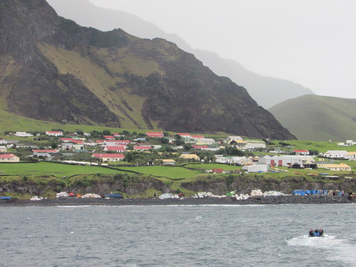 Arriving at Tristan da Cunha: Edinburgh of the Seven Seas.
It had been hoped to offer a ‘strenuous’ hike to Base but, since this involved the use of fixed ropes to help in the ascent, I had discounted that option before the Islanders advised that the recent rain made the climb unsuitable for visitors. The remaining options were a conducted tour of the town or a walking tour, graded ‘moderate’, to Potato Patches – a round trip of 5 miles. I elected for the latter, reasoning that I could make a self-guided tour of the town afterwards.
At about 8.45 a.m. I was landed by Zodiac. Two odd-looking breakwaters (made from concrete forms shaped like oversized ‘jacks’ intended to absorb the the power of the waves) reached into the sea to provide some protection to the concrete quay we were to land at. The Zodiac headed for a set of steps set into the quay wall and used power to hold the bow pressed against the quay whilst expedition team members helped the passengers scramble ashore. The quay was the usual untidy array of vehicles, small fishing boats on trailers and the impedimenta of fishing activity. We threaded our way through these obstructions to the ramped access road which led up to the town level, built on a sloping site around fifty feet above the harbour. The access road gave good views of the cramped harbour. An excavator mounted on a barge was being used to dredge the approach to the quays while a large tracked jib crane was being used on building work repairing or improving one area of the quay. The main equipment for handling cargo was a portal crane apparently intended for dealing with shipping containers.
The weather was fairly warm but overcast and drizzling as I completed the climb to the town. I was passed by a modern ‘Transit’ people carrier, carrying the interesting registration ‘TDC 8’. This was apparently the island’s bus but on the day of our visit chartered to provide a shuttle service between the Settlement and Potato Patches for the ship’s passengers.
Armed with a street plan (which quickly became very sodden with rain), I threaded my way through the Settlement to the only road out of the town, leading to Potato Patches. I learned that most of the eighty families on the island grew their own vegetables at allotments about two and a half miles from Settlement at the area known as Potato Patches where weekends were frequently spent. I was intrigued by the concept of escaping the rat race of life in the Settlement by going away for the weekend.
The road followed the contours of the grassy plateau between the cliffs or steep hills which rose up to the mist surrounding Base on my left and the stock-proof fence before the drop to the sea on my right. The road, like the roads in Settlement, were generally concrete, wide enough for a single vehicle. Sometimes, a tarmac layer had been added. In places where the concrete had broken up, a lightweight reinforcing mesh was visible. Every so often, three bags of cold-curing tarmac (‘Much Mix’ from South Africa) were dumped at the side of the road, to deal with the inevitable potholes. There were sections with no surfacing at all where the black, volcanic stone had simply been rolled to provide a carriageway.
Some of the land was fenced and there were various hen houses or duck houses dotted around but it appeared to be mainly open pasture for cows or sheep. At one point, I passed three farmers with the inevitable Japanese pick-up driving a group of about 40 cows and 4 bulls towards the settlement.
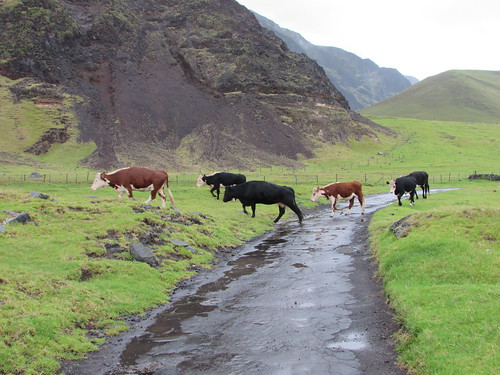 Walking to Potato Patches: 'Route West' with livestock being herded towards The Settlement. On the left, the hills rise up to 'Base'.
Concrete water troughs for the animals appeared in various places, sometimes fed by a pipeline leading from the cliffs on my left. Various birds wheeled overhead and, despite the rain, it was a pleasant walk as I passed the various marker stones with names like ‘The Valley’, ‘Below The Hill’ or ‘Twitty Patch’.
Rather incongruously, there were also bus stops. Near each was a properly-built bus shelter, with a concrete base, wooden framing , wood or metal cladding, internal wooden benches and a hinged half-door secured with a wooden catch. The nicest feature was the hand-painted sign with the name of the stop, embellished with simple pictures of an animal, a bird or a sailing boat. A couple of the signs I found inside the shelter, laid on the bench, like Dailys Hill Shelter where a pair of boots also sat patiently in the corner - a somehow endearing touch.
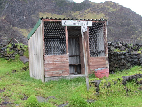 Tristan da Cunha: Hottentot Bus Shelter.
Eventually, I came to ‘Patches’ – strip allotments carefully bounded by dry stone walls made from volcanic rock with a ‘garden shed’ at one end also made from volcanic rock with a gabled, corrugated iron roof.
 Walking to Potato Patches: Jan at Twitty Patch (Photo: Laurent).
There were also ‘holiday homes’. These were generally constructed from building blocks with steel-framed windows and a flat roof but details and level of maintenance varied. There were a few similar but derelict structures. When the concrete road petered out, at The Bluff, I decided to turn back, with the idea of perhaps catching the bus, which had passed me a few times shuttling ship’s passengers up and down, back to the Settlement. But by this time, the drizzle had stopped and the sun had come out, so I thought to myself “I’ll walk a bit further before catching the bus” and I eventually reached the Settlement, rather tired but under my own power. I needed a bit of a breather before walking round the town, so I went to the Post Office and Tourist Centre and bought some books before relaxing for a while in the attached café with a cup of tea and a fruit cake.
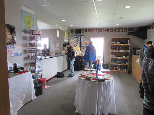 Tristan da Cunha: The Post Office and Tourist Centre.
Suitably revitalised, I set off to explore the town armed with my sodden town map, by then disintegrating after the earlier rain. I’ll tell you more next time.
Related posts
Tristan da Cunha (part 2).
All my South Atlantic posts.
My pictures
You can find all my pictures on the trip in the Collection Cape to Cape (still being added to, at the time of writing).
There are a few pictures of the trip in the album South Atlantic Voyage.
['Cape to Cape' collection added 5-Apr-2016]
Tuesday, 15th March 2016: A day on the most remote inhabited archipelago in the world
The island rises out of the sea to a plateau called ‘Base’. 'Base' is topped by a cone-shaped mountain called 'The Peak' but, as we approached the island, the cone was completely hidden in mist. We could make out the buildings of the one town, delightfully named Edinburgh of the Seven Seas but usually more prosaically called ‘The Settlement’. The total population is under 300. Our ship anchored in the bay a few hundred yards from the rather rudimentary harbour, called ‘Calshot Harbour’, which is currently being upgraded. Britain annexed the Island group in 1816 and it is now part of the Overseas Territory of St. Helena so it was a British official who came aboard to conduct clearance before we could land.
Arriving at Tristan da Cunha: Edinburgh of the Seven Seas.
It had been hoped to offer a ‘strenuous’ hike to Base but, since this involved the use of fixed ropes to help in the ascent, I had discounted that option before the Islanders advised that the recent rain made the climb unsuitable for visitors. The remaining options were a conducted tour of the town or a walking tour, graded ‘moderate’, to Potato Patches – a round trip of 5 miles. I elected for the latter, reasoning that I could make a self-guided tour of the town afterwards.
At about 8.45 a.m. I was landed by Zodiac. Two odd-looking breakwaters (made from concrete forms shaped like oversized ‘jacks’ intended to absorb the the power of the waves) reached into the sea to provide some protection to the concrete quay we were to land at. The Zodiac headed for a set of steps set into the quay wall and used power to hold the bow pressed against the quay whilst expedition team members helped the passengers scramble ashore. The quay was the usual untidy array of vehicles, small fishing boats on trailers and the impedimenta of fishing activity. We threaded our way through these obstructions to the ramped access road which led up to the town level, built on a sloping site around fifty feet above the harbour. The access road gave good views of the cramped harbour. An excavator mounted on a barge was being used to dredge the approach to the quays while a large tracked jib crane was being used on building work repairing or improving one area of the quay. The main equipment for handling cargo was a portal crane apparently intended for dealing with shipping containers.
The weather was fairly warm but overcast and drizzling as I completed the climb to the town. I was passed by a modern ‘Transit’ people carrier, carrying the interesting registration ‘TDC 8’. This was apparently the island’s bus but on the day of our visit chartered to provide a shuttle service between the Settlement and Potato Patches for the ship’s passengers.
Armed with a street plan (which quickly became very sodden with rain), I threaded my way through the Settlement to the only road out of the town, leading to Potato Patches. I learned that most of the eighty families on the island grew their own vegetables at allotments about two and a half miles from Settlement at the area known as Potato Patches where weekends were frequently spent. I was intrigued by the concept of escaping the rat race of life in the Settlement by going away for the weekend.
The road followed the contours of the grassy plateau between the cliffs or steep hills which rose up to the mist surrounding Base on my left and the stock-proof fence before the drop to the sea on my right. The road, like the roads in Settlement, were generally concrete, wide enough for a single vehicle. Sometimes, a tarmac layer had been added. In places where the concrete had broken up, a lightweight reinforcing mesh was visible. Every so often, three bags of cold-curing tarmac (‘Much Mix’ from South Africa) were dumped at the side of the road, to deal with the inevitable potholes. There were sections with no surfacing at all where the black, volcanic stone had simply been rolled to provide a carriageway.
Some of the land was fenced and there were various hen houses or duck houses dotted around but it appeared to be mainly open pasture for cows or sheep. At one point, I passed three farmers with the inevitable Japanese pick-up driving a group of about 40 cows and 4 bulls towards the settlement.
Walking to Potato Patches: 'Route West' with livestock being herded towards The Settlement. On the left, the hills rise up to 'Base'.
Concrete water troughs for the animals appeared in various places, sometimes fed by a pipeline leading from the cliffs on my left. Various birds wheeled overhead and, despite the rain, it was a pleasant walk as I passed the various marker stones with names like ‘The Valley’, ‘Below The Hill’ or ‘Twitty Patch’.
Rather incongruously, there were also bus stops. Near each was a properly-built bus shelter, with a concrete base, wooden framing , wood or metal cladding, internal wooden benches and a hinged half-door secured with a wooden catch. The nicest feature was the hand-painted sign with the name of the stop, embellished with simple pictures of an animal, a bird or a sailing boat. A couple of the signs I found inside the shelter, laid on the bench, like Dailys Hill Shelter where a pair of boots also sat patiently in the corner - a somehow endearing touch.
Tristan da Cunha: Hottentot Bus Shelter.
Eventually, I came to ‘Patches’ – strip allotments carefully bounded by dry stone walls made from volcanic rock with a ‘garden shed’ at one end also made from volcanic rock with a gabled, corrugated iron roof.
Walking to Potato Patches: Jan at Twitty Patch (Photo: Laurent).
There were also ‘holiday homes’. These were generally constructed from building blocks with steel-framed windows and a flat roof but details and level of maintenance varied. There were a few similar but derelict structures. When the concrete road petered out, at The Bluff, I decided to turn back, with the idea of perhaps catching the bus, which had passed me a few times shuttling ship’s passengers up and down, back to the Settlement. But by this time, the drizzle had stopped and the sun had come out, so I thought to myself “I’ll walk a bit further before catching the bus” and I eventually reached the Settlement, rather tired but under my own power. I needed a bit of a breather before walking round the town, so I went to the Post Office and Tourist Centre and bought some books before relaxing for a while in the attached café with a cup of tea and a fruit cake.
Tristan da Cunha: The Post Office and Tourist Centre.
Suitably revitalised, I set off to explore the town armed with my sodden town map, by then disintegrating after the earlier rain. I’ll tell you more next time.
Related posts
Tristan da Cunha (part 2).
All my South Atlantic posts.
My pictures
You can find all my pictures on the trip in the Collection Cape to Cape (still being added to, at the time of writing).
There are a few pictures of the trip in the album South Atlantic Voyage.
['Cape to Cape' collection added 5-Apr-2016]
Tuesday, 15 March 2016
South Georgia (day 4)
In the previous post in this series South Georgia (day 3), I described our landings in Grytviken and Fortuna Bay. But what many think is the most beautiful site in South Georgia was saved for our last landing...
Thursday, 9th March 2016: Gold Harbour: Sitting with Seals, Walking with Penguins,
The option of an early morning landing at 5.30 a.m. was offered to allow the sunrise to be enjoyed from the beach. Although I’m no stranger to early rising, I’d been feeling rather tired and decided to go for the ‘normal’ landing at 8.30 a.m.
Overnight, the ship had sailed from Fortuna Bay and, at 4.45 a.m.on our arrival in Gold Harbour, the noise of the anchor chain being run out woke me up. In the forward cabins like mine, the noise of both the anchor chain and the use of the bow thrusters is quite loud on this ship. Once awake, I thought I might as will make the early landing, although the time it took me to get ready meant that I wasn’t able to try the “Early Risers Danish and Coffee” laid on in the Panorama Lounge.
There were at least three Zodiac trips to ferry the “sunrise landers” ashore. The temperature wasn’t bad and there was little wind but light snow was falling. It was light enough to see but, of course, in the low light conditions photography was not ideal for my fairly modest camera. We landed on a curved sand and pebble beach. In places the stones were quite large making walking harder. The rocky foreshore was framed by green hills with mountains behind. Snow capped the mountain tops and thinning snow remained on much of the grassland. In the distance on our left, the Berntrab Glacier inclined towards the sea.
Most remarkable, however, was the population of this landscape. The offshore rocks were crowded with fur seals and, approaching the shingle beach, the Zodiac driver had to slow and wait for a continuous knot of fur seals to be ‘shooed’ away by the shore party. The landing area had been chosen to be away from the main penguin colony which lay to our left but there were still hundreds of King Penguins near the landing, some simply standing erect like colourful statues, others moving in small convoys in various directions and managing to look very determined as if late for the office. Sprinkled amongst the King penguins there were a few Gentoo and Chinstrap. On our right were a number of Elephant Seals of various ages, the largest longer than our Zodiacs. Generally, the Elephant Seals were content to lie huddled together on the sand, but occasionally one would move into or out of the surf with an improbable undulating motion whichh left a shallow identation in the sand. Finally, there was birdlife large and small, the smaller birds fluttering overhead, the larger soaring above us. Certain birds were happy to wander around the beach looking for food whilst some of the sea birds would just sit on a patch of sand, ignoring all activity around them, including humans passing by. Walking past these creatures brought home how large some of the seabirds are.
 Sunrise over King Penguin Colony: Gold Harbour, South Georgia.
I joined Peter’s group for expert explanation about what we were seeing as we made our way parallel to the shore skirting the the main colony. The timing of our visit allowed us to see various phases of the penguin’s period on land all at once - immature, adult, moulting, even a few ‘late breeder’ pairs still incubating the single annual egg produced. With an estimate of 70,000 breeding pairs in Gold Harbour (counting the main and various smaller colonies), the noise of the ‘trumpeting’ call of penguins was incessant and the distinctive odour of their waste matter was all pervasive.
As we continued our walk, the sun slowly broke through the cloud cover and it started to become lighter. At the end of the main beach, a low rocky hill covered in tussock grass rose up and Peter led the group to the summit. I followed but more slowly and when I stopped for a breather and sat on the tussock, I lost contact. Looking around, I could see that the whole hillside was covered in fur seals, just lying around, occasionally play-fighting and periodically raising their heads to sniff the air.
I continued to the flat top of the hill which commanded splendid views of the bay, our ship, the main colony I’d just traversed and, looking in the opposite direction, a lake and smaller King Penguin colony.
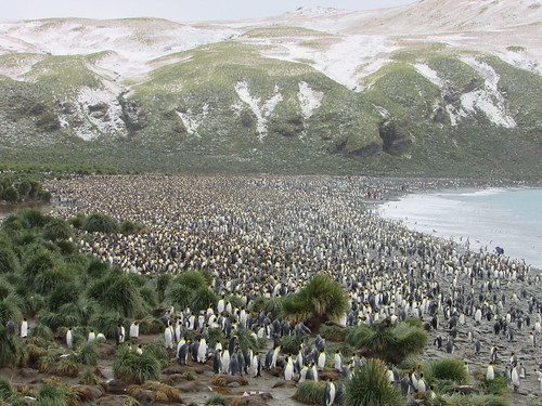 King penguin colony, Gold Harbour, South Georgia.
Within a few feet of me, half hidden in the tussock grass were at least a dozen fairly small fur seals. I was captivated by the scene and found my own tussock on the edge of the group to sit on. Considering the effort I’d had climbing the hill, I was amazed that fur seals, provided only with flippers which make them elegant swimmers in the water but are less-than ideal for locomotion on land, should choose to spend time on top of a hill. Most of the fur seals just ignored me. From time to time, curiosity would induce one or other to approach me.
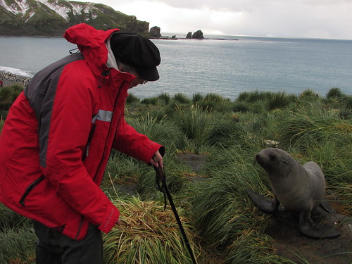 Jan and new friend: Gold Harbour, South Georgia.
My technique was to talk softly to them, expressing my perfectly genuine admiration for their beauty which either soothed or puzzled them, but at no time did I have any fear of attack. These were wild animals and it’s dangerous to anthropomorphise but it’s hard not to feel some sort of kinship with creatures sharing so many human characteristics. Half-buried in the long tussock grass, the seals had the same sort of appeal as meerkats.
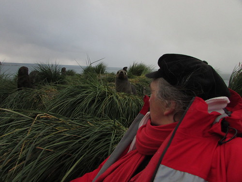 Sitting with Seals: Gold Harbour, South Georgia.
I must have stayed in these idyllic surroundings for at least half an hour before rather reluctantly descending to the main beach, where I watched a South Georgia Pipit hopping across the rock face.
This time on my own, I retraced my outgoing route back towards the landing point, taking a few photographs but mainly trying to absorb the scene. With such a crowded scene, it was hard to avoid closely approaching creatures. The penguins stood alert, walked in groups, came and went between the beach and the sea where shoals swam up and down. Fur seals either lay relaxing, scampered around looking for play fights or took to the water where their rather clumsy movements were instantly transformed into a elegant ballet. I passed a few isolated elephant seals who merely relaxed, occasionally relieving an itch by languid scratching with a front flipper. So, I found myself walking with penguins and other species and, after a while, it seemed quite normal. I tried to keep my movements slow and steady so as not to ‘spook’ the creatures but, from time to time, they would appear to not notice me and nearly run into me. Again, my technique was to talk quietly to nearby creatures, reasoning that if it works with dogs (admittedly partly domesticated by man), why not other species?
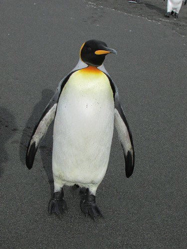
King penguin: Gold Harbour, South Georgia.
Arriving back at the landing point, I’d originally intended to explore in the opposite direction but expedition staff were clearing that area following an incident where one of my fellow travellers had been bitten by a small fur seal! Instead, I had a good look at the group of elephant seals before perching myself on a suitable flat rock in a shallow stream to watch the behaviour of a small group of King Penguins for a while.
It was now after 10.00 a.m. and so, tired after my early start, I returned by Zodiac to the ship after a very special experience at Gold Harbour.
After the exertions of the morning, I was glad of a more relaxed afternoon. The ship left Gold Harbour on a heading of about 30 degrees east of north for four days sailing to our next landfall at Gough Island. The afternoon had become sunny and it was pleasant being on deck watching South Georgia recede behinds us. There was considerable interest as we passed two icebergs. On the television in my room I watched the Milestone Films extracts from the early film ‘Southward on the Quest’ about Sir Ernest Shackleton’s 1914-1916 Antarctic exploration mission. At 5.15, I attended Luke Kenny’s interesting lecture on the two years he spent at King Edward Point Research Station, Grytviken, carrying out research to support the current policy on fishing in South Georgia waters.
But the afternoon brought more excitement: a large iceberg had been seen on radar about 13 nautical miles ahead, slightly to the right of our track and the Captain would give us a slightly closer view. And what a view! We were approaching a tabular iceberg where the vertical ice wall facing us was at least 2 miles in extent, rising above the sea at least 150 feet. Most of the passengers were on deck to admire this unexpected spectacle, although the wind was quite strong. In addition, when the wake from the ship bounced off the wall of the iceberg and returned, the sea became quite lively and spray was being thrown at the side of the ship perhaps 20 feet above the water. Once we passed the second corner of the iceberg, it was clear that the adjacent ‘side’ was at least as long as the first. It was an unbelievable sight.
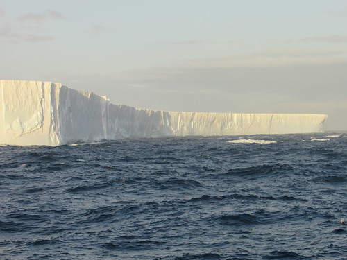 Iceberg!
The evening meal was a very special Centenary Dinner to celebrate 100 years since the Shackleton Endurance Expedition 1914-1917. The food on this trip, under the supervision of Executive Chef Pia, had been uniformly excellent, with a varied selection of menus at each meal.
That was the end of our period in South Georgia. There were four full days sailing to reach the final islands on our itinerary - the Tristan da Cunha group.
Related posts
Next South Atlantic post.
All my South Atlantic posts.
My pictures
You can find all my pictures on the trip in the Collection Cape to Cape (still being added to, at the time of writing).
There are a few pictures of the trip in the album South Atlantic Voyage.
['Cape to Cape' collection added 5-Apr-2016]
Thursday, 9th March 2016: Gold Harbour: Sitting with Seals, Walking with Penguins,
The option of an early morning landing at 5.30 a.m. was offered to allow the sunrise to be enjoyed from the beach. Although I’m no stranger to early rising, I’d been feeling rather tired and decided to go for the ‘normal’ landing at 8.30 a.m.
Overnight, the ship had sailed from Fortuna Bay and, at 4.45 a.m.on our arrival in Gold Harbour, the noise of the anchor chain being run out woke me up. In the forward cabins like mine, the noise of both the anchor chain and the use of the bow thrusters is quite loud on this ship. Once awake, I thought I might as will make the early landing, although the time it took me to get ready meant that I wasn’t able to try the “Early Risers Danish and Coffee” laid on in the Panorama Lounge.
There were at least three Zodiac trips to ferry the “sunrise landers” ashore. The temperature wasn’t bad and there was little wind but light snow was falling. It was light enough to see but, of course, in the low light conditions photography was not ideal for my fairly modest camera. We landed on a curved sand and pebble beach. In places the stones were quite large making walking harder. The rocky foreshore was framed by green hills with mountains behind. Snow capped the mountain tops and thinning snow remained on much of the grassland. In the distance on our left, the Berntrab Glacier inclined towards the sea.
Most remarkable, however, was the population of this landscape. The offshore rocks were crowded with fur seals and, approaching the shingle beach, the Zodiac driver had to slow and wait for a continuous knot of fur seals to be ‘shooed’ away by the shore party. The landing area had been chosen to be away from the main penguin colony which lay to our left but there were still hundreds of King Penguins near the landing, some simply standing erect like colourful statues, others moving in small convoys in various directions and managing to look very determined as if late for the office. Sprinkled amongst the King penguins there were a few Gentoo and Chinstrap. On our right were a number of Elephant Seals of various ages, the largest longer than our Zodiacs. Generally, the Elephant Seals were content to lie huddled together on the sand, but occasionally one would move into or out of the surf with an improbable undulating motion whichh left a shallow identation in the sand. Finally, there was birdlife large and small, the smaller birds fluttering overhead, the larger soaring above us. Certain birds were happy to wander around the beach looking for food whilst some of the sea birds would just sit on a patch of sand, ignoring all activity around them, including humans passing by. Walking past these creatures brought home how large some of the seabirds are.
Sunrise over King Penguin Colony: Gold Harbour, South Georgia.
I joined Peter’s group for expert explanation about what we were seeing as we made our way parallel to the shore skirting the the main colony. The timing of our visit allowed us to see various phases of the penguin’s period on land all at once - immature, adult, moulting, even a few ‘late breeder’ pairs still incubating the single annual egg produced. With an estimate of 70,000 breeding pairs in Gold Harbour (counting the main and various smaller colonies), the noise of the ‘trumpeting’ call of penguins was incessant and the distinctive odour of their waste matter was all pervasive.
As we continued our walk, the sun slowly broke through the cloud cover and it started to become lighter. At the end of the main beach, a low rocky hill covered in tussock grass rose up and Peter led the group to the summit. I followed but more slowly and when I stopped for a breather and sat on the tussock, I lost contact. Looking around, I could see that the whole hillside was covered in fur seals, just lying around, occasionally play-fighting and periodically raising their heads to sniff the air.
I continued to the flat top of the hill which commanded splendid views of the bay, our ship, the main colony I’d just traversed and, looking in the opposite direction, a lake and smaller King Penguin colony.
King penguin colony, Gold Harbour, South Georgia.
Within a few feet of me, half hidden in the tussock grass were at least a dozen fairly small fur seals. I was captivated by the scene and found my own tussock on the edge of the group to sit on. Considering the effort I’d had climbing the hill, I was amazed that fur seals, provided only with flippers which make them elegant swimmers in the water but are less-than ideal for locomotion on land, should choose to spend time on top of a hill. Most of the fur seals just ignored me. From time to time, curiosity would induce one or other to approach me.
Jan and new friend: Gold Harbour, South Georgia.
My technique was to talk softly to them, expressing my perfectly genuine admiration for their beauty which either soothed or puzzled them, but at no time did I have any fear of attack. These were wild animals and it’s dangerous to anthropomorphise but it’s hard not to feel some sort of kinship with creatures sharing so many human characteristics. Half-buried in the long tussock grass, the seals had the same sort of appeal as meerkats.
Sitting with Seals: Gold Harbour, South Georgia.
I must have stayed in these idyllic surroundings for at least half an hour before rather reluctantly descending to the main beach, where I watched a South Georgia Pipit hopping across the rock face.
This time on my own, I retraced my outgoing route back towards the landing point, taking a few photographs but mainly trying to absorb the scene. With such a crowded scene, it was hard to avoid closely approaching creatures. The penguins stood alert, walked in groups, came and went between the beach and the sea where shoals swam up and down. Fur seals either lay relaxing, scampered around looking for play fights or took to the water where their rather clumsy movements were instantly transformed into a elegant ballet. I passed a few isolated elephant seals who merely relaxed, occasionally relieving an itch by languid scratching with a front flipper. So, I found myself walking with penguins and other species and, after a while, it seemed quite normal. I tried to keep my movements slow and steady so as not to ‘spook’ the creatures but, from time to time, they would appear to not notice me and nearly run into me. Again, my technique was to talk quietly to nearby creatures, reasoning that if it works with dogs (admittedly partly domesticated by man), why not other species?
King penguin: Gold Harbour, South Georgia.
Arriving back at the landing point, I’d originally intended to explore in the opposite direction but expedition staff were clearing that area following an incident where one of my fellow travellers had been bitten by a small fur seal! Instead, I had a good look at the group of elephant seals before perching myself on a suitable flat rock in a shallow stream to watch the behaviour of a small group of King Penguins for a while.
It was now after 10.00 a.m. and so, tired after my early start, I returned by Zodiac to the ship after a very special experience at Gold Harbour.
After the exertions of the morning, I was glad of a more relaxed afternoon. The ship left Gold Harbour on a heading of about 30 degrees east of north for four days sailing to our next landfall at Gough Island. The afternoon had become sunny and it was pleasant being on deck watching South Georgia recede behinds us. There was considerable interest as we passed two icebergs. On the television in my room I watched the Milestone Films extracts from the early film ‘Southward on the Quest’ about Sir Ernest Shackleton’s 1914-1916 Antarctic exploration mission. At 5.15, I attended Luke Kenny’s interesting lecture on the two years he spent at King Edward Point Research Station, Grytviken, carrying out research to support the current policy on fishing in South Georgia waters.
But the afternoon brought more excitement: a large iceberg had been seen on radar about 13 nautical miles ahead, slightly to the right of our track and the Captain would give us a slightly closer view. And what a view! We were approaching a tabular iceberg where the vertical ice wall facing us was at least 2 miles in extent, rising above the sea at least 150 feet. Most of the passengers were on deck to admire this unexpected spectacle, although the wind was quite strong. In addition, when the wake from the ship bounced off the wall of the iceberg and returned, the sea became quite lively and spray was being thrown at the side of the ship perhaps 20 feet above the water. Once we passed the second corner of the iceberg, it was clear that the adjacent ‘side’ was at least as long as the first. It was an unbelievable sight.
Iceberg!
The evening meal was a very special Centenary Dinner to celebrate 100 years since the Shackleton Endurance Expedition 1914-1917. The food on this trip, under the supervision of Executive Chef Pia, had been uniformly excellent, with a varied selection of menus at each meal.
That was the end of our period in South Georgia. There were four full days sailing to reach the final islands on our itinerary - the Tristan da Cunha group.
Related posts
Next South Atlantic post.
All my South Atlantic posts.
My pictures
You can find all my pictures on the trip in the Collection Cape to Cape (still being added to, at the time of writing).
There are a few pictures of the trip in the album South Atlantic Voyage.
['Cape to Cape' collection added 5-Apr-2016]
South Georgia (day 3)
In the previous post in this series South Georgia (day 2), I talked about the visits on our second day. But there was more...
Wednesday, 9th March 2016: Grytviken
After anchoring overnight in a suitable sheltered bay, in the early morning the ship sailed into Cumberland East Bay and rounded King Edward Point. Through the rain-streaked window of my cabin I saw the modern buildings of King Edward Point Research Station operated by the British Antarctic Survey, with the conical-shaped mountain behind rising to a height of 443 metres. Moored at the adjacent jetty, I could see a small motor launch and the Fisheries Protection Vessel ‘Pharos SG’. We dropped anchor facing the settlement of Grytviken itself. From the rain-soaked deck, I had a panoramic view of the bay and the scattered buildings. I could see the neat, white-painted church, what was clearly the remains of the whaling station, a number of small steam-powered boats sunk on the shore and a cluster of modernised, white-painted buildings.
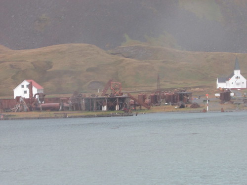 Remains of the whalking station at Grytviken viewed from 'Silver Explorer'.
At 7.45 a.m., a presentation was made in the theatre by Sarah Lurcock from South Georgia Heritage Trust. She had come on board to talk about the rat eradication programme in South Georgia. The first three phases had been completed, apparently successfully, and they were commencing a long-term monitoring programme for which complete funding had not been obtained. At the time, the programme had cost around ten million U.S. dollars! Rats were introduced accidentally by visiting ships and had represented a serious predator to South Georgia’s unique species, like the South Georgia Pipit.
On a dull, rainy morning at 8.30 a.m. our Zodiacs started to land passengers at a stony beach just away from the main settlement. There were lots of small fur seals around as we walked the few yards to Grytviken’s cemetery which was surrounded by a white painted fence. Almost all of the 64 graves are those of Norwegian sealers and whalers but Ernest Shackleton’s grave is the object of pilgrimage for some visitors. Drinks in plastic cups were provided and Peter gave a short eulogy to Shackleton before a toast to the man still often called “The Boss”.
 Shackleton's Grave, Grytviken. Peter Harrison proposes a toast to 'The Boss'.
We then walked around the shore towards the main part of the settlement. I joined the party led by Sarah Lurcock who actually lives at Grytviken. We first came to the present hydro-electric power plant. A dam was built on nearby Gull Lake in the 1920s with now-abandoned turbines to power the whaling station. In the summers of 2007/2008 and 2008/2009, the dam was raised 30 cm. and strengthened. A new penstock can supply up water at up to 30 tonnes/minute to the 230 kW turbine supplied by Gilbert Gilkes and Gordon. The new facility was opened by the Princess Royal during her visit in March 2009. I didn’t have an opportunity of studying earlier generating plant standing on the hillside – it looked like a pair of 8-cylinder diesel generating sets and a turbine-generator set.
Sunk in the bay just offshore is what little remains of the barque ‘Louise’, built in 1869 in Freeport, Maine. She arrived in November 1904 with materials to construct the whaling station and was retained as a ‘coaling hulk’. Nearby, on the beach was a wooden-hulled motor boat used for towing whales and general purposes around the whaling station.
We reached the main part of the station with all sorts of intriguing industrial plant around, denuded of the corrugated iron buildings which would once have covered it. The South Georgia Heritage Trust (SGHT) had provided 14 information boards around the site with well thought out identification of the equipment to be seen and brief technical descriptions of the various processes. I’m indebted to SGHT for some of the information below. I rapidly collected as many pictures as I could for later study. This task was made somewhat harder by the rain, which kept ‘spotting’ the lens of my camera and the need to avoid stepping on the fur seals who had managed to insinuate themselves in all sorts of places around the site for their ‘morning laze’.
A row of four electrically-driven compressors were presumably intended for the freezer plant. Apparently, they had been installed originally at Husvik whaling station in 1958 and moved to Grytviken in 1961/62 but never actually installed.
We passed the Workshops with a slipway allowing complete boats to be hauled out of the water for attention. The building had been demolished but a heavy-duty plate-rolling machine and press remained. The rather odd-looking sunken structure in the bay outside the Workshops would have been the floating dock which was capable of lifting a complete whale chaser boat out of the water for attention to the hull.
A reasonably complete whale catcher boat, the ‘Petrel’, was beached next to the slipway. The vicious-looking harpoon gun mounted on the bow was a reminder of the vessels purpose. Despite the old-fashioned appearance given by the tall funnel, the structure supporting the radar scanner is visible by the bridge. In the latter days of mass whaling, RADAR and ASDIC became important tools, supplementing the traditional technique of having a lookout in the “crow’s nest” – a wooden barrel secured to the top of the foremast.
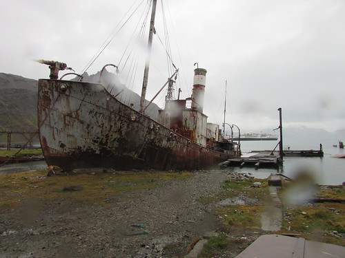 Whale catcher 'Petrel' beached at Grytviken.
Grytviken was established as a whaling station by the Norwegian Carl Anton Larsen in 1904. Describing the business of disposing of whales remains distasteful but over the years, new plant was installed so that Grytviken, as a highly mechanised plant, had become remarkably efficient. The station continued to operate until 1964. The whale was first winched ashore onto an area called the the Flensing Plan where it was hacked into manageable sections and cooked to extract the oil. Until the extraction of mineral oils became common and the petro-chemical industry developed, whales were an important source of oil. Originally, only the meat was cooked to extract the oil – bones were regarded as a waste product. Later, it was realised that significant oil could be extracted by cooking the bones so separate Bone Cookeries were provided. Baleen Plates, ‘whalebone’, were initially a product with many uses (perhaps its use in ladies corsets is best known) but, as the plastics industry developed, whalebone lost its value.
At first, vertical cookers were used but I also saw a more modern Hartman cooker and two Kvaerner cookers. There were also the remains of the alternative Rose-Downs plant which produced higher quality oil and protein-rich meal by mincing and lightly cooking the meat followed by pressing through screens. I also saw the remains of the Separator Plant. The initial cooking produced oil, an oil-water liquid called ‘glue water’ and solid residue – ‘grax’. The Separator Plant ensured maximum oil extraction. The solid residue was dried in rotating oil fired ovens, crushed and bagged as meal for animal feed or fertiliser.
There were two more whaling vessels beached – firstly, the ‘Albatros’, built in 1924 in Norway and secondly, the ‘Dias’. The ‘Dias’ was built in 1906 as a Hull trawler called ‘Viola’, converted for whaling in 1927 and served as a whale catcher or seal catcher until 1964!
The original administrative building had been modernised and converted into an excellent museum, with a number of larger objects displayed outside and a museum annexe to one side.
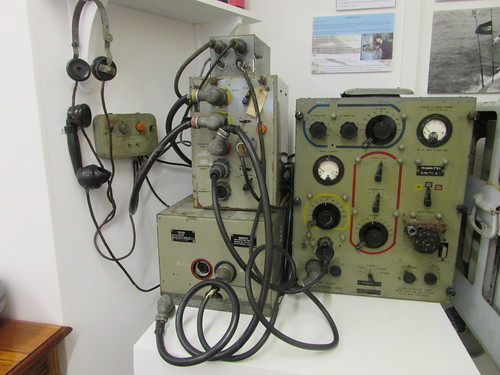 Grytviken Museum: Marconi Radio Equipment used on Whale Catchers.
There was a Post Office with an attached exhibition about Shackleton’s ‘Endurance’ expedition. Last Zodiac back to our ship was at 11.30 a.m. so, about 11.20, I reluctantly returned to the ship after a fascinating, if brief, visit to Grytviken.
The ship moved to St. Andrew’s Bay whilst the passengers had lunch but conditions were found unsuitable for the scheduled landing so the Captain decided to move to Fortuna Bay rather than lose the afternoon landing. I’ll describe our visit to Fortuna Bay when I can.
Related posts
Next South Atlantic post.
All my South Atlantic posts.
My pictures
You can find all my pictures on the trip in the Collection Cape to Cape (still being added to, at the time of writing).
There are a few pictures of the trip in the album South Atlantic Voyage.
['Cape to Cape' collection added 5-Apr-2016]
Wednesday, 9th March 2016: Grytviken
After anchoring overnight in a suitable sheltered bay, in the early morning the ship sailed into Cumberland East Bay and rounded King Edward Point. Through the rain-streaked window of my cabin I saw the modern buildings of King Edward Point Research Station operated by the British Antarctic Survey, with the conical-shaped mountain behind rising to a height of 443 metres. Moored at the adjacent jetty, I could see a small motor launch and the Fisheries Protection Vessel ‘Pharos SG’. We dropped anchor facing the settlement of Grytviken itself. From the rain-soaked deck, I had a panoramic view of the bay and the scattered buildings. I could see the neat, white-painted church, what was clearly the remains of the whaling station, a number of small steam-powered boats sunk on the shore and a cluster of modernised, white-painted buildings.
Remains of the whalking station at Grytviken viewed from 'Silver Explorer'.
At 7.45 a.m., a presentation was made in the theatre by Sarah Lurcock from South Georgia Heritage Trust. She had come on board to talk about the rat eradication programme in South Georgia. The first three phases had been completed, apparently successfully, and they were commencing a long-term monitoring programme for which complete funding had not been obtained. At the time, the programme had cost around ten million U.S. dollars! Rats were introduced accidentally by visiting ships and had represented a serious predator to South Georgia’s unique species, like the South Georgia Pipit.
On a dull, rainy morning at 8.30 a.m. our Zodiacs started to land passengers at a stony beach just away from the main settlement. There were lots of small fur seals around as we walked the few yards to Grytviken’s cemetery which was surrounded by a white painted fence. Almost all of the 64 graves are those of Norwegian sealers and whalers but Ernest Shackleton’s grave is the object of pilgrimage for some visitors. Drinks in plastic cups were provided and Peter gave a short eulogy to Shackleton before a toast to the man still often called “The Boss”.
Shackleton's Grave, Grytviken. Peter Harrison proposes a toast to 'The Boss'.
We then walked around the shore towards the main part of the settlement. I joined the party led by Sarah Lurcock who actually lives at Grytviken. We first came to the present hydro-electric power plant. A dam was built on nearby Gull Lake in the 1920s with now-abandoned turbines to power the whaling station. In the summers of 2007/2008 and 2008/2009, the dam was raised 30 cm. and strengthened. A new penstock can supply up water at up to 30 tonnes/minute to the 230 kW turbine supplied by Gilbert Gilkes and Gordon. The new facility was opened by the Princess Royal during her visit in March 2009. I didn’t have an opportunity of studying earlier generating plant standing on the hillside – it looked like a pair of 8-cylinder diesel generating sets and a turbine-generator set.
Sunk in the bay just offshore is what little remains of the barque ‘Louise’, built in 1869 in Freeport, Maine. She arrived in November 1904 with materials to construct the whaling station and was retained as a ‘coaling hulk’. Nearby, on the beach was a wooden-hulled motor boat used for towing whales and general purposes around the whaling station.
We reached the main part of the station with all sorts of intriguing industrial plant around, denuded of the corrugated iron buildings which would once have covered it. The South Georgia Heritage Trust (SGHT) had provided 14 information boards around the site with well thought out identification of the equipment to be seen and brief technical descriptions of the various processes. I’m indebted to SGHT for some of the information below. I rapidly collected as many pictures as I could for later study. This task was made somewhat harder by the rain, which kept ‘spotting’ the lens of my camera and the need to avoid stepping on the fur seals who had managed to insinuate themselves in all sorts of places around the site for their ‘morning laze’.
A row of four electrically-driven compressors were presumably intended for the freezer plant. Apparently, they had been installed originally at Husvik whaling station in 1958 and moved to Grytviken in 1961/62 but never actually installed.
We passed the Workshops with a slipway allowing complete boats to be hauled out of the water for attention. The building had been demolished but a heavy-duty plate-rolling machine and press remained. The rather odd-looking sunken structure in the bay outside the Workshops would have been the floating dock which was capable of lifting a complete whale chaser boat out of the water for attention to the hull.
A reasonably complete whale catcher boat, the ‘Petrel’, was beached next to the slipway. The vicious-looking harpoon gun mounted on the bow was a reminder of the vessels purpose. Despite the old-fashioned appearance given by the tall funnel, the structure supporting the radar scanner is visible by the bridge. In the latter days of mass whaling, RADAR and ASDIC became important tools, supplementing the traditional technique of having a lookout in the “crow’s nest” – a wooden barrel secured to the top of the foremast.
Whale catcher 'Petrel' beached at Grytviken.
Grytviken was established as a whaling station by the Norwegian Carl Anton Larsen in 1904. Describing the business of disposing of whales remains distasteful but over the years, new plant was installed so that Grytviken, as a highly mechanised plant, had become remarkably efficient. The station continued to operate until 1964. The whale was first winched ashore onto an area called the the Flensing Plan where it was hacked into manageable sections and cooked to extract the oil. Until the extraction of mineral oils became common and the petro-chemical industry developed, whales were an important source of oil. Originally, only the meat was cooked to extract the oil – bones were regarded as a waste product. Later, it was realised that significant oil could be extracted by cooking the bones so separate Bone Cookeries were provided. Baleen Plates, ‘whalebone’, were initially a product with many uses (perhaps its use in ladies corsets is best known) but, as the plastics industry developed, whalebone lost its value.
At first, vertical cookers were used but I also saw a more modern Hartman cooker and two Kvaerner cookers. There were also the remains of the alternative Rose-Downs plant which produced higher quality oil and protein-rich meal by mincing and lightly cooking the meat followed by pressing through screens. I also saw the remains of the Separator Plant. The initial cooking produced oil, an oil-water liquid called ‘glue water’ and solid residue – ‘grax’. The Separator Plant ensured maximum oil extraction. The solid residue was dried in rotating oil fired ovens, crushed and bagged as meal for animal feed or fertiliser.
There were two more whaling vessels beached – firstly, the ‘Albatros’, built in 1924 in Norway and secondly, the ‘Dias’. The ‘Dias’ was built in 1906 as a Hull trawler called ‘Viola’, converted for whaling in 1927 and served as a whale catcher or seal catcher until 1964!
The original administrative building had been modernised and converted into an excellent museum, with a number of larger objects displayed outside and a museum annexe to one side.
Grytviken Museum: Marconi Radio Equipment used on Whale Catchers.
There was a Post Office with an attached exhibition about Shackleton’s ‘Endurance’ expedition. Last Zodiac back to our ship was at 11.30 a.m. so, about 11.20, I reluctantly returned to the ship after a fascinating, if brief, visit to Grytviken.
The ship moved to St. Andrew’s Bay whilst the passengers had lunch but conditions were found unsuitable for the scheduled landing so the Captain decided to move to Fortuna Bay rather than lose the afternoon landing. I’ll describe our visit to Fortuna Bay when I can.
Related posts
Next South Atlantic post.
All my South Atlantic posts.
My pictures
You can find all my pictures on the trip in the Collection Cape to Cape (still being added to, at the time of writing).
There are a few pictures of the trip in the album South Atlantic Voyage.
['Cape to Cape' collection added 5-Apr-2016]
South Georgia (day 2)
In the previous post in this series South Georgia (day 1), I talked about my first experiences in this fascinating place. But we were destined to see more...
Tuesday, 8th March 2016
On Tuesday morning, we explored the two and a half mile long steep-sided inlet called Larsen Harbour by Zodiac.
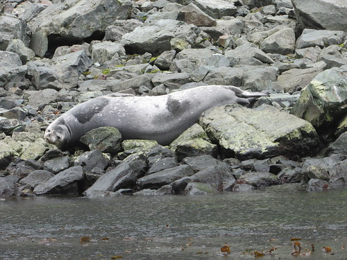 Larsen Harbour: Weddell Seal (about 9 feet long) relaxing on the rocks.
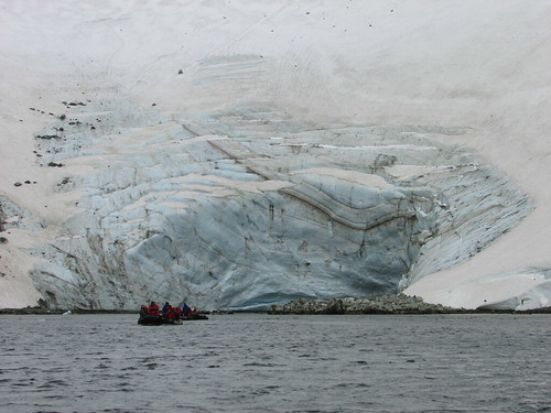 Larsen Harbour: the face of the Glacier.
With everybody back on board, the Captain took our ship for a cruise along Drygalski Fjord, pirouetting the ship when we reached the glacier face so that everybody had an opportunity to appreciate the beauty of the place.
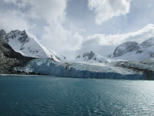 The face of the Glacier, Drygalski Fjord.
 The passengers admire the face of the Glacier, Drygalski Fjord.
Whilst the passengers enjoyed lunch in the dining room, the Captain moved the ship to Cooper Bay where we saw fur seals, King and Chinstrap penguins also Macaroni penguins with their extravagant plumes.
 Life on the beach in Cooper Bay.
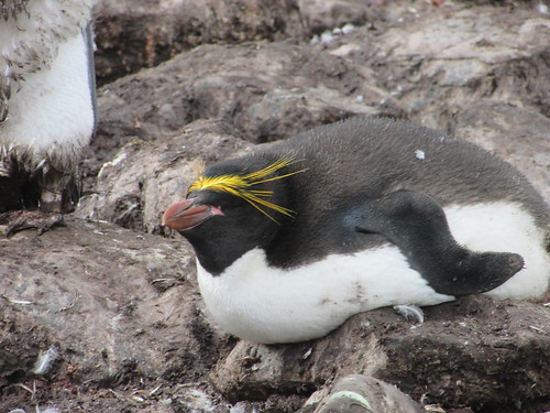 Macaroni Penguin, Cooper Bay, South Georgia.
Related posts
Next South Atlantic post.
All my South Atlantic posts.
My pictures
You can find all my pictures on the trip in the Collection Cape to Cape (still being added to, at the time of writing).
There are a few pictures of the trip in the album South Atlantic Voyage.
['Cape to Cape' collection added 5-Apr-2016]
Tuesday, 8th March 2016
On Tuesday morning, we explored the two and a half mile long steep-sided inlet called Larsen Harbour by Zodiac.
Larsen Harbour: Weddell Seal (about 9 feet long) relaxing on the rocks.
Larsen Harbour: the face of the Glacier.
With everybody back on board, the Captain took our ship for a cruise along Drygalski Fjord, pirouetting the ship when we reached the glacier face so that everybody had an opportunity to appreciate the beauty of the place.
The face of the Glacier, Drygalski Fjord.
The passengers admire the face of the Glacier, Drygalski Fjord.
Whilst the passengers enjoyed lunch in the dining room, the Captain moved the ship to Cooper Bay where we saw fur seals, King and Chinstrap penguins also Macaroni penguins with their extravagant plumes.
Life on the beach in Cooper Bay.
Macaroni Penguin, Cooper Bay, South Georgia.
Related posts
Next South Atlantic post.
All my South Atlantic posts.
My pictures
You can find all my pictures on the trip in the Collection Cape to Cape (still being added to, at the time of writing).
There are a few pictures of the trip in the album South Atlantic Voyage.
['Cape to Cape' collection added 5-Apr-2016]
South Georgia (day 1)
In the previous post in this series Sailing to South Georgia , I described the two-day journey to reach South Georgia. On the first day in South Georgia, I started to understand why so many of my fellow passengers are returning to this remarkable place after one or more previous visits ...
Monday, 7th March 2016
Around 6.30 a.m. the ship reached northern side of South Georgia and our earliest views confirmed the description sometimes used of ‘The Alps in the Sub-Antarctic’. Through the early morning mists, we could see snow-covered mountain peaks rearing up inland. The ship anchored in the Bay of Isles a few hundred yards from Salisbury Plain – the largest area of flatland in South Georgia, flanked by the Grace Glacier to the West and the Lucas Glacier to the east. After our Zodiacs scouted a suitable beach landing site, passengers wishing to take the “long strenuous hike” were landed. At around 8.00 a.m. the remaining passengers (including me) were landed.
Salisbury Plain is famous for its large colony of King Penguins (estimated at 30,000 breeding pairs) and, as we approached the shore, the racket made by the penguins was apparent before the smell. The beach was made up of large flat stones, quite tiring to walk upon. Although there were hundreds and hundreds of King Penguins near the edge of the beach where we landed, this was not the main colony which we reached by walking east, near the water’s edge. The view of thousand upon thousand of King Penguins was staggering. In addition to filling the width of the beach, many more penguins occupied the low hillside leading inland.
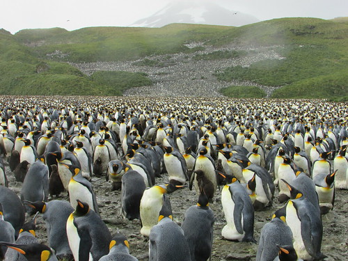 Thousands of King penguins at Salisbury Plain, South Georgia.
Our visit was near the end of the breeding season so, in addition to the young produced by the Early Breeders, incubation was still going on amongst some of the Late Breeders. It was an amazing sight.
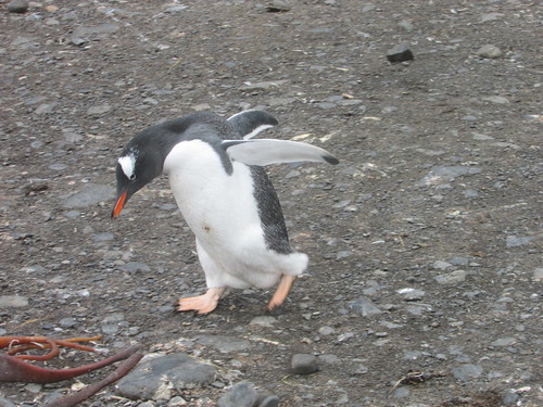 Salisbury Plain: Gentoo Penguin "I'm late, I'm late, for a very important date".
Whilst we took lunch, the ship moved to Prion Island, named after the Antarctic Prions which nest there. Fur seals and Wandering Albatrosses were also abundant. A well-built set of 180 steps made ascent to higher level easy (if you avoided the fur seal pooh). There’s lots more to describe (and lots of pictures to upload), but at least that gives you a brief introduction to this marvellous place.
Related posts
Next South Atlantic post.
All my South Atlantic posts.
My pictures
You can find all my pictures on the trip in the Collection Cape to Cape (still being added to, at the time of writing).
There are a few pictures of the trip in the album South Atlantic Voyage.
['Cape to Cape' collection added 5-Apr-2016]
Monday, 7th March 2016
Around 6.30 a.m. the ship reached northern side of South Georgia and our earliest views confirmed the description sometimes used of ‘The Alps in the Sub-Antarctic’. Through the early morning mists, we could see snow-covered mountain peaks rearing up inland. The ship anchored in the Bay of Isles a few hundred yards from Salisbury Plain – the largest area of flatland in South Georgia, flanked by the Grace Glacier to the West and the Lucas Glacier to the east. After our Zodiacs scouted a suitable beach landing site, passengers wishing to take the “long strenuous hike” were landed. At around 8.00 a.m. the remaining passengers (including me) were landed.
Salisbury Plain is famous for its large colony of King Penguins (estimated at 30,000 breeding pairs) and, as we approached the shore, the racket made by the penguins was apparent before the smell. The beach was made up of large flat stones, quite tiring to walk upon. Although there were hundreds and hundreds of King Penguins near the edge of the beach where we landed, this was not the main colony which we reached by walking east, near the water’s edge. The view of thousand upon thousand of King Penguins was staggering. In addition to filling the width of the beach, many more penguins occupied the low hillside leading inland.
Thousands of King penguins at Salisbury Plain, South Georgia.
Our visit was near the end of the breeding season so, in addition to the young produced by the Early Breeders, incubation was still going on amongst some of the Late Breeders. It was an amazing sight.
Salisbury Plain: Gentoo Penguin "I'm late, I'm late, for a very important date".
Whilst we took lunch, the ship moved to Prion Island, named after the Antarctic Prions which nest there. Fur seals and Wandering Albatrosses were also abundant. A well-built set of 180 steps made ascent to higher level easy (if you avoided the fur seal pooh). There’s lots more to describe (and lots of pictures to upload), but at least that gives you a brief introduction to this marvellous place.
Related posts
Next South Atlantic post.
All my South Atlantic posts.
My pictures
You can find all my pictures on the trip in the Collection Cape to Cape (still being added to, at the time of writing).
There are a few pictures of the trip in the album South Atlantic Voyage.
['Cape to Cape' collection added 5-Apr-2016]
Subscribe to:
Posts (Atom)
