skip to main |
skip to sidebar
Below is more than you wanted to know about the ship I’m currently travelling on. There are some queries in the issued information which I’ve not yet been able to resolve.
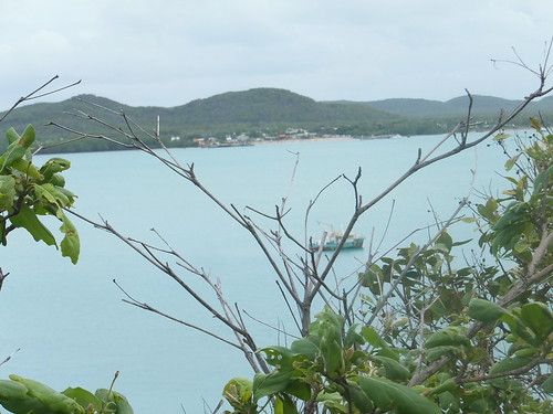
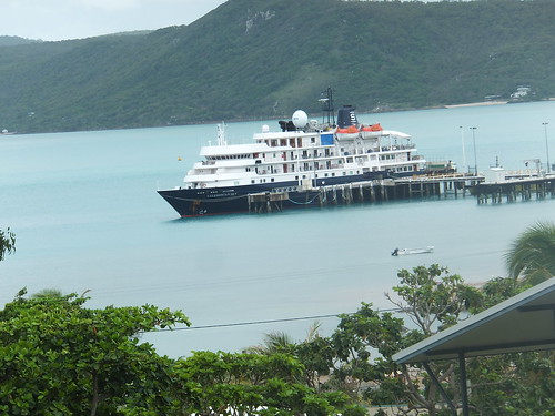 'Caledonian Sky' at Thursday Island, Australia.
The Motor Ship ‘Caledonian Sky' is operated by the travel company Noble Caledonia. Founded in 1991, the company specialises in 'small ship cruises'. Their description of 'Caledonian Sky' says:-
"Formerly known as the Hebridean Spirit, the MS Caledonian Sky began her life with Noble Caledonia in May 2012. Accommodating a maximum of 114 passengers in 57 spacious outside suites, she is more akin to a country hotel than the big cruise ships of today. The vessel is the ideal partner to our MS Island Sky, both were built in the same yard and at similar times and share the same excellent attributes that make them two of the finest small ships in the world and we are very proud to have them as our flagships.
Onboard the MS Caledonian Sky there are 57 exceptionally spacious and well designed suites, 23 of which have private balconies located on the Promenade or Bridge Decks. Each suite exudes great character and grandeur with wood panelling and brass features found throughout. The large suites all measure between 20 and 23 square metres and the balconies range in size from 4.2 to 5.6 square metres. Suites are arranged over four decks and all have outside facing views. All suites feature a sitting room area complete with coffee table, armchairs and flat screen televisions (DVD players and DVDs can be borrowed from reception for use in your suite). The beds in each cabin offer exceptionally comfortable mattresses and pillows and can be configured as large double beds or twins."
 A view of cabin 'Isle of Gigha'.
There's more from Noble Caledonia here.
The ship was built by Nuovi Cantieri Apuania in Italy in 1991 for Renaissance Cruises Inc. Initially named Renaissance VI, she was later Sun Viva 2, Megastar Capricorn, Hebridian Spirit, Sunrise before assuming her current name, Caledonian Sky. The Maritime Connector site will indicate the ship's current position (provided AIS information is being received) and it gives dates for the various name changes:-
SUNRISE until 2011 Sep
HEBRIDEAN SPIRIT until 2009 Apr
CAPRI until 2001 May
MEGASTAR CAPRICORN until 2001 Mar
SUN VIVA 2 until 2000 Apr
RENAISSANCE SIX until 1998 Dec
I believe 'Caledonian Sky' is currently owned by the daughter of the founder of Salén Ship Management AB through a holding company in the Bahamas called Caledonian Sky Shipping Inc,
The ship is operated by Salén Ship Management AB, based in Gothenburg, Sweden and is on long-term lease to Noble Caledonia.
The information below is derived from the information book placed in cabins on board or the Salén Ship Management Website (unconfirmed, with only minor editing):-
NAME: Caledonian Sky
FORMER NAMES: Sunrise, Hebridean Spirit, Megastar Capricorn, Sun Viva II, Renaissance Six
TYPE: Passenger Vessel
NUMBER OF PASSENGERS: 114
NUMBER OF CREW: 71
OWNER: Caledonian Sky Shipping Inc, Bahamas
OPERATOR/MANAGER: Salén Ship Management AB, Sweden
CHARTERER: Noble Caledonia Ltd, London, UK
PORT OF REGISTRY: Nassau, Bahamas
BUILDERS: Nuovi Cantieri Apuania, Italy
BUILT: 1991
RETROFIT: 2001/2009/2011 by George Prior Engineering, Great Yarmouth
CLASSIFICATION: +100 A1 Bureau Veritas
PASSENGER CLASSIFICATION: Passenger Vessel under Bahamas Maritime Administration
LENGTH OVERALL (LOA): 90.6 m
LENGTH BETWEEN PERPENDICULARS (LBP): 78.8 m
BREADTH (MOULDED): 15.3 m
DRAUGHT (MAXIMUM): 4.20 m
DEPTH (UPPER DECK): 5.85 m
SPEED: 14 knots maximum
GROSS TONNAGE: 4,200
NET TONNAGE: 1,263
LIGHTSHIP DISPLACEMENT: 2,606 tons
LOADED DISPLACEMENT: 3,291 tons at 4.2 m draft
FRESH WATER CAPACITY: 220 tons (plus production capacity on board of 45 tons/day)
NAVIGATION EQUIPMENT:
Fully Certified Transas ECDIS (Electronic Chart Display and Information System)
Two JRC Arpa Radar Sets
Two SAAB DGPS
One JRC Echo Sounder
One Gyro Compass with Electronic Interface to Satellite Communications systems and Radars and Exterior Repeaters
One Anschute Autopilot and Conning Wheel
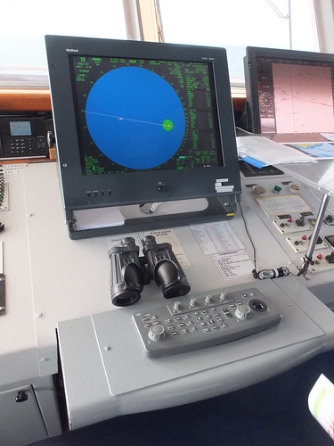
One (of two) Radar Displays, with the main ECDIS display on the right. Note the well-used binoculars - the 'Mark One Eyeball' is still a vital adjunct to the electronics.
 The Anschute Autopilot and Conning Wheel.
COMMUNICATION EQUIPMENT:
One V-SAT Satellite
One VHF Unit with Ten Handheld VHF Units
One Navtex Navigational and Weather Report Telex Receiver
One Global Maritime Distress Safety System (fully integrated to a Global Positioning System for instant radio transmission of distress to Coastguard, giving position of a vessel to an accuracy of a few yards and also capable of receiving information from Coastguard)
Two VHF DSC units
Two SAT-C GMDSS units
One MF/HF Radio unit
 The Communications Console on the Bridge of 'Caledonian Sky'. Note the VHF Transceiver (in between the two printers) set to Channel 16, the 'hailing frequency'.
LIFE SAVING APPARATUS:
Four Motor Lifeboats (each 48 person capacity)

One of four 48-person motor lifeboats, mounted on davits.
Two Inflatable Liferafts (each 25 person capacity)
Loose Equipment (commensurate with the ship’s total complement)
SAFETY SYSTEMS: The vessel is fitted with fire detection/alarm systems, low level lighting and watertight door to a modern high standard in compliance with the latest International Maritime Safety Requirement
SMALL BOATS: Ten ‘Zodiacs”
MAIN ENGINES: Two MAN/B&W Alpha 8-cylinder 8L 28/32A, each developing 2,360 b.h.p. (1,760 kW) at 750 r.p.m. (cylinder bore: 280 m.m., stroke: 320 m.m., engine start by compressed air, Fuel: Marine Gas Oil and Intermediate Fuel Oil, built in Denmark)
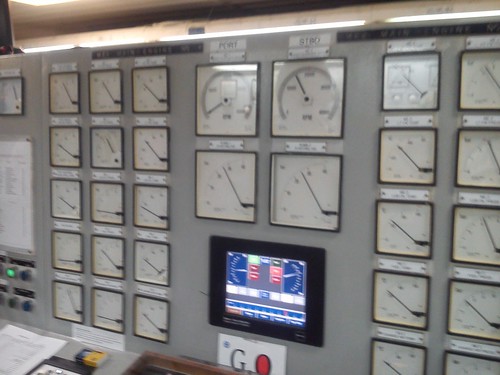 View of the Control Console for the two Main Engines in the cramped Engine Control Room.
AUXILIARY ENGINES: Two MAN/B&W Holby 5L 28/32, each developing 1,000 kW at 720 r.p.m. (cylinder bore: 280 m.m., stroke: 320 m.m, generating capacity: 2 x 1,250 kVA, emergency generator: 300 kVA or 240 kW)
SHAFT ALTERNATORS: Two each 800 kW (a Power Take-Off from the Main Engines allows the utilisation of electricity produced to supply the vessel’s electrical demand whilst at sea)
SHIP’S VOLTAGE:
440v 3-phase 60 Hz
220v single-phase 60 Hz
110v single-phase 60 Hz
PROPELLORS: Two B&W Alpha Controllable Pitch Propellors (4 blades at 2.8m dia., Propellor Shaft 15m in length)
STEERING GEAR: Two Frydenbo HS30 2D electro-hydraulic rotary vane units (each comprising an electric motor driven variable-delivery pump delivering pressure to rotary vane unit fitted to each rudder stock)
BOW THRUST UNIT: Brunvoll FU-45LTC-137 Transverse Thrust Unit (capable of transmitting 447 kW and used in conjunction with a Controllable-Pitch Propellor allowing the vessel to be manoeuvred in ports and confined waters)
STABILISERS: Blohm & Voss SK 10-3m 22 (?) Retractable Folding Fins controlled hydraulically (Stabilisation not only adds comfort to clients, but also reduces stresses caused by rolling of vessel in adverse weather conditions)
WINDLASSES: Steen Vertical Cable Lifters (electrically driven)
BOILERS: Aalborg AQ-12 providing 2500 kg/hour at 7 Bar pressure (the steam is used to heat the hot water heat exchangers and auxiliary equipment around the ship)
WATER MAKERS: Two Rochem type RORO 1530-DT-30S Reverse Osmosis Plants producing in total 45 tons/day with UC (?) filtration/chlorine injection (these units produce fresh water from sea water by Reverse Osmosis whereby freshwater permeates a semi-permeable membrane from sea water at a pressure of 60 Bar [around 850 p.s.i.] leaving salts behind)
OILY WATER SEPARATOR: Type RWO m3/hour separation capacity (?) with final discharge quality 15 p.p.m. or less oil content (IMO approved to MARPOL and US Coastguard requirements)
SEWAGE TREATMENT: Two Hamworthy Super Trident Units capable of processing 20 tonnes (?) per day (these units convert the sewage biologically to water of a quality to be discharged overboard).
MMSI: 311061100. [The Maritime Mobile Service Identity number uniquely identifies ships and maritime installations for communications purposes. See the Wikipedia article here.]
IMO: 8802870. [The IMO number (mandated under the Imternational Maritime Organisation's SOLAS convention) uniquely identifies a ship's hull. See the Wikipedia article here.]
You can find all the posts on my trip aboard 'Caledonian Sky' here.
My pictures
Joining 'Caledonian Sky'.
'Caledonian Sky' Bridge.
Engine Control Room, 'Caledonian Sky'.
[Minor revisions 9-Feb-2015, further changes 17-Feb-2015, 24-Feb-2015, 26-Feb-2015]
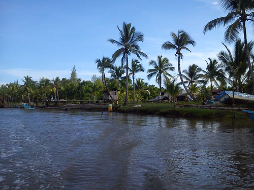
Leaving Syuru and heading for Triton Bay : Sunday, 1st February 2015
Before our ship departed for Triton Bay, we had an Early Morning Zodiac Cruise. We left the ship and headed towards Syuru village where we’d had such a remarkable visit the previous afternoon.
 View of part of Syuru village from the Creek.
This time, it was much quieter. Because it was near high tide, the mudbanks which had been such a feature of our arrival the previous day were covered in water. We were able to continue up the creek on our right and on our left past part of the village which was just waking up. We exchanged greetings with some of the villagers before crossing to the right hand side of the creek to study the mangroves. The Asmat Swamp is a wetland sometimes claimed to be the largest alluvial swamp in the world. It is a diverse area. The creek we were on was, of course, tidal so the dominant species were the mangrove and the nipah palm which have adapted to a saline environment. For more information about these interesting adaptations, see the Wikipedia articles Mangrove and Nypa fruticans.
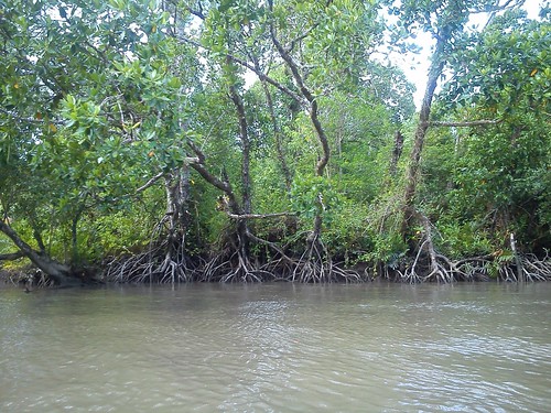 The distinctive appearance of Mangroves with the 'root system' lifted out of the water.
Inland, the swamp is fresh-water allowing a wider variation of vegetation to develop. After an interesting cruise along the creek, we returned to the ship at 9.00 a.m. The ship’s funnel was already emitting dark smoke, suggesting that the main engines had been recently started prior to getting under way on the next leg of our voyage – the 283 nautical miles to Triton Bay.
 Approaching the special "marina deck" incorporated into the stern of 'Caledonian Sky'.
During the day, there were three lectures on diverse topics but I was still trying to document our earlier adventures and transfer my photographs onto my notebook computer for safe keeping. Later in the afternoon, there was time to visit the Bridge. During daylight when the ship was underway in 'open water', there was an "Open Bridge" policy, so I was a fairly frequent visitor.
 View of the Arafura Sea from the Bridge, late afternoon on 1st February 2015.
Triton Bay : Monday, 2nd February 2015
We were still travelling towards Triton Bay when I took breakfast on Monday.
 Nearing Triton Bay, early morning, 2nd February 2015.
At 9.00 a.m., I attended the lecture by Lea McQuillan, a naturalist from the ship’s Expedition Team, about the Coral Triangle. By the time this interesting lecture was complete, the Captain had moored at Triton Bay in deep water and the Zodiacs were being made ready to offer a Zodiac cruise of Triton Bay.
Zodiac Cruise
We set off by Zodiac for a network of small islands in Triton Bay, limestone pillars fringed with trees struggling to remain attached. Tidal action had eroded the limestone at water level so as to undercut the pillar, leaving the columns balanced on a much smaller base.
 Passing between two limestone islands, showing the remarkable 'undercutting' at water level.
The Zodiac enabled us to examine the trees and flowers on the islands close-up. At one point, there was a cave large enough to actually take the Zodiac inside. The area only seemed suitable for craft like the Zodiacs but suddenly a large passenger vessel appeared, the K.M. ‘Wally Philan’ and sailed right past us. There were at least a couple of hundred local people on the foredeck, the roof of the superstructure and the afterdeck, all apparently delighted to see us, waving and cheering. Our 'local expert', Oswald, from Destination Asia, confirmed that it was a regular ferry service. The 'K.M.', he said, stood for 'Motor Ship' and the name would be the owner's name.
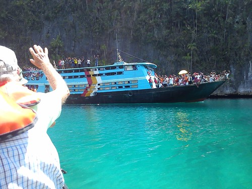 Lots of enthusiasm, not so much Health and Safety.
Ashore in Triton Bay
After lunch, the Zodiacs took us to a sandy beach where we disembarked into water a few inches deep (a ‘wet landing’) The weather was good and there was a narrow beach of fine, white sand leading to the water’s edge, allowing both swimming and snorkelling. But a number of people reported that the pull of the tide was greater than expected and, after a bit of floating around, I found that I was getting buffeted by the tide so I retired to the sand. Later, I walked the extent of the beach with some of the ‘beachcombers’ from the passengers.
On to Andamatta and Kokas
Once again, the ‘Caledonian Sky’ sailed overnight to our next destination – this time Kokas and Andamatta. I’ll tell you more about that area next time.
You can find all the posts on this trip here.
My pictures
Triton Bay.
[Minor revisions, pictures and links to pictures added 24-Feb-2015]
Syuru and Agats: Saturday, 31st January 2015
As our Zodiac approached the shore, we could see a large number of dugout canoes, each made from a single tree-trunk which I estimate was 15 to 20 feet long and quite narrow. Each was being paddled towards our group of Zodiacs by a number of standing men using simple wooden oars. There were also crowds of men gathered on the shore. They were all chanting in time with a drumbeat from the shore, each rower thrusting his oar vertically down into the water before levering the craft forward.
The first boat to reach us was much larger than the other boats but still long and thin. I think it was of wooden plank construction – it was certainly propelled by an outboard motor at the stern. There were three men in modern dress plus one in a tribal costume, clearly a Chief. The Chief was a commanding figure, dressed in a long grass skirt, bare chested but wearing a traditional headpiece with two white, fringed extensions, like horns. As he chanted, he periodically punched the air with one arm. His exposed coffee-coloured skin had been covered with traditional markings in white on his face, arms and torso.
The dugout canoes surrounded our Zodiacs and stopped paddling but kept up the rhythmic chanting. Each canoe had two or three rowers and all were in a version of tribal costume, ranging from simply body painting with a pair of modern mid-length sports shorts to variations on the Chief’s attire with long grass skirts, head pieces and body painting. The body painting was in apparently individual styles including completely white-face, a white ‘U’ on the lower face (like a beard) or a ring around the eyes. Some of the men also had red body paint in addition to white. In the bewildering variety of this melee of boats, with the incessant chanting, it was difficult to make observations. If the ceremony had originally been intended to terrify visitors, it was certainly successful – this was the most fierce-looking welcome I have ever had. Some of the canoes also had passengers in the form of boy children too young to be rowers but adorned with body painting. We tried to count the number of canoes involved, but with all the activity, the best answer was “more than 40”.
 Part of the 'welcoming committee' in dugout canoes.
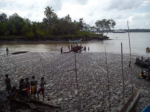
The village lay ahead of us, served by a rather ramshackle jetty leading down to what would have been water had the receding tide not left a muddy gap of about thirty yards. The Zodiac was beached and we started to wonder how we would ever get to the jetty, but our hosts, men and boys, enthusiastically jumped into the mud and surrounded our craft, hauling it slowly across the mud to the landing stage. Our helpers were sinking into the mud up to their knees – grey, particularly glutinous stuff formed from fine grains of sand.
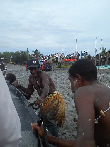
My Zodiac being hauled across the mud to the landing stage.
With a lot of heaving on their part, we arrived at the landing stage. The first few feet of the landing stage was wooden steps, formed from two inclined uprights connected by rather nobbly timber steps, about two or three inches diameter. With help from ‘human handrails’ we all made it safely onto the boardwalk leading to land. We couldn’t move very far because the passengers from earlier Zodiacs had been positioned onshore in the available space, leaving later arrivals to line the jetty.
Throughout our undignified landing, the crowds of men onshore who were dressed and painted like the canoe rowers danced and chanted, working themselves into a state of some excitement. A few of the men demonstrated what we now describe as “twerking”. Although my position on the jetty gave me good views of the later parts of the ceremony, I couldn’t see much of the dancing. It was only afterwards that I found out that there had been a separate section with local women dancing – what I saw was completely male-dominated.
There were a number of men from Noble Caledonia’s Land Agent on hand, one of whom had a battery-operated public address and was providing a running commentary on the proceedings. With all the noise from the dancers, it was a while before I realised his commentary was in English but I eventually grasped that, in addition to the welcome to Noble Caledonia, a traditional ceremony for the launching of a new dugout canoe was in hand. After some palm fronds had been thrown around, a new dugout canoe emerged from the milling dancers, being carried by at least 30 men. The canoe had been painted white with vertical red stripes along its length. A large man wearing very skimpy underpants with a grass skirt and, inexplicably, a bra was standing balanced on the gunwhales of the canoe as it was carried across the mud to the water's edge and placed in the water.
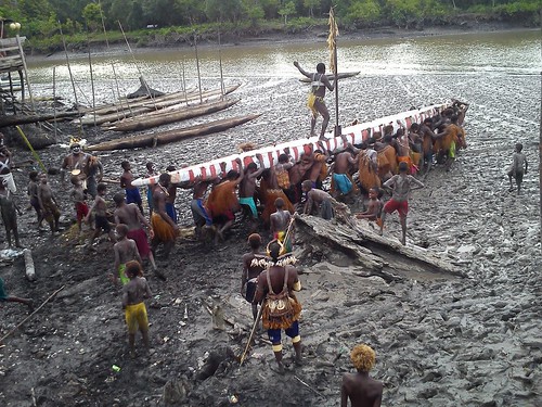 The first new dugout canoe being carried to the water's edge.
We were not finished yet. More palm fronds were being tossed aside. It appears that it is customary to complete the boatbuilding ‘in secret’ and a temporary fence was being removed from around three more new canoes and the palm fronds discarded, having served their traditional purpose of keeping the new dugouts from prying eyes. The ‘launching’ we’d just watched was repeated three times, with great enthusiasm. Each time there were at least 30 men to carry the canoe, with one man standing on the gunwhales, in his particular variation of traditional dress, encouraging the boat carriers.
 Villagers prepare to 'unveil' another new dugout canoe.
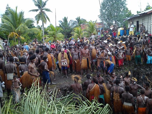
It’s hard to estimate how many people participated in the chanting and dancing. But it must have been between two hundred and three hundred at least. We were told that three villages combined their efforts to perform this ceremony. All the villagers not involved in the ceremony were watching from various vantage points. All the passengers had been very impressed by the amazing experience and the expedition crew who, of course, are widely travelled agreed that they had never seen such a spectacle.
 The last of the new dugout canoes is lowered into the water. In the foreground, the muddy 'beach', in the background 'Caledonian Sky' awaits our return.
We slowly moved away from the landing area and proceeded along the boardwalk through the village. The houses were wooden and built on wooden piles. Most roofs were corrugated iron but a few used thatch. At one point, we passed a pushcart carried on two bicycle wheels, brightly painted and marked ‘BAKSO’: this was the mobile shop. Periodically, we passed a modern addition – solar-powered street lamps. We crossed a muddy creek with a wide variety of outboard- or inboard-powered craft. There were lots of villagers about, curious about their strange-looking visitors but not unfriendly. Children, in particular, were intrigued but readily responded to a wave or a kind word and, from time to time, I found myself with a small band of followers.
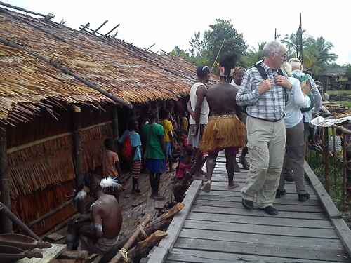 The area is famous for woodcarvings in a 'primitive style' which some villagers displayed for sale. We were told that the 'Long House' on the left was a dormitory for unmarried young men.
There were not just local people moving in both directions on foot along the boardwalk. Some used bicycles but there were also what looked like mopeds but were actually powered from a rechargeable battery and thus very quiet, except that, as their wheels passed over the individual slats forming the surface of the boardwalk, they produced a distinctive ‘clack-clack-clack’sound.
Continuing our walk, we passed the local power station. A dull roar from one or more diesel alternators came from inside one of a group of wooden buildings. A number of oil drums were stored on a wooden platform outside. Another part of the storage platform had a number of large distribution transformers, ready for installation.
We came to a large, wooden private house on wooden piles painted rather oddly in purple and pale blue. What caught my eye were two ‘ham’ amateur radio station signs marked ‘STASIUM RADIO AMATIR’ and the ‘call signs –‘YD9SWQ’ and ‘YD9STG’. Of course, there were quite substantial antenna installations in the garden.
After we passed an Indonesan Christian church built of wood and crossed another muddy creek, we traversed a short rural area before the buildings started again. I imagined we were now in Agats, but I couldn’t find confirmation of this, except that the boardwalk changed to an all-concrete construction supported on round columns. The actual walking surface was formed from concrete ‘paving slabs’ where the electric mopeds now produced a sort of ‘tung-click-tung-click’ as each slab rocked slightly.
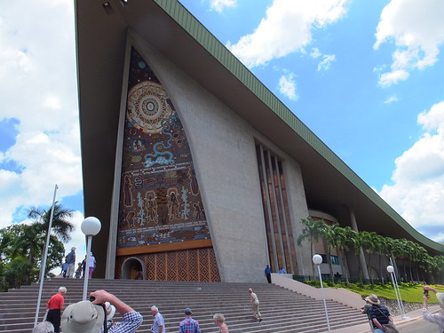
On our right, the cathedral church (‘KATEDRAL’) was a striking modern design in the form of an inverted ‘V’. The broad boardwalk platform in front of the cathedral was wooden-slatted. Part of the area was marked out in white forming a series of small ‘parking bays’ for the electric mopeds. On the opposite side of the main boardwalk, there was a carved Calvary, illuminated by a single pendant electric light.
 The Cathedral Church.
We were invited to look around the Museum of Local Art. This was a large, airy building but rather gloomy. Although there were large windows at high level, it was starting to get dusk and there were very few electric lights in use. However, there was a wide range of carvings in the local 'primitive style' on display.
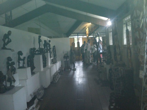 The Museum of Local Art.
The Bank building on our left was distinguished by a series of flagpoles with brightly-coloured advertising flags on either side of the access boardwalk. After passing over another muddy creek with a variety of beached boats, I noticed that the shop on our right extended back some distance and seemed to be carrying very comprehensive stocks.
The next group of buildings on our right formed Agats Hospital. The Blood Transfusion Unit was particularly smart, wooden with a corrugated iron roof, pale green window frames and varnished wooden wallo cladding. There was even at least partial air conditioning. A young man approached me and, in excellent English, told me I should speak to the Doctors and find out more, pointing to a group of three people sitting under a verandah. I did so. All three were Doctors at the Emergency Unit which I was told had six beds. The main hospital adjacent had about 20 beds.
 A view of part of Agats Hospital.
At a crossroads in the boardwalk, there was a large piece of 'public art'. From each of the four corners of the crossroads, a curved pillar rose, joining the other pillars to form a series of arches, topped with a statue.
We passed a large, low building I took for a school because of the flagpole and the large wooden platform in front which looked like a ‘playground’. Another commercial building on our right was ‘AGATS STUDIO FOTO’ offering a Fuji film Digital Imaging Service. The large AN-NUR Mosque we passed was painted in traditional pale green and white.
We were then in what was certainly ‘Downtown Agats’ – shops on both sides of the boardwalk selling a bewildering array of goods. We saw one young man who’d presumably caught the ugly-looking catfish he was carrying. It was about three feet long and he was happy to pose for photographs. One café had a barbeque outside being prepared for action, fired with coconut shells.
 'Downtown Agats'.
Now almost dark, we arrived at the shore. There was a substantial high-level concrete jetty to accommodate the larger ferries which serve Agats but there was also a low-level jetty for local boats where we joined our ‘Zodiacs’ for the journey back to our ship. The jetty area was crowded with local people, many of whom had come to see the foreigners and it was quite a jolly send-off.
 Queuing for 'Zodiacs' on the local jetty, watched by a crowd of locals on the high-level jetty.
A most memorable experience. Next time, I’ll describe our Zodiac cruise the following morning to study the Mangrove Ecosystem around Syuru. You can find all the posts on this trip here.
My pictures
Syuru.
[Minor revisions, pictures and links to pictures added 23-Feb-2015]
Leaving Thursday Island, Australia: Thursday, 29th January 2015
We left Thursday Island around 5.00 p.m. Thursday and cautiously made our way through the channels to the open sea, with the Port Pilot on board to assist the Captain.
 Passing a barely-covered sandbank with a warning marker as we leave Thursday Island.
Welcome Cocktails were served in the Lounge at 7.00 p.m. with the Captain, Hakan Admarker, and Officers and Senior Crew. We then adjourned to the Welcome Dinner at 7.30 p.m. in the Dining Room on Deck 2.
At Sea: Friday, 30th January 2015
We spent the whole day heading across the Arafura Sea towards our next destination, Agats in Indonesia in the area called 'Asmat'. The day was enlivened by various presentations and a special showing of the film ‘Breakfast at Tiffany’s’. As we were heading west, clocks and watches had to be moved back by one hour before Saturday morning.
Arrival at Syuru, Indonesia: Saturday, 31th January 2015
Port Moresby had been in Papua New Guinea. We were heading for Syuru Village in the 'Asmat' area of west New Guinea which is part of Indonesia. Indonesia incorporates numerous ethnic groups. The Asmat are one of these groups with a population of perhaps 70,000 who live in an area of west New Guinea also called ‘Asmat’. We were told that the village we were to visit, Syuru, is typical of Asmat villages in the area. It is situated on the banks of Teluk Flamingo, some miles from the open sea, requiring careful attention to the tides and cautious navigation to avoid grounding. In addition to the Echo Sounding Depth Measuring equipment on the ship, one of the ship’s Zodiacs, temporarily fitted with electronic depth measuring equipment, was dispatched ahead of the ship to check the safety of the intended course.
It was already afternoon when we final moored mid-river a few hundred yards from Syuru. First of all, members of the expedition crew went to the village by Zodiac to confirm arrangements with support staff from Noble Caledonia’s Ground Support company and with people from the village. Disembarkation was arranged for Port side cabins first and then for Starboard side cabins. By the time I actually set off by Zodiac from the ship it was well after 4.00 p.m.
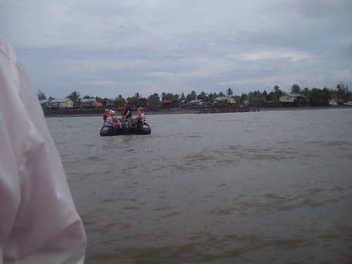 Heading towards the Village in our fleet of Zodiacs.
Next time, I’ll described our time in the village. You can find all the posts on this trip here.
My pictures
Syuru.
[Pictures and links to pictures added 17-Feb-2015]
Thursday Island, Australia: Thursday, 29th January 2015
The Australian state of Queensland has a projection extending north called Cape York Peninsula with a cluster of islands extending beyond Cape York called the Prince of Wales Islands. This is the area of the Torres Strait which divides the Coral Sea to the east from the relatively shallow Arafura Sea to the west.
 Threading our way between the islands to Thursday Island.
Thursday Island is one of the smaller islands in the Prince of Wales Group but it is home to a thriving, modern community usually just called ‘TI’. It formerly had a strategic importance and hosted military installations, now disused, but a modern Australian Navy depot of some kind remains. Thursday Island is the administrative centre of the region.
Good navigation was called for to negotiate these waters and bring our ship safely between the various islands to the jetty (usually called ‘Main Wharf’) where we tied up. A large ‘Sea Swift’ road tanker was waiting on the jetty and he immediately moved into position and started to transfer fuel to the ship. I think it took three large tanker loads and one small to replenish our bunkers. Sea Swift appear to provide a number of services on TI, including sea freight services. There are a number of helicopter landing sites (‘helipads’) around the island suitable for small helicopters but otherwise, everything required in the island comes by sea.
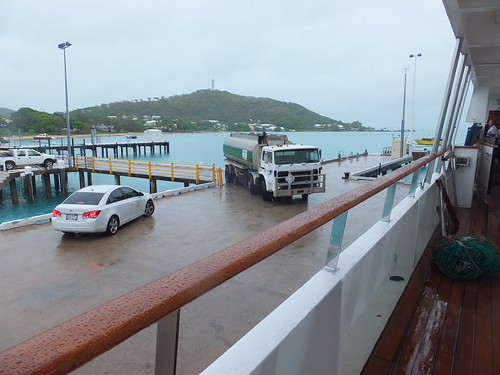 As we moored at the jetty, the first ‘Sea Swift’ fuel tanker arrived.
Before we could go ashore, we had to go through Australian Immigation Procedures. A man and a woman, both in uniform, came aboard and set up office in the ship’s lounge and then the passengers queued up to be processed. I think there are just two air conditioned coaches on the Island – a 20-seat and a 53-seat, both operated by Peddells (who are also ferry operators). When it had finished its School Contract run, the 53 seater parked on the jetty to form the 9.00 a.m. tour for passengers with cabins on the starboard side (which included me). Port side passengers had to wait until the bus completed the first tour before they could board for the second tour starting at around 10.30 a.m. It was raining quite hard as we set off from the wharf but, by the time we reached our first stop at Green Hill Fort, the rain had eased and later stopped altogether.
Green Hill Fort
The idea of a fort on the high ground in the west of the island was proposed in 1881. Construction started in 1891 using just picks and shovels on the rocky ground and by 1893 soldiers were installed there. The main armament was provided by three Six-Inch guns built by Sir W. G. Armstrong & Mitchell. In 1912, cooling plant was installed. In 1926 the fort was abandoned but, in World War II, it was brought back into service a Signal Station. From 1954 to 1993, it was used as a weather station. The Torres Strait Historical Society have moved their museum to the fort buildings.
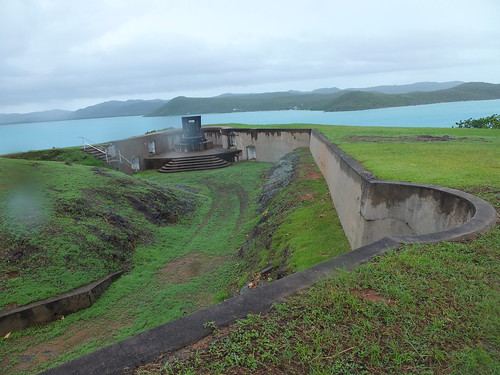 The view from Green Hill Fort.
Thursday Island Cemetary
On the north side of the island, we stopped at the island’s cemetary. In this area, the shore is covered with mangrove swamp and we were warned to take care when near the water since it’s a spot favoured by Salt Water Crocodiles. The graves themselves were rather more colourful than is common in England. ‘Unveiling’ of the tombstone is not normally done until a year after burial. Thursday Island was formerly the centre of the pearl shell trade. Shells were initially easy to find but, with continued harvesting, increasingly hazardous ‘free diving’ or diving with helmets was required. Many Japanese were involved in this trade and lost their lives diving, so there is now a modern Japanese-style memorial to them in the cemetary. I was puzzled by a flagpole and flag at one grave. The inscription explained the Bernard Namok, whose grave it was, was the designer of the Torries Straits flag. But I never did find out why one grave, in addition to the tombstone, had a rusting iron bedhead.
 Thursday Island Cemetary.
A walk back to the Ship
The bus continued back to the town centre and stopped outside the NAB Bank, allowing passengers who wanted to walk round the town a chance to get off before the bus continued to the ship. I left the bus and walked west along Douglas Street passing various shops, the Queensland Government Building, the Torres Shire Council Chambers/Library and the Primary Health Centre. I visited the Council-maintained small Anzac Memorial Park and a dignified memorial to the fallen. I passed the Roman Catholic church and visited the Anglican Church of Australia building All Souls and St. Bartholomew Former Cathedral and Quetta Memorial Church. In a car port nearby, I spotted a modern estate car marked ‘ANGLICARE – North Queensland’.
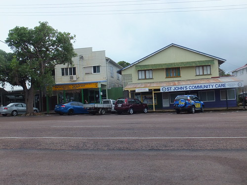 Commercial premises line Douglas Street.
A short walk took me to the sandy shore along the south of the island at Victoria Parade. Walking east, I could see ‘Caledonian Sky’ at the Main Wharf. On the way, I called into the Gab Titui Cultural Centre. This centre, established in 2004 in a surprisingly lavish building claims to provide “a unique insight into the region’s vibrant art and culture”. In addition to a changing pattern of exhibitions, the centre, run by the Torres Strait Regional Authority supports more than 70 artists in 20 communities across the Torres Strait and Northern Peninsula area and provides an “ethical outlet” for selling their work.
Before reaching Main Wharf, I came to Engineer’s Wharf which appeared to be the base for a number of inter-island ferry services, including Peddells service to Seisia on the Australian mainland (I think called “Big Island” locally). This is operated by 20 metre, 120 passenger modern catamarans. There’s an alternative route to the Australian mainland by taking a ferry to nearby Horn Island which has an airport but I didn’t discover any details about this route.
 The catamaran ferry 'Strait Magic' at Engineer's Wharf.
At Main Wharf, there were a variety of shipping containers serving as a reminder that everything required by the island has to come in by sea (which reminded me of an earlier visit to St. Helena). One container operated by A&R Removals amused me. According to the logo on the container they apparently sponsor a sports team in Northern Queensland called ‘Cowboys’. If I were contemplating a house move, I’m not sure that the association with ‘Cowboys’ would really encourage me. Some of the containers were refrigerated to carry fresh food. These incorporate electric-powered refrigeration plant and are usually called ‘Reefers”.
A walk around the eastern half of the island
The bus tour and my walk back to the ship had given me a good idea of the western half of the island but during lunch on the ship I conceived the idea of walking around the eastern half of the island. By this time, it was quite warm but I set off confidently from the ship on Hastings Street, heading north. First, I passed the modern buildings of Thursday Island Primary Campus which is part of Tagai State College. It had one of those signs cinemas sometimes use where individual letters can be assembled to form a relevant message. I thought the message was unique “TUCK SHOP OPEN SELLING FOOD & UNIFORMS”. I left the central town area behind and the road became Loban Road. Set back from the road on my right was the Torres Shire Sports Complex and the Fire Station operated by Queensland Fire and Rescue.
When I came to the Frog Gully junction, I turned right, leaving the route I’d travelled earlier by bus. The island’s power station was situated at this junction. Counting the chimneys suggested that there were four diesel alternator sets and there was also an impressive line of fuel tanks. The Torres Council Transfer Station which presumably deals with the island's refuse was also located at this junction. The road led to the suburb of Rosehill with a sandy beach, stone jetty, a boat ramp suitable for small boats and a number of houses. A channel of a few hundred yards width separated Thursday Island from a second island, with a heavily wooded hill leading to a sandy beach. I think this was Hammond Island. A jetty suggested that ferries serve the island. There were also two independent mooring towers (similar to those at Thursday Island) which hinted at a former Naval presence.
 The beach and jetty at Rosehill, with Hammond Island in the background.
I carried on past the premises of Australian Helicopters but there was no sign of activity. A short climb on the access road on my right gave me views of the reservoir which provides Thursday Island’s water supply. Beyond the reservoir, I could see the two wind turbines and a radio transmission tower which crown Milman Hill which is the highest point of Thursday Island.
I carried on along the main road until a junction where a sign marked ‘Lions Lookout and Sadies Beach’ pointed to a climbing road to the right, graded but unsurfaced. I took this road which clung to the wooded hillside. After passing a number of termite mounds, I came to a derelict World War II lookout station. This was Lions Lookout and it gave views of yet another island which must have been Horn Island where I could see a beach and buildings and another independent mooring tower.
 View of Horn Island from 'Lions Lookout' on Thursday Island.
Another sign pointed down the hill to ‘Sadies Beach’ but I kept going along the road which was still high on the hillside. Looking seaward, I could see a third Thursday Island jetty. As I watched, a catamaran passenger ferry arrived, paused for a few minutes and then left. It was marked ‘Rebel’ which I think is the name of the operator and ‘Robert Henry’ which I think is the name of the vessel.
By this time, I was getting rather tired but, according to my wristwatch, there was plenty of time to get back to ‘Caledonian Sky’ before she left. As the road I was on turned around the hillside, my ship came into view.
'Caledonian Sky' seen from the road from 'Lions Lookout'.
A map I’d seen earlier marked land in the area as ‘Naval’, so I was not surprised to see a fenced compound on my left with signs declaring ‘Commonwealth of Australia Department of Defence – TRESPASSING IS PROHIBITED – It is a punishable offence for a person to be on this property without lawful excuse’. There were a number of modern structures on the site but the gates were locked and there was no sign of anybody. I could only surmise it was some sort of storage depot. There were certainly a number of hazard signs about Lithium Batteries, Flammable Gas, Flammable Liquids, Oxidizing Agents, Hazardous Chemicals, Radiation and Explosives!
Next to this intriguing compound, I noted that the house was appropriately numbered 13. The 4 x 4 parked outside the house was marked Seventh Day Adventist Church. There was also a large motor cruiser mounted on a trailer.
A few houses further on, there was a large van with a tail-lift marked ‘T.I. Main Events’. Apparently they supply Marquees, tables, chairs and accessories. Citing Mark 12:29,30 and 31 and Proverbs 19:21, the van also states ‘T.I.M.E. now meke ready’.
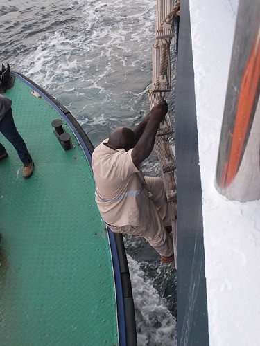
As I walked along the jetty to my ship, I stopped to watch the car ferry arrive. I could see that the actual ferry was unpowered but it was strapped to a tug which provided the motive power.
 The vehicle ferry arrives at the slipway at Main Wharf, Thursday Island.
It was only then that I discovered that my watch was 90 minutes slow – it had somehow become altered on the journey and I’d only arrived back in the nick of time! It was a good walk, though.
Very soon, we were under way on our 532 nautical mile journey to Agats, Indonesia.
I’ll tell you more about the trip when I'm able. You can find all the posts on this trip here.
Biblical References
It’s perhaps a sign of the times that it took a little while to locate a copy of the Bible on the ship. One of the crew loaned their ‘Good News’ Bible which gave the following:-
Mark 12 (concerning commandments):
29 “The most important one,” answered Jesus, “is this: ‘Hear, O Israel, the Lord our God, the Lord is one.
30 Love the Lord your God with all your heart and with all your soul and with all your mind and with all your strength.’
31 The second is this: ‘Love your neighbour as yourself.’ There is no commandment greater than these.”
Proverbs 19:
21 Many are the plans in a man’s heart, but it is the LORD’S purpose that prevails.
Book references
[1] ‘Timeless Isle – An Illustrated History of Thursday Island’ (Fourth Edition, 2003) by Captain John C. H. Coley, published by the Torres Strait Historical Society (ISBN 0 9592660 0 3).
My pictures
Arriving at Thursday Island.
Thursday Island Bus Tour.
Thursday Island views around the town.
Thursday Island (Eastern part).
[Biblical References added 7-Feb-2015: Pictures and picture links added ]
On Board ‘Caledonian Sky': Tuesday, 27th January 2015
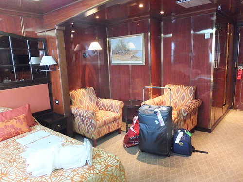
Our buses dropped us near the bottom of the gangway of ‘Caledonian Sky’ just before 3.00 p.m. There were the minimum of formalities in reception before I was handed the ‘key’ to my cabin – a grey plastic rectangle with a series of holes punched into it forming a code, labelled ‘Vingcard’ and made in Norway. My cabin was on Deck 3 and only a few yards from Reception. I arrived at my cabin 346 (also labelled ‘Isle of Gigha’) at the same time as a crew member with my luggage.
The cabin was a generous size for a double cabin, so it was very suitable for just one passenger. The bed was made up as a double but alternately could be arranged as twin beds. There was adequate wardrobe space (with a safe) and one corner of the room had been partitioned off as a well-furnished bathroom including a corner bath incorporating a shower. One corner of the room had two easy chairs, the desk (which included a small refrigerator) was provided with an upright chair and the dressing table had a stool. Daylight was provided by one large window (not a porthole) supplemented by a comprehensive arrangement of electric lights.

Cabin 346 - 'Isle of Gigha'.
At about 4.30 p.m. all passengers were summoned to the lounge for the mandatory Safety and Lifeboat Drill. The vessel has four motor lifeboats, each with a capable of carring 48 persons, mounted on davits either side of the ship.
Around 4.00 p.m., the ship got under way with a Port Pilot on the bridge to ensure our safe passage. About 1 mile out to sea, the Pilot Boat drew alongside on the port side whilst we were still under way, a rope ladder was lowered from our ship and the Pilot and one other clambered down the ladder and joined the Pilot Boat which immediately accelerated and returned to Port Moresby Harbour.
"Dropping the Pilot" leaving Port Moresby.
A ‘Welcome Aboard Briefing’ had been arranged for 6.30 p.m. in the Lounge to allow the Expedition Team to introduce themselves. According to the Noble Caledonia booklet the team comprised:-
Jane Wilson (Expedition Leader)
Andrea Machacek (Assistant Expedition Leader)
Danny Edmunds (Naturalist/Zodiac Driver)
Hannah Lawson (Naturalist/Zodiac Driver)
Damon Ramsey (Naturalist/Zodiac Driver)
Lea McQuillan (Naturalist/Zodiac Driver)
Craig Ward (Naturalist/Zodiac Driver)
Simon Cook (Naturalist/Zodiac Driver)
Kathryn Robinson (Guest Speaker)
 The Lounge on 'Caledonian Sky'.
Dinner was available at 7.00 p.m. When the weather allowed, meals could be taken either on the Lido Deck (Deck 5) in a roofed but open-sided area or in the inside Restaurant on Deck 2. By the time the meal was over, I was very tired so I retired to my cabin to prepare for bed.
On Board ‘Caledonian Sky: Wednesday, 28th January 2015
I had slept well and was partly restored on Wednesday, when we would be at sea for the whole day and the following night crossing the Coral sea and entering the Torres Strait which separates Papua New Guinea from the northernmost tip of Australia.
A ‘Zodiac Safety Briefing’ had been arranged for 10.00 a.m. in the Lounge. Later in the morning there was a talk by Damon Ramsey. After lunch there were two presentations, the first by Kathryn Robinson, the second by Craig Ward. At 6.30 p.m. there was a ‘Recap and Briefing’ by the Expedition Team with information about our landing the next day on Thursday Island and this was followed by Dinner. Once again, I was pretty tired and happy to retire to my cabin after the meal.
A large egg-shaped Radome mounted on the roof of the Panorama Lounge (Deck 6, Aft) provided communications via satellite. Two HP computers were available for e-mail access inside the Panorama Lounge without charge. In addition, Wi-Fi access was available around the ship on a chargeable basis. I found the connection a bit erratic.
 View from the Forward Observation Deck, looking astern, showing the Panorama Lounge with Satellite Radome on the roof. Port Moresby is in the background.
I’ll tell you more about the trip when I'm able. You can find all the posts on this trip here.
My pictures
Joining 'Caledonian Sky'.
Port Moresby's Docks.
[Pictures and picture link added 15-Feb-2015]
On to Papua New Guinea: Tuesday, 27th January 2015
Particularly since we were over three hours late leaving Singapore, I found the flight rather gruelling. I was tired when we started and having the narrow seat in an almost vertical position all night didn’t help. The aircraft itself was a fairly modern Air Niugini Boeing 767-300, registration P2-PXW with 2-3-2 seating in economy and the audio-visual system in economy was a seat back mounted touch-screen. There was quite a wide range of video on demand programming but the touch screen was rather erratic – often touches failed to be registered whilst at other times, all sorts of commands were spuriously triggered. I nearly gave up at times but watched most of ‘The Judge’ and later ‘The Pelican Brief’ (which I’d seen before). I’d been led to expect no catering in economy but, in fact, we were served a reasonable lunch on a tray with drinks shortly after take off and a simple ‘breakfast box’ comprising a cake and an apple also with drinks shortly before we landed at Port Moresby airport. Looking out, I could see the terrain was very ‘lumpy’. Papua New Guinea is at the meeting point of two tectonic plates where folds of earth have been pushed up by the action of the two plates moving in opposite directions.
We left the aircraft through a conventional airbridge, but the fixed corridors linking each airbridge to the terminal building was a rather odd design with a pitched roof. We trooped into a fairly scruffy arrivals hall which soon became quite crowded. However, the Immigration Staff were processing passengers quite quickly and I was soon through to the Baggage Hall. After a short wait, I retrieved my luggage and, in the Arrivals Hall, met up with the helpful staff from the Local Agents acting for Noble Caledonia. They took away the luggage to travel by a separate lorry and divided us up among the four non-air conditioned and fairly care-worn buses. Leaving the airport, I was quite impressed by an iconic Douglas DC3 which was supported on two pylons.
We were heading for the Crowne Plaza Hotel where ‘Day Rooms’ were to be provided for us to ‘freshen up’ and take breakfast before using the same buses for a city tour. Port Moresby is no Singapore. Although there were multi-storey buildings, the overall impression was decidedly ‘Third World’. The city seemed to sprawl without apparent plan and it was clear, from the ‘Shanty Towns’ we passed, that there is widespread poverty.
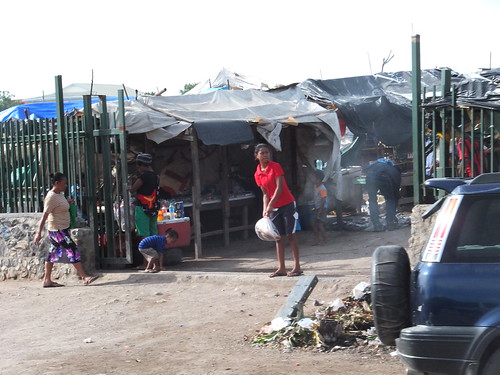 The entrance to an Open Market.
We were warned that crime was widespread (just like England, I suppose). The latest round of civil unrest, we discovered, had been triggered by a strike of workers in the petrol industry causing shortages of fuel. Every time we passed a filling station which was still selling petrol, we became embroiled in a traffic jam of motorists trying to ‘top-up’. Despite the strike, there seemed to be heavy traffic. There were some modern commercial buildings, there were some attractive-looking chalet homes and a lot of new development was taking place in the ‘hotel area’ overlooking the sea which was our destination.
 The 'hotel area' overlooks an azure sea.
There were certainly a lot of mobile phones in use. But the overall impression was rather depressing despite the hot sun. It was rather reminiscent of Africa, in fact the name ‘New Guinea’ was given by one of the early explorers who thought the natives looked similar to the people of Guinea in Africa.
We were made very welcome at the Crowne Plaza Hotel. The hotel staff were local people: the senior management were Australian. Once we had identified our luggage, we were taken up to our rooms. Because of late arrival, very little time was left. I managed a shower in cold water (although I discovered other rooms had hot water) before going for breakfast, where an area of the dining room had been reserved for the Noble Caledonia party. The staff were very friendly and looked after us very well. Then the lights went out. Power cuts are not unknown in Papua New Guinea but after a short pause, power was restored. I returned to my room, where I could hear the hotel’s standby diesel generator chugging away outside. I re-packed my case and, as instructed, placed it outside the room for collection. As I finished getting ready, the lights went out again and, this time, there was no re-assuring chugging from the generator set. Without power, of course, there was no lift in operation so I made my way to the nearest fire exit where there were hotel staff and a group of Noble Caledonia guests. We walked down to ground level, noting the bright orange numbers stencilled on the wall at each floor. I noticed that the ‘3’ for level 3 had been stencilled upside down. We emerged in the hotel grounds and had to walk round to the entrance to get back into the hotel, where we waited for the staff to struggle down the stairs with our luggage. It was all very good-natured and it was impossible to be cross.

Crowne Plaza Hotel, Port Moresby.
We boarded our four buses and set off back along the road we’d arrived on, turning off to pass by the harbour where we would board our ship in a few hours. I was pleased to catch a glimpse of our ship, already moored. The tall stacks of shipping containers meant I couldn’t get a good view of the facilities but I counted three massive Straddle Cranes used for moving containers on and off the stacks. We passed a large, modern brewery which produces the popular ‘SP’ lager beer and pulled up at the National Parliament building, a large, dramatic structure.
We were told it was a ten minute photo-stop to see the outside but, unusually, we were invited inside (the parliament was not sitting). The huge entrance hall was impressive enough (although it seemed an odd place to house a large collection of mounted butterflies) but we were taken up the broad stairs and entered what I supposed was the Public Gallery, looking down on the debating chamber itself. Each member had a modern swivel chair set behind a desk provided with a microphone, all set in a series of semicircular rows facing an arrangement similar to the United Kingdom Government. There was a table (presumably for two party leaders), a row of chairs I imagined were for Clerks (since they faced a row of law books) and, looking down on all this, a massive, elaborately-carved chair which must be for the Speaker.
 Papua New Guinea's National Parliament Building, Port Moresby.
Back in the buses, we drove to our final destination – Port Moresby Nature Park. We were divided into two groups and conducted around the park by experienced local staff who showed us plants, animals and birds.
 The Papuan Hornbill at Port Moresby Country Park.
We finished up at ‘Natures Café’ where we enjoyed a meal in a covered but open-sided dining area. In a nearby grassed area, there were a number of craft stalls and we were treated to a performance of a traditional dance by a group. Apparently, this had all been set-up because of our visit.
 A traditional dance performed for us at Port Moresby Country Park.
I talked to the young Australian lady who is general manager of the park. They are keen to attract more tourists – at present foreign tourists are only about 8% of the total. The local staff were from the park’s Education Department. All school children in Papua New Guinea have visits to the park, which tries to harmonise its tours with the needs of the school curriculum. But they also encourage family leisure visits and there are a number of picnic areas around the site. I was charmed by the visit – the professionalism of the staff combined with their friendliness made it a memorable visit.
Then it was ‘back on the buses’. There was confusion amongst some passengers because three of our four buses carried the painted number ‘4’ and two of the three were in the same livery. I didn’t think to memorise the registration number on the number plate. One lady said to me “You’re in my seat” before I explained she was in the wrong bus. Once sorted out we drove back to the harbour, this time driving onto the site and right up to our home for the next few days – ‘Caledonian Sky’.
 View of Port Moresby from ‘Caledonian Sky’ prior to departure.
I’ll tell you more about the trip when I'm able. You can find all the posts on this trip here.
My pictures
Port Moresby, Papua New Guinea.
Crowne Plaza Hotel, Port Moresby.
Port Moresby Country Park.
Port Moresby's Docks.
[Updated 30-Jan-2015: Links to pictures added 14-Feb-2015]
More from Singapore: Monday, 26th January 2015
At noon, the whole group boarded two large, modern coaches for a sightseeing tour around Singapore. We drove through the forest of tall buildings which covers most of the city centre to a small area in Chinatown called Far East Square. Here, a group of earlier brick-built Shophouses have been modernised but retaining much of the original. The development won an Architectural Heritage Award in 1999. We walked to a Chinese restaurant called Spring (Fu Chun Yuan) for lunch. After lunch, we returned to our coaches and continued the tour.
Our next stop was at the oldest Taoist temple in Singapore, Thian Hock Keng, originally built in 1821 as “a humble joss house”. Preparations for the Chinese New Year were well advanced, so we saw all sorts of decorations.
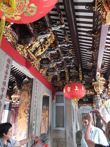
Thian Hock Keng Temple, Singapore.
Later, we drove past both Hindu and Buddhist places of worship on the way to Clarke Quay, where the passengers from each bus joined two tourist boats for a River trip.
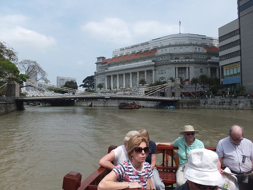 Singapore - City river trip.
They called the boats we took by the traditional name of a ‘Bum Boat’ but, in these days of Health and Safety, the whole business has become far more regulated. There were lots of tourist boats on view, all of similar design and apparently well-maintained, with the staff wearing T-sheets and baseball caps carrying the company logo. It was far more fun ten years ago when I just went to Clifford Pier and hired a rather beat-up launch which took me on a splendid tour of river, container port and one of the islands (briefly described in an earlier post here).
The modern trip boats took us down river, under the various road bridges named after Englishmen from the British era and into the broad stretch of water called Marina Bay. This area has seen major developments since my last visit. The symbol of Singapore, the Merlion statue, was there ten years ago but is currently swathed in scaffolding. The north west quay now has One Fullerton (a “food centre’), the Fullerton Pavilion and the Fullerton Bay Hotel. The south east quay now has a futuristic-looking Art Science Museum, theatres, a casino, a convention centre, various event spaces and rather pompously-named “The Shoppes at Marina Bay Sands”. The scruffy water taxi dock at Clifford Quay which I remember has gone – I was told it has been relocated. As our boat retraced its route back to the river, we passed two more recent features – ‘The Helix’, a bridge with two opposed spirals inspired by the ‘Double Helix’ structure of DNA and ‘The Marina Bay Seating Gallery’ (a huge inclined slab of concrete with open-air seating facing the water). To complement the Seating Gallery, a large floating pontoon has been moored in the water which carries a giant television screen. I suppose inevitably, in this computer-obsessed age, the pontoon is called “The Float @ Marina Bay”. We disembarked at the landing stage at Clarke Quay where we’d boarded and walked back to the coaches.
Another drive across the city took us to Singapore Botanic Gardens which is seeking adoption as a World Heritage Site. Our guides took us on a walking tour of the world-famous Orchid Gardens. It has a section displaying ‘V.I.P. Orchids’ where the flower has been selected by a politician or member of a Royal family from a number of hybrids offered. An adjacent, similar selection showed ‘Celebrity Orchids’ chosen by people from the entertainment history.
 Singapore Botanic Gardens has a spectacular display of hybrid orchids.
Then it was back onto the two coaches for our final transfer to the airport where we were to check in a 5.00 p.m. for our overnight Air Niguini flight to Papua New Guinea. We then found out that check-in would not commence until 7.00 p.m. because the inbound aircraft was late. We made a queue of our luggage which our tour organiser for this section agreed to guard, allowing the members of the tour to wander off.
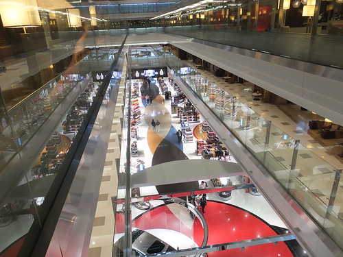
Singapore Airport currently has three Terminals (T1, T2 and T3). A fourth Terminal is being built. These terminals are linked by a network of driverless trains running on rubber tyres. I decided to check this out whilst waiting to check-in with the airline. I travelled from T1 to T2 on one line, T2 to T3 on a second line and T3 back to T1 on a third. That’s not the full extent of the lines!
Back safely at T1, I joined my luggage at the check-in queue. One young man started check-in on time, but it was an awfully slow process at first. Later, a girl opened a second check-in position which improved matters. But the disappointing news was that departure had gone back to 11.00 p.m. This delay meant that the check-in agents were writing a voucher for each passenger to pay for a snack. It transpired that the value of the voucher was only 8 Singapore dollars (about four pounds Sterling) but I, and the other group of passengers I was with, made sure we used these. Eventually, our flight was called so we walked to the gate – D40. Security was being carried out at the Gate, so we had to join another queue waiting to pass through a thorough security check before we could enter the Departure Lounge. The staff were pleasant enough, which helped a bit. I think it was just after 11.00 p.m. when we finally started boarding the Boeing 777-300 and it must have been well after after 11:30 when we finally took off. For this leg, I was booked Economy so I found it all a bit cramped and, on top of the delay at Singapore, I was not looking forward to another six hours or so of overnight flight before we reached Port Moresby Airport in Papua New Guinea.
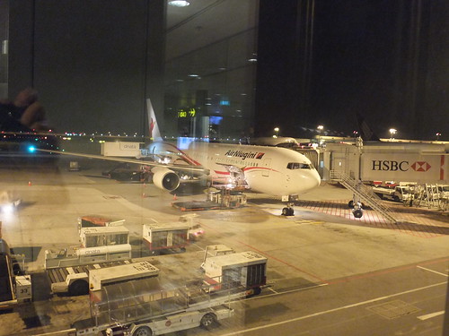 The Air Niugini Boeing 777-300 which took us to Papua New Guinea.
P.S. It got better! I’ll tell you about it when I'm able. You can find all the posts on this trip here.
My pictures
Singapore, 2015.
Singapore - City river trip.
Singapore Botanic Gardens.
Singapore (Changi) Airport.
[Pictures and links to albums added 14-Feb-2015]
More from Singapore: 26th January 2015
I enjoyed a wonderful night's sleep in the huge bed at the Shangri-La and awoke refreshed. Buffet Breakfast was in 'The Line' restaurant which the hotel claims is "a spectacular display of cutting edge modern surrounds, The Line is designed by the world acclaimed Adam D. Tihany". It's modern, illuminated by large orange-coloured rectangular lighting fittings mounted at odd angles and full of hard surfaces and structural beams so, of course, I didn't like it. Even though I picked a less-busy area, it was still noisy and accompanied (like the whole of Singapore I rather think) by the penetrating low-frequency rumble of air conditioning plant. It's a large restaurant, broken up into a number of areas each with a different table layout. The food, however, was impressive. A wide range of styles is on offer from what the hotel rather archly calls "16 interactive theatre kitchens". This means there are lots of counters manned by cooks who take your requirements and cook it in front of you. Simpler items are laid out for self-service. I was impressed with the variety on offer and the quality of the end product.
 Part of 'The Line' Restaurant, Shangri-La Hotel, Singapore.
After breakfast, I met up with the the lady from 'Destination Asia Singapore' at the special Hospitality Desk for people on this Noble Caledonia trip. I discovered that the reason I'd not found her the previous evening was because the 'main party' didn't arrive at the hotel until after 8.0 p.m. because of delay to the British Airways flight from London. At noon, the whole group will have a sightseeing tour including lunch at a Chinese Restaurant and a river trip.
We'll then check-in at the airport for our overnight flight to Papua New Guinea.
More when I'm able. You can find all the posts on this trip here.
My pictures
Shangri-La Hotel, Singapore.
Singapore.
An update from Singapore
I left the lounge at Dubai in good time for flight EK354 to Singapore. As I expected, the aircraft was the huge Airbus A380, where the Business Class is on the Upper Deck, served by a separate Air Bridge. So the gate 'A8' I'd been directed to was only dealing with upper deck passengers. There was still something of a queue at the gate, probably because of the sheer size of the upper deck. Although an A380 can be configured for around 800 passengers total, I think the Emirates version like the one I boarded, an A380-800 registration A6-EED, 'only' caters for 500 odd. In the upper deck, all seats are aisle seats and every other row is also a window seat.
I watched a couple of recent Science Fiction films ('Lucy' and a Tom Cruise outing about 'Mimics' invading Earth) then I slept for a bit until they served breakfast. That probably sounds more pleasant than it seemed to me - it was my second 7-hour flight since leaving home the day before. At least the A380 seat becomes properly flat when turned into a bed.
On our approach to Singapore, our aircraft turned over the sea so as to approach runway 02 from the south, giving me a brief view of the dozens and dozens of ships, including large container ships and oil tankers, awaiting their turn to enter the port.
I was quite relieved to get off the plane, despite the long walk needed to reach Passport Control. Matters were helped by a number of 'moving pavements' which, I noticed, they call 'Travellators'. The delay at Passport Control was quite moderate and, moving on to the Luggage Hall, although the carousel area was crowded with waiting passengers, my case arrived after a couple of minutes. My luggage was quickly X-rayed by two helpful young men and I was waved through Customs. My air fare had included a limousine to my hotel so I found the Emirates desk dealing with car transfers and, having checked his list, he gave me a note of the car number allocated and directions to the waiting zone. A procession of smart black Mercedes were pulling up, loading passengers and driving off. In the three or four minutes I was waiting for the right car, at least a dozen must have loaded.
The journey into the city was quite relaxing. The dual carriageways seemed to be limited to a speed of 90 km/hr. I was amused that my Black Mercedes was consistently indicating '89'. On my last visit in 2005 (there's a brief description here, I commented on the multi-storey flats everywhere. Somehow, they've found room to shoe-horn more in and today there seems to be new buildings and building work in progress everywhere.
This trip was my first stay at the Shangri-La in Singapore but I've previously stayed at the Shangri-La Bangkok). The Singapore staff were helpful and the room was a good standard so I was tempted to just stay in the hotel but I finally decided to make a short walk, leaving the hotel just before 5.0 p.m. The Shangri-La is in a fairly upmarket area of hotels and apartments about 15 minutes walk from the main shopping street, Orchard Road. I declined the hotel's "Shopper's Bus" which frequently circles the major shopping destinations. The pavements were crowded, mainly with young people, including plenty of Europeans (a mixture of holiday makers and ex-patriates, I think).
Back at the hotel, I briefly explored the hotel facilities before returning to my room to set up my Notebook computer. I decided to have a meal in my room (yes - fish and chips), followed by a bath, by which time I was really in need of some proper sleep.
More when I'm able. You can find all the posts on this trip here.
My pictures
A380 DXB-SIN (pictures during the A380 flight).
Shangri-La Hotel, Singapore.
Singapore.
An update from Dubai
It's two o'clock in the morning and I'm in the Emirates Business Lounge in Terminal A of Dubai Airport. I caught the EK040 from Birmingham Airport which left about right time at 13:25. The aircraft was a smart Boeing 777-300, registration A6-ECZ. It should have taken 6 hours 20 minutes to Dubai but, mainly because of a headwind of about 40 knots, we were around one and a half hours late into Dubai. Dubai airport seems to have expanded again since my last trip through. There's now driverless rubber-tyred 'trains' between the three terminals that accelerate at a cracking pace. There was quite a bit of walking before and after the train. According to the signage, it takes 12 minutes to walk from one end of the Business Lounge to the other end! I'd had a meal on the inbound flight (I had a very decent grilled turbot in butter sauce with rice and carrots as the main course) but I was ready for a small bowl of minestrone with a small baguette before I located the business lounge and the Samsung machine I'm using. I had some trouble getting into Google - the browser is Internet Explorer and I got locked in a loop with Microsoft telling me what a wonderful experience the new Explorer delivers before it reluctantly dumped me into Bing.
 View from the Business Class lounge in Terminal A at Dubai.
Shortly, I'll make my way to gate A8 for the 03:15 flight EK354 to Singapore which is apparently a 'Code Share' with Quantas. The wonders of modern air transport still impress me, but I don't have the stamina I once had.
More when I'm able. You can find all the posts on this trip here.
My pictures
Dubai Airport, U.A.E. (pictures from this and other trips).
