Tuesday, 30 December 2014

Peak Rail 'Santa' Trains, 2014

Introduction

I was the driver of 'Lord Phil' on the 21st December 2014. Top and tailed with 'Penyghent', we provided four round trips between Rowsley and Matlock Town, working a 7-coach train. Phil Mason was Fireman and Colin Dodsley Cleaner.

Volunteer of the Year

Phil had been awarded 'Volunteer of the Year' for 2014 and, before we left the shed at Rowsley, Roger Hallett (Joint Managing Director) came aboard to present the engraved glass award to Phil. This was well-deserved recognition for Phil's work on the railway.
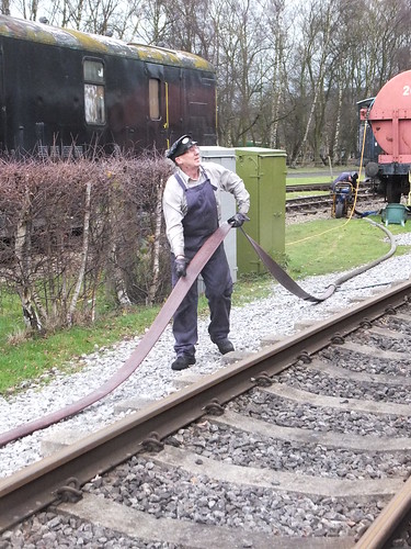

Phil Mason (shown draining the fire hose used for watering the locomotive at Rowsley).

Working the trains

The operation was generally similar to the 2013 'Santa' trains (described here, except that we terminated at Matlock Town station (rather than Matlock Riverside) and timings were adjusted to the standard Winter Timetable.

I think each pre-booked train was filled to capacity and, in addition, the 'Palatine' dining set provided a Christmas lunch to pre-booked guests.

This year, 'Lord Phil' was sporting a 'Christmas Pudding' headboard.
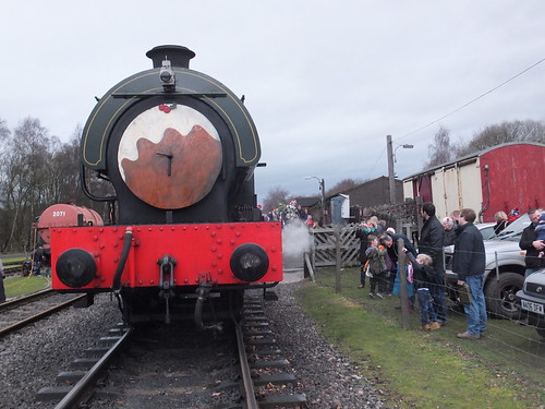
'Lord Phil' ready to leave Rowsley, showing the 'Christmas Pudding' headboard.

We ran without incident during the day, except that 'Penyghent' made an unscheduled stop with 'dragging brakes' on one departure from Matlock Town. The Guard and other members of train staff climbed down to 'pull the strings' on all the vacuum brake cylinders of the coaches and we were quickly under way again.

On the last round trip, it was starting to get dark. Colin lit a paraffin loco lamp on the footplate and, when we stopped at Darley Dale, he exchanged it for the unlit lamp we'd displayed from Rowsley. The single lamp next to the chimney is the standard headcode for an 'ordinary passenger train' stopping at intermediate stations. There's a little more about traditional paraffin lamps used on trains here. When we arrived at Matlock Town, I moved the headlamp to a position above one buffer and inserted the red glass 'shade', so that we correctly displayed a red tail lamp on the way back to Rowsley.
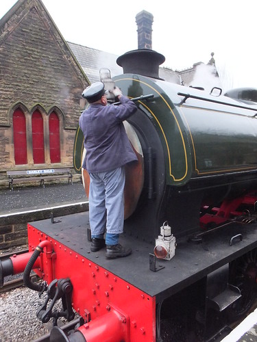

At Darley Dale, Colin removes the unlit headlamp, prior to fitting the lighted lamp.

As last year, Christmas Illuminations were provided on both platforms at Darley Dale, in addition to the traditional platform lighting on the Up Platform. I'm afraid that the cast iron columns for similar lighting on the Down platform still await fitting of the lanterns.
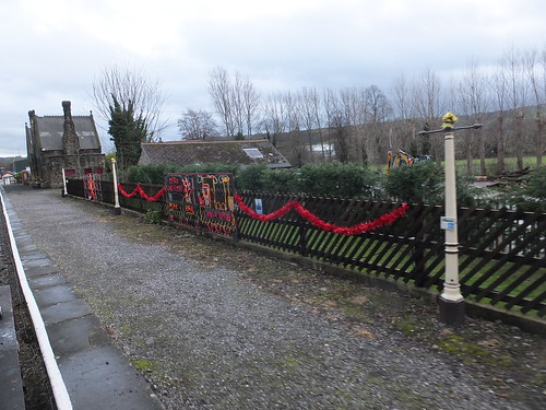
View of the Down Platform at Darley Dale, showing Christmas Illuminations.

Hard work during the day by many volunteers (and especially Santa Claus and his Elves distributing presents to the children) meant that our visitors went away happy.

Disposal

On arrival back at Rowsley on the last train, we uncoupled and made our way across to the shed where Harvey coaled us, ready for the following day's service. We then stabled the locomotive on the outside pit and, with good teamwork, quickly completed disposal - remaining fire 'knocked out' (leaving a small fire pushed against the firebox tubeplate to allow the boiler to cool gently), ashpans raked out, smokebox char removed, all tools returned to stores, boiler filled, gauge frames isolated, all steam cocks closed, inspection all round looking for any possible problems, locomotive hosed down to remove loose ash. There's more information on disposal here. Once these duties were complete, Phil, Colin and I 'signed off' after a satisfying day.

My Pictures

Peak Rail 'Santa' Trains 2014

Friday, 12 December 2014

On foot around Liverpool Docks (3)

Introduction

In my earlier post, On foot around Liverpool Docks (2), I described the start of my walk around the Liverpool Northern Docks area on Saturday, 22nd November 2014, as far as the northern extent of the 19th century docks. My description of the walk continues below.

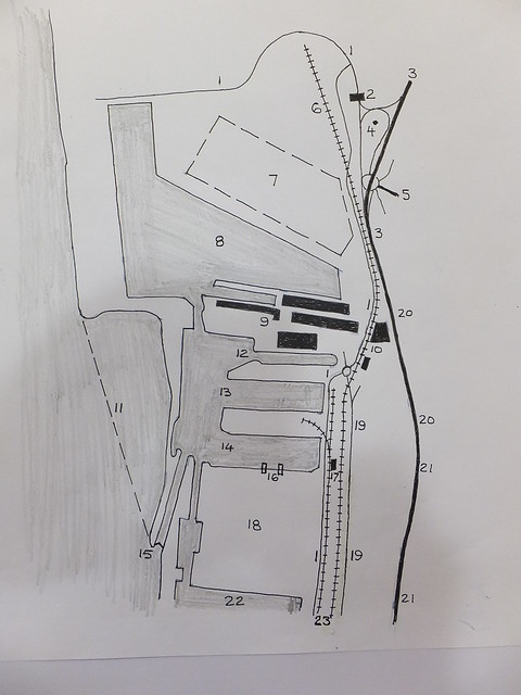
Sketch Map of Part of Liverpool Docks


Gladstone and Royal Seaforth Docks in 2014. For explanation of the reference numbers, see the table below.

Ref Description
1 Dock access roads.
2 Main Entrance.
3 A565 Dual Carriageway (Crosby Road South).
4 Landscape feature (preserved buoy).
5 Princess Way.
6 Royal Seaforth Container Terminal Railhead.
7 Hardstanding for Shipping Containers.
8 Royal Seaforth Dock.
9 Soybean Crush/Refine and Imported Feed Ingredient Terminal S2 (Cargill).
10 Seaforth Corn Mill (DACSA).
11 New Quay under construction for 'Liverpool2'.
12 Gladstone Branch Dock No. 3 (formerly Gladstone Graving Dock).
13 Gladstone Branch Dock No. 2.
14 Gladstone Branch Dock No. 1.
15 Gladstone Lock (now single pair of gates).
16 Unloading Cranes for loose materials at Liverpool Bulk Terminal.
17 Rail Loading Facility at Liverpool Bulk Terminal (a separate facility allows road vehicles to be loaded).
18 Liverpool Bulk Terminal.
19 Northern part of Regent Road (no public access).
20 A565 Dual Carriageway (Rimrose Road).
21 A565 Dual Carriageway (Derby Road).
22 Alexandra Dock.
23 Dock railway lines (Peel Ports).
24 Canada Graving Dock.

Walking past Gladstone Docks in 2014
In the earlier post here, I explained how my walk northwards had to continue along the dual carriageway A565 (which changed its name as a proceeded, first from Derby Road to Rimrose Road and then to Crosby Road South).

I was now level with the massive Gladstone Dock, planned in the early twentieth century. Gladstone Graving Dock was the first to open, in 1913. The rest of the dock, with its two branch docks, opened in 1927. The lock 1,070 feet long and 130 feet wide connecting Gladstone Dock with the River Mersey was intended to take the largest ships afloat.

I knew that, some years earlier, the southern quay of Gladstone Branch Dock Number 1 had been converted as E.on's Liverpool Bulk Terminal (LBT) for the import of coal. E.on claim:-
"LBT is capable of handling five million tonnes of coal from vessel to stock and then reclaiming to rail or road loading hoppers. A major feature of the Terminal design is the environmental controls designed to minimised coal dust emissions. This involves dust suppression sprays fitted on fixed conveying plant and around the coal stockyard. In addition a water bowser is used for spraying coal stocks to prevent dust. The Terminal is designed to store, treat and reuse water. The drainage system has been designed to collect all water run-off from around the site into a large concrete sump. The water is then pumped through a water treatment system that removes the solids and stores the clarified water ready for reuse. All water discharged into the dock complies with consent limits imposed by the Environment Agency".
As more recent legislation makes the use of coal ever more unattractive, E.on committed around twenty million pounds Sterling to convert LBT so as to allow import of wood pellets as an alternative fuel.

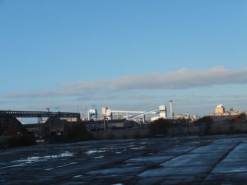
View of Liverpool Docks looking north from Nelson Street. The white enclosed conveyors, white transfer towers and blue grab cranes are part of the LBT.

The main contractor for the 'biomass' handling modifications was Hargreaves Industrial Services and there's a little more information here. Fire detection and suppression systems are provided on the conveyors - there's more information here. To ensure the large unloading cranes are used safely, wind speed and direction are continuously monitored - there's a little information here. The massive fabric-clad warehouse for 'biomass' has a skeleton steel framework designed and installed by the UK division of De Boer Structures and the tensile fabric covers were provided by Base Structures. There's a description of the warehouse here.

The biomass facility was commissioned in 2013 and is intended to handle fuel for E.on's Ironbridge power station which has been converted to use Biomass, extending its life to 2015 as described here.

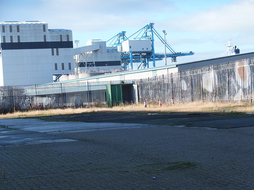
View of Liverpool Bulk Terminal from Rimrose Road, showing the white transfer towers, conveyor and blue grab cranes.

By this time, I was flagging a little. Fortunately, I'd had the foresight to bring cheese sandwiches with me. I ate these eagerly and, energy levels restored, carried on. I'm afraid I could see neither Gladstone Branch Dock Number 2 nor Gladstone Branch Dock Number 3. Number 3 is actually the former Gladstone Graving Dock, converted to a 'wet dock' and now used by P & O Ferries passenger and freight ferries to Dublin.

Walking past Seaforth Dock in 2014
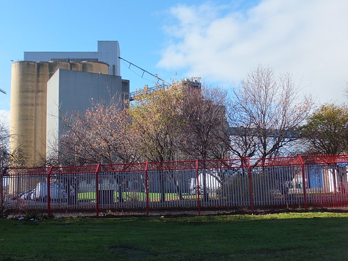
The massive concrete bulk of what appeared to be grain silos appeared on the left, followed by more tall buildings which looked like a corn mill. This was confirmed when I passed the offices, marked 'Seaforth Corn Mill' and 'DACSA'. I'm afraid I had to look up 'DACSA' afterwards. DACSA originated in Spain in 1968 as 'MAICERIAS ESPAÑOLAS SA' and, in 1995, acquired Seaforth Corn Mill which, with a production capability of 960 tonnes per day of raw material, is one of the largest maize mills in Europe.

Part of Seaforth Corn Mill, operated by DACSA.

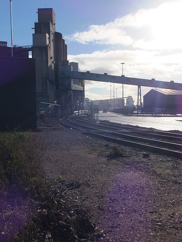
Once I'd passed the Corn Mill, I had a view of the most recent of the Liverpool docks - Seaforth (often called 'Royal Seaforth') - opened in 1972 as a container handling port. The corner of the dock was within 160 yards of the road I was on. The dock railway line passed behind the DACSA mill and ran parallel to the A565, separated by the dock's steel fencing.


Seaforth, looking south. (L-R) rear of DACSA mill, dock railway line, dock road.

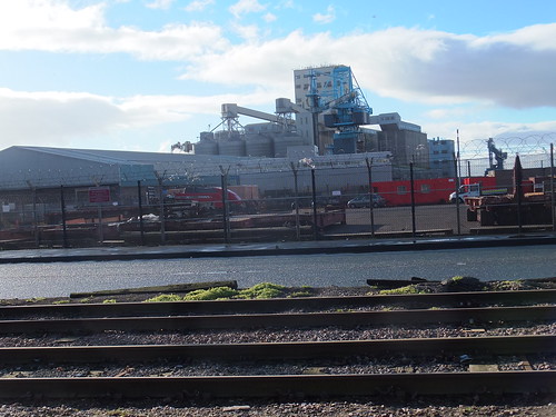
I also had a fairly good view of the south quay of Seaforth dock which was clearly arranged for grain handling. Earlier in the walk that day I'd seen Cargill's rapeseed crush and refinery at Brocklebank. (described in the post here). Now I was looking at Cargill's soybean crush/refinery and imported feed ingredient terminal (S2) at Seaforth Dock. The S2 terminal can unload 650,000 tonnes per annum from bulk carrier ships. The refinery processes crude vegetable oil for "food chain and technical uses".

Seaforth, showing Cargill's soybean crush/refinery and S2 imported feed ingredient terminal.

An ACL container ship (Atlantic Concert, I think) was berthed alongside the north quay of Seaforth dock. Two of the massive travelling dockside container cranes were engaged in unloading or loading containers. A little further along the quay, I could see more container cranes awaiting business, with their jibs lifted clear. There's a brief history of ACL here and useful information on the vessels they operate here.

ACL Container Ship moored alongside the North Quay at Seaforth Dock.

On the landward side of the container cranes there was a large hand-standing area where containers were stored awaiting the next part of their journey. Containers to and from ships can travel by road or rail but I couldn't get a decent view of the rather grandly-titled Royal Seaforth Container Terminal Railhead. It's operated by Freightliner who claim that "with over 37 direct route offerings Freightliner can move maritime containers from the deep sea ports of Felixstowe, Southampton, Tilbury, London Gateway and Seaforth to all major conurbations in the UK". These routes are shown here.

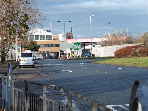
I'd now left the A565 and was on the slip road leading to a large traffic island where passenger and freight road traffic turns off to reach the main dock entrance.

Port of Liverpool, Seaforth Entrance.

Liverpool2

I could see none of the activity creating a new quay on the river side of Seaforth Dock which Peel Ports proudly call 'Liverpool2' which will be able to handle larger 'Post-Panamax' container ships. There's more information here and an excellent explanation of the terms 'Panamax' and 'Post-Panamax' in Wikipedia here.

More exploration in Liverpool and Birkenhead

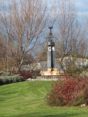
Happy with what I'd been able to see, it was time to walk inland and head for the nearest station. As I made my way across the complicated junctions, a 'landscape feature' caught my attention - a withdrawn navigation buoy set in the ground as the centre piece of some rather attractive landscaping.


The two metal triangles at the top of the buoy are the "topmark" and indicate that this was used as a West Cardinal Mark, meaning ships should pass to the west of the buoy.

To reach the nearest railway station, I joined Princess Road inland. In November 1984 Princess Anne opened Liverpool Freeport comprising a number of docks (Royal Seaforth, Gladstone, Hornby, Alexandra and Langton) where ships do not pay customs duties or taxes. I wondered if the road name commemorates this visit.

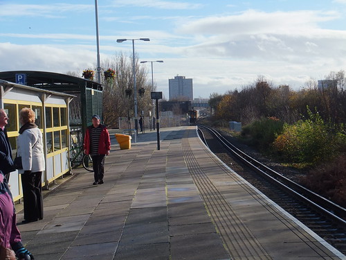
Seaforth and Litherland Station is now a simple island platform on Merseyrail's Northern Line. Formerly, this was quadruple track and a junction south of the station allowed some Liverpool Overhead trains to terminate here, rather than at Seaforth Sands.

Seaforth & Litherland Station, looking south with a Southport train approaching. The overbridge in the background carries the North Mersey Branch over the Southport Line.

I caught the next southbound train, changing at Liverpool Central for the Wirral Line. I followed the (almost compulsory) pattern of alighting at James Street, walking to the Museum of Liverpool to check if the 'Lion' locomotive was safe (it was) and then taking the Mersey Ferry to Birkenhead, with an intermediate stop at Seacombe. As always, I enjoyed being on the water but, my, the wind was cold.

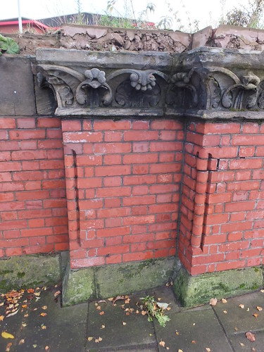
I disembarked at Birkenhead to take some pictures of the remaining section of wall which supported the arched roof at the long-gone Birkenhead Woodside station, following a previous visit described here. There's a post about the station - Services to Birkenhead Woodside in Steam Days.


Surviving brickwork and carved stonework from Birkenhead Woodside station.

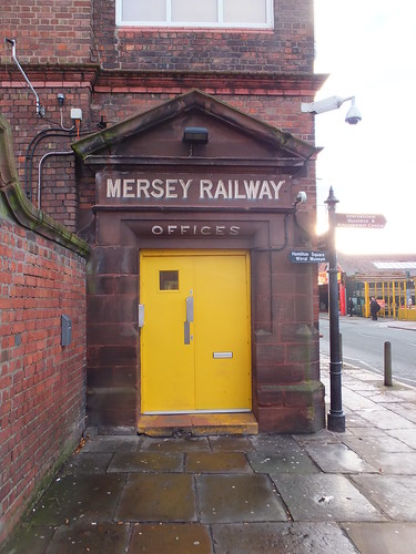
On a previous trip, I had learned that Birkenhead Hamilton Square station would be closed for refubishment but I decided to walk to the station and see what the rail replacement bus service was like. By the time I'd worked out where the pick-up point was, a bus was approaching so I hopped on and headed off for Liverpool Central. I was quite taken with the carved portal to the 'MERSEY RAILWAY OFFICES', less so with the horrible modern doors and all the cables and bric-a-brac attached to the walls.


Entrance to the 'MERSEY RAILWAY OFFICES' at Birkenhead Central.

There was a train for Liverpool actually in the platform, so I hurried down the access stairs to catch it and gratefully flopped down in a seat. It was a new experience to run slowly through the deserted platform at Birkenhead Hamilton Square without stopping. By the time my train arrived at Liverpool Lime Street station, I'd decided that I'd had enough adventures for the day and that I should make my way home. That decision was confirmed when I found out that there was a 'London Midland' departure for Wolverhampton in just four minutes, so I made my way quickly to the platform and boarded the train at the end of a tiring but interesting day.

Related posts on this website

Notes on Liverpool and its Docks..
On foot around Liverpool Docks.
On foot around Liverpool Docks (2)

My Pictures

Click on any picture above for an uncropped view or search the albums below for pictures at different resolutions which may be downloaded for non-commercial purposes.

Liverpool Docks.
Liverpool.
Merseyrail.
Birkenhead and its Docks.

Tuesday, 9 December 2014
Bagan Medical Clinic

This report is based on information from Doctor Hla Tun, who also supplied the photographs.

The previous report showing monthly statistics covered the period up to the end of March 2014, when the total number of treatments since the Clinic opened on August 6, 2011 was 100,203.

Treatment Summary

The table below summarises the number of treatments per month from April to October in 2014 and the total number of treatments since the clinic opened on August 6, 2011.
Month Treatments in month Total treatments
April 2014 1,070 101,273
May 2014 2,691 103,964
June 2014 1,921 105,885
July 2014 2,233 108,118
August 2014 3,425 111,543
September 2014 3,471 115,014
October 2014 3,787 118,801

Monthly notes

April

The Bagan Clinic was closed for two weeks during April, because of the important Water Festival and New Year, which is why the number of treatments in the month is below the average.

September

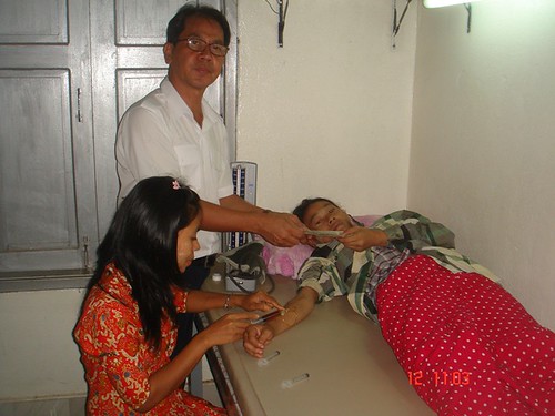
The picture below shows a 28 year old lady came to the clinic with dyspnea (breathlessness) which she had suffered since the birth of her daughter four months previously. Her delivery had been at home with a traditional birth attendant, being unable to afford a hospital delivery. She displayed pallor and an ECG indicated ischemia. Her haemoglobin level was 7.7 gm% (which should have been more than 10 gm%) and she was also malnourished. She required blood tests, ECG test and medicine (costing the equivalent of 16 USD) and hospitalisation, which she said she could not afford. She lived around 120 miles from the Bagan clinic and had travelled by train with her daughter and mother in law (at a cost of around 7 USD per person since travel by truck would have been around the equivalent of 12 USD each). No charge was made for the treatment at Bagan and, to give mother and daughter a chance of survival, a donation of the equivalent of 50 USD was made for her hospitalisation.


October

A lady attending the clinic from a village around 130 miles away had covered her umbilicus with tape, with the intention of preventing motion sickness on the journey. In general, road conditions in Burma can be poor and journeys to the clinic can take anything up to 8 hours. Dr. Hla Tun comments that he has seen this technique adopted before, in both children and adults and, of course, these patients are also suffering from underlying health conditions.


The photograph below shows the progress on a new shelter for patients at Bagan which will shortly be completed.

A new shelter for patients at Bagan nears completion.

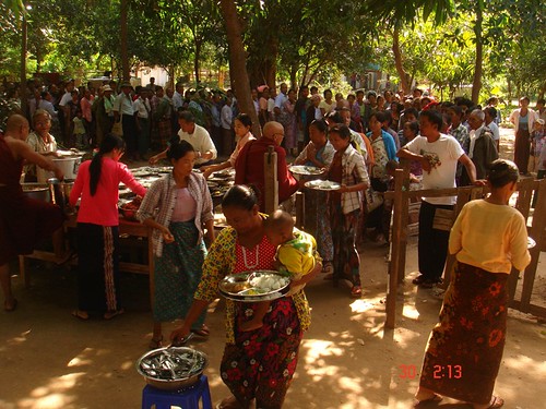
On Clinic Days (Friday, Saturday and Sunday), the Head Monk, in co-operation with the ship 'Road to Mandalay' and Donors ensures that patients and their companions are served a free lunch.

Patients and their companions receiving a free lunch.

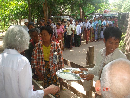
On 4th October, one of the Donors helped to serve over 200 free lunches to waiting patients.

Free lunch being served to waiting patients.

Other posts on medical support in Myanmar

There are a number of posts in this Blog describing medical support in Myanmar provided by the RTM Social Contribution with help from donors around the world. You can find them all here.

Photographs

There's a collection of pictures showing the Bagan Clinic from its inception here.

Doctor Hla Tun's photographs showing the work of the Bagan Clinic in 2014 are here.

Friday, 28 November 2014

On foot around Liverpool Docks (2)

Introduction

In the post On foot around Liverpool Docks, I described a walk along Regent Road from Sandhills south to Pierhead. I resolved to continue the exploration by returning to walk from Sandhills north to Seaforth. The weather forecast for Saturday 22nd November 2014 looked promising so, anticipating that this might be my best chance to make the walk before the New Year 2015, I made the familiar journey to Liverpool by bus to Wolverhampton, Virgin train to Edinburgh as far as Crewe and then a very crowded London Midland 'Desiro' to Liverpool (I could have caught the London Midland service from Wolverhampton but the Virgin train came first, so I took it, to avoid waiting around at Wolverhampton. Of course, that meant waiting around at Crewe but Crewe still hasn't quite lost its magic for me). I left the London Midland train at Liverpool South Parkway, purchased a Merseytravel All Routes 'Saveaway' ticket and boarded a Merseyrail third-rail electric train for Southport, getting off at Sandhills.

Aerial view of Huskisson Dock in 1949


Huskisson Dock in 1949. The Liverpool Overhead Railway and Regent Road run L-R near the middle of the photograph. L-R the docks are Canada Branch Dock No. 2, Canada Graving Dock, Canada Branch Dock No. 1, Huskisson Branch Dock No. 3 with Huskisson Dock bottom right (Click on the image for a slightly larger version).

Sketch Map of part of Liverpool Docks in 2014


Sketch Map of part of Liverpool Docks in 2014. For explanation of reference numbers, see the table below.

Ref Description
1 Gladstone Dock.
2 Gladstone Lock (now single pair of gates).
3 Bulk Materials Stockyard.
4 Dock railway lines (Peel Ports).
5 Regent Road.
6 Derby Road.
7 Railway to Southport (Merseyrail).
8 Bootle New Strand Station (Merseyrail).
9 Alexandra Dock.
10 Leeds and Liverpool Canal.
11 Limit of public access to Regent Road.
12 Bootle Branch (Network Rail).
13 Nelson Street.
14 Bootle Oriel Road Station(Merseyrail).
15 Alexandra Dock Tunnel (283 yds).
16 Langton Dock (Langton Branch, Langton Graving 2, Langton Graving 1 Docks filled-in).
17 Millers Bridge.
18 Brocklebank Dock.
19 Filled-in Dock (Carrier).
20 Langton Lock (now a single, transverse gate).
21 Filled-in Dock (Brocklebank Graving).
22 Canada Branch Dock 3.
23 Canada Branch Dock 2.
24 Canada Graving Dock.
25 Canada Branch Dock 1.
26 Bankfield St.
27 Bank Hall Station (Merseyrail).
28 Oriel Road Tunnel (288 yards).
29 Railway to Kirkdale and Aintree (Merseyrail).
30 Huskisson Branch Dock 3.
31 Reinforced concrete Transit Shed.
32 Tyle Street.
33 Bankhall Lane.
34 Huskisson Branch Dock 1.
35 Sandon Half-Tide Dock.
36 Former Sandon Dock (now filled-in and United Utilities Liverpool Wastewater Treatment Works).
37 Sandhills Lane.
38 Sandhills Station (Merseyrail).
39 Sandhills Signalling Control Centre (Merseyrail).
40 Railway to Liverpool and Hunts Cross (Merseyrail).
41 Bootle Junction (crossovers between Merseyrail and Network Rail Bootle Branch.
42 Automatic Level Crossing type AOCL (Network Rail).

A walk along Regent Road in 2014

I walked down Sandhills Lane towards the docks until I reached Regent Road and then turned right heading north towards Seaforth. Whilst the docks from here south towards Pierhead remain divided from the dock estate by tall boundary walls, the docks towards Seaforth are segregated by more modern steel fencing.

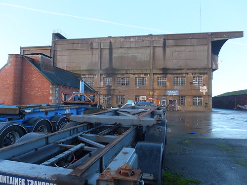
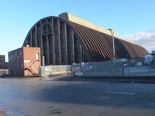
The first sight on my left was the end view of the ugly bulk of the reinforced concrete transit shed built to serve the north quay of Huskisson Branch Dock 1. In faded white letters, I could just make out the painted identification 'North Huskisson Branch Dock No. 1'. I presume the raised part of the roof on the left carried one rail used by the group of moveable electric cranes (all gone) which originally were used to unload and load cargoes. The concrete awning on the right would have provided some weather protection to road vehicles loading and unloading. A smaller sign identified the Mersey Docks and Harbour Company's 'Engineers Department' (untroubled by an apostrophe). With concrete crumbling from the walls, it all looked pretty derelict, I'm afraid. In the foreground, a smaller brick building with stone detailing looked as good as new and must be a contribution by the remarkable Jesse Hartley dating from the dock's construction in 1852 [No - it looks new because it's a local control room built as part of the Mersey Estuary Pollution Alleviation Scheme (MEPAS) and only around 30 years old - more later].

Transit Shed for Huskisson Branch Dock No. 1.

Looking north, I could see a similar transit shed associated with Huskisson Branch Dock No. 3. Huskisson Branch Dock No. 2 had clearly been filled in (as have a number of Liverpool's docks), but it was only when I checked the Wikipedia entry here that I discovered the grisly explanation. In 1941, the SS Malakand, berthed in Huskisson Branch Dock No. 2 and carrying 1,000 tons of munitions, exploded killing four people following a fire caused by an earlier air raid. After World War II, these two modern transit sheds were erected and Huskisson Branch Dock No. 2 was filled in.

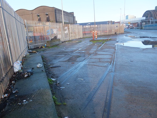
It was here, near the former Huskisson Branch Dock No. 2, that I found a surviving fragment of the double-track dock railway line which formerly ran the length of the docks (much of it beneath the elevated Liverpool Overhead Railway). All the track is 'inset', using tram rail. Two turnouts and a diamond crossing were discernable, all set in concrete. This is the only track I've found in public areas to date. The cover plates adjacent to the pivots of the switch rails were marked 'HADFIELDS SHEFFIELD'. Wikipedia has a little about Hadfields here. Hadfields were renowned for hard-wearing permanent way, following their work on the development of manganese steel, mentioned in Grace's Guide to British Industrial History here.

'Inset' track with points and crossings.

Next, on the right, I passed the Tate & Lyle Sugar Silo, completed in 1957 and now listed Grade II. Now unused, the overhead conveyor across Regent Road from the docks and the associated brick-built transfer tower has been dismantled. English Heritage have an interesting 'slide-show' presentation on the construction of this building here.

The Tate & Lyle Sugar Silo.

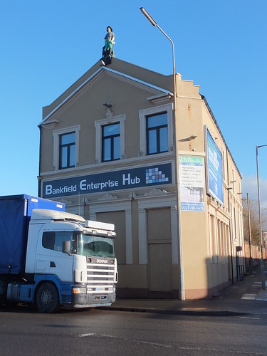
I was now starting to pass Canada Dock (dating from 1859) but I was intrigued by Bankfield Enterprise Hub on my right, and particularly by the statue on the peak of the roof looking out across the river, which represents a woodman with his dog. At one time, this was a public house, the Dominion Hotel, but it has recently been refurbished and now houses various business tenants.


Bankfield Enterprise Hub, formerly the Dominion Hotel.

On my right, I passed the large, modern Administration Centre of S. Norton & Co. Ltd. Their website here states that the company is in "the forefront of British metals recycling, exporting worldwide and earning valuable export income for the country". They talk about their 'eco-friendly' credentials in promoting the use of 'secondary raw materials' (scrap metal) which offers energy savings and pollution reduction compared with producing metals from ore. Metals recycling is now a highly technical industry and, of course, is covered by the European Union's Industrial Emissions Directive 2010/75/EU. If you want an idea of the complication behind metal fragmentising, read the Mayer Enviro report here. Behind the Administration Centre, I spotted a couple of metal fragmentising plants which appeared to feed a conveyor on a bridge across Regent Road.

The offices of S. Norton & Co. Ltd, with an overhead conveyor in the distance.

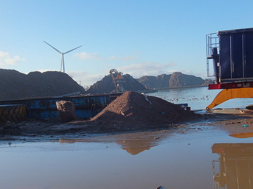
An indication of the firm's output could be gained because each of the quays around Canada Dock appeared to be covered with a lunar landscape of huge mountains of metal fragments.

An unidentified former passenger ferry (presumably awaiting the attentions of ship breakers) with mountains of metal fragments behind. Canada Graving Dock is in the foreground. The brick building on the far right appears to be the pumphouse once used to empty the Graving Dock.

Mountains of metal fragments around Canada Dock. Note the huge tracked grab crane on the far quay, the wind turbine and (just visible) a ship probably awaiting scrapping.

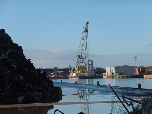
I found the floating crane 'Lara 1' moored in Canada Branch Dock No. 3. She is operated by Hapo International Barges and there's more information on their website here. Fitted with a FIGEE electric offshore crane, she can lift up to 250 tons. Propulsion is by two electrically driven Voith-Schneider propellors. For more technical information on the Voith-Schneider system, there's a report here. I'd first come across Voith-Scheider propellors in 2008, on the river cruise ship Road to Mandalay. On 'Lara 1', power is derived from two 806 KW Ruston/Brush generator sets.

Floating crane 'Lara 1' moored in Canada Branch Dock No. 3. Note the red and green navigation buoys on the quayside.

Brocklebank Dock dates from 1862 but it was originally named Canada Half-Tide Dock. Both Brocklebank Graving Dock and Carrier Dock have been filled in and the area is now occupied by Cargill, a large American-owned international company founded in 1865 I'm ashamed to say I'd not heard of. They're involved in a wide range of foodstuffs, agricultural and industrial products. The Cargill Brocklebank plant is a rapeseed crush facility and refinery. The sign at the gate read, cryptically, 'Cargill GOSCE CROE'. Well, after a little hunting, I found that GOSCE refers to Cargill's Grain and Oilseeds Supply Chain Europe and CROE to Cargill Refined Oils Europe. There's an interesting Cargill Liverpool document you can download as a PDF 'Cargill Liverpool Answers to Frequently Asked Questions' from here (although I deprecate their use of the ugly construct 'Answerannaire' to describe it).

Cargill Brocklebank with part of the refinery in the background.

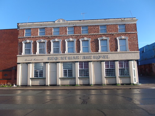
Directly opposite Cargill's refinery, rather improbably, stands the 2-star Regent Maritime Hotel, built in 1864.


The Regent Maritime Hotel.


Next, Brocklebank Dock came very close to Regent Road and moored in the dock was 'Seatruck Panorama'. I'd seen this 'Roll-on, Roll-off' ferry before at Heysham on 14th December 2013, described in my post Return to Heysham. Seatruck Ferries is a dedicated Irish Sea freight ferry company. The bunkering barge 'Mersey Endurance' lay alongside the ferry, which had an open access door in the side of the hull, so I assumed the ferry had replenished its fuel tanks.

Brocklebank Dock with 'Mersey Endurance' alongside 'Seatruck Panorama'.

'Seatruck Panorama' is a 'P' series ferry, comprehensively described in the document here. Access to the lorry decks on these ferries is via stern doors and the picture below shows the cavernous main deck and, on the port side, the ramp to the Weather Deck. An internal ramp leads from the Main Deck to Tank Tops.

'Seatruck Panorama' berthed with stern doors open.

Since Seatruck Ferries is a freight operator (carrying only the lorry drivers as passengers), there is no fancy passenger terminal and a series of prefabricated buildings provide quayside accommodation and security at the gates.

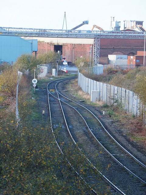
Although Regent Road stretched ahead of me into the distance, I had come to the limit of public access at Peel Ports gates. As it happened, the gates were open and two security men, each with a car, were chatting. I talked to them for a few minutes and they explained that it's unusual for these gates to be open, which I believed since there was no security hut. So I took Nelson Street inland to the busy Derby Road. The only rail connection to Liverpool Docks is now Network Rail's Bootle Branch which emerges from Alexandra Dock Tunnel, passes under Derby Road still double track, becomes single and then crosses Regent Road on a level crossing with lights (type AOCL). Beyond the level crossing, the single line becomes Peel Ports responsibility, splitting into various sidings which run north parallel to and on the river side of Regent Road. In the distance, I could just see a stabled main line freight locomotive (a Class 60, I think).


View of the level crossing from the Derby Road bridge. Note the railway signal facing approaching trains (which displayed a flashing red) and the 'spring' points. One of the twin flashing lights on Regent Road is also visible in the picture.

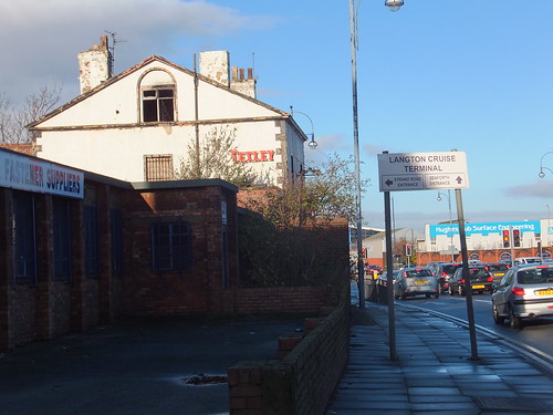
I continued north on Derby Road, but could see little of Langton Dock, opened in 1881. In particular, I could see no sign of Langton Dock's once-grand pumphouse, placed on the Victorian Society's Endangered Buildings List and briefly described here. Langton Dock had various alterations in the twentieth century, culminating in a major re-arrangement of access to the river via Langton Lock in 1962. Occasionally, Langton Dock was used as a cruise liner terminal, after the Princes Landing Stage was taken out of use in 1973. In 2013, a new Cruise Terminal was constructed near Pierhead and the Langton Cruise Terminal is no longer used (although the road signs are still in place).

Junction of Derby Road and Strand Road. Note the obsolete sign to Langton Cruise Terminal.

I couldn't see much of Alexandra Dock either, but I did recognise the futuristic lines of the Isle of Man Steam Packet Company vessel Manannan, which I guessed was laid up over winter. The Strand Road entrance gates to the Port of Liverpool were firmly locked. Nearby, the oddly-named 'Rubber Duck' public house stands next to what remains of the Harland and Wolff works, which appears to now be mainly used for self-storage.

Former Harland and Woolff works in Strand Road, Bootle, with the 'Rubber Duck' public house on the left. The Harland and Wolff Engineering Offices were in Regent Road and, I believe, were only demolished in 2013.

The next dock to the north was Hornby Dock, opened in 1884 but now filled in so I could see nothing from Derby Road. It was the last of the nineteenth century docks built in Liverpool.

My description of the rest of the walk is in the post On foot around Liverpool Docks (3).

Related posts on this website

Notes on Liverpool and its Docks..
On foot around Liverpool Docks.
On foot around Liverpool Docks (3).

Books

[1] 'Jesse Hartley - Dock Engineer to the Port of Liverpool 1824-60' by Nancy Ritchie-Noakes, published by National Museums and Galleries on Merseyside (ISBN 0 906367 05 0).
[2] 'L.N.W.R. and the M.D.& H.B. - The History of the Dock Lines from the Records' by J. C. James, Limited Edition published c1981.
[3] 'Liverpool and its Canal' by Mike Clarke and Allison Hewitt published 1992 by Merseyside Port Folios (ISBN 0 9516129 3 X).
[4] 'An Illustrated History of Liverpool's Railways' by Paul Anderson, published Irwell Press (ISBN 1-871608-68-6).

My Pictures

Click on any picture above for an uncropped view or search the albums below for pictures at different resolutions which may be downloaded for non-commercial purposes.

Liverpool Docks.
Liverpool.

[15-Dec-2014: Corrections]

Thursday, 27 November 2014

Twilight Storytelling Walk around Brewood

On 26th November 2014, Brewood Libraries organised a 'Twilight Storytelling Walk around Brewood'. This was an initiative by the Libraries and Arts Service of Staffordshire County Council. Michael Reynolds (Library Development Officer) had written a suitable mystery/horror story titled "A Recent Acquisition" and, dressed in period costume, he was the narrator of the tale.

A party of 25 met up at Brewood Library at 3.30 p.m. and were conducted through the village by Michael and library staff to Brewood Hall, where the main gates had been opened, allowing the visitors to be greeted at the front door by Jan (in a Victorian dress).

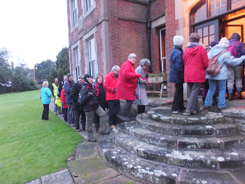
The visitors gathered in a semicircle on the lawn around Michael as he told his story. Then the whole party moved round to the side of the house so that the door to the Ice House was visible for the next part of the story. Michael then led his audience into the house for the last part of the story (this was fortuitous as it was starting to drizzle).

The audience entering Brewood Hall.

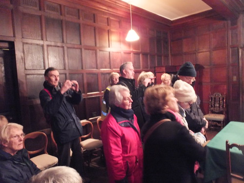
The audience then moved into the oak-panelled Dining Room for the climax of Michael's grisly story.

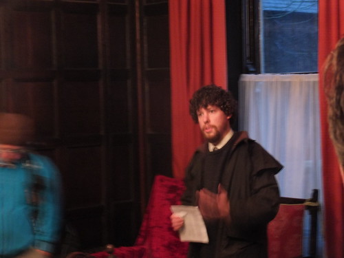
The audience pay close attention as Michael finishes his tale.

Michael Reynolds, Author and Narrator.

The whole party, expressing their appreciation for the use of Brewood Hall, were then led back to Brewood Library, where I understand hot soup and rolls were available. Later in the evening, there was a well-attended lecture at the Library.

Brewood Library have received many favourable comments regarding this initiative, one of the most common being "When are you doing it again?"

You can read more about Brewood Hall and various events held there over the years here.

My pictures

Twilight Storytelling Walk around Brewood.

Friday, 21 November 2014

A Weekend in Vienna (Part 4)

In November 2014, I spent a weekend in Vienna with my friend Rita. We decided to visit Schoenbrunn Palace on Sunday morning. Schoenbrunn Palace was the summer palace built for the Habsburg dynasty which ruled for around 600 years. For more information about this important royal family, try the Encyclopedia Brittanica article here. Schoenbrunn is now a World Heritage Site. The Wikipedia article here gives a good impression of the site. The official Schoenbrunn web site is rather commercially oriented.

Trip to Schoenbrunn Palace, Sunday morning, 9th November 2014

Since our 'Red Route' Big Bus Tour the previous day (described in Part 3) had been a success, we used the 'Blue Route' Big Bus Tour to get to Schoenbrunn. There's a map of Vienna showing the 'Blue Route' here.

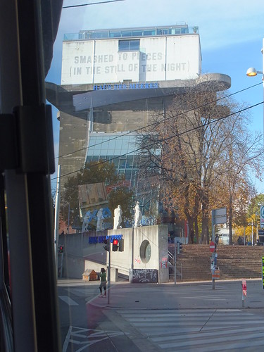
After a generous breakfast at the Ambassador Hotel, we walked to the usual bus stop in the Walfischgasse to catch the ten o'clock Big Bus. The bus joined the clockwise Ringstrasse before taking a left turn into Mariahilferstrasse. At Esterhazypark, we passed another World War II Flak Tower (we'd encountered one the day before as described in Part 3). The tall, rectangular concrete tower would have been striking in any case but this one was brought back into use in 1957 as an aquarium, the Haus des Meeres with a lean-to glazed section. Even more striking is the artwork by conceptual artist Lawrence Weiner in 1991 - the top section of the building has been painted white with the slogan 'SMASHED TO PIECES (IN THE STILL OF THE NIGHT)' added in large block capitals in both English and German.


The former Flak Tower in Esterhazypark, now the 'Haus des Meeres'.

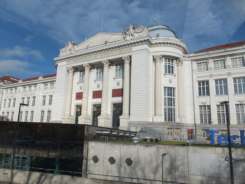
We continued through the prosperous West End of the city, eventually passing the Technical Museum on our right. Their website is here.

The Technisches Museum.

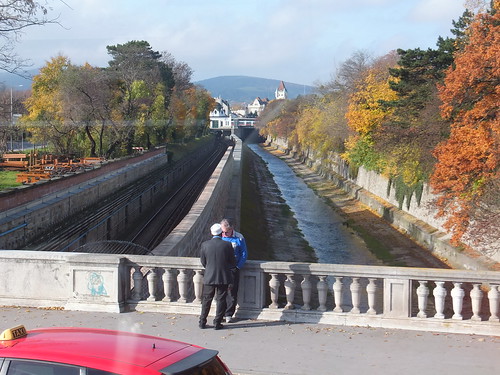
The sun brightened, revealing the glowing autumn colours of the trees which (in contrast with England) still retained most of their foliage. Our route crossed a subway line (U4) and a drainage channel but it looked quite rural as we approached Schoenbrunn Palace.

A rural scene near Schoenbrunn Palace.

We drove past the entrance to the Schoenbrunn Palace, which is flanked by two tall obelisks and opens onto a large courtyard with the rear elevation of the main palace building beyond. Schoenbrunn is reputed to be the most popular tourist attraction in Austria, so I was not surprised to see lots of people around. Our bus continued on the public road about 400 metres to the car park and bus unloading point. Rita and I joined the crowds walking towards the palace entrance. Surprisingly, entrance to the park and gardens is free, but palace tours and other attractions require payment.

Just inside the entrance, we found a large ticket office. This was heaving with people, making it difficult to work out what our options were. A rather harassed lady was manning an enquiry desk so we queued for a minute or two but, before we got to her desk, she abandoned her post. There seemed to be three different channels, one for automatic ticket machines (the machines themselves were invisible because of the crush of visitors), one for a series of ticket windows manned by sales staff and one for groups and others with pre-booked tickets. Then we realised that the 'pre-booked' channel also provided access to a small cafe area which was fairly quiet, so we opted for a drink first. Waiter service is still usual in Vienna - a very pleasant change from the self-service common in England. As we watched the adjacent queues, the crowding seemed to become worse, not better, so I volunteered to sort out the tickets.

The lady from the enquiry desk was now standing near the entrance and appeared to be shepherding all newcomers to the queue for the ticket windows. After a little thought, I decided to join the ticket machine queue which appeared to be smaller and I thought should move quicker. As my queue slowly shuffled forward, I could see that there were five modern touch-screen ticket machines. Tickets were not being issued as quickly as I'd hoped, because most people seemed to be having trouble and often going back to the start of the ticketing process. I suppose this is very similar to the problems people encounter using automatic ticket machines in England. I carefully watched people on different machines to see how they worked. There was a range of languages available, a restricted range of tickets (compared with the ticket windows) and credit cards were accepted. When my turn came, I was able to purchase our tickets quickly and without error. By this time, Rita was checking out the souvenir shop.

Schoenbrunn: View from the courtyard, looking back towards the main entrance.

We'd elected to take the 'Imperial Tour', visiting 20 rooms in the palace, as opposed to the 'Grand Tour' taking in 40 rooms. We crossed the courtyard and, after some confusion on my part, found the correct entrance to the palace building, joining another queue waiting to enter the tour proper. Audio Guides or a written description of the tour were available. Rita took the Audio Guide whilst I elected for the 'hard copy'. Photography is prohibited inside the palace so I've no record of the rooms we inspected but it was an interesting tour. In fact, when we finished our tour, Rita was all for extending our ticket to see the other 20 rooms! However, by the time Rita had examined the extensive souvenir shop and we'd arranged our return to the ground floor by lift, Rita was happy to see part of the gardens instead.

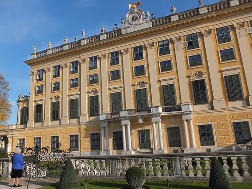
Rita studies the garden elevation of the palace.

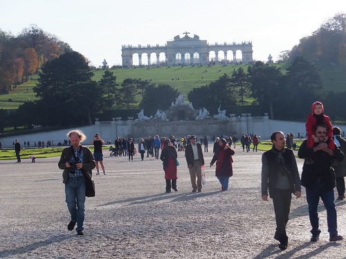
View from the palace, looking towards the Gloriette on its imposing hilltop site.

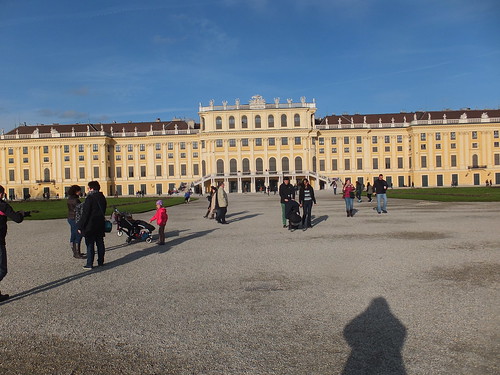
A view of the courtyard elevation of the palace, taken as we left.

The bus on the 'Blue Route only runs every hour, so we decided to conclude our visit and hurry back to to bus stop. We only had a few minutes to wait before the bus picked us up. The bus uses a different route on the return, so we saw a little more of the city. We passed the recently-modernised central railway station and stopped at the huge brick and stone bulk of the Arsenal. This complex is now home to the Museum of Military History, Vienna. The museum's official website is here.


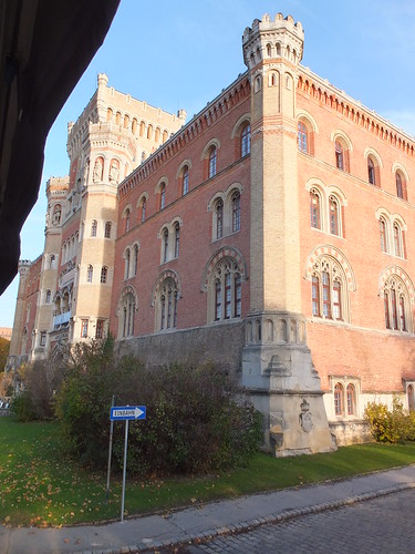
The Museum of Military History, Vienna

The final bus stop before the city was at the Belvedere, two magnificent 18th century palaces built as the summer residence for Prince Eugene of Savoy (1663-1736). The Belvedere has a splendid, comprehensive website here including history, illustrations of the sumptuous interiors and details of the various art exhibitions held here. From the website, I even learnt about the group of Austrian artists formed in 1899 called the Hagenbund.

View from Gurtel Landstrasse of the Belvedere gardens showing the lake and, in the background, the Upper Belvedere Palace.

We were now back on familiar territory. Our bus passed the Soviet War Memorial, negotiated the Schwartenplatz with the Palais Archduke Ludwig Viktor on our right and finally alighted in the Walfischgasse.

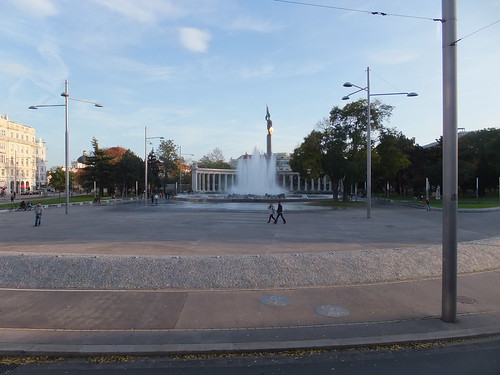
The Soviet War Memorial.

However, we were not finished yet. In a few minutes, a 'Red Route' Big Bus arrived and we set off for the Danube Tower, which I'll describe in the next part.

Related posts on this website

A Weekend in Vienna (Part 1).
A Weekend in Vienna (Part 2).
A Weekend in Vienna (Part 3).
A Weekend in Vienna (Part 5).

Books

[1] 'Imperial Vienna' by Lina Schnorr, published by H.B. Medienvertrieb GesmbH (ISBN: 978-3-9502396-9-0).
[2] 'Vienna: Art and Architecture', by various authors, published by h.f. ullmann (ISBN 978-3-8331-6006-6).

My Pictures

Click on any picture above for an uncropped view or search the albums below for pictures at different resolutions which may be downloaded for non-commercial purposes.

The albums below relate to this post:-
'Blue Route' City Tour.
Schoenbrunn Palace.

The collection below includes all the albums on the Vienna trip:-
Austria.