skip to main |
skip to sidebar
Peak Rail Santa Specials operate from Rowsley, where all passengers board and alight, to Matlock Town. 'Technical' stops are made at Darley Dale in both directions. In 2016 trains were operated 'top-and-tail' by visiting locomotive 'Ring Haw' (0-6-0ST Hunslet 1982 of 1940) at the south end of the train and either resident Class 31 or Class 44 diesel-electric at the north end. Jan was rostered as the driver of 'Ring Haw' on Tuesday 20th December and Thursday 22nd December.
Events of Tuesday 20th December 2016
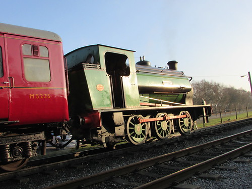
'Ring Haw', highlighted by the afternoon sun, ready to start the last train of the day from Rowsley on 20th December 2016.
I was rostered with Keiron R. as fireman, working with 'Penyghent' at the north end. The load was six passenger coaches plus a 'BG' luggage van to store the presents which Santa Claus would distribute to the visiting children. 'Ring Haw' rather appealed to me. It is a '14-inch Hunslet', less powerful than the 'Austerity' 0-6-0ST locomotives (which were based on the '16-inch Hunslet'). It served at the Nassington Iron Ore Mine near Peterborough until withdrawal in 1970. It is now based at the North Norfolk Railway and the owners limit its use to the equivalent of a 4-coach load so 'diesel banking' was specified on parts of the Peak Rail route. Following clearance by the Railway Inspectorate, it was also specified that the diesel locomotive would create the vacuum brake even when 'Ring Haw' was working the train, so the vacuum ejector in the cab of 'Ring Haw' was simply used the driver's brake application valve.
Whilst 'oiling round' I had plenty of time to notice the similarities with the 'Austerity' tank locomotives - two inside cylinders with slide valves operated by 'Stephenson' Link Motion.
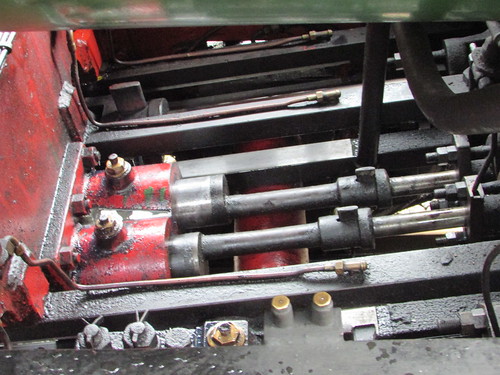
'Ring Haw' at Peak Rail: View from right-hand foot framing, showing slide bars and valve rods.
As far as lubrication is concerned, a number of conventional oil cups with trimmings and oil holes have been retained but a large mechanical lubricator is now fitted to 'Ring Haw' serving not only the cylinders and the regulator in the dome but also the axleboxes, slide bars, piston and valve glands via copper pipes fitted with the appropriate non-return valves. Oil with an SAE of 680 is used in the mechanical lubricator.

'Ring Haw' at Peak Rail: Mechanical lubricator mounted on the left-hand foot-framing.
Unusually, the axlebox hornguides are grease lubricated from a separate system fed from grease nipples mounted along the top of the main frames.
The saddle tank is pierced by the dome which accommodates the regulator. Externally, the dome mounts two Ross 'Pop' safety valves side-by-side together with a high-toned whistle. The saddle tank does not extend over the smoke box.
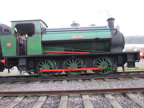 'Ring Haw' at Peak Rail
The cab layout is typical of industrial locomotives - right hand drive with a two-handled regulator, steam brake valve capable of being operated from linked handles on either side of the cab, two gauge glasses and two Davies and Metcalfe backhead injectors. The Davies and Metcalfe vacuum ejector and the steam heating shut-off cock with automatic pressure regulator are, of course, features added in preservation.
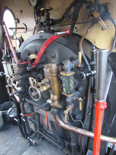
'Ring Haw' at Peak Rail: View of boiler backhead viewed from driver's side of cab.
'Ring Haw' steamed well and was economical on coal and water. Keiron and I had an enjoyable day carrying out four round trips to Matlock Town as we helped to provide the proper 'Santa Special' experience which relies on the work of a large number of volunteers.
Events of Thursday 22nd December 2016
Once again I was rostered with Keiron R. as fireman, working with 'Penyghent' at the north end and the same 7-coach load as on the Tuesday, carrying out four round trips to Matlock Town. 'Ring Haw' gave us no concerns during the day.
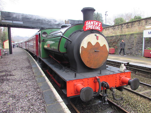 'Ring Haw' at Matlock Town, with 'Christmas Pudding' headboard, ready to be pulled back to Rowsley.
As on the previous Tuesday, we lit the engine lamps for the last round trip as it was already becoming dark (the Winter Solstice had been on Wednesday, 21st December, giving less than 8 hours of daylight). At the end of traffic, 'Penyghent' uncoupled from the train and headed smartly up the loop until clear of the crossover to the Headshunt (which I prefer to call the 'Third Line'). Meanwhile, Keiron uncoupled 'Ring Haw' from the train and, in possession of the Single Line Token, we headed towards Matlock until clear of the South Ground Frame so that Keiron could turn me into the loop. Once clear of the points, I gave three short whistles to Keiron (the old British Railways whistle code for "Clear of All Running Lines") and, once Keiron had rejoined the engine, we followed 'Penyghent' to the North End.
I stopped clear of the road crossing until 'Penyghent' passed us, heading for Shed Road 2 then I followed suit and we also stabled on Road 2. Whilst we went about disposal duties, Harvey C. used the Bucket Loader to refill the bunker ready for the following days service. Then it was complete the paperwork, sign off and return home.
My Pictures
'Ring Haw' at Peak Rail.
I'd kept up to date fairly well until our second encounter with the "Drake", then contemporary posts stopped briefly until the sea (and my digestion) had settled. Once we arrived at Ushuaia, there was too much travelling to do other than produce a short version of my exploits. (Do I hear you say "For this relief, much thanks"?). However, now I am safely back home, I intend to expand the reports on the last, hectic days of my marathon trip.
Events of Thursday, 1st December
I woke at 2.30 in the morning, aware that something had changed, although it took my addled brain a few moments to work it out: The erratic lurches of the ship had been replaced by a regular rocking, still quite strong but far less unsettling. By morning, the situation was quite tolerable and the dining room filled up for breakfast. Matters continued like this throughout Thursday.
Events of Friday, 2nd December
We docked peacefully at Ushuaia but guests were required to leave the ship shortly after 8.39 a.m. because the crew had to prepare for another shipful of guests arriving later that day. I took the Silversea option of a tour bus all of 200 yards to the town where we had about 90 minutes to explore. I managed to visit two interesting, small museums on the foreshore then it was back on the bus for transfer to the small, modern airport. Having checked in, I waited outside the terminal with some of my new friends. The flight to Buenos Aires was very full and very tedious but, on arrival, I was greeted by a charming young girl and promptly transferred to my hotel, the Plaza. I'd hoped to travel on the city's Metro, also called 'Subte', as it had been some years since I tried it. I discovered it's all been modernised and ticketing is now by a 'credit card' which you 'charge' at any station. After some problems, I travelled on, I think, four of the city's lines. My interest is not purely technical. If you dress inconspicuously, you can 'people watch' and learn about the way of life by observation. By the time I returned to my hotel, I was very tired but pleased.
Events of Saturday, 3rd December
I was collected earlier than I would have wished for my internal flight to the Argentine airport serving Iguassu. The flight was less than two hours and my baggage arrived fairly quickly so I was quite optimistic until I discovered there was no guide. I made enquiries (sometimes another guide can locate the missing person) but, having drawn a blank, I decided after half an hour to make my own way to the hotel. My ignorance of the geography around Iguassu was such that I didn't realise my hotel was on 'Brazilian Side' and we would have to cross the border. Having pre-paid a taxi firm, we set off, went through Argentine Immigration, crossed the River Bridge which forms the actual border and were just conducting formalities at Brazilian Immigration when my missing guide arrived. Luggage was transferred to the new car and we continued to my hotel.
We passed the Helisul helicopter pad and, as the weather was rather overcast, my guide suggested I take my 10-minute flight over the Falls first and I enjoyed that.
The hotel is within Iguassu National Park so we had to stop and pay the park admission fee. We were still not finished. The hotel have their own entrance gate beyond which only certain vehicles can proceed. Oddly, the big buses providing public transport can go but my car couldn't so we had to transfer my luggage again to the hotel Shuttle Bus and I arranged a meeting time (at the gate) of 8.00 a.m. Sunday. At the hotel, I was expected and I was informed that I'd been upgraded to a splendid suite, with small balconies accessed by double=doors, one of which had excellent views of part of the falls. I went outside to watch the sunset but otherwise remained in my room with the balcony doors open, lulled to sleep by the continuous roar of rushing water.
Events of Sunday, 4th December
I quickly discovered why my guide has suggested an early start. We sailed through the border crossing back into Argentina which can involve long queues.
We paid to go into the Argentine National Park and started a walking tour around the top of the Falls.
To be continued ...
Related Posts
Just posts on the Antarctic segment: Antarctic Peninsula.
All posts describing this trip (Chilean, Antarctic, Argentinian and Brazilian sectors): Chilean Fjords.
My pictures
All my pictures taken in Antarctica on both this visit and my earlier visit in 2008 are in the collection here.
I've also made some additions to the 2006 collection on Brazil to show Iguazzu here.
Events of Wednesday, 30th November
We’d spent the previous night at anchor in calm seas just off Deception Island with the intention of letting the unfavourable weather system pass before we entered the unprotected waters of the South Atlantic and the uncertainties of the Drake Passage to reach our destination at Ushuaia.
We raised the anchor at around 6.30 a.m. and initially sailed north with Deception Island on our port side (left), turning west to pass to the north of Deception Island with the main South Shetland Island chain to starboard.
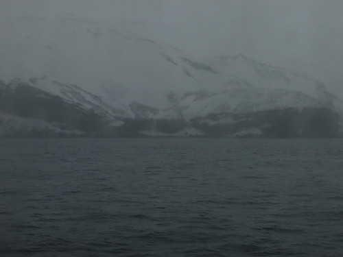
Into the South Atlantic: "the main South Shetland Island chain to starboard".
The wave action was noticeably increased after our turn but conditions were still quite comfortable and I took breakfast as normal, although the restaurant seemed quieter than normal.
I attended the first lecture of the day by Hans Peter talking about Water but, once we were clear of Snow Island, the ship turned northwards to head for Ushuaia, passing through the Boyd Strait between Smith Island (to port) and Snow Island (to starboard). The wave action became significantly greater, with occasional waves much larger than the average. With some difficulty, I made my way through the ship to the restaurant for lunch. There were definitely far fewer people taking a meal and the buffet selection on offer was less than normal. The expedition team estimated the waves at 4 to 5 metres.
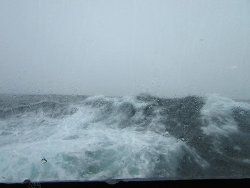
Passing through the Boyd Strait.
The meal was punctuated by the occasional crashing noises as tableware was deposited on the floor in different parts of the restaurant in response to a lurch from the ship. Although I took only a carefully-selected light lunch, a little later I started to feel rather queasy and decided to rest in my cabin, in the hope of attending another lecture later in the afternoon.
The amplitude of the larger waves must have increased further because loose items started to move around in the cabin. All my papers with notes on the trip were swept from the desk and fanned across the floor. Dozing off, I was rudely awakened as an unused wine cooler and cake stand (provided as standard cabin equipment) became dislodged and loudly rattled across the floor. On a few occasions, daylight was suddenly excluded from the cabin for a couple of seconds as a larger-than-normal wave completely obscured the rectangular window. Once, the sea water was thrown against the window with such a loud ‘bang’ that I half-expected the very-thick, toughened glass panel to shatter.
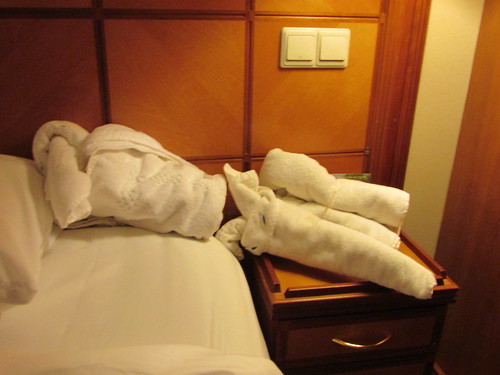
Into the South Atlantic: My elephant 'went to pieces' during the heavy weather.
I didn’t attend the lectures in the theatre, although I did switch the television to channel 9 which gave the sound-track of the lecturer plus the associated slides being displayed in the theatre. The rest of the time, I would normally leave the television on channel 1 which gave a moving-map display of position, speed, heading and wind.
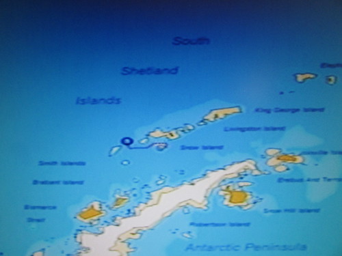
Into the South Atlantic: Television Channel 1 gave a moving-map display of position, speed, heading and wind.
The Drake Passage had been kind to us on our way south but seemed to be living up to its fearsome reputation as we returned north. However, I think my first passage south through the Drake Passage back in 2008 was probably worse.
I decided to remain in my cabin for the evening and take only a very light snack, eventually taking one of the little blue Meclizine tablets supplied by reception for motion sickness. Within 30 minutes or so I felt incredibly drowsy and the erratic lurches of my world seemed less important. I lay on top of the bed and succumbed to sleep.
Related Posts
Next post describing this trip: Returning across the Drake Passage.
All posts describing this trip: Chilean Fjords.
Just posts on the Antarctic segment: Antarctic Peninsula.
My pictures
Where necessary, clicking on an image above will display an 'uncropped' view or, alternately, my pictures from this (and earlier) trips may be selected, viewed or downloaded, in various sizes, from the albums listed:-
Into the South Atlantic.
'Silver Explorer'.
All my pictures taken in Antarctica on both this visit and my earlier visit in 2008 are in the collection here.
[Links to pictures and pictures added 10-Feb-2017]
Events of Tuesday, 29th November
Overnight we had headed away from the Antarctic Peninsula to intercept a unique island, Deception Island, which lies south of the main South Shetland Group. Early explorers considered the island ‘normal’. It was only later that a narrow passage (‘Neptune’s Bellows’, around 230m wide) was identified establishing that the island was, in fact, horse-shoe shaped, offering a protected anchorage around 9 km by 6 km within the horse-shoe. The misleading appearance of the island gave rise to the name ‘Deception Island’.
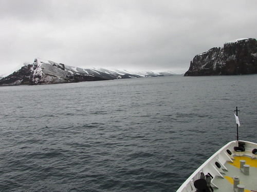
Deception Island: Approaching Neptune's Bellows.
The whole island is an ‘active’ volcano, where an earlier eruption had caused the side of the cone to collapse, allowing the sea to flood the caldera, producing the present arrangement. The island provided a useful refuge to the early sealers and whalers then, in 1906, a base was constructed in Whalers’ Bay, which supported 13 whaling factory ships by 1914. The role of the onshore plant was to boil whale carcasses to extract whale oil but, following the price collapse during the Great Depression, the base was abandoned in 1931, to be later used by the British for a time as a research station.
Whalers’ Bay
We were encouraged to be on deck for around 8.00 a.m. to observe the passage through Neptune’s Bellows. Starting at 9.00 a.m., a wet landing by Zodiac was offered, allowing walking around the extensive, flat area of black 'sand' leading back from the sea. The buildings and equipment in Whalers’ Bay are in derelict condition and a decision has been made not to attempt restoration.

Deception Island: Derelict buildings and equipment in Whalers’ Bay.
I spent my time walking from the landing point to the abandoned aircraft hanger and back, making a photographic survey of the buildings, equipment and wildlife.
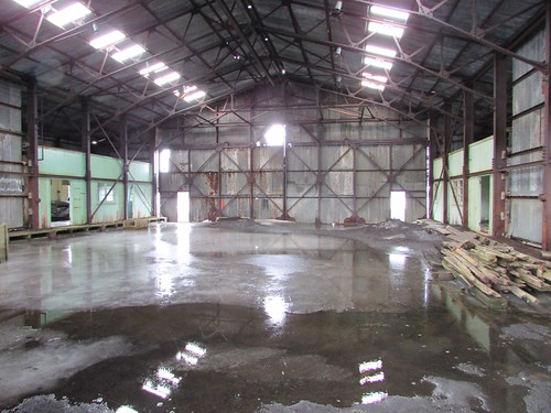
Deception Island: The abandoned aircraft hanger, Whalers' Bay.
I didn’t take the guided walk to a viewpoint called Neptune’s Window as I’d done that on my earlier visit to Deception Island in 2008 (described here).
Near the Zodiac landing, steam could be seen rising and, in places, the water and black 'sand' were pleasantly warm, attesting to the ‘active’ nature of the volcanic site (the last eruption was in 1970). However, I declined to take the ‘Polar Plunge’ by swimming in the (hopefully) warm water as I’d done that in 2008, although a number of my fellow guests did accept the challenge.
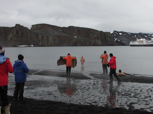
Deception Island: One guest makes use of his hat when emerging from a 'skinny dip' whilst another takes the 'warm sand treatment'.
After a very enjoyable shore visit, it was back to the ship by Zodiac, in time for lunch in the restaurant. Whilst we enjoyed lunch, the ship re-positioned to Telefon Bay, also within the caldera of Deception Island where we had a final opportunity to go ashore.
Telefon Bay
It was quite cold when we made our landing on a windswept beach of black ‘sand’. A 1 km walk was offered to inspect the crater formed during the 1970 eruption. Most of the route was covered in soft snow which made walking very tiring. I was on the point of turning back when Steffan from the Expedition Team pointed out how close the crater rim was so, after a breather, I persevered and was rewarded with an impressive, if bleak, sight.
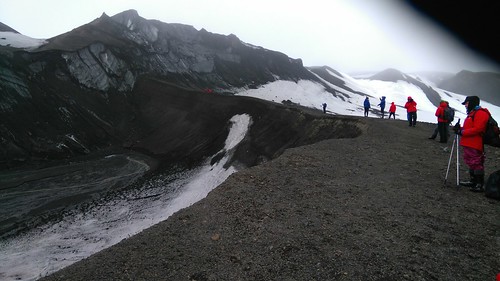
Deception Island - View of the crater, Telefon Bay.
Quite a few guests continued on a further 2 km hike which they concluded with a slide down a snow-covered hillside on their way back to the landing point. I decide to retrace my outwards route back to the Zodiac, in the company of quite a few guests.

Deception Island - View of our ship, Telefon Bay.
The wet landing at Telefon Bay was the last trip ashore before we left the South Shetland Islands to cross the Drake Passage to our final destination, Ushuaia in Argentina. However, the weather forecast for the area was not promising, so the Captain decided to move the ship outside the caldera of Deception Island and anchor overnight, hopefully allowing the unfavourable weather system to pass before we attempted our passage.
In the evening I attended the Captain's Farewell Cocktail Party in the theatre followed by the Captain's Farewell Dinner in the restaurant.
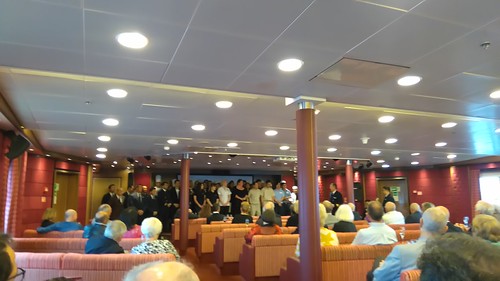
'Silver Explorer': Most of the crew, housekeeping and catering staff on stage in the theatre at the Captain's Farewell Cocktail Party held on Tuesday evening.
Related Posts
Next post describing this trip: Into the South Atlantic.
All posts describing this trip: Chilean Fjords.
Just posts on the Antarctic segment: Antarctic Peninsula.
My pictures
Where necessary, clicking on an image above will display an 'uncropped' view or, alternately, my pictures from this (and earlier) trips may be selected, viewed or downloaded, in various sizes, from the albums listed:-
Deception Island - 2016.
'Silver Explorer'.
All my pictures taken in Antarctica on both this visit and my earlier visit in 2008 are in the collection here.
[Links to pictures added 6-Feb-2017: Pictures added 8-Feb-2017]
Events of Monday, 28th November
Brown Bluff
Brown Bluff is located on the Antarctic Peninsula, facing the Antarctic Sound. A rust-coloured, steep-sided, flat-topped mountain towers above a shingle beach which is home to Gentoo and Adelie penguin rookeries.
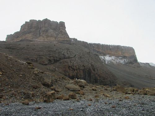
Brown Bluff
The Zodiac ride led us through numerous large pieces of ice to a wet landing on the beach. The wind was quite sharp and it was snowing, so I was well wrapped-up.
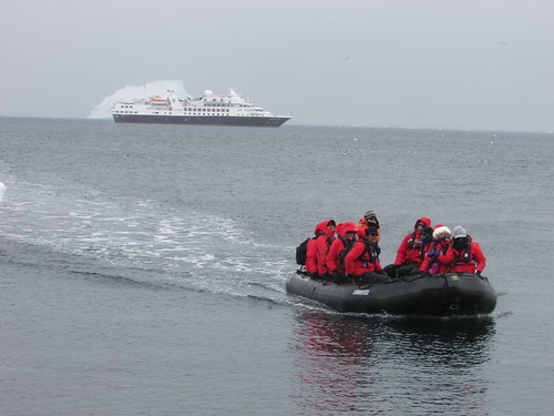
Brown Bluff: A Zodiac lands another group of guests.
Although some of the penguins were nesting around the large rocks at the foot of the cliff, most were congregated near the shore so we were asked to take a path higher up the beach. We passed colonies of both Gentoo (readily recognised by their white ‘ear muffs’) and Adelie (no head marking but with piercing eyes) commencing nesting.
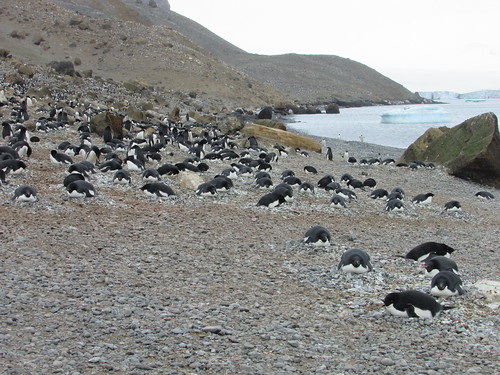
Brown Bluff: Adelie penguins nesting on the beach.
Both species on the beach were either standing, perambulating or, in a few cases, lying on their front. The Adelie has a very urgent way of walking (“I’m late, I’m late, for a very important date”) and they seem very sheep-like, walking one after another, single-file. One of my new friends suggested their behaviour was “lemming-like”.

Brown Bluff: A group of Adelie penguins march, single-file, across the shingle.
Puzzling is the way there can be a sudden change of plan, where the direction of travel is suddenly reversed. At times, a column of Adelies would end at the water’s edge and, one after another would dive in, apparently in pursuit of fish. But, on at least one occasion, we saw a version of the ‘change of plan’ behaviour where, almost as soon as the penguins had entered the water, they were hastening out again.
We had been offered a guided walk by Hans Peter to the moraine area of the adjacent glacier. I started on this walk which started by climbing a rather steep diagonal pitch up a hill from the beach over loose ‘scree’. There were good views from the top of this climb.

Brown Bluff: View from the top of the 'scree' showing the beach and numerous large pieces of ice.
Looking ahead, as the path crossed the moraine and continued up the ice at the edge of the glacier, I decided that it would be more prudent to return to the beach, particularly as the snow flakes were getting larger.
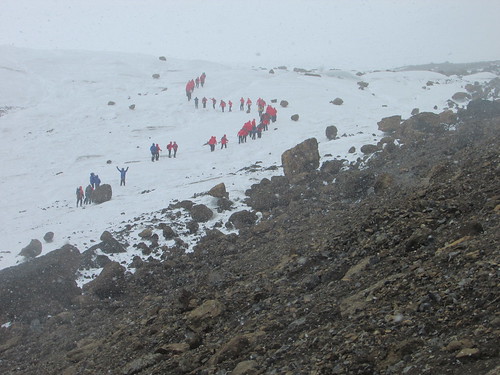
Brown Bluff: Guests crossing the moraine and continuing up the edge of the glacier.
So, having agreed my return with the Expedition Team, I very cautiously made my way back over the loose rock to the Zodiac Landing point. Back on the beach and finding partial shelter behind large rocks, I was happy to remain on the beach taking in the scene for some time before joining other returning passengers on the ‘Zodiac Shuttle’ service back to the ship. Once again, the morning’s activities had given me a good appetite for lunch. Whilst we enjoyed our meal, the ship moved along the coast to Hope Bay, where Argentina’s Esperanza Station is located.
Esperanza Station
Esperanza Station is a civilian settlement and research station built in 1953. In winter, there are 55 inhabitants, including a number of children.
At the kind invitation of the Station Commander, we made a wet Zodiac landing on a pebble slipway adjacent to a small jetty.
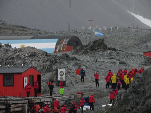
Esperanza Station: Guests coming ashore. The cemetery is visible in the background.
We were welcomed by the Assistant Station Commander and divided into two groups for a conducted tour around some of the station’s 43 buildings. Although some areas were roped off and reserved for the penguins on the island, the penguins, used to the presence of humans, wander unconcernedly across the whole Station.

Esperanza Station: A Gentoo penguin studies a large, abandoned satellite antenna in a 'Penguins Only' area.
We viewed the remains of the stone hut in which Andersson, Duse and Grunden were forced to over-winter in 1903 after the sinking of the 'Antarctic'. There's more information about this expedition here.

Esperanza Station: The remains of the stone hut in which Andersson, Duse and Grunden over-wintered in 1903.
Some large artefacts from the early days of the Station, such as a ‘Snowcat’, sledge and a section of railway track have been preserved outside.
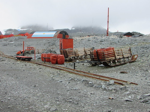
Esperanza Station: Large artefacts preserved outside.
Smaller objects were indoors in a nicely laid out museum building, including an incubator for human infants as used in the early period when there were at least eight births at the Station. Outside the museum, a series of cast brass plates listed the residents of the Station year by year.
We were invited into the school building (not in use when we visited although I saw some young children by the jetty). The well-equipped building was kept heated so is also used for other functions. I was intrigued that the main room of the school was decorated with balloons but the schoolmaster explained that it had recently been used for his wedding to the lady teacher carried out by the Station Commander. The school provides pre-school, kindergarden, primary and (using distance learning) secondary education. The distance learning, of course, requires internet and a number of satellite dishes could be seen around the station providing voice, data and television services.
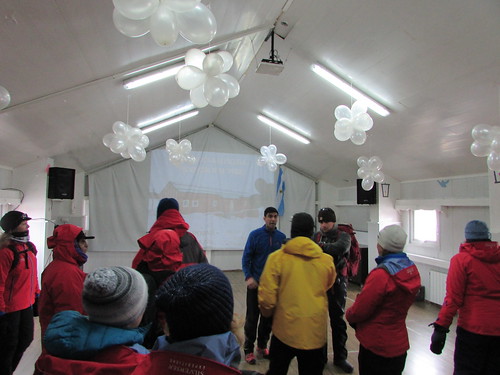
Esperanza Station: The Schoolmaster welcomes his visitors.
After we’d visited a small, nicely decorated Roman Catholic church, we were invited into the main meeting room provided with table tennis and pool tables, a seating area and bar. Trestle tables had been set along one wall with light refreshments for the visitors. Tables near the opposite wall were selling souvenirs relating to the Station.

The visitors enjoy refreshments and purchase souvenirs.
Everybody was most friendly and I was quite sad when we made our way back to the Zodiac landing point after a fascinating visit.
Tabular Icebergs
The day's excitement was not over because our course leaving Esperanza would take us through 'Iceberg Alley' where we were able to see a number of icebergs, including an impressive Tabular Iceberg, a huge flat-topped mass of drifting ice, rising at least 50 metres above the sea.
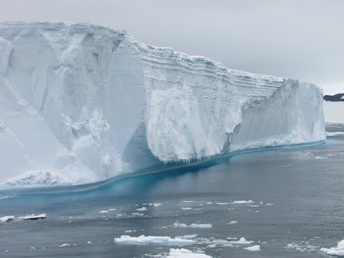
Tabular Iceberg.
For many of the guests, it was their first sighting of a Tabular Iceberg although, on an previous voyage, I'd seen a very large tabular iceberg or 'Mega Berg' which I described in the post South Georgia (day 4). The day ended with the ‘Recap and Briefing’ followed by a specially-themed buffet meal.
Related Posts
Next post describing this trip: Visiting Deception Island.
All posts describing this trip: Chilean Fjords.
Just posts on the Antarctic segment: Antarctic Peninsula.
My pictures
Where necessary, clicking on an image above will display an 'uncropped' view or, alternately, my pictures from this (and earlier) trips may be selected, viewed or downloaded, in various sizes, from the albums listed:-
Brown Bluff - 2016.
Esperanza Station, Hope Bay - 2016.
Tabular Icebergs.
All my pictures taken in Antarctica on both this visit and my earlier visit in 2008 are in the collection here.
[Links to pictures added, pictures added: 3-Feb-2017. Tabular icebergs added: 6-Feb-2017]
Events of Sunday, 27th November
Cierva Cove
Overnight, we had moved back north at slow speed towards Cierva Cove which is located on the west coast of Graham Land. The cove was named in 1960 in honour of Juan de la Cierva, inventor of the ‘Autogyro’, regarded as the first successful rotary-wing aircraft. When I got up, visibility was poor because it was snowing and the temperature was around minus one or two Celsius.
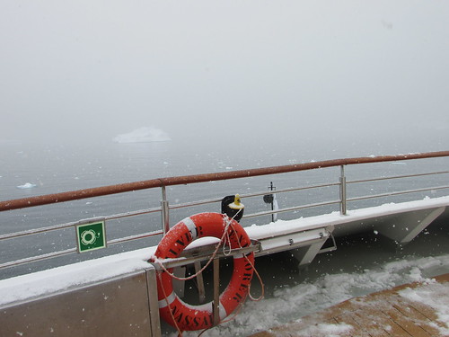
Snow at Cierva Cove. View looking forward from the observation deck. The 'black ball' visible on the flagstaff indicates to other vessels that we are at anchor.
90 minute Zodiac tours were offered, with groups 3 and 4 leaving the ship at 8.00 a.m. and groups 1 and 2 leaving the ship at 10 a.m. Since I was in group 1, I had plenty of time to work on the computer before getting ready to leave the ship.
I was in a smaller Zodiac with just six passengers and Steffan driving. It was still snowing but not hard and the sheltered location in the long cove minimised the wind so I found it quite pleasant, although the contrast with the previous day’s weather was very pronounced.
Tall snow-covered mountains loomed on both sides of us, with bare rock outcrops in places. There was brash ice and icebergs of various sizes in all directions. We were quite close to an Argentinian Research Station on the mountain side called Base Primavera which carries out botanical research during the summer but did not appear to be staffed this season as yet.
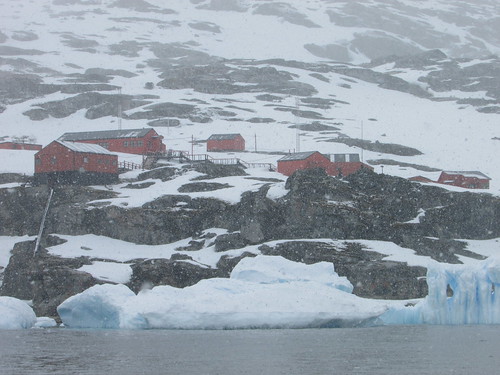
Zodiac Cruise - Cierva Cove: Argentinian Base Primavera in the snow.
What was noticeable was the apparent good state of maintenance of the cluster of wooden buildings forming the base and the number of tall radio transmitting masts which appeared to be required. There were various groups of penguins near Base Primavera, some standing statue-like, others lying on their front.
As we moved further along the cove, the sheer variety of icebergs was noticeable, both in size and in the fantastical shapes they acquire as they thaw, roll in the sea with the change of centre of gravity and then re-freeze. Unless there’s a man-made object, like a Zodiac, nearby it’s very hard to determine how big any lump if ice is, but the tendency is to underestimate scale – the human mind is reluctant to accept how large a chunk of frozen water can be.
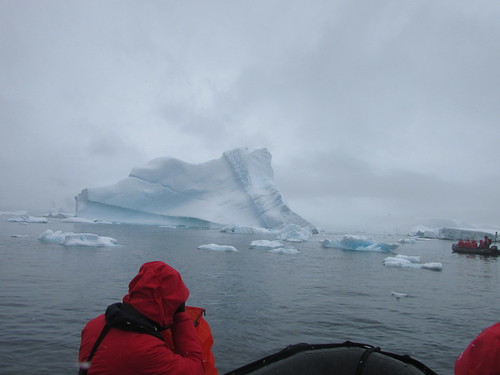
Zodiac Cruise - Cierva Cove
Perhaps most striking aspect of icebergs is the blue colouration that parts of the ice, particularly crevices, can display - not a faint, bluish tinge but often a bright, electric blue as if emanating from some internal source of illumination.
We came upon a flat piece of sea ice, roughly fifty feet across with a single Weddell seal stretched out on top. He opened his eyes to survey the strange creatures approaching but showed no interest in disturbing his relaxation as we sailed around his temporary ‘home’ twice.
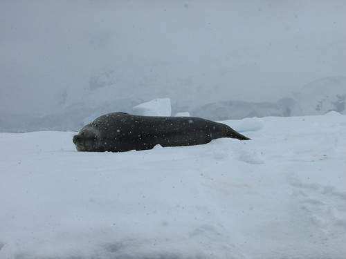
Zodiac Cruise - Cierva Cove: Weddell seal relaxing.
Further into the cove, we found a group of five Gentoo penguins relaxing quietly on a humped section of sea ice about fifty feet across. In the background, we could see the glacier front of the Sikorsky Glacier. This glacier appeared to have a very ragged, overhanging front so we were not surprised, a few minutes later, when a rumble like thunder announced a calving.
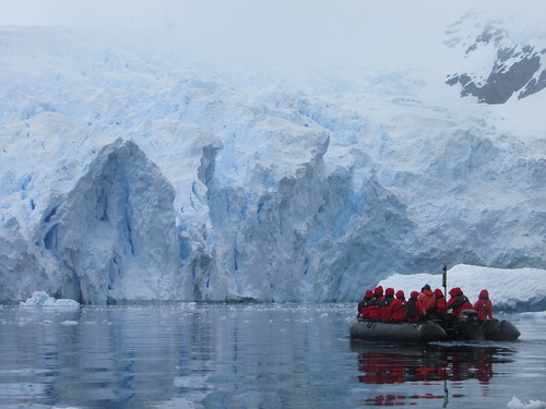
Zodiac Cruise - Cierva Cove: Face of the Sikorsky Glacier.
Presently, we could clearly see the small wave propagating across the surface of the sea produced by the ice collapsing from the glacier face. When this wave passed the mass of sea ice with the penguins, it set the ice slowly oscillating. This motion appeared to disturb one of the penguins who made his way towards the edge of the sea ice and the others followed, as if playing “follow my leader”. The leading penguin dived into the water followed, in turn, by each of the other penguins, as if performing a synchronised swimming display.

Zodiac Cruise - Cierva Cove: Gentoo penguins enter the water one after another.
Mikkelsen Harbour
Whilst the guests enjoyed lunch, the ship sailed towards Mikkelsen Harbour - a rocky islet in a bay on the southern side of Trinity Island in the Palmer Archipelago. Once again, the variability of Antarctic weather asserted itself. The entrance to the bay is via a narrow channel and, on our approach to this channel, the Captain determined that the local wind was too strong for the ship to enter in safety. Since the wind was expected to abate, it was decided that our ship would wait an hour or so in the hope of entering the channel and still making a landing.
After around one hour’s wait, the wind did lessen and we passed through the channel, intending to anchor in front of the islet where we could see the Argentine emergency refuge hut.
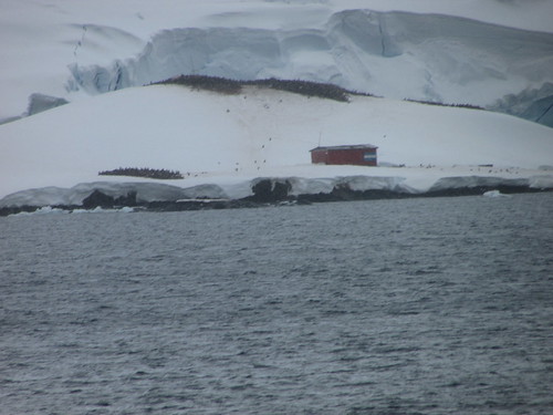
Penguins and the Argentine emergency refuge hut at Mikkelsen Harbour.
However, sea ice in the area started to move, preventing anchoring. Since there was deemed to be insufficient clear water around the ship to ‘hold station’ without anchoring, the Captain decided that, on safety grounds, the planned landing would be abandoned. So the ship was turned and exited through the narrow channel, then continuing north again.
Instead, Luke gave an interesting lecture titled ‘Fishing in Antarctica’ at 5.00 p.m., there was a ‘Recap and Briefing’ at 6.45 p.m. and the accustomed splendid dinner in the restaurant at 7.30 p.m.
Related Posts
Next post describing this trip: Visiting the Antarctic Peninsula (3).
All posts describing this trip: Chilean Fjords.
Just posts on the Antarctic segment: Antarctic Peninsula.
My pictures
Where necessary, clicking on an image above will display an 'uncropped' view or, alternately, my pictures from this (and earlier) trips may be selected, viewed or downloaded, in various sizes, from the albums listed:-
Zodiac Cruise - Cierva Cove 2016.
All my pictures taken in Antarctica on both this visit and my earlier visit in 2008 are in the collection here.
[Links to pictures added, pictures added: 2-Feb-2017]
Events of Saturday, 26th November
Cuverville Island
Overnight, we had cruised towards Cuverville Island, which is situated just offshore the Antarctic Peninsula itself. I was up early and on the Observation Deck as we approached our anchorage. The temperature was around zero Celsius but the wind chill made it appear cooler. I was happy to return inside for breakfast and then ‘suit-up’ for a ‘wet landing’ on the beach by Zodiac at 7.45 a.m.
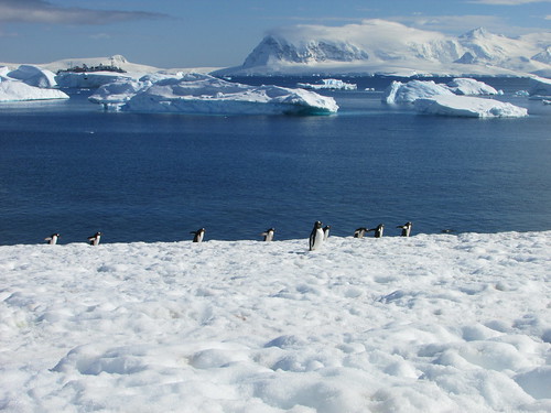
The sheltered location of our anchorage and the appearance of bright sun meant that conditions were much improved by the time I reached the shore. I had decided that the “difficult hike” on offer would be too demanding. The bay we were in was picturesque, littered with oddly-sculpted icebergs of various sizes, patrolled by birds of various Antarctic species and criss-crossed by Gentoo penguins continuously making their (to human eyes) clumsy progress between the various colonies on the snow-clad hills and the sea where they are instantly transformed into the most elegant and athletic swimmers. Since the weather was so inviting and untypical of the Antarctic Spring, I decided to move only a few hundred yards from the landing site, sit in the snow and contemplate this world.
Contemplating the view from Cuverville Island.
It’s hard to convey what a special experience this was. I remained there, perfectly warm in my multiple-layers of clothing for around two hours, occasionally taking photographs but mainly trying to ‘absorb the moment’. I was so comfortable that, from time to time, I lay back in the snow, listening to the calls of the penguins, looking up at the blue sky tinged with wisps of clouds (which would have counted as a memorable Summer’s day back home in England). The gentlest hint of breeze carried the odour of the ‘guano’ from the large number of penguins but, where I was located, it was distinctive but not unpleasant. In the past I’d discovered that, near large colonies of penguins, the smell can be almost overwhelming.
From my spot, I could see fellow-guests clambering aboard Zodiacs to be returned to our ship, which I could also see across the bay. I watched the hikers return from their more strenuous excursion but, noting the ‘Last Zodiac returns to Ship’ time we’d been advised, I was still reluctant to break the spell Antarctica had cast.
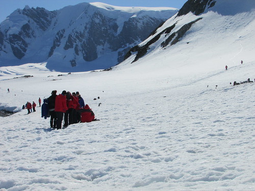
Cuverville Island: Guests making their way back to the Zodiacs.
Eventually I rose from the snow, which was at least two feet thick but nowhere near as solid as it appeared (injudicious movement could result in collapse of the snow into a deep depression, as I’d seen happen to a fellow passenger earlier). I made my way back to the landing area, in plenty of time to avoid rebuke, but ferried back to the ship in the last or last-but-one passenger Zodiac. We took the ‘scenic route’ back to the ship, cruising amongst the strange shapes of the scattered icebergs.

"... cruising amongst the strange shapes of the scattered icebergs".
Since we had the Ship’s ‘Videographer’ Ray aboard, we took a little longer to complete the trip – at one point he was using a ‘Go-Pro’ waterproof video camera attached to a trekking pole to take underwater shots illustrating the submerged bulk of icebergs. I boarded the ship, elated at the experience of the morning, quite ready for a mug of boullion to sustain me until lunchtime.
Once everyone was back on board, the ship moved south, heading for Port Lockroy. Antarctica is, of course, in the Southern hemisphere with the seasons reversed compared with my home in England. This trip to Antarctica was ‘Silversea’s’ first of the spring, when the winter’s sea ice starts to thaw and access to some areas is still uncertain. From Cuverville Island, there were two possible routes to Port Lockroy – a shorter, northern route and a longer, southern route. The Captain attempted the northern route but decided that there was too much sea ice remaining (the ship is ice-hardened but is not an icebreaker). So we diverted to the southern route. But this, too, still had quite a lot of sea ice.
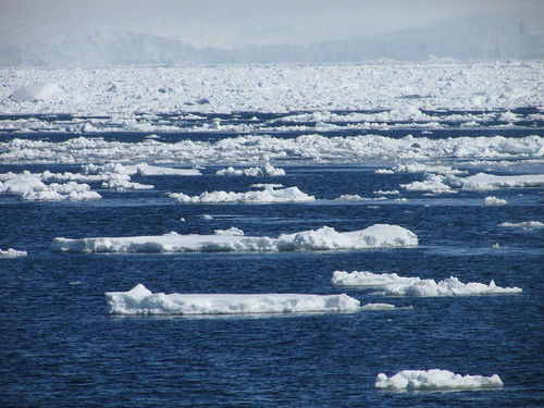
Through the ice.
However, we did get some good sightings of a group of Orca whales before the Captain decided that the visit to Port Lockroy be abandoned. The Captain and Expedition Team then had to review the various possibilities to re-plan the next part of the trip.
Jean-Baptiste Charcot
Whilst the ship was re-positioning, a lecture on the French expolorer Charcot was given by Peter in the theatre. This lecture was originally advertised for earlier in the voyage but had been cancelled on that occasion because of our ‘extra trip’ to Cape Horn.
Enterprise Island
The ship cruised to Enterprise Island where we were offered a late-afternoon Zodiac Cruise in a picturesque bay with snow-covered mountains, icebergs, birds, penguins and the possibility of whale sightings. In the middle of the bay lay the wreck of the whaling ship ‘Governoren’, which was accidentally set on fire at a party to celebrate a successful season. The amount of whale oil on board ensured the complete destruction of the ship.

Wreck of the whaling ship 'Governoren'.
Because of the altered timing of the events, the planned recap and briefing was cancelled.
Related Posts
Next post describing this trip: Visiting the Antarctic Peninsula (2).
All posts describing this trip: Chilean Fjords.
Just posts on the Antarctic segment: Antarctic Peninsula.
My pictures
Where necessary, clicking on an image above will display an 'uncropped' view or, alternately, my pictures from this (and earlier) trips may be selected, viewed or downloaded, in various sizes, from the albums listed:-
Cuverville Island 2016.
Through the ice 2016.
Zodiac Cruise - Enterprise Island 2016.
All my pictures taken in Antarctica on both this visit and my earlier visit in 2008 are in the collection here.
[Links to pictures added, pictures added: 1-Feb-2017]
Events of Friday, 25th November
Aitcho Island
Having entered the Drake Passage with benign weather conditions on Wednesday evening, we had spent the whole of Thursday continuing the crossing and the weather remained good. Around 6.30 a.m. on Friday, we started to see the South Shetland Island chain. We anchored in the English Strait in the Aitcho Island group at about 7.30 a.m. 'Aitcho’, we were told, stands for ‘H.O.’ or ‘Hydrographic Office’. A ‘wet landing’ was announced for 8.00 a.m. There was some confusion in calling groups to Reception on Deck 3 but, eventually, my group was boarded on one of the larger Zodiacs to be taken ashore with Peter Damisch driving. The sea was quite lively and there was a cold wind. Although Peter took a roundabout route to shore to minimise the spray, we received a fair soaking. Hans Peter took us on a conducted tour of the Gentoo and Chinstrap penguin breeding colonies.
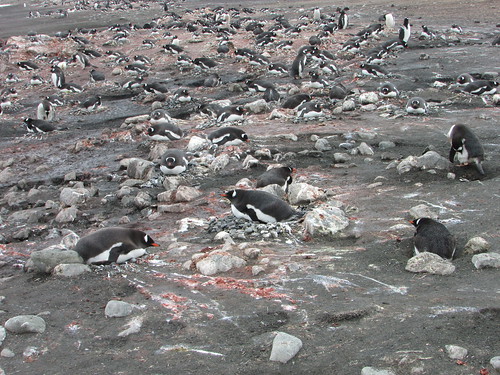
Aitcho Island: A colony of Gentoo penguins. The pink guano indicates a diet of krill.
It was overcast and started to snow – “A typical day in Antarctica” commented Hans Peter. We saw Skuas patrolling between the penguin nests, looking for a chance to steal an egg. A little later, two inquisitive Skuas walked right up to our group, reminding us that they are quite large birds. We passed a time-lapse camera set up on a short pole in the one colony, part of an ongoing research project tracking changes in penguin numbers. Hans Peter then indicated an area we could explore freely (with the usual restrictions applicable to Antarctica) and we spent the rest of the time on shore as we wished, before returning by Zodiac to the ship for an early lunch whilst the ship re-positioned to Halfmoon Island which is also part of the South Shetland Islands.
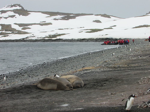
Aitcho Island: Guests boarding a Zodiac to return to the ship, ignored by the wildlife.
Halfmoon Island
It had been hoped that we would reach Halfmoon Island by 1.00 p.m. but adverse wind meant it was around 1.30 p.m. when we dropped anchor and the start of disembarkation to shore was similarly delayed. A weak sun was shining and a fairly sheltered location meant that it was much more pleasant. Various walking routes had been identified with red flags.
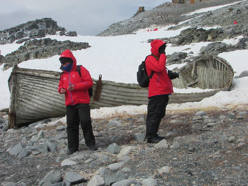
Halfmoon Island: 'Silver Explorer' guests explore the island.
Most of the areas were covered with snow but, fortunately, it was not actually snowing. Deviating from the trodden path by even a few inches risked a wellington-booted foot sinking into the snow up to the top of the boot but I’d taken a trekking pole on this landing and that helped a lot. In places, our marked path crossed ‘penguin highways’ extending from the shore to the top of the adjacent hill and, at these locations, penguins had right of way.

Halfmoon Island: Chinstrap penguins using one of the 'penguin highways'.
The colonies were Chinstrap apart from a single Macaroni Penguin who, we were told, is an annual visitor. Near one of the beaches, a Weddell Seal (with the attractive, innocent face all Weddell’s seem to have) was relaxing on the shingle. When the Expedition Team suggested that we should make our way back to the landing site, I carefully complied and was ferried back to the ship by Zodiac. I was in time to enjoy tea with scones.
At 6.45 p.m. we had our usual recap and briefing. Plans for the following day were somewhat flexible because of uncertainties about the weather. Then, I enjoyed another splendid dinner in the company of an English couple and our knowledgeable Guide and Historian Peter Damisch.
Related Posts
Next post describing this trip: Visiting the Antarctic Peninsula (1).
All posts describing this trip (Chile, Antarctic, Argentina, Brazil): Chilean Fjords.
Just posts on the Antarctic segment: Antarctic Peninsula.
My pictures
Where necessary, clicking on an image above will display an 'uncropped' view or, alternately, my pictures from this (and earlier) trips may be selected, viewed or downloaded, in various sizes, from the albums listed:-
Aitcho Island 2016.
Halfmoon Island 2016.
All my pictures taken in Antarctica on both this visit and my earlier visit in 2008 are in the collection here.
[Links to pictures added, pictures added: 1-Feb-2017]
This trip to the Antarctic Peninsula is a continuation of my trip to the Chilean Fjords.
Events of Thursday, 24th November
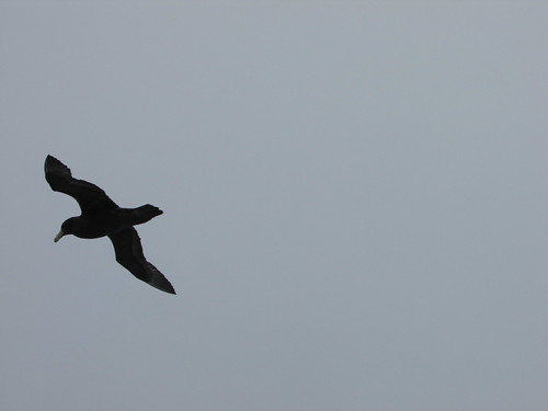
Albatross were never far from the ship.
Having entered the Drake Passage with benign weather conditions on the previous evening, we spent the whole of Thursday continuing the crossing and the weather remained good. The sea state was also moderate, although, as we traversed the Antarctic Convergence (where the warm water from the north meets the cold water from the south) the sea water temperature dropped from 10 degrees Celsius to zero degrees Celsius.
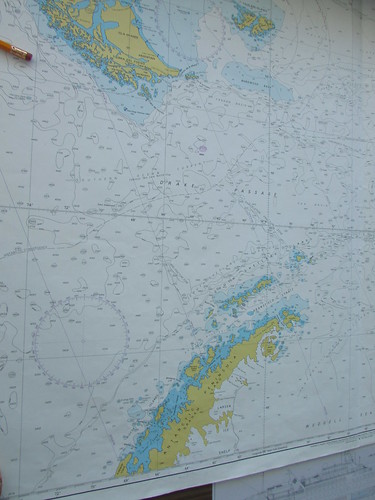
Ship's chart of the Drake Passage. Cape Horn is near the top of the picture, the Antarctic Peninsula at the bottom.
Click for larger view
Sheri gave a most interesting lecture of the Antarctic Treaty and its provisions which makes Antarctica a unique example of co-operation between many countries in the administration of a continent.
One of the provisions of the Antarctic Treaty relates to the preservation of the environment and, to comply with this, there was a Biosecurity Inspection, item by item, of all guests’ outer clothing before going ashore in Antarctica.
After lunch, the ship’s bridge was open to visitors for a time so, of course, I re-acquainted myself with the modern systems which control the ship.
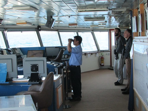
'Silver Explorer' Bridge Visit.
Once the ship’s internet service had been resumed, I managed to sort out problems on my laptop which I think were partly caused by earlier intermittent internet service. By the time I’d checked e-mail and updated the blog, it was time for afternoon tea, which a particularly jolly affair as one of the waiters from the restaurant, Allan, gave a “Barista class with Cappuccino and coffee art demonstrations”.
At 5.00 p.m. Peter Damisch gave one of his invariably stimulating and meticulously-researched lectures titled “Shackleton, By Endurance We Conquer”.
The Recap and Briefing at 6.45 p.m. reviewed recent sightings and outlined the plans for the following day at the South Shetland Islands.
Related Posts
Next post describing this trip: The South Shetland Islands.
All posts describing this trip: Chilean Fjords.
Just posts on the Antarctic segment: Antarctic Peninsula.
My pictures
Where necessary, clicking on an image above will display an 'uncropped' view or, alternately, my pictures from this (and earlier) trips may be selected, viewed or downloaded, in various sizes, from the album listed:-
Silver Explorer.
'Silver Explorer' Bridge Visit.
All my pictures taken in Antarctica on both this visit and my earlier visit in 2008 are in the collection here.
[Links to pictures added, pictures added: 30-Jan-2017]
On Monday 21st November, I got in a muddle with the dating of events, which I corrected as soon as I was able but, once we entered the Drake Passage, we had some (fortunately temporary) trouble with internet access.
Events of Wednesday, 23rd November
The previous evening, Kara, the Expedition Team Leader, had announced that we were to take an alternate channel through the islands of Terra del Fuego which should save time, allowing a closer look at Cape Horn, which the Chilean Navy had approved.
Our first few days travelling south from Valparaiso had enjoyed good weather and this had continued overnight. On Wednesday morning Kara announced that, with a following wind, we had made good time overnight. As we continued our transit to Cape Horn, I was able to spend some time outside on the open deck without the need to wrap up.
IAATO Briefing
At ten o’clock there was a mandatory IAATO Briefing in the theatre. The International Association of Antarctica Tour Operators (IAATO) was set up by the industry to regulate tourism in Antarctica so as to comply with the objectives of the multi-governmental Antarctic Treaty System which has developed from the original Antarctic Treaty of 1959 designating Antarctica as “a zone of peace and science”. The briefing outlined guests’ roles in:-
Protecting Antarctic wildlife
Respecting protected areas
Respecting scientific research
Remaining safe
Keeping Antarctica pristine
IAATO has a website here.
Learning about Whales
A feature of the Silversea Cruises is the regular lectures by members of the Expedition Team. At 11:15, Luke’s lecture on whales and identifying species was warmly received and was followed by many questions from the audience
.
Approaching Cape Horn
The afternoon lecture by Peter on the little-known Polar explorer Charcot was postponed as we approached the impressive bulk of Cape Horn. The decision to divert to Cape Horn had introduced a complication: We’d had two Chilean Pilots on board since leaving Valparaiso and I think the original plan called for us to release the pilots at a small port to the north of Cape Horn. The small manned station actually at Cape Horn, we discovered, is serviced by the Chilean Navy and the revised plan called for us to ‘drop’ the Pilots at this station, from where the Navy would transfer them to an airport for an internal flight back north.
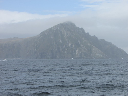
Approaching Cape Horn.
So we ‘Rounded the Horn’ and could then see the lighthouse on the next headland where the manned station is located. As we came closer, the ‘Albatross Memorial’ could be seen near to the station. Of course, all of this was very unfamiliar to most passengers (and, indeed, most of the Expedition Team).
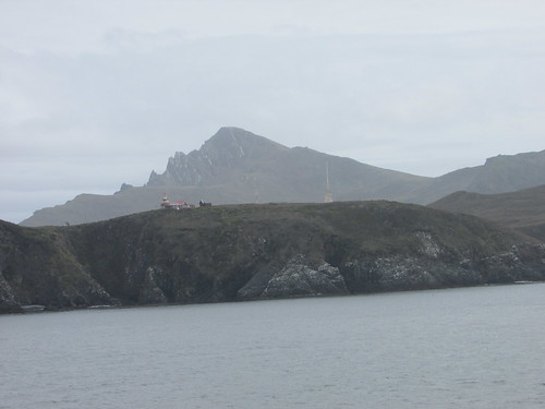
Cape Horn Station.
The plan was to put the Pilots ashore by Zodiac and assess whether it would be safe for the guests to make a landing. As we anchored a few hundred yards from the steep cliffs, we could see a tiny, boulder-strewn beach with a daunting-looking set of wooden steps zig-zagging up the cliff face. Our survey Zodiac reported favourably so those wishing to go ashore dressed warmly for a ‘wet landing’. Since the landing groups rotate, on this occasion I was in one of the last Zodiac groups.

Cape Horn: The landing place, steps, funicular and (left background) the Albatross Memorial.
Our Zodiac driver went bow to the shore, with two members of the Expedition Team holding on to the Zodiac whilst passengers clambered over the side of the boat into a foot or so of water. The first couple of yards over large, round stones was tricky, but help was at hand from the Expedition Team members. Then it was onto well-constructed wooden stairs with a handrail – a stiff climb but with wonderful views from the top. I was surprised to find a working funicular railway provided to carry stores from the landing site to the top of the cliff. There was a modern brick building, with a huge Chilean flag facing the sea which housed the electric motor and winch for the funicular railway. Nearby was a fuel tank and a helicopter landing pad. A long boardwalk with some steps led to the lighthouse building with a modern extension serving as office, visitor centre and accommodation for the family in residence. Just outside was a small, rustic wooden church. Another boardwalk with steps led to the ‘Albatross Memorial’ which commemorates all sailors who lost their lives near Cape Horn.
A Navy launch arrived and anchored near our ship to collect our two Chilean Pilots and one man from the Cape Horn station. The Captain of the launch and three of his men took the opportunity presented by their unusual assignment to come ashore and take pictures. The Naval Captain chatted to us in excellent English. We had plenty of time to enjoy this very special visit before returning to the ship.
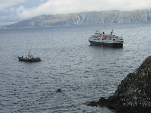
View from Cape Horn station. L: Navy Launch, R: 'Silver Explorer'. In the foreground, a Zodiac is returning passengers to the ship.
With everyone back on board, we set off on our long crossing of the Drake Passage which would take the rest of Wednesday, all of Thursday, making landfall at the South Shetland Islands sometime Friday morning.
Related Posts
Next post describing this trip: The Drake Passage.
All posts describing this trip: Chilean Fjords.
My pictures
Where necessary, clicking on an image above will display an 'uncropped' view or, alternately, my pictures from this (and earlier) trips may be selected, viewed or downloaded, in various sizes, from the album listed:-
Cape Horn.
All my pictures of Chile can be found in the collection Chile.
[Links to pictures added, pictures added: 26-Jan-2017]

