skip to main |
skip to sidebar
Events of Sunday, 27th November
Cierva Cove
Overnight, we had moved back north at slow speed towards Cierva Cove which is located on the west coast of Graham Land. The cove was named in 1960 in honour of Juan de la Cierva, inventor of the ‘Autogyro’, regarded as the first successful rotary-wing aircraft. When I got up, visibility was poor because it was snowing and the temperature was around minus one or two Celsius.
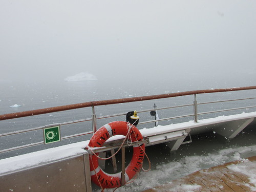
Snow at Cierva Cove. View looking forward from the observation deck. The 'black ball' visible on the flagstaff indicates to other vessels that we are at anchor.
90 minute Zodiac tours were offered, with groups 3 and 4 leaving the ship at 8.00 a.m. and groups 1 and 2 leaving the ship at 10 a.m. Since I was in group 1, I had plenty of time to work on the computer before getting ready to leave the ship.
I was in a smaller Zodiac with just six passengers and Steffan driving. It was still snowing but not hard and the sheltered location in the long cove minimised the wind so I found it quite pleasant, although the contrast with the previous day’s weather was very pronounced.
Tall snow-covered mountains loomed on both sides of us, with bare rock outcrops in places. There was brash ice and icebergs of various sizes in all directions. We were quite close to an Argentinian Research Station on the mountain side called Base Primavera which carries out botanical research during the summer but did not appear to be staffed this season as yet.
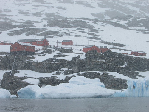
Zodiac Cruise - Cierva Cove: Argentinian Base Primavera in the snow.
What was noticeable was the apparent good state of maintenance of the cluster of wooden buildings forming the base and the number of tall radio transmitting masts which appeared to be required. There were various groups of penguins near Base Primavera, some standing statue-like, others lying on their front.
As we moved further along the cove, the sheer variety of icebergs was noticeable, both in size and in the fantastical shapes they acquire as they thaw, roll in the sea with the change of centre of gravity and then re-freeze. Unless there’s a man-made object, like a Zodiac, nearby it’s very hard to determine how big any lump if ice is, but the tendency is to underestimate scale – the human mind is reluctant to accept how large a chunk of frozen water can be.
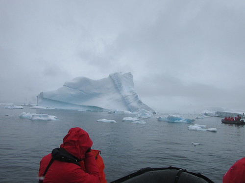
Zodiac Cruise - Cierva Cove
Perhaps most striking aspect of icebergs is the blue colouration that parts of the ice, particularly crevices, can display - not a faint, bluish tinge but often a bright, electric blue as if emanating from some internal source of illumination.
We came upon a flat piece of sea ice, roughly fifty feet across with a single Weddell seal stretched out on top. He opened his eyes to survey the strange creatures approaching but showed no interest in disturbing his relaxation as we sailed around his temporary ‘home’ twice.
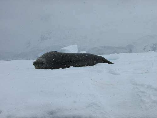
Zodiac Cruise - Cierva Cove: Weddell seal relaxing.
Further into the cove, we found a group of five Gentoo penguins relaxing quietly on a humped section of sea ice about fifty feet across. In the background, we could see the glacier front of the Sikorsky Glacier. This glacier appeared to have a very ragged, overhanging front so we were not surprised, a few minutes later, when a rumble like thunder announced a calving.
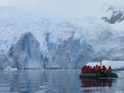
Zodiac Cruise - Cierva Cove: Face of the Sikorsky Glacier.
Presently, we could clearly see the small wave propagating across the surface of the sea produced by the ice collapsing from the glacier face. When this wave passed the mass of sea ice with the penguins, it set the ice slowly oscillating. This motion appeared to disturb one of the penguins who made his way towards the edge of the sea ice and the others followed, as if playing “follow my leader”. The leading penguin dived into the water followed, in turn, by each of the other penguins, as if performing a synchronised swimming display.

Zodiac Cruise - Cierva Cove: Gentoo penguins enter the water one after another.
Mikkelsen Harbour
Whilst the guests enjoyed lunch, the ship sailed towards Mikkelsen Harbour - a rocky islet in a bay on the southern side of Trinity Island in the Palmer Archipelago. Once again, the variability of Antarctic weather asserted itself. The entrance to the bay is via a narrow channel and, on our approach to this channel, the Captain determined that the local wind was too strong for the ship to enter in safety. Since the wind was expected to abate, it was decided that our ship would wait an hour or so in the hope of entering the channel and still making a landing.
After around one hour’s wait, the wind did lessen and we passed through the channel, intending to anchor in front of the islet where we could see the Argentine emergency refuge hut.
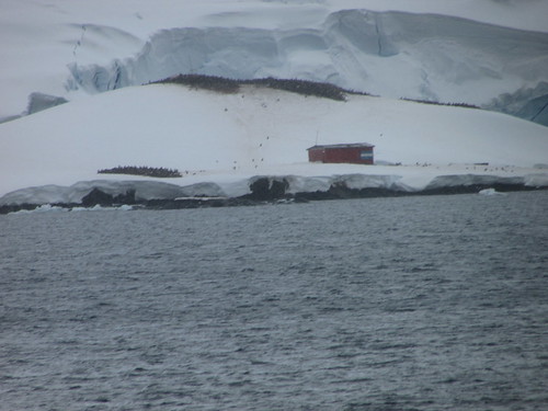
Penguins and the Argentine emergency refuge hut at Mikkelsen Harbour.
However, sea ice in the area started to move, preventing anchoring. Since there was deemed to be insufficient clear water around the ship to ‘hold station’ without anchoring, the Captain decided that, on safety grounds, the planned landing would be abandoned. So the ship was turned and exited through the narrow channel, then continuing north again.
Instead, Luke gave an interesting lecture titled ‘Fishing in Antarctica’ at 5.00 p.m., there was a ‘Recap and Briefing’ at 6.45 p.m. and the accustomed splendid dinner in the restaurant at 7.30 p.m.
Related Posts
Next post describing this trip: Visiting the Antarctic Peninsula (3).
All posts describing this trip: Chilean Fjords.
Just posts on the Antarctic segment: Antarctic Peninsula.
My pictures
Where necessary, clicking on an image above will display an 'uncropped' view or, alternately, my pictures from this (and earlier) trips may be selected, viewed or downloaded, in various sizes, from the albums listed:-
Zodiac Cruise - Cierva Cove 2016.
All my pictures taken in Antarctica on both this visit and my earlier visit in 2008 are in the collection here.
[Links to pictures added, pictures added: 2-Feb-2017]
Events of Saturday, 26th November
Cuverville Island
Overnight, we had cruised towards Cuverville Island, which is situated just offshore the Antarctic Peninsula itself. I was up early and on the Observation Deck as we approached our anchorage. The temperature was around zero Celsius but the wind chill made it appear cooler. I was happy to return inside for breakfast and then ‘suit-up’ for a ‘wet landing’ on the beach by Zodiac at 7.45 a.m.
The sheltered location of our anchorage and the appearance of bright sun meant that conditions were much improved by the time I reached the shore. I had decided that the “difficult hike” on offer would be too demanding. The bay we were in was picturesque, littered with oddly-sculpted icebergs of various sizes, patrolled by birds of various Antarctic species and criss-crossed by Gentoo penguins continuously making their (to human eyes) clumsy progress between the various colonies on the snow-clad hills and the sea where they are instantly transformed into the most elegant and athletic swimmers. Since the weather was so inviting and untypical of the Antarctic Spring, I decided to move only a few hundred yards from the landing site, sit in the snow and contemplate this world.
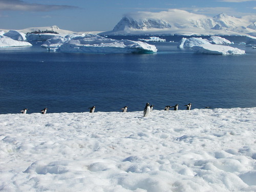
Contemplating the view from Cuverville Island.
It’s hard to convey what a special experience this was. I remained there, perfectly warm in my multiple-layers of clothing for around two hours, occasionally taking photographs but mainly trying to ‘absorb the moment’. I was so comfortable that, from time to time, I lay back in the snow, listening to the calls of the penguins, looking up at the blue sky tinged with wisps of clouds (which would have counted as a memorable Summer’s day back home in England). The gentlest hint of breeze carried the odour of the ‘guano’ from the large number of penguins but, where I was located, it was distinctive but not unpleasant. In the past I’d discovered that, near large colonies of penguins, the smell can be almost overwhelming.
From my spot, I could see fellow-guests clambering aboard Zodiacs to be returned to our ship, which I could also see across the bay. I watched the hikers return from their more strenuous excursion but, noting the ‘Last Zodiac returns to Ship’ time we’d been advised, I was still reluctant to break the spell Antarctica had cast.
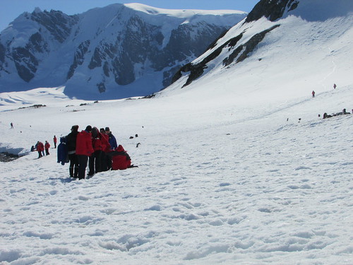
Cuverville Island: Guests making their way back to the Zodiacs.
Eventually I rose from the snow, which was at least two feet thick but nowhere near as solid as it appeared (injudicious movement could result in collapse of the snow into a deep depression, as I’d seen happen to a fellow passenger earlier). I made my way back to the landing area, in plenty of time to avoid rebuke, but ferried back to the ship in the last or last-but-one passenger Zodiac. We took the ‘scenic route’ back to the ship, cruising amongst the strange shapes of the scattered icebergs.

"... cruising amongst the strange shapes of the scattered icebergs".
Since we had the Ship’s ‘Videographer’ Ray aboard, we took a little longer to complete the trip – at one point he was using a ‘Go-Pro’ waterproof video camera attached to a trekking pole to take underwater shots illustrating the submerged bulk of icebergs. I boarded the ship, elated at the experience of the morning, quite ready for a mug of boullion to sustain me until lunchtime.
Once everyone was back on board, the ship moved south, heading for Port Lockroy. Antarctica is, of course, in the Southern hemisphere with the seasons reversed compared with my home in England. This trip to Antarctica was ‘Silversea’s’ first of the spring, when the winter’s sea ice starts to thaw and access to some areas is still uncertain. From Cuverville Island, there were two possible routes to Port Lockroy – a shorter, northern route and a longer, southern route. The Captain attempted the northern route but decided that there was too much sea ice remaining (the ship is ice-hardened but is not an icebreaker). So we diverted to the southern route. But this, too, still had quite a lot of sea ice.
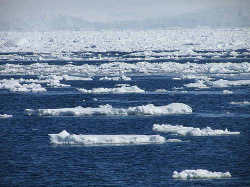
Through the ice.
However, we did get some good sightings of a group of Orca whales before the Captain decided that the visit to Port Lockroy be abandoned. The Captain and Expedition Team then had to review the various possibilities to re-plan the next part of the trip.
Jean-Baptiste Charcot
Whilst the ship was re-positioning, a lecture on the French expolorer Charcot was given by Peter in the theatre. This lecture was originally advertised for earlier in the voyage but had been cancelled on that occasion because of our ‘extra trip’ to Cape Horn.
Enterprise Island
The ship cruised to Enterprise Island where we were offered a late-afternoon Zodiac Cruise in a picturesque bay with snow-covered mountains, icebergs, birds, penguins and the possibility of whale sightings. In the middle of the bay lay the wreck of the whaling ship ‘Governoren’, which was accidentally set on fire at a party to celebrate a successful season. The amount of whale oil on board ensured the complete destruction of the ship.

Wreck of the whaling ship 'Governoren'.
Because of the altered timing of the events, the planned recap and briefing was cancelled.
Related Posts
Next post describing this trip: Visiting the Antarctic Peninsula (2).
All posts describing this trip: Chilean Fjords.
Just posts on the Antarctic segment: Antarctic Peninsula.
My pictures
Where necessary, clicking on an image above will display an 'uncropped' view or, alternately, my pictures from this (and earlier) trips may be selected, viewed or downloaded, in various sizes, from the albums listed:-
Cuverville Island 2016.
Through the ice 2016.
Zodiac Cruise - Enterprise Island 2016.
All my pictures taken in Antarctica on both this visit and my earlier visit in 2008 are in the collection here.
[Links to pictures added, pictures added: 1-Feb-2017]
Events of Friday, 25th November
Aitcho Island
Having entered the Drake Passage with benign weather conditions on Wednesday evening, we had spent the whole of Thursday continuing the crossing and the weather remained good. Around 6.30 a.m. on Friday, we started to see the South Shetland Island chain. We anchored in the English Strait in the Aitcho Island group at about 7.30 a.m. 'Aitcho’, we were told, stands for ‘H.O.’ or ‘Hydrographic Office’. A ‘wet landing’ was announced for 8.00 a.m. There was some confusion in calling groups to Reception on Deck 3 but, eventually, my group was boarded on one of the larger Zodiacs to be taken ashore with Peter Damisch driving. The sea was quite lively and there was a cold wind. Although Peter took a roundabout route to shore to minimise the spray, we received a fair soaking. Hans Peter took us on a conducted tour of the Gentoo and Chinstrap penguin breeding colonies.
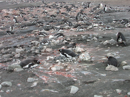
Aitcho Island: A colony of Gentoo penguins. The pink guano indicates a diet of krill.
It was overcast and started to snow – “A typical day in Antarctica” commented Hans Peter. We saw Skuas patrolling between the penguin nests, looking for a chance to steal an egg. A little later, two inquisitive Skuas walked right up to our group, reminding us that they are quite large birds. We passed a time-lapse camera set up on a short pole in the one colony, part of an ongoing research project tracking changes in penguin numbers. Hans Peter then indicated an area we could explore freely (with the usual restrictions applicable to Antarctica) and we spent the rest of the time on shore as we wished, before returning by Zodiac to the ship for an early lunch whilst the ship re-positioned to Halfmoon Island which is also part of the South Shetland Islands.
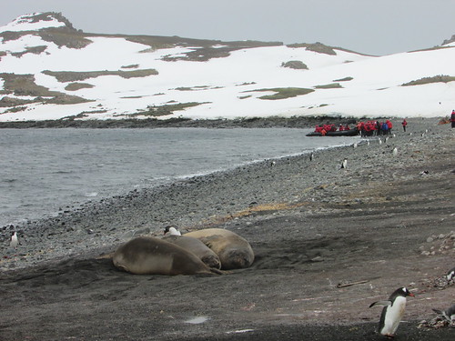
Aitcho Island: Guests boarding a Zodiac to return to the ship, ignored by the wildlife.
Halfmoon Island
It had been hoped that we would reach Halfmoon Island by 1.00 p.m. but adverse wind meant it was around 1.30 p.m. when we dropped anchor and the start of disembarkation to shore was similarly delayed. A weak sun was shining and a fairly sheltered location meant that it was much more pleasant. Various walking routes had been identified with red flags.
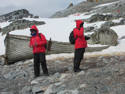
Halfmoon Island: 'Silver Explorer' guests explore the island.
Most of the areas were covered with snow but, fortunately, it was not actually snowing. Deviating from the trodden path by even a few inches risked a wellington-booted foot sinking into the snow up to the top of the boot but I’d taken a trekking pole on this landing and that helped a lot. In places, our marked path crossed ‘penguin highways’ extending from the shore to the top of the adjacent hill and, at these locations, penguins had right of way.

Halfmoon Island: Chinstrap penguins using one of the 'penguin highways'.
The colonies were Chinstrap apart from a single Macaroni Penguin who, we were told, is an annual visitor. Near one of the beaches, a Weddell Seal (with the attractive, innocent face all Weddell’s seem to have) was relaxing on the shingle. When the Expedition Team suggested that we should make our way back to the landing site, I carefully complied and was ferried back to the ship by Zodiac. I was in time to enjoy tea with scones.
At 6.45 p.m. we had our usual recap and briefing. Plans for the following day were somewhat flexible because of uncertainties about the weather. Then, I enjoyed another splendid dinner in the company of an English couple and our knowledgeable Guide and Historian Peter Damisch.
Related Posts
Next post describing this trip: Visiting the Antarctic Peninsula (1).
All posts describing this trip (Chile, Antarctic, Argentina, Brazil): Chilean Fjords.
Just posts on the Antarctic segment: Antarctic Peninsula.
My pictures
Where necessary, clicking on an image above will display an 'uncropped' view or, alternately, my pictures from this (and earlier) trips may be selected, viewed or downloaded, in various sizes, from the albums listed:-
Aitcho Island 2016.
Halfmoon Island 2016.
All my pictures taken in Antarctica on both this visit and my earlier visit in 2008 are in the collection here.
[Links to pictures added, pictures added: 1-Feb-2017]
This trip to the Antarctic Peninsula is a continuation of my trip to the Chilean Fjords.
Events of Thursday, 24th November
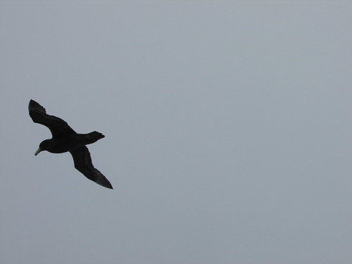
Albatross were never far from the ship.
Having entered the Drake Passage with benign weather conditions on the previous evening, we spent the whole of Thursday continuing the crossing and the weather remained good. The sea state was also moderate, although, as we traversed the Antarctic Convergence (where the warm water from the north meets the cold water from the south) the sea water temperature dropped from 10 degrees Celsius to zero degrees Celsius.
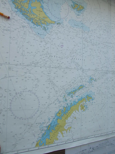
Ship's chart of the Drake Passage. Cape Horn is near the top of the picture, the Antarctic Peninsula at the bottom.
Click for larger view
Sheri gave a most interesting lecture of the Antarctic Treaty and its provisions which makes Antarctica a unique example of co-operation between many countries in the administration of a continent.
One of the provisions of the Antarctic Treaty relates to the preservation of the environment and, to comply with this, there was a Biosecurity Inspection, item by item, of all guests’ outer clothing before going ashore in Antarctica.
After lunch, the ship’s bridge was open to visitors for a time so, of course, I re-acquainted myself with the modern systems which control the ship.
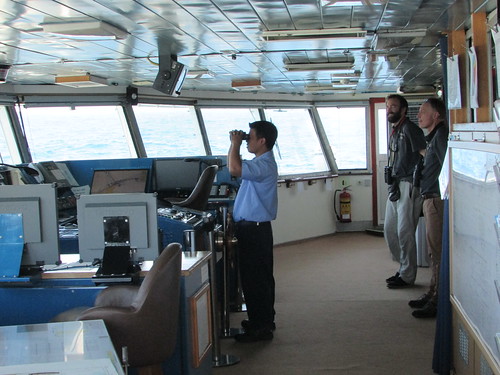
'Silver Explorer' Bridge Visit.
Once the ship’s internet service had been resumed, I managed to sort out problems on my laptop which I think were partly caused by earlier intermittent internet service. By the time I’d checked e-mail and updated the blog, it was time for afternoon tea, which a particularly jolly affair as one of the waiters from the restaurant, Allan, gave a “Barista class with Cappuccino and coffee art demonstrations”.
At 5.00 p.m. Peter Damisch gave one of his invariably stimulating and meticulously-researched lectures titled “Shackleton, By Endurance We Conquer”.
The Recap and Briefing at 6.45 p.m. reviewed recent sightings and outlined the plans for the following day at the South Shetland Islands.
Related Posts
Next post describing this trip: The South Shetland Islands.
All posts describing this trip: Chilean Fjords.
Just posts on the Antarctic segment: Antarctic Peninsula.
My pictures
Where necessary, clicking on an image above will display an 'uncropped' view or, alternately, my pictures from this (and earlier) trips may be selected, viewed or downloaded, in various sizes, from the album listed:-
Silver Explorer.
'Silver Explorer' Bridge Visit.
All my pictures taken in Antarctica on both this visit and my earlier visit in 2008 are in the collection here.
[Links to pictures added, pictures added: 30-Jan-2017]
On Monday 21st November, I got in a muddle with the dating of events, which I corrected as soon as I was able but, once we entered the Drake Passage, we had some (fortunately temporary) trouble with internet access.
Events of Wednesday, 23rd November
The previous evening, Kara, the Expedition Team Leader, had announced that we were to take an alternate channel through the islands of Terra del Fuego which should save time, allowing a closer look at Cape Horn, which the Chilean Navy had approved.
Our first few days travelling south from Valparaiso had enjoyed good weather and this had continued overnight. On Wednesday morning Kara announced that, with a following wind, we had made good time overnight. As we continued our transit to Cape Horn, I was able to spend some time outside on the open deck without the need to wrap up.
IAATO Briefing
At ten o’clock there was a mandatory IAATO Briefing in the theatre. The International Association of Antarctica Tour Operators (IAATO) was set up by the industry to regulate tourism in Antarctica so as to comply with the objectives of the multi-governmental Antarctic Treaty System which has developed from the original Antarctic Treaty of 1959 designating Antarctica as “a zone of peace and science”. The briefing outlined guests’ roles in:-
Protecting Antarctic wildlife
Respecting protected areas
Respecting scientific research
Remaining safe
Keeping Antarctica pristine
IAATO has a website here.
Learning about Whales
A feature of the Silversea Cruises is the regular lectures by members of the Expedition Team. At 11:15, Luke’s lecture on whales and identifying species was warmly received and was followed by many questions from the audience
.
Approaching Cape Horn
The afternoon lecture by Peter on the little-known Polar explorer Charcot was postponed as we approached the impressive bulk of Cape Horn. The decision to divert to Cape Horn had introduced a complication: We’d had two Chilean Pilots on board since leaving Valparaiso and I think the original plan called for us to release the pilots at a small port to the north of Cape Horn. The small manned station actually at Cape Horn, we discovered, is serviced by the Chilean Navy and the revised plan called for us to ‘drop’ the Pilots at this station, from where the Navy would transfer them to an airport for an internal flight back north.
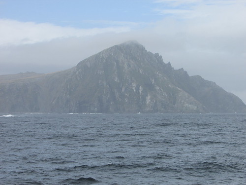
Approaching Cape Horn.
So we ‘Rounded the Horn’ and could then see the lighthouse on the next headland where the manned station is located. As we came closer, the ‘Albatross Memorial’ could be seen near to the station. Of course, all of this was very unfamiliar to most passengers (and, indeed, most of the Expedition Team).
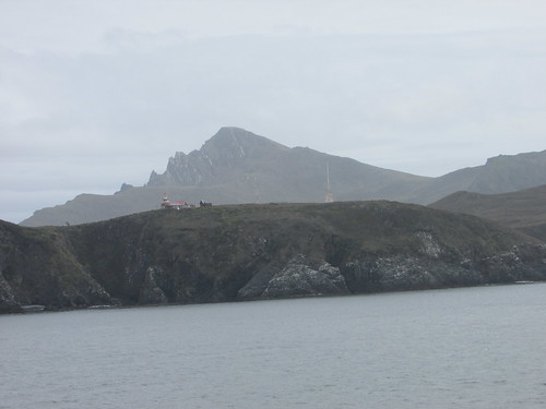
Cape Horn Station.
The plan was to put the Pilots ashore by Zodiac and assess whether it would be safe for the guests to make a landing. As we anchored a few hundred yards from the steep cliffs, we could see a tiny, boulder-strewn beach with a daunting-looking set of wooden steps zig-zagging up the cliff face. Our survey Zodiac reported favourably so those wishing to go ashore dressed warmly for a ‘wet landing’. Since the landing groups rotate, on this occasion I was in one of the last Zodiac groups.

Cape Horn: The landing place, steps, funicular and (left background) the Albatross Memorial.
Our Zodiac driver went bow to the shore, with two members of the Expedition Team holding on to the Zodiac whilst passengers clambered over the side of the boat into a foot or so of water. The first couple of yards over large, round stones was tricky, but help was at hand from the Expedition Team members. Then it was onto well-constructed wooden stairs with a handrail – a stiff climb but with wonderful views from the top. I was surprised to find a working funicular railway provided to carry stores from the landing site to the top of the cliff. There was a modern brick building, with a huge Chilean flag facing the sea which housed the electric motor and winch for the funicular railway. Nearby was a fuel tank and a helicopter landing pad. A long boardwalk with some steps led to the lighthouse building with a modern extension serving as office, visitor centre and accommodation for the family in residence. Just outside was a small, rustic wooden church. Another boardwalk with steps led to the ‘Albatross Memorial’ which commemorates all sailors who lost their lives near Cape Horn.
A Navy launch arrived and anchored near our ship to collect our two Chilean Pilots and one man from the Cape Horn station. The Captain of the launch and three of his men took the opportunity presented by their unusual assignment to come ashore and take pictures. The Naval Captain chatted to us in excellent English. We had plenty of time to enjoy this very special visit before returning to the ship.
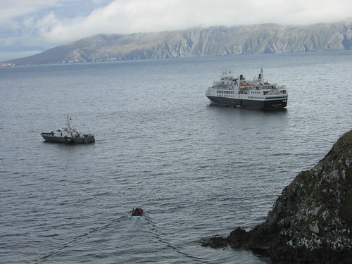
View from Cape Horn station. L: Navy Launch, R: 'Silver Explorer'. In the foreground, a Zodiac is returning passengers to the ship.
With everyone back on board, we set off on our long crossing of the Drake Passage which would take the rest of Wednesday, all of Thursday, making landfall at the South Shetland Islands sometime Friday morning.
Related Posts
Next post describing this trip: The Drake Passage.
All posts describing this trip: Chilean Fjords.
My pictures
Where necessary, clicking on an image above will display an 'uncropped' view or, alternately, my pictures from this (and earlier) trips may be selected, viewed or downloaded, in various sizes, from the album listed:-
Cape Horn.
All my pictures of Chile can be found in the collection Chile.
[Links to pictures added, pictures added: 26-Jan-2017]
Events of Tuesday, 22nd November
I slept well with the ship moored against the jetty at Punta Arenas. My cabin on the port side was away from the quay, looking across the bay, so I was not disturbed by any lighting on the jetty. The programme offered a trip titled ‘Living Heritage in Punta Arenas’ by tour bus, lasting around 5 hours. By no means all of the guests took this trip – I think the duration discouraged some.
On leaving the ship at 8.00 a.m. we first had to walk to the landward end of the jetty past the activity on the dock where one cargo ship was unloading some sort of packaged marine-related product onto a curtain-sided lorry. At the gate I’d used the previous evening, we were then directed through the Punta Arenas Passenger Terminal (the inevitable steel-framed warehouse with souvenir shop) where we passed through a metal detector arch and all backpacks and similar hand-baggage was X-rayed. Two modern tour buses were waiting outside, each with an English-speaking local guide and members of the ship’s Expedition Team.
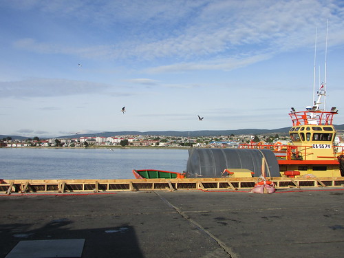
Punta Arenas tour: View of town from the jetty.
Punta Arenas is in the Region Magellianes and, because of the remoteness from Santiago, Chile’s capital, the region has its own local government and the people are fiercely independent. There is a regional flag and a popular movement for further independence.
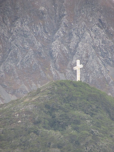
The bus drove to a viewpoint on La Cruz Hill where we had a few minutes to admire the town laid out below us. Then we set off north through the town, just starting to come alive in the leisurely way I’ve come to expect on this continent. It was a surprise to see just how far the town has spread out around the bay – we must have travelled two or three miles on a dual carriageway before we came to the end of the development, passing attractive detached housing, schools, hospitals and university buildings. I believe that there are three state universities in Punta Arenas, plus private facilities. One university campus had an open air industrial museum attached. We turned back towards the town centre when we reached the military base near the Asmar site which appeared to be a ship repair yard (this is one of three shipyards operated by Asmar Shipyards in Chile - their website is here). On the way back, I had a good view of the public cemetery donated by the successful Braun family. The bus stopped outside the Maggiorino Borgatello Museum (the limit of my exploration the previous evening) and we spent a too-short 45 minutes touring the museum’s four sections.
Notes on the history of the museum
The indigenous peoples of the area around the Strait of Magellan and Tierra del Fuego were the Kaweskar, Tehuelches, Selk’nam and Yamanas. In the 19th century, the Jesuits promoted an initiative to these areas, the Salesian Mission, to convert the indigenous population to Christianity. In 1893, one of the priests, Maggiorino Borgatello and Coadjutor Angel Benove started the museum to form a record of the fast-disappearing indigenous cultures.
The first section of the museum deals with the archaeology, paleontology and fauna of Patagonia.
The second section covers the now-extinct indigenous peoples and the Salesian Mission.
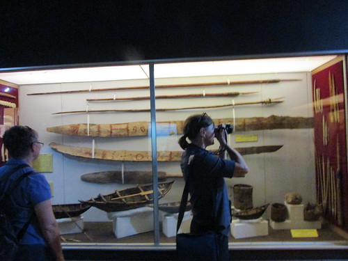
Maggiorino Borgatello Museum: Part of the displays of artefacts of the indigenous peoples.
The third section presents a history of colonisation, immigration, evangelisation, the whaling industry and the exploration of the Antarctic and housing artefacts used by the indigenous cultures.
The last section deals with modern industrialisation of the region, covering the extraction of gas and oil and the development of aviation.
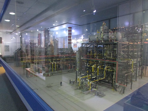
Maggiorino Borgatello Museum: A large model of a petrochemical plant.
The museum has a website here.
Plaza de Armas
After our brief museum visit I boarded our bus with some reluctance and we drove to the Plaza de Armas (which I’d also reached on foot the previous evening) where we had 30 minutes to explore. It was much busier than the previous evening but still with the same relaxed feeling. It was a warm, sunny day which, we were told, is very unusual for Punta Arenas where the normal weather is dull and overcast.
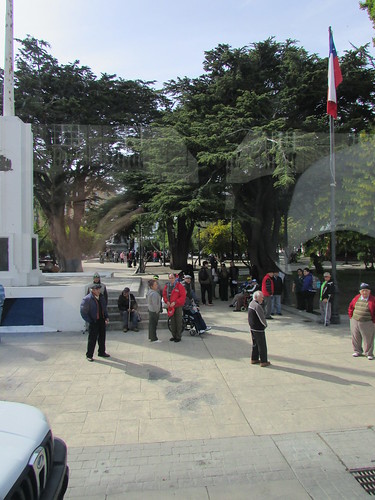
Punta Arenas tour: Plaza de Armas.
Our bus then continued south to the edge of town where we were to visit a sheep farm. On the way we passed two old ‘nodding donkey’ oil well pumps and a locomotive boiler displayed, near where the hulks of a number of old ships had been beached. The largest ship had four masts and what looked like an iron hull (later research revealed this as the 'County of Peebles', described on Wikipedia here and, a few hundred yards further south, the remains of 'Lord Lonsdale' detailed here on an interesting website called 'Wrecksite').

Punta Arenas tour: 'County of Peebles' in use as a breakwater.
El Galpon Estanza
The area we saw was a ‘demonstration farm’ but the owner who conducted the tour also has 30, 000 sheep! We were invited into a large, modern wooden barn with tables and seating for perhaps 100 which could clearly be used when required as a function room for full meals. Old farming and domestic artefacts were displayed everywhere. The was a display of a number of cast iron doors from old wood burning stoves and one large complete wood burning stove made by ‘Smith … Columbian Stove Works … London Liverpool Glasgow & London’ now just used as a serving table. After a brief introduction, the owner showed a short video on the history of the area and the introduction of sheep farming. The owner then led us up the hillside through a nature walk set up by him to re-introduce various local flora and past a small field with a group of sheep and llamas to another wooden barn set up to demonstrate sheep shearing.

El Galpon Estanza: The owner describes flora on our nature walk.
One end of the sheep shearing shed was provided with tiered wooden benches, theatre-style, to accommodate at least 100 people. This faced a shearing area with five shearing sets. One set had an electric ‘Lister Shearing 3-speed Shearing Set’ made after Lister became part of Hawker Siddeley which offered speeds of 2000, 2850 and 3200 r.p.m. (by manually shifting a drive belt connecting the motor pulley to the driven pulley). However, there was also an common overhead drive shaft to the shearing sets and a large single cylinder ‘Lister’ stationary water-cooled diesel engine which an elderly assistant laboriously hand-cranked into life, where upon the farm owner (who, it was becoming clear, was quite an enthusiast for preserving the old ways and equipment) slipped a drive belt around the Lister’s flywheel to power up the shearing sets connected to the overhead drive shaft. A retired shearer was then introduced to us and a sheep was brought in, which three minutes later had had its fleece removed in virtually one piece.
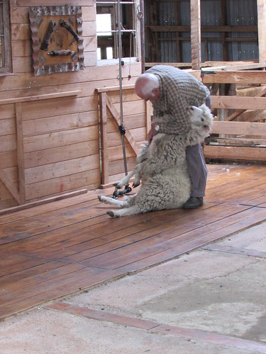
El Galpon Estanza: A demonstration of sheep shearing.
We were then invited into the other half of the shed which served as a garage for the farm owner’s collection of cars and an early ‘Evinrude’ outboard motor for boats which we were invited to examine.
The owner then led us to another similar wooden barn, this one laid out as a museum of the history of the area. What was particularly interesting was a section devoted to the owner’s family with photographs and artefacts.
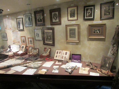
El Galpon Estanza: Part of the owner's museum.
Finally, we returned to the first barn where we sat and were given drinks and a snack. Then it was back onto our two tour buses for the short drive back to the Passenger Terminal at the Port (which I believe is operated by EP Austral) and the walk along the jetty to ‘Silver Explorer’.
Leaving Punta Arenas
At our scheduled departure time,2.00 p.m., two tugs were standing by next to the ship – ‘Beagle’ which had attended our arrival the previous day and ‘Calafate’ (replacing ‘Pelicano II’ from the previous day), but bunkering was still in progress from a large, articulated tanker parked next to the ship. The tanker did not have pumping facilities so it was supported by a pick-up truck towing a rather home-made trailer. This trailer mounted a large automotive engine and gearbox coupled to a pump to transfer fuel via hoses from the tanker to the ship. Once pumping operations had finished, the ship prepared to leave.

Leaving Punta Arenas: 'Silver Explorer' prepares to leave after being replenished by lorry and tanker.
The tanker driver made rather a business out of reversing the articulated vehicle along the jetty, not made easier by the pick-up towing the pump trailer making rather a mess of turning round and then sneaking out ahead of the fuel tanker. As expected, no assistance was required from the tugs as the Captain manoeuvred the ship away from the quay. One puzzle was that a very noisy small tug ‘Atlas’ came bow-first against the opposite side of the jetty with power applied as we left, almost as if our departure was expected to displace the whole jetty sideways!
!
Later in the afternoon, I attended Sheri Bluestein’s lecture titled ‘Cool Science in Cold Places’ outlining some of the research work being carried out at the various Antarctic Research Bases.
There was a special, short briefing at 6.15 p.m. where Kara announced a change of plan. Instead of following the originally-intended route to the Drake Passage via the Strait of Magellan, we were to follow an alternate channel through the islands of Terra del Fuego which was actually shorter and the time saved might allow us to have a closer look at Cape Horn, with the Chilean Navy’s blessing. All would depend upon wind and weather.
At 7.00 p.m. there was a Venetian Society cocktail party in the theatre. The Venetian Society is the charity set up by Silversea’s owners. Repeat travellers with Silversea are enrolled upon agreeing to a modest daily donation whilst on board.
For me, the last event of a busy and enjoyable day was dinner in the restaurant. Some guests liked to go on to the Panorama Lounge for a ‘nightcap’ but I usually spent some time sorting out photographs or writing text for my blog whilst the memory of the events was fresh.
Related Posts
Next post describing this trip: Cape Horn.
All posts describing this trip: Chilean Fjords.
My pictures
Where necessary, clicking on an image above will display an 'uncropped' view or, alternately, my pictures from this (and earlier) trips may be selected, viewed or downloaded, in various sizes, from the albums listed:-
Punta Arenas tour.
Maggiorino Borgatello Museum.
El Galpon Estanza.
Leaving Punta Arenas.
All my pictures of Chile can be found in the collection Chile.
[Links to pictures added, pictures added: 26-Jan-2017]
Events of Monday, 21st November
At some time during the early hours of Tuesday, we left sheltered waters for a time and the wave action became more pronounced. It didn’t greatly disturb me but other guests reported minor accidents with loose items sliding around. We were cruising south-east in the Strait of Magellan, a channel with steep, grassed sides and some exposed rock. Traces of snow remained on the peaks and mist hung on the mountain tops. The weather was overcast but surprisingly warm in locations sheltered from the wind. After a leisurely breakfast, I attended an informative lecture ‘Antarctic Biodiversity: An Overview’ by Hans Peter.
Before long, lunch was upon us followed by a choice of lectures in the theatre during the afternoon. I missed the lecture on Vulcanology by Steffan since it conflicted with our transit past Cape Froward where the Strait of Magellan turns northwards to reach Punta Arenas.

Strait of Magellan: Cape Froward.
Strictly speaking, Cape Froward is the southernmost point on the South American continent since Tierra del Fuego on the opposite side of the Strait of Magellan is an island and the better-known Cape Horn is on a further island, south of Tierra de Fuego.
Strait of Magellan: Passing Cape Froward.
Favourable winds meant that we were able to dock in Punta Arenas earlier than anticipated at around 20:30 on Tuesday evening. At the Recap and Briefing, the Expedition Leader announced that it should be possible for passengers to go ashore to explore late evening on Tuesday, in addition to the planned excursion on the following day. I decided to skip dinner at 19:30, in order to be able to watch the docking at the jetty and then be ready to go ashore.
Punta Arenas revealed itself as a large town which had originally developed along the shore but now extended into the low hills on the landward side.
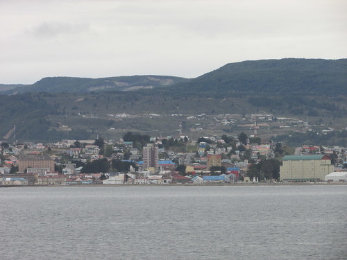
Arriving at Punta Arenas.
A single, straight jetty extended into the sea and, as we approached the quay, two modern, powerful tugs appeared and ‘shadowed’ us in. As I watched the ‘Pelicano II’, the tug just astern of us on the port side, three dolphins breached the water in synchronism in between our ship and the tug before disappearing again, repeating this performance two or three times, each time nearer the bow of the tug. After a short pause, the dolphins repeated their leaping further forward on the port side before moving to the bow of our ship and delighting a new audience.
Apparently, the dolphins were not alone in wanting to display their prowess in the water. The second tug accompanying us was ‘Beagle’, matching our speed and keeping station on the port side near our bow.
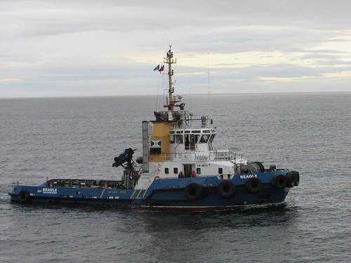
Arriving at Punta Arenas: Tug 'Beagle'.
Then, for no obvious reason, the manoeuvrable 'Beagle' turned through 180 degrees and matched our speed travelling astern! Once having proved the point, ‘Beagle’ turned again and once again matched our speed going ahead. I indicated my appreciation of this manoeuvre by a very small nod of my head, which was rewarded by a broad smile from the deckhand on the ‘Beagle’, after which we exchanged friendly waves.
Using the control panel on the starboard bridge wing, our Captain gently eased ‘Silver Explorer against the quay watched by the various shore parties waiting to receive the mooring lines from the ship. One of our two Chilean Pilots who had travelled with us from Valparaiso was also on the bridge wing, using a handportable radio. Within a few minutes, our ship was secured and the gangway was set up between Deck 5 and the quayside.
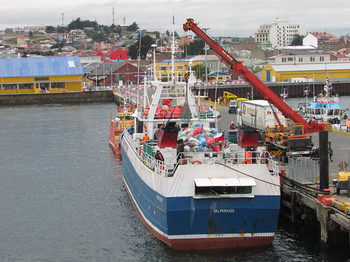
View of jetty and Punta Arenas from the deck of 'Silver Explorer'.
Once the ship had been cleared by Chilean Customs, passengers were allowed ashore. The credit-card sized room key was also used to tally guest movements on and off the ship using a laptop computer, both via the gangway or Zodiac. We were allowed to walk the length of the jetty and were then waved through the entrance gates by port security staff.
The town square (Plaza de Armas) was only a few hundred yards away and I’d determined to explore at least that far. A small group of passengers disembarked at the same time and fanned out in various directions. Punta Arenas developed to support Atlantic – Pacific shipping via the Strait of Magellan but the opening of the Panama Canal, of course, damaged that trade. There was a short-lived Gold Rush but sheep farming provided more enduring traffic. The population is now around 150,000 and the town is clean and pleasant, a mixture of modern and more classical French and Spanish styles of architecture. Having reached the town square, I decided to explore a little further and I reached the building of the Maggiorino Borgatello Museum before deciding to return to the ship by a slightly different route. On the way back, I started to pass many more guests who had decided to take dinner on the ship before venturing out.
Back in my cabin, I had a club sandwich, chocolate mousse and English breakfast tea from room service, after which I retired to bed.
Related Posts
Next post describing this trip: Visiting Punta Arenas.
All posts describing this trip: Chilean Fjords.
My pictures
Where necessary, clicking on an image above will display an 'uncropped' view or, alternately, my pictures from this (and earlier) trips may be selected, viewed or downloaded, in various sizes, from the albums listed:-
Aboard 'Silver Explorer'.
Strait of Magellan: Cape Froward.
Arriving at Punta Arenas.
All my pictures of Chile can be found in the collection Chile.
[Date of events corrected: 24-Nov-2016. Links to pictures added, pictures added: 25-Jan-2017]
Events of Sunday, 20th November (Afternoon)
After lunch, I worked on the computer for a while before going to the Panorama Lounge for afternoon tea. Another Trivia Quiz was in progress but since the subjects were ‘Prehistoric Animals’ and ‘Food around the World’, I didn’t feel that I could contribute anything. However, the quiz rather ended in disarray following an announcement over the Public Address that Orca whales had been spotted to starboard and encouraging all passengers to come out on deck. There was a mass exodus towards the observation decks, fore and aft. Many of the passengers, including me, were only in indoor clothes but it was a warm afternoon with no wind in the sheltered waters so it was very enjoyable.
On an expedition ship like ‘Silver Explorer’, it’s not unusual for plans to change at short notice so I was not surprised when the ship abandoned its original course and turned to place us nearer the location of the sighting. An extraordinary period of half an hour or so followed as the guests gasped in amazement each time the massive creatures appeared at the surface.
There was a pod of at least four whales, identified by the Expedition Team as South Atlantic Orcas, probably sub-type A. We were told that it’s unusual to find them this far north. To avoid disturbing the whales, the ship did not attempt too close an approach but our sighting as rated as ‘very good’ by our field experts. Certainly the whales made no attempt to move away, although they would certainly have been aware of the ship. Eventually, the whales were seen to be slowly moving northwards so the sighting was terminated and the ship resumed its southern route. I'm afraid I didn't have my camera with me to record the scene but, in any case, neither my camera nor its owner are very well suited for nature photography.
The Orca sighting had overlapped the planned start of the five o’clock lecture, which was duly deferred to 5.15 p.m., when we were entertained by an informative and amusing lecture by Peter Damisch, the historian on the expedition team, entitled ‘Search for the Unknown Antarctic Continent’. A little later, the usual ‘Recap and Briefing’ took place in the theatre, where the programme for the next day was laid out (we were to have another ‘day at sea’ as we continued to Punta Arenas). There was then discussion and questions regarding the whale sighting and the birds observed to which a number of members of the Expedition Team contributed.
Another splendid evening meal followed which I enjoyed with a couple originally from England but now retired to Australia. During the meal, we passed a small cargo ship with three self-unloading cranes going north but I failed to identify it. This was the first ship I’d noticed since we came through English Narrows.

Aboard 'Silver Explorer': View from the restaurant as we pass a northbound cargo ship.
This was not quite the end of the evening. The friendly and attentive restaurant staff urged my companions and I to go the Panorama Lounge at ten o’clock where three members of the restaurant staff forming ‘The Crew Band’ were to sing for the guests to the music of the resident pianist. It was a jolly end to the evening before retiring to bed.
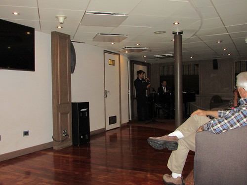
Aboard 'Silver Explorer': Vocals by members of the waiting staff in the Panorama Lounge.
Related Posts
Next post describing this trip: Cruising to Punta Arenas.
All posts describing this trip: Chilean Fjords.
My pictures
Where necessary, clicking on an image above will display an 'uncropped' view or, alternately, my pictures from this (and earlier) trips may be selected, viewed or downloaded, in various sizes, from the albums listed:-
Pictures aboard 'Silver Explorer' are here.
All my pictures of Chile can be found in the collection Chile.
[Events date and Orca type corrected: 24-Nov-2016. Link to pictures added, picturers added: 25-Jan-2017]
Events of Sunday, 20th November (Morning)
I awoke to a glorious sunny morning at our anchorage a mile or so short of the glacier face of the Pio XI glacier, originally called the Bruggen Glacier. This glacier is the largest outflow to the west from the Southern Patagonian Ice Field.
Glacier theory
Glaciers are produced in land areas where annual snowfall exceeds the rate of annual melting. Over a long period, as the thickness of snow increases, gravity crushes the lower layers of snow, expelling entrained air bubbles and creating dense, clear ice under pressure. Gravity also causes the dense ice mass to slowly slide towards lower ground at a speed determined by the topography and the frictional resistance to the ice movement presented by the underlying rock. This rock becomes fractured and ground by the ice and carried along with the glacial movement, often as a dark-coloured ‘moraine’. Where a glacier meets a fjord, pressure from the glacier further ‘upstream’ on the unsupported ice causes fracturing and the creation of an exposed glacier front. As pressure is relieved within the ice, the glacier face continues to fracture and ice breaks away in a process called ‘calving’.
The location
Pio XI is the longest glacier in the southern hemisphere outside Antarctica at about 64 km long. Whilst most glaciers are currently ‘in retreat’, between 1945 and 1976, this glacier advanced by around 5 km. The glacier face is 4.5 km wide but gives the impression of being smaller because, viewed from the fjord, there is little to give a sense of scale. In the case of Pio XI, the glacier is set between green, wooded hills and the proximity of mature trees offers some hint as to the true size of the glacier but it is difficult to avoid underestimating the scale of such an unfamiliar object.
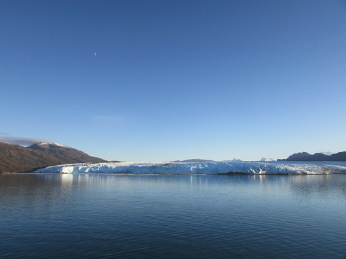
Pio XI Glacier.
The Zodiac Cruise
Conditions were ideal for a Zodiac Cruise. Since it was planned that we would be on the water for 1.5 hours, we were warned to wear sufficient clothing to remain warm whilst sedentary. I made sure that I had a substantial breakfast and was ready in good time for when my group was called by public address to deck 3 for boarding the Zodiacs.
The first Zodiac away from the ship was driven by botanist Hans Peter in one of the larger Zodiacs. I was in the second Zodiac, driven by Luke and, with just 8 passengers, we had plenty of room. We sailed towards the glacier face which rose like a cliff from a ‘beach’ of ground-up rock of moraine materials.The glacier face was heavily fissured as pressures within the glacier had been relieved by cracking. Quite frequently, a loud rumbling like thunder could be heard as the glacial ice ‘re-arranged’ itself and, on a few occasions during our Zodiac cruise, this was accompanied by a visible fall of ice producing a white spray as the internal pressure produced an explosive release of material. The internal pressure had also resulted in crevasses in the top surface of the glacier leaving a very uneven appearance.
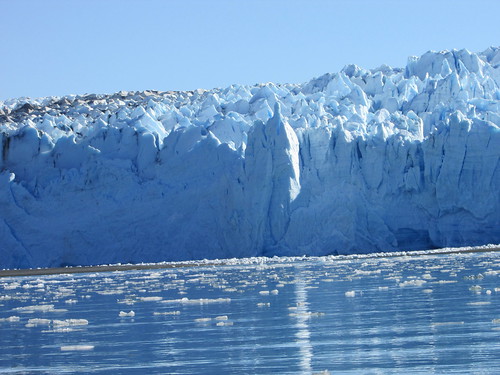
Pio XI Glacier Zodiac Cruise: Cliff-like glacier face and heavily-crevassed top surface.
As we came a little closer, the sea was littered with ice ranging from a few inches to a few feet across which had fallen from the glacier front. Sometimes the shape of the ice suggested a shard which had broken away from the glacier face, but often partial thawing and re-freezing had produced a strangely-shaped object, like some example of modern art. Only around 10% of each lump of ice is visible above the surface so care is needed when passing through ice debris called ‘brash ice’ and ‘bergy bits’.
Luke identified two types of ice. The first type has a white appearance, like frozen snow. The colour is produced by small air bubbles trapped in the ice. The second type is translucent without bubbles where pressures within the glacier have expelled the trapped air, leaving frozen water. This type of ice, in a large piece, takes on a bluish tinge because of the differential light absorption of water and water/air.
Luke also demonstrated the effect of holding a small, flat piece of ice containing air bubbles between both palms. As the body heat warms the ice, release of trapped air produces a series of audible ‘pops’, each accompanied by a slight vibration which can be felt. The air may have been imprisoned for thousands of years and laboratory tests now exist for releasing the air from samples of ice and analysing it to determine changes in the earth’s atmosphere.
Hans Peter, the botanist, presented our Zodiac with a piece of Kelp he’d found floating. Kelp grows rapidly as a series of broad leaves a couple of metres long, interconnected by flexible stems with air bladders. Each leaf is green, slightly corrugated and covered with a thin layer of mucous material. Normally, one end of the plant would be anchored to rock but wind and tide can break the stem, as had happened to the sample we examined.
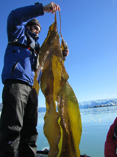
Pio XI Glacier Zodiac Cruise: Luke displays the kelp presented by Hans Peter.
We spent some time cruising across the face of the glacier but keeping a respectful distance and examining the floating ice. At one location, the ice contained moraine material and was dark coloured. As the sun melted the ice, the crushed rock was released as sediment.
Crew Safety Drill
We had been advised that the ship’s crew were carrying out a safety drill whilst we were on the Zodiac Cruise but we didn’t know the details so, looking back at the ship, it was a surprise to see that one of the lifeboats had been launched. At the same time, a strange noise alerted us to the fact that we were being filmed by Ray from his drone hovering above us! I was delighted when we headed towards the lifeboat as I had not seen one in the water, only stowed on the davits.
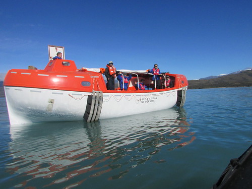
Pio XI Glacier Zodiac Cruise: One lifeboat had been launched in a Crew Safety Drill.
Silver Explorer has two motorised lifeboats, each capable of holding 150 people. We drew alongside the lifeboat and I was amazed to see various members of the restaurant staff on board who presented us with a glass of champagne, cake and a variety of sweetmeats. The captain had agreed to let an essential training exercise serve a second, delightful purpose.
Our Zodiac then returned us to the ship after a wonderful cruise. Noticing that the lifeboat was about to be recovered, I hurried to the observation deck in time to see the electric winch lift the lifeboat out of the water and swing the davit arms and lifeboat into the ‘stowed’ position.

Aboard 'Silver Explorer': Following the Crew Safety Drill, the lifeboat is returned to the davits.
Once all the passengers were back on board and the Zodiacs recovered, we set off south again, this time on a ‘leg’ of 447 miles to Punta Arenas which would take more than one day. Meanwhile, I had a little time to work on the computer before lunch and a programme of lectures was offered during the afternoon.
Related Posts
Next post describing this trip: On to the Strait of Magellan.
All posts describing this trip: Chilean Fjords.
My pictures
Where necessary, clicking on an image above will display an 'uncropped' view or, alternately, my pictures from this (and earlier) trips may be selected, viewed or downloaded, in various sizes, from the albums listed:-
Pictures on the Pio XI Zodiac Cruise are here.
Pictures aboard 'Silver Explorer' are here.
All my pictures of Chile can be found in the collection Chile.
[Pictures added 13-Jan-2017]
Events of Saturday, 19th November
Saturday was to be a day on the ship as we continued south. The previous evening, the ship had emerged from behind the protection of the chain of islands to cross an area of open sea called ‘The Gulf of Pain’ because of the poor sea conditions which can exist. Fortunately, the area failed to live up to its name and, by the time I took breakfast on Saturday, the ship was already entering more sheltered water and cruising towards the Iceberg Fjord.
There were two illustrated lectures in the theatre during the morning and I attended both. At 09:45 Luke Kenny gave a fascinating talk on salmon, which has become the mainstay of the Chilean aquaculture industry. At 11:15 Claire Allum described the indigenous people of Patagonia and Tierra del Fuego and the impact of European immigrants. Her interesting talk included short clips of motion picture film and still photographs from the 1920s illustrating a way of life which has disappeared.
Whilst I was enjoying lunch in the restaurant, we entered Iceberg Fjord so once I’d finished my meal, I wrapped up warmly to watch proceedings from one of the open decks.
Iceberg Fjord
Correctly, the term ‘Fjord’ is applied to a location where “current or past glaciation extended below sea level before retreating, to leave a characteristic U-shaped narrow, steep-sided inlet filled with sea water”. Although we could see snow on the distant mountains, the sides of the Iceberg Fjord were a mixture of rock, grass and trees. However, there is a glacier called Tempanos at the landward end of the fjord, supposedly because of the noises created by the glacial ice cracking. The ship travelled to within a mile or so of the glacier front at the end of the fjord. The observation decks were crowded with guests taking pictures of the glacier but I elected to observe from the foredeck on level 4, where the anchor winches are located, because this area of deck is only available to passengers occasionally and it is usually less windy than the higher decks.
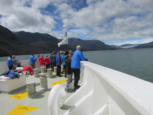
Cruising Chilean Fjords: Iceberg Fjord.
Zodiac Cruise
Suddenly, to the delight of guests, the public address announced that an unscheduled Zodiac cruise would take place, allowing closer views of the glacier front. Before long, I was boarding one of the Zodiacs. I discovered that not all the guests had decided to take the unexpected cruise. With dry weather, a temperature of about ten degrees Celsius and intermittent appearance of an unexpectedly warm sun, the cruise closer to the glacier front was very enjoyable.
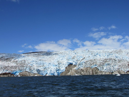
Zodiac cruise in Iceberg Fjord: The glacial ice advancing over the underlying rock at Tempanos Glacier.
We saw one fall of ice from the ice front as the tremendous pressures in the ice were relieved by cracking. At another time, we heard one loud explosion, like a single crack of thunder, as glacial ice cracked.
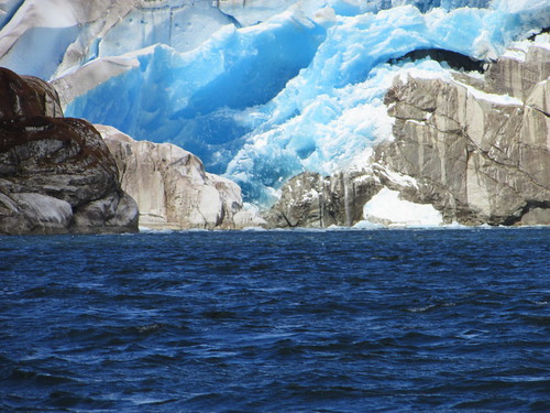
Zodiac cruise in Iceberg Fjord: Vivid blue colours in the Tempanos Glacier.
After a 45-minute cruise, we returned to ‘Silversea Explorer’, in time for me to take afternoon tea in the Panorama Lounge whilst the ship turned and cruised back along Iceberg Fjord.
Shipwreck
Following afternoon tea, I wrapped-up again and went to the forward outside observation deck in time to watch the ship leave Iceberg Fjord and turn towards English Narrows.
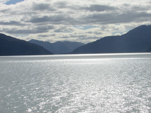
Leaving Iceberg Fjord and rejoining the broad channel leading to English Narrows.
At around 6.15 p.m. we passed the grounded shipwreck of the ‘Captain Leonides’ lost when carrying cargo of sugar. Investigation established that the loss was, in fact, an insurance fraud and the captain at the time had his “Master’s Ticket” cancelled.
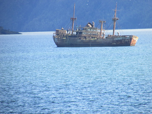
Grounded shipwreck of the ‘Captain Leonides’.
English Narrows
‘English Narrows’ is the name of an ‘S’-shaped narrow channel with strong currents between a cluster of islands. Ships cannot pass in the channel, so a one way system is in operation and the channel is only used in daylight. Two Chilean Pilots with extensive experience in the waters we were traversing were aboard to assist the Captain in locations like English Narrows. Our transit was due to start at 7.00 p.m. but this was slightly delayed, waiting for a small Chilean cargo ship heading north to clear the channel (northbound traffic has right-of-way).
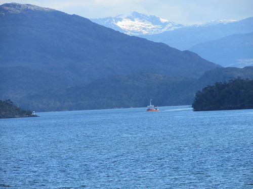
Through English Narrows: Awaiting our turn to enter the narrow channel.
As it passed, I was able to identify it as ‘Seivag’ before we threaded our way through the twisting channel. Apart from the expected channel markers, there were three statues of the Madonna protecting travellers but I only saw one of them.
Having successfully negotiated English Narrows, it was time for our evening meal. There was always a ‘set’ menu, often offering a ‘Flavours of Chile’ collection of dishes but I usually found myself selecting from the wide ‘A la carte’ range. The ship continued south during the night so as to reach an anchorage off the Pio XI Glacier early on Sunday morning.
Related Posts
Next post describing this trip: Pio XI Glacier.
All posts describing this trip: Chilean Fjords.
My pictures
Where necessary, clicking on an image above will display an 'uncropped' view or, alternately, my pictures from this (and earlier) trips may be selected, viewed or downloaded, in various sizes, from the albums listed:-
Pictures Cruising Chilean Fjords are here.
Pictures of the Zodiac Cruise in Iceberg Fjord are here.
Pictures of our passage Through English Narrows are here.
Pictures aboard 'Silver Explorer' are here.
All my pictures of Chile can be found in the collection Chile.
[Pictures added 13-Jan-2017]

